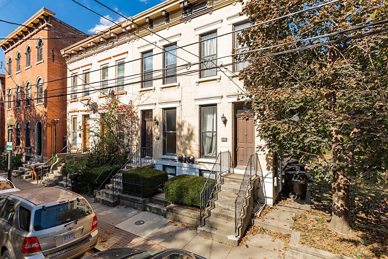
Chestnut Street
420-422 Chestnut St,
Cincinnati,
OH
45203
-
Monthly Rent
$1,295
-
Bedrooms
2 bd
-
Bathrooms
1.5 ba
-
Square Feet
--

Pricing & Floor Plans
-
Unit 420 A Chestnut Streetprice $1,295square feetavailibility Now
-
Unit 420 A Chestnut Streetprice $1,295square feetavailibility Now
Fees and Policies
Details
Property Information
-
4 units/2 stories
Chestnut Street is an apartment community located in Hamilton County and the 45203 ZIP Code. This area is served by the Cincinnati Public Schools attendance zone.
Unique Features
- Stove and oven
- Heat
- Laundry
- Sewer
- Trash
- Water
Contact
Community Amenities
- Recycling
Apartment Features
Air Conditioning
Dishwasher
Refrigerator
Range
- Air Conditioning
- Dishwasher
- Range
- Refrigerator
- Recycling
- Stove and oven
- Heat
- Laundry
- Sewer
- Trash
- Water
- Air Conditioning
- Dishwasher
- Range
- Refrigerator
West End is a historic neighborhood about 1.5 miles northwest of Downtown Cincinnati. Once a manufacturing hub for beer, clothing, soap, and other goods, West End is an up-and-coming neighborhood undergoing revitalization. Several new developments are entering the neighborhood including a football stadium set to open in 2021. Along with housing several museums, West End rests next to one of the city’s most popular museums, the Cincinnati Museum Center at Union Terminal.
Combined with its charming historic buildings, West End is known for its strong sense of community. Community gardens and programs at the West End’s several recreation centers are just two ways locals connect. West End has rentals options for every budget in a variety of styles including apartments in renovated brick buildings. Proximity to downtown allows residents to have easy access to Cincinnati’s biggest attractions like the Duke Energy Convention Center and Paul Brown Stadium, home of Cincinnati Bengals.
Learn more about living in West End| Colleges & Universities | Distance | ||
|---|---|---|---|
| Colleges & Universities | Distance | ||
| Drive: | 9 min | 2.7 mi | |
| Drive: | 9 min | 3.0 mi | |
| Drive: | 10 min | 4.5 mi | |
| Drive: | 13 min | 5.1 mi |


View GreatSchools Rating Methodology
Data provided by GreatSchools.org © 2025. All rights reserved.
Transportation options available in Cincinnati include Washington Park Station, 12Th & Race, located 0.4 mile from Chestnut Street. Chestnut Street is near Cincinnati/Northern Kentucky International, located 14.1 miles or 26 minutes away.
| Transit / Subway | Distance | ||
|---|---|---|---|
| Transit / Subway | Distance | ||
| Walk: | 7 min | 0.4 mi | |
| Walk: | 7 min | 0.4 mi | |
| Walk: | 9 min | 0.5 mi | |
| Walk: | 11 min | 0.6 mi | |
| Walk: | 12 min | 0.7 mi |
| Commuter Rail | Distance | ||
|---|---|---|---|
| Commuter Rail | Distance | ||
|
|
Walk: | 18 min | 1.0 mi |
| Airports | Distance | ||
|---|---|---|---|
| Airports | Distance | ||
|
Cincinnati/Northern Kentucky International
|
Drive: | 26 min | 14.1 mi |
Time and distance from Chestnut Street.
| Shopping Centers | Distance | ||
|---|---|---|---|
| Shopping Centers | Distance | ||
| Walk: | 12 min | 0.6 mi | |
| Walk: | 14 min | 0.8 mi | |
| Drive: | 8 min | 2.3 mi |
| Parks and Recreation | Distance | ||
|---|---|---|---|
| Parks and Recreation | Distance | ||
|
OMNIMAX Theater
|
Walk: | 18 min | 1.0 mi |
|
Duke Energy Children's Museum
|
Walk: | 18 min | 1.0 mi |
|
Museum of Natural History and Science
|
Walk: | 18 min | 1.0 mi |
|
Cincinnati History Museum
|
Walk: | 18 min | 1.0 mi |
|
John G. & Phyllis W. Smale Riverfront Park
|
Drive: | 5 min | 1.5 mi |
| Hospitals | Distance | ||
|---|---|---|---|
| Hospitals | Distance | ||
| Drive: | 6 min | 1.8 mi | |
| Drive: | 9 min | 3.2 mi | |
| Drive: | 7 min | 3.8 mi |
| Military Bases | Distance | ||
|---|---|---|---|
| Military Bases | Distance | ||
| Drive: | 71 min | 55.0 mi | |
| Drive: | 77 min | 60.0 mi | |
| Drive: | 80 min | 63.3 mi |
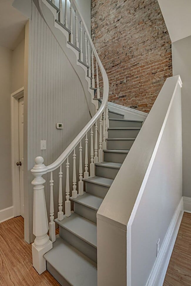
Chestnut Street Photos
-
Chestnut Street
-
-
-
-
-
-
-
-
Nearby Apartments
Within 50 Miles of Chestnut Street
Chestnut Street does not offer in-unit laundry or shared facilities. Please contact the property to learn about nearby laundry options.
Utilities are not included in rent. Residents should plan to set up and pay for all services separately.
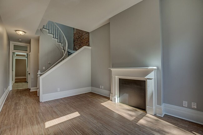
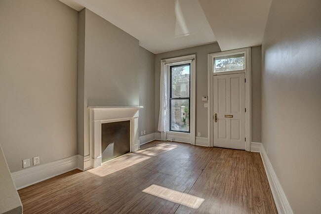
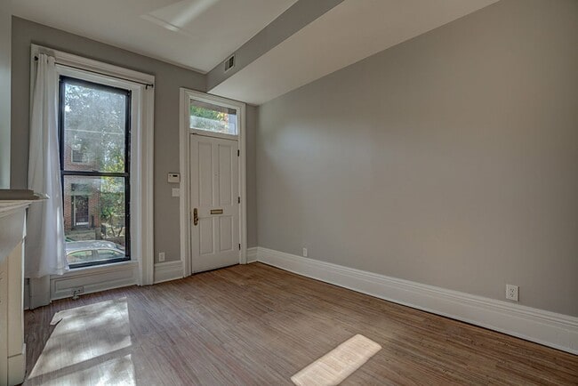
Chestnut Street has two-bedrooms apartments renting for $1,295/mo.
Chestnut Street does not allow pets, though service animals are always welcome in accordance with applicable laws.
A good rule of thumb is to spend no more than 30% of your gross income on rent. Based on the lowest available rent of $1,295 for a two-bedrooms, you would need to earn about $47,000 per year to qualify. Want to double-check your budget? Try our Rent Affordability Calculator to see how much rent fits your income and lifestyle.
Chestnut Street is not currently offering any rent specials. Check back soon, as promotions change frequently.
While Chestnut Street does not offer Matterport 3D tours, renters can request a tour directly through our online platform.
What Are Walk Score®, Transit Score®, and Bike Score® Ratings?
Walk Score® measures the walkability of any address. Transit Score® measures access to public transit. Bike Score® measures the bikeability of any address.
What is a Sound Score Rating?
A Sound Score Rating aggregates noise caused by vehicle traffic, airplane traffic and local sources

420-422 Chestnut St
Cincinnati, OH 45203
Property Manager Responded