
The Boulevard
2635 Contra Costa Blvd,
Pleasant Hill, CA 94523
$2,233 - $2,360
1 Bed
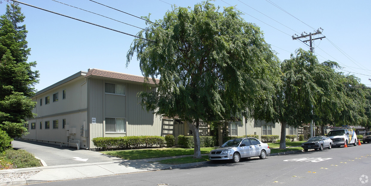
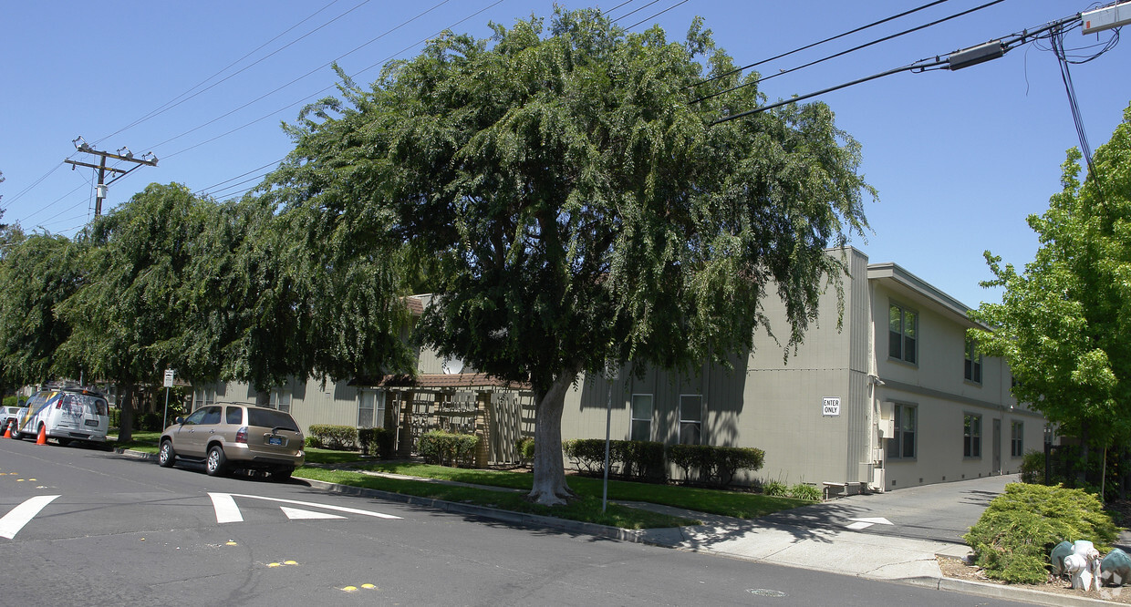

Enjoy Concord living at Chestnut Gardens. Located at 3515 Chestnut Ave in Concord, this community is perfectly situated for work or play. From amenities to floor plan options, the leasing staff is available to help you find the best floor plan for your lifestyle. Drop by the leasing office to see available floor plans and make your move to Chestnut Gardens.
Chestnut Gardens is an apartment community located in Contra Costa County and the 94519 ZIP Code. This area is served by the Mt. Diablo Unified attendance zone.
Pool
Laundry Facilities
Gated
Property Manager on Site
Air Conditioning
Dishwasher
High Speed Internet Access
Granite Countertops
Located in Contra Costa County, Concord combines suburban comfort with convenient access to the San Francisco Bay Area. The downtown area centers around Todos Santos Plaza, home to weekly farmers' markets and summer concerts. The rental market offers apartments and houses to fit various needs, with current average rents ranging from $1,888 for one-bedroom units to $3,220 for four-bedroom homes. Recent data shows studio apartments experienced a 5.4% rent increase year-over-year, reflecting the area's steady rental market.
Outdoor recreation abounds with Mount Diablo State Park and Lime Ridge Open Space nearby, offering hiking trails and natural areas to explore. The Concord Pavilion hosts concerts and events throughout the year, while Sunvalley Shopping Center provides retail options. The area is served by the Mount Diablo Unified School District, with several private school options also available. Two BART stations connect residents to San Francisco and the greater Bay Area.
Learn more about living in Concord| Colleges & Universities | Distance | ||
|---|---|---|---|
| Colleges & Universities | Distance | ||
| Drive: | 12 min | 4.2 mi | |
| Drive: | 23 min | 12.6 mi | |
| Drive: | 27 min | 13.6 mi | |
| Drive: | 34 min | 20.7 mi |


Transportation options available in Concord include Concord, located 1.1 miles from Chestnut Gardens. Chestnut Gardens is near Metro Oakland International, located 30.5 miles or 44 minutes away, and San Francisco International, located 42.5 miles or 62 minutes away.
| Transit / Subway | Distance | ||
|---|---|---|---|
| Transit / Subway | Distance | ||
|
|
Drive: | 3 min | 1.1 mi |
|
|
Drive: | 7 min | 3.1 mi |
|
|
Drive: | 12 min | 6.0 mi |
|
|
Drive: | 11 min | 6.6 mi |
|
|
Drive: | 13 min | 7.2 mi |
| Commuter Rail | Distance | ||
|---|---|---|---|
| Commuter Rail | Distance | ||
|
|
Drive: | 17 min | 9.5 mi |
| Drive: | 34 min | 21.9 mi | |
|
|
Drive: | 33 min | 23.6 mi |
|
|
Drive: | 36 min | 25.1 mi |
| Drive: | 37 min | 26.5 mi |
| Airports | Distance | ||
|---|---|---|---|
| Airports | Distance | ||
|
Metro Oakland International
|
Drive: | 44 min | 30.5 mi |
|
San Francisco International
|
Drive: | 62 min | 42.5 mi |
Time and distance from Chestnut Gardens.
| Shopping Centers | Distance | ||
|---|---|---|---|
| Shopping Centers | Distance | ||
| Walk: | 1 min | 0.1 mi | |
| Walk: | 3 min | 0.2 mi | |
| Drive: | 4 min | 1.2 mi |
| Parks and Recreation | Distance | ||
|---|---|---|---|
| Parks and Recreation | Distance | ||
|
Markham Nature Park and Arboretum
|
Walk: | 19 min | 1.0 mi |
|
The Ruth Bancroft Garden
|
Drive: | 11 min | 5.6 mi |
|
Arbolado Park
|
Drive: | 13 min | 5.7 mi |
|
Heather Farm Park
|
Drive: | 12 min | 6.1 mi |
|
Gardens at Heather Farm
|
Drive: | 12 min | 6.2 mi |
| Hospitals | Distance | ||
|---|---|---|---|
| Hospitals | Distance | ||
| Drive: | 4 min | 1.7 mi | |
| Drive: | 5 min | 2.0 mi | |
| Drive: | 12 min | 6.1 mi |
Pets Allowed Fitness Center Pool In Unit Washer & Dryer High-Speed Internet Stainless Steel Appliances Hardwood Floors
Pets Allowed Fitness Center In Unit Washer & Dryer Stainless Steel Appliances Business Center Package Service Elevator
Pets Allowed Fitness Center In Unit Washer & Dryer High-Speed Internet Controlled Access EV Charging Rooftop Deck
What Are Walk Score®, Transit Score®, and Bike Score® Ratings?
Walk Score® measures the walkability of any address. Transit Score® measures access to public transit. Bike Score® measures the bikeability of any address.
What is a Sound Score Rating?
A Sound Score Rating aggregates noise caused by vehicle traffic, airplane traffic and local sources

3515 Chestnut Ave
Concord, CA 94519


