
Presidential Towers
555 W Madison St,
Chicago, IL 60661
$1,610 - $9,445
Studio - 2 Beds

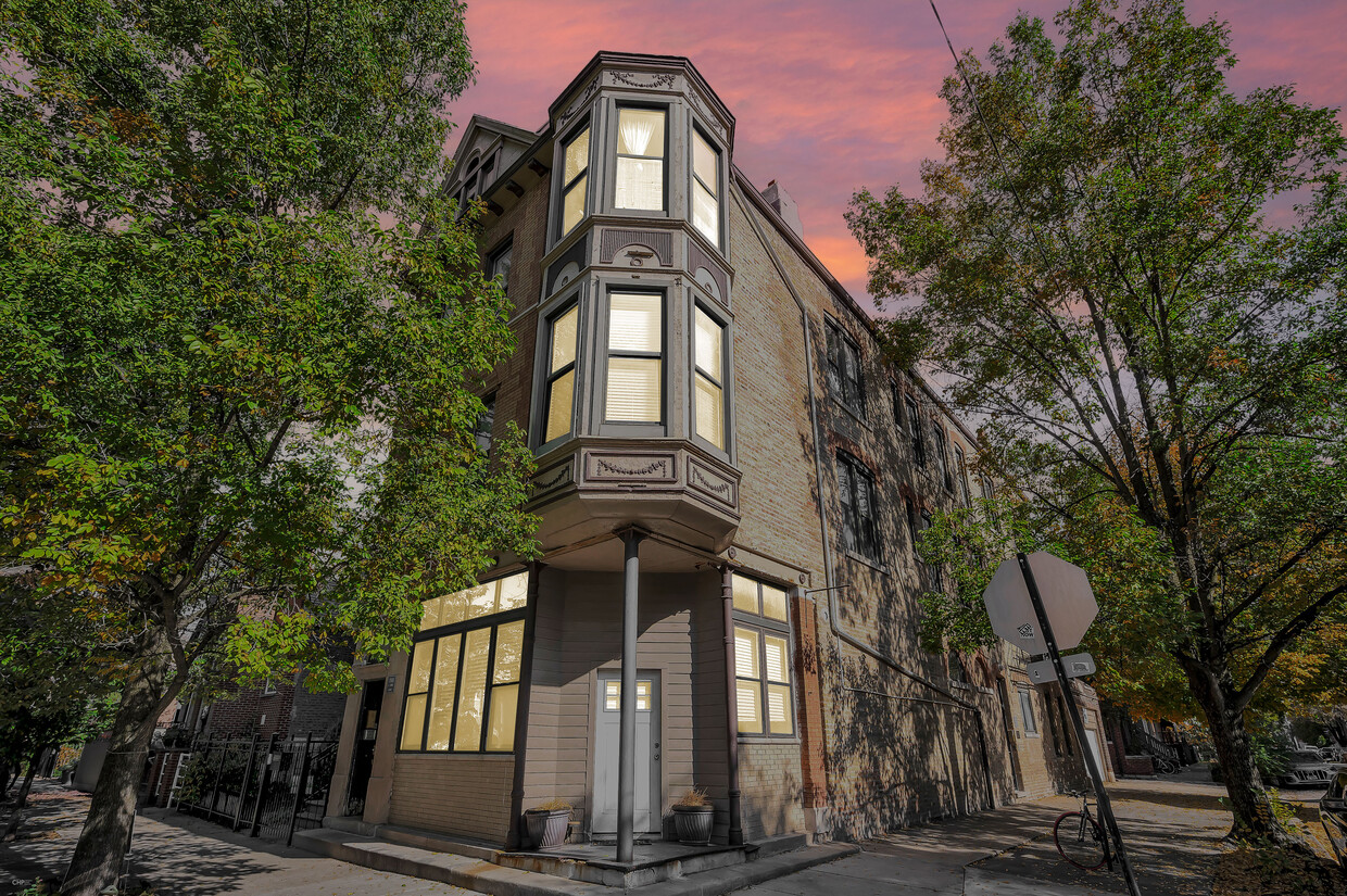
This very charming all brick building is located in a wonderful Bucktown neighborhood. The turret gives it an old English feel while the rehabbed interior makes it feel newer.Enjoy many fine dining locations and cultural experiences including: Coast Sushi, Le Bouchon, Takashi, Babylon and Nick's Pit Stop.You will also enjoy the convenient location of this unit with easy access to 90/94, and both the Armitage and Damen bus lines. The Blue line also stops under a mile away. The building has Laundry in the basement and a bike rack on the side. Sponsored Broker Firm - Rockwell Property Company
Charleston 2054 W is an apartment community located in Cook County and the 60647 ZIP Code. This area is served by the Chicago Public Schools attendance zone.
Unique Features
Bucktown is one of Chicago’s trendiest neighborhoods, and it’s more affordable than nearby neighborhoods. It’s just a few miles northwest of downtown Chicago and is bordered by the Chicago River on the east. Kennedy Expressway (I-94) runs right through the neighborhood, giving residents easy access to the Chicago area and beyond. Public transportation is extensive, and the neighborhood is walkable and filled with shopping, dining, and artsy entertainment. There’s a great selection of live music, art exhibits, live theater, and themed bars. A ton of restaurants offer a variety of food from different cultures.
If you’re looking for family fun in Bucktown, there are plenty of public parks available for the community, such as Holstein Park, Churchill Park, and Ehrler Park. Amenities include open green space, swimming pools, ball fields, and more.
Learn more about living in BucktownCompare neighborhood and city base rent averages by bedroom.
| Bucktown | Chicago, IL | |
|---|---|---|
| Studio | $2,081 | $1,585 |
| 1 Bedroom | $2,480 | $1,960 |
| 2 Bedrooms | $3,091 | $2,475 |
| 3 Bedrooms | $3,683 | $3,010 |
| Colleges & Universities | Distance | ||
|---|---|---|---|
| Colleges & Universities | Distance | ||
| Drive: | 4 min | 1.8 mi | |
| Drive: | 5 min | 2.1 mi | |
| Drive: | 6 min | 3.0 mi | |
| Drive: | 7 min | 3.4 mi |


Transportation options available in Chicago include Western Station (Blue Line - O'hare Branch), located 0.7 mile from Charleston 2054 W. Charleston 2054 W is near Chicago Midway International, located 11.7 miles or 22 minutes away, and Chicago O'Hare International, located 14.0 miles or 22 minutes away.
| Transit / Subway | Distance | ||
|---|---|---|---|
| Transit / Subway | Distance | ||
|
|
Walk: | 12 min | 0.7 mi |
|
|
Walk: | 15 min | 0.8 mi |
|
|
Drive: | 3 min | 1.2 mi |
|
|
Drive: | 3 min | 1.5 mi |
|
|
Drive: | 4 min | 1.7 mi |
| Commuter Rail | Distance | ||
|---|---|---|---|
| Commuter Rail | Distance | ||
|
|
Walk: | 14 min | 0.8 mi |
|
|
Drive: | 6 min | 2.9 mi |
|
|
Drive: | 7 min | 2.9 mi |
|
|
Drive: | 7 min | 3.6 mi |
|
|
Drive: | 6 min | 3.8 mi |
| Airports | Distance | ||
|---|---|---|---|
| Airports | Distance | ||
|
Chicago Midway International
|
Drive: | 22 min | 11.7 mi |
|
Chicago O'Hare International
|
Drive: | 22 min | 14.0 mi |
Time and distance from Charleston 2054 W.
| Shopping Centers | Distance | ||
|---|---|---|---|
| Shopping Centers | Distance | ||
| Walk: | 9 min | 0.5 mi | |
| Walk: | 13 min | 0.7 mi | |
| Walk: | 15 min | 0.8 mi |
| Parks and Recreation | Distance | ||
|---|---|---|---|
| Parks and Recreation | Distance | ||
|
Wrightwood Park
|
Drive: | 4 min | 1.3 mi |
|
Oz Park
|
Drive: | 5 min | 2.0 mi |
|
Humboldt Park
|
Drive: | 4 min | 2.1 mi |
|
Lincoln Park
|
Drive: | 6 min | 2.9 mi |
|
Lincoln Park Zoo
|
Drive: | 6 min | 3.0 mi |
| Hospitals | Distance | ||
|---|---|---|---|
| Hospitals | Distance | ||
| Drive: | 4 min | 1.6 mi | |
| Drive: | 5 min | 2.4 mi | |
| Drive: | 6 min | 2.6 mi |
| Military Bases | Distance | ||
|---|---|---|---|
| Military Bases | Distance | ||
| Drive: | 30 min | 21.6 mi |
What Are Walk Score®, Transit Score®, and Bike Score® Ratings?
Walk Score® measures the walkability of any address. Transit Score® measures access to public transit. Bike Score® measures the bikeability of any address.
What is a Sound Score Rating?
A Sound Score Rating aggregates noise caused by vehicle traffic, airplane traffic and local sources
2054 W Charleston St
Chicago, IL 60647


