
Terman
4230 Terman Dr,
Palo Alto, CA 94306
2-3 Beds $3,430 - $4,441
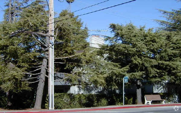
Discover your new home at Cedars Apartments in Los Altos Hills, CA. You'll find this community at 201 Cuesta Dr. in the North Los Altos area of Los Altos Hills. Compare 1 to 3 bedroom apartments then schedule a visit to see them in person. Enjoy a great selection of amenities at this community. These include: balconies, high-speed internet access, and convenient on-site parking options. It's time to find your new home. Contact or stop by Cedars Apartments to schedule a tour!
Cedars Apartments is an apartment community located in Santa Clara County and the 94022 ZIP Code. This area is served by the Los Altos Elementary attendance zone.
North Los Altos contains the city’s vibrant commercial centers. The many shops and eateries of Main Street are in the southern portion of North Los Altos, while the diverse restaurants and cafes of San Antonio Road are in the northern stretches near San Antonio Center.
Outside of these commercial areas, North Los Altos is predominantly residential, offering an array of apartments available for rent along tree-lined avenues. Many of the rentals in North Los Altos feature stunning mountain views, as well as close proximity to Mountain View, Foothill College, Stanford University, and Palo Alto. Getting around from North Los Altos is simple with access to El Camino Real, Interstate 280, and San Antonio Station.
Learn more about living in North Los Altos| Colleges & Universities | Distance | ||
|---|---|---|---|
| Colleges & Universities | Distance | ||
| Drive: | 5 min | 1.6 mi | |
| Drive: | 8 min | 3.7 mi | |
| Drive: | 12 min | 5.7 mi | |
| Drive: | 13 min | 6.1 mi |


Transportation options available in Los Altos Hills include Mountain View Station, located 3.0 miles from Cedars Apartments. Cedars Apartments is near Norman Y Mineta San Jose International, located 11.8 miles or 20 minutes away, and San Francisco International, located 26.3 miles or 37 minutes away.
| Transit / Subway | Distance | ||
|---|---|---|---|
| Transit / Subway | Distance | ||
| Drive: | 8 min | 3.0 mi | |
|
|
Drive: | 8 min | 3.0 mi |
|
|
Drive: | 10 min | 4.0 mi |
|
|
Drive: | 10 min | 4.3 mi |
| Drive: | 11 min | 5.1 mi |
| Commuter Rail | Distance | ||
|---|---|---|---|
| Commuter Rail | Distance | ||
| Drive: | 5 min | 2.7 mi | |
| Drive: | 8 min | 2.9 mi | |
| Drive: | 9 min | 3.1 mi | |
| Drive: | 11 min | 4.9 mi | |
| Drive: | 11 min | 5.1 mi |
| Airports | Distance | ||
|---|---|---|---|
| Airports | Distance | ||
|
Norman Y Mineta San Jose International
|
Drive: | 20 min | 11.8 mi |
|
San Francisco International
|
Drive: | 37 min | 26.3 mi |
Time and distance from Cedars Apartments.
| Shopping Centers | Distance | ||
|---|---|---|---|
| Shopping Centers | Distance | ||
| Drive: | 4 min | 1.3 mi | |
| Drive: | 4 min | 1.5 mi | |
| Drive: | 4 min | 1.6 mi |
| Parks and Recreation | Distance | ||
|---|---|---|---|
| Parks and Recreation | Distance | ||
|
Redwood Grove
|
Drive: | 4 min | 1.6 mi |
|
Foothill College Observatory
|
Drive: | 5 min | 1.9 mi |
|
Terman Park
|
Drive: | 6 min | 3.0 mi |
|
Esther Clark Nature Preserve
|
Drive: | 6 min | 3.0 mi |
|
Byrne Preserve
|
Drive: | 8 min | 3.2 mi |
| Hospitals | Distance | ||
|---|---|---|---|
| Hospitals | Distance | ||
| Drive: | 5 min | 2.1 mi | |
| Drive: | 13 min | 6.5 mi | |
| Drive: | 14 min | 6.8 mi |
| Military Bases | Distance | ||
|---|---|---|---|
| Military Bases | Distance | ||
| Drive: | 14 min | 5.9 mi |
What Are Walk Score®, Transit Score®, and Bike Score® Ratings?
Walk Score® measures the walkability of any address. Transit Score® measures access to public transit. Bike Score® measures the bikeability of any address.
What is a Sound Score Rating?
A Sound Score Rating aggregates noise caused by vehicle traffic, airplane traffic and local sources

201 Cuesta Dr
Los Altos Hills, CA 94022


