
Trestle
333 El Camino Real,
San Carlos, CA 94070
$3,632 - $7,409
1-3 Beds

CITY OF GOOD LIVING Enjoy living in the heart of charming downtown San Carlos. Centered directly between San Francisco and San Jose, the city of San Carlos attracts residents with its upscale neighborhoods and laid-back lifestyles. Easy commutes to some of the country's largest technology firms and elite universities allow San Carlos to be one of the area's most coveted residential locations. Convenient access to highways 280 and 101. Public transportation options are Samtrans, Amtrak, and a Caltrain stop right downtown. Phenomenal school district Rated 10 out of 10 in California. Just a few blocks stroll to Laurel Street, which offers several great restaurants, coffee shops, and even two or three pubs. There's a terrific year-round local farmer on Laurel Street in downtown San Carlos. Shopping. There are numerous beautiful parks and hiking trails. Apartment Details Ready to move in 1 bedroom, 1 bath unit in an excellent location on Cedar Street. The apartment includes plenty of closet space, a ceiling fan in the bedroom, and a balcony outside the living room. Appliances include oven, stove, refrigerator, microwave, disposal, and smoke/carbon monoxide detectors. Building Amenities Elevator, Atrium in the lobby, On-site laundry facility for tenants., one assigned covered carport. Smokefree Living. RENTAL TERMS: Lease Duration: 1 year Deposit: $2,250 Rent: $2,250 Utilities Included. Renter's Insurance required. One cat or one small dog weighing less than 25 pounds okay. Additional $300 security deposit. Application fee $35. No Cash Please
Cedar Patio Apartments is an apartment community located in San Mateo County and the 94070 ZIP Code. This area is served by the San Carlos Elementary attendance zone.
Laundry Facilities
Elevator
Property Manager on Site
Storage Space
Dishwasher
High Speed Internet Access
Microwave
Refrigerator
Nicknamed “The City of Good Living,” San Carlos is exactly that. With family-friendly entertainment, vibrant urban areas, and delicious eateries, San Carlos is a must-visit coastal destination. Nestled on the San Francisco Peninsula overlooking the bay with proximity to both San Francisco and San Jose, San Carlos offers a premier location on California’s coast.
A commuter-friendly city, San Carlos is near multiple interstate highways, making trips to neighboring cities a breeze. With pristine parks, great weather, a lively community, and family-friendly shopping and dining options, San Carlos is a wonderful place to put down roots.
Explore the Hiller Aviation Museum overlooking the San Carlos Airport, great for all ages, or try out one of the local hot spots around town. Blue Line Pizza offers high ceilings, an artsy vibe, casual digs, and even an outdoor patio that’s dog-friendly.
Learn more about living in San Carlos| Colleges & Universities | Distance | ||
|---|---|---|---|
| Colleges & Universities | Distance | ||
| Drive: | 13 min | 5.7 mi | |
| Drive: | 13 min | 6.4 mi | |
| Drive: | 14 min | 7.5 mi | |
| Drive: | 22 min | 9.2 mi |


Transportation options available in San Carlos include Millbrae (Caltrain Transfer Platform), located 11.5 miles from Cedar Patio Apartments. Cedar Patio Apartments is near San Francisco International, located 12.6 miles or 19 minutes away, and Metro Oakland International, located 28.2 miles or 37 minutes away.
| Transit / Subway | Distance | ||
|---|---|---|---|
| Transit / Subway | Distance | ||
|
|
Drive: | 17 min | 11.5 mi |
|
|
Drive: | 17 min | 11.5 mi |
| Commuter Rail | Distance | ||
|---|---|---|---|
| Commuter Rail | Distance | ||
| Walk: | 13 min | 0.7 mi | |
| Drive: | 4 min | 1.7 mi | |
| Drive: | 4 min | 1.7 mi | |
| Drive: | 6 min | 2.7 mi | |
| Drive: | 9 min | 3.8 mi |
| Airports | Distance | ||
|---|---|---|---|
| Airports | Distance | ||
|
San Francisco International
|
Drive: | 19 min | 12.6 mi |
|
Metro Oakland International
|
Drive: | 37 min | 28.2 mi |
Time and distance from Cedar Patio Apartments.
| Shopping Centers | Distance | ||
|---|---|---|---|
| Shopping Centers | Distance | ||
| Drive: | 3 min | 1.2 mi | |
| Drive: | 3 min | 1.2 mi | |
| Drive: | 3 min | 1.3 mi |
| Parks and Recreation | Distance | ||
|---|---|---|---|
| Parks and Recreation | Distance | ||
|
Edgewood Park & Natural Preserve
|
Drive: | 7 min | 3.3 mi |
|
Red Morton Park
|
Drive: | 10 min | 3.8 mi |
|
Stulsaft Park
|
Drive: | 11 min | 4.3 mi |
|
Pulgas Ridge Open Space Preserve
|
Drive: | 10 min | 4.7 mi |
|
Filoli Gardens
|
Drive: | 15 min | 5.7 mi |
| Hospitals | Distance | ||
|---|---|---|---|
| Hospitals | Distance | ||
| Drive: | 6 min | 2.2 mi | |
| Drive: | 6 min | 3.0 mi | |
| Drive: | 8 min | 3.3 mi |
| Military Bases | Distance | ||
|---|---|---|---|
| Military Bases | Distance | ||
| Drive: | 23 min | 15.2 mi |
What Are Walk Score®, Transit Score®, and Bike Score® Ratings?
Walk Score® measures the walkability of any address. Transit Score® measures access to public transit. Bike Score® measures the bikeability of any address.
What is a Sound Score Rating?
A Sound Score Rating aggregates noise caused by vehicle traffic, airplane traffic and local sources
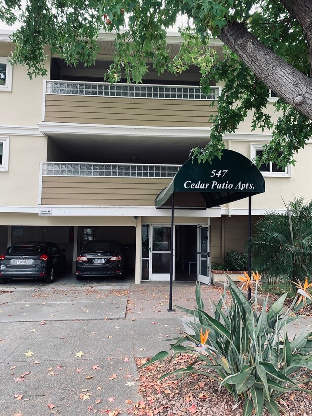
547 Cedar St
San Carlos, CA 94070


