
Vicino Apartments
12350 Del Amo Blvd,
Lakewood, CA 90715
$2,011 - $3,057
1-3 Beds
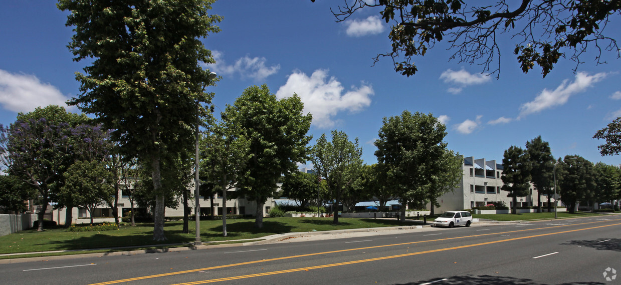
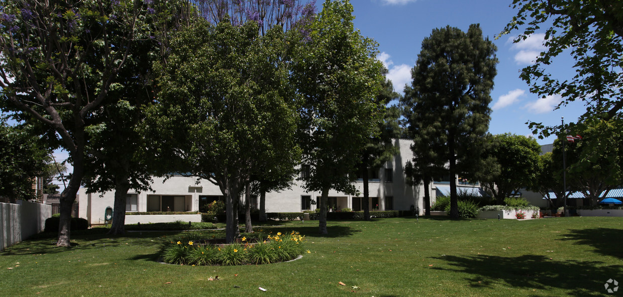
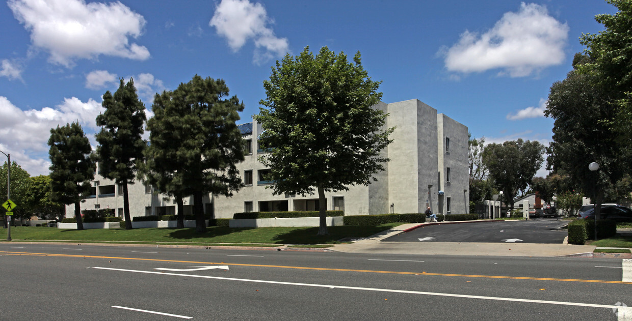
Candlewood Park is ready to be your home. The 90712 location in Lakewood has much to offer its residents. Come for a visit to see the current floorplan options. The professional leasing staff will assist you in finding the perfect place. Visit Candlewood Park today.
Candlewood Park is an apartment community located in Los Angeles County and the 90712 ZIP Code. This area is served by the Paramount Unified attendance zone.
Situated in the southern portion of Los Angeles County, about 20 miles south of Downtown Los Angeles, Lakewood is a scenic suburb with a peaceful atmosphere. Lakewood is known for its tree-lined streets and lush greenery as well as its many popular parks. Mayfair Park, Del Valle Park, and Rynerson Park are all within the city’s borders, and El Dorado East Regional Park neighbors the city to the southeast.
In addition to ample opportunities for outdoor recreation, Lakewood residents enjoy a wide variety of shopping options at the Lakewood Center Mall, and nearby Los Cerritos Center. An array of local and chain restaurants are strewn throughout the city as well.
Lakewood is just minutes away from some of Southern California’s most exciting attractions, including Knott’s Berry Farm, Disneyland, the Queen Mary, Cabrillo Marine Aquarium, and miles of beautiful Pacific Coast beaches. Quick access to the 405, 605, and 710 freeways makes getting around from tranquil Lakewood a breeze.
Learn more about living in Lakewood| Colleges & Universities | Distance | ||
|---|---|---|---|
| Colleges & Universities | Distance | ||
| Drive: | 7 min | 2.7 mi | |
| Drive: | 11 min | 5.1 mi | |
| Drive: | 14 min | 6.2 mi | |
| Drive: | 12 min | 6.6 mi |


Transportation options available in Lakewood include Lakewood Station, located 4.4 miles from Candlewood Park. Candlewood Park is near Long Beach (Daugherty Field), located 4.6 miles or 9 minutes away, and Los Angeles International, located 21.5 miles or 31 minutes away.
| Transit / Subway | Distance | ||
|---|---|---|---|
| Transit / Subway | Distance | ||
|
|
Drive: | 9 min | 4.4 mi |
|
|
Drive: | 10 min | 4.7 mi |
|
|
Drive: | 11 min | 5.1 mi |
|
|
Drive: | 12 min | 5.5 mi |
|
|
Drive: | 14 min | 7.5 mi |
| Commuter Rail | Distance | ||
|---|---|---|---|
| Commuter Rail | Distance | ||
|
|
Drive: | 16 min | 9.2 mi |
|
|
Drive: | 19 min | 12.8 mi |
|
|
Drive: | 21 min | 13.5 mi |
|
|
Drive: | 23 min | 14.9 mi |
|
|
Drive: | 23 min | 16.2 mi |
| Airports | Distance | ||
|---|---|---|---|
| Airports | Distance | ||
|
Long Beach (Daugherty Field)
|
Drive: | 9 min | 4.6 mi |
|
Los Angeles International
|
Drive: | 31 min | 21.5 mi |
Time and distance from Candlewood Park.
| Shopping Centers | Distance | ||
|---|---|---|---|
| Shopping Centers | Distance | ||
| Walk: | 2 min | 0.1 mi | |
| Walk: | 5 min | 0.3 mi | |
| Walk: | 10 min | 0.5 mi |
| Parks and Recreation | Distance | ||
|---|---|---|---|
| Parks and Recreation | Distance | ||
|
El Dorado Nature Center
|
Drive: | 11 min | 5.8 mi |
|
Earl Burns Miller Japanese Garden
|
Drive: | 12 min | 6.3 mi |
|
Colorado Lagoon
|
Drive: | 14 min | 6.7 mi |
|
El Dorado East Regional Park
|
Drive: | 14 min | 6.8 mi |
|
Compton Creek Natural Park at George Washington Elementary
|
Drive: | 16 min | 9.7 mi |
| Hospitals | Distance | ||
|---|---|---|---|
| Hospitals | Distance | ||
| Walk: | 14 min | 0.7 mi | |
| Drive: | 9 min | 4.2 mi | |
| Drive: | 10 min | 5.6 mi |
| Military Bases | Distance | ||
|---|---|---|---|
| Military Bases | Distance | ||
| Drive: | 20 min | 11.6 mi | |
| Drive: | 28 min | 15.4 mi |
What Are Walk Score®, Transit Score®, and Bike Score® Ratings?
Walk Score® measures the walkability of any address. Transit Score® measures access to public transit. Bike Score® measures the bikeability of any address.
What is a Sound Score Rating?
A Sound Score Rating aggregates noise caused by vehicle traffic, airplane traffic and local sources

4051 Candlewood St
Lakewood, CA 90712


 - Violet on Virgil")


