
8012 Jayseel St
8012 Jayseel St,
Sunland, CA 91040
$4,250 Total Monthly Price
3 Beds 12 Month Lease

We will accommodate tours via Facebook messenger to respect social distancing."
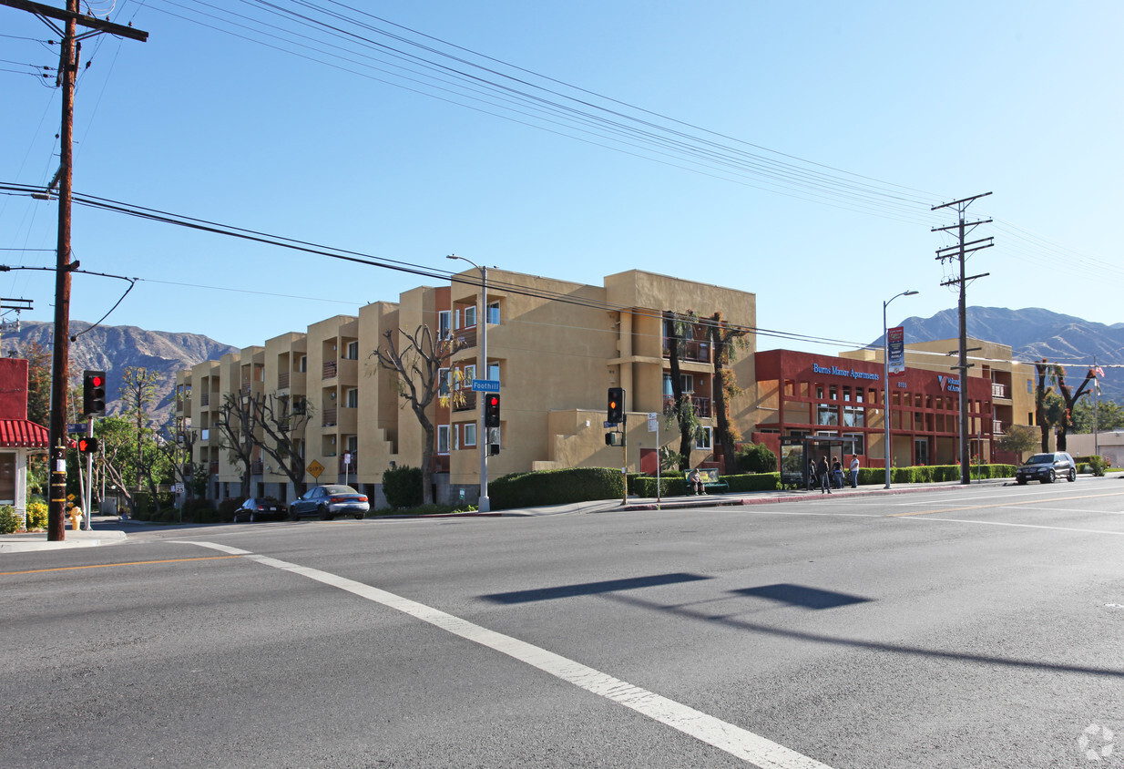
Burns Manor Apartments is an apartment community located in Los Angeles County and the 91040 ZIP Code. This area is served by the Los Angeles Unified Rocp School District attendance zone.
Laundry Facilities
Controlled Access
24 Hour Access
Maintenance on site
Air Conditioning
Dishwasher
Ceiling Fans
Heating
Nestled between the Verdugo Mountains and the San Gabriel Mountains, Sunland boasts stunning mountain views that seem to cover the landscape. While Sunland is a predominantly residential area, the commercial district lies right in the center of it all with a distinct mix of local businesses and national chains lining Foothill Boulevard.
Sunland exudes a small-town feel between the bustling Los Angeles area and the tranquil Angeles National Forest. Sunland residents enjoy access to a host of hiking trails as well as plenty of metropolitan amenities. The famous Griffith Park, Rose Bowl Stadium, Dodger Stadium, Hollywood, and Downtown Los Angeles are all just minutes from Sunland. Convenience to the 210 Freeway makes getting around from Sunland easy.
Learn more about living in Sunland| Colleges & Universities | Distance | ||
|---|---|---|---|
| Colleges & Universities | Distance | ||
| Drive: | 13 min | 7.0 mi | |
| Drive: | 12 min | 8.8 mi | |
| Drive: | 16 min | 10.7 mi | |
| Drive: | 19 min | 10.9 mi |


Transportation options available in Sunland include North Hollywood Station, located 9.8 miles from Burns Manor Apartments. Burns Manor Apartments is near Bob Hope, located 7.1 miles or 13 minutes away, and Los Angeles International, located 35.4 miles or 46 minutes away.
| Transit / Subway | Distance | ||
|---|---|---|---|
| Transit / Subway | Distance | ||
|
|
Drive: | 16 min | 9.8 mi |
|
|
Drive: | 20 min | 12.1 mi |
| Commuter Rail | Distance | ||
|---|---|---|---|
| Commuter Rail | Distance | ||
|
|
Drive: | 10 min | 6.0 mi |
| Drive: | 12 min | 6.9 mi | |
|
|
Drive: | 14 min | 7.9 mi |
|
|
Drive: | 14 min | 9.9 mi |
|
|
Drive: | 17 min | 10.4 mi |
| Airports | Distance | ||
|---|---|---|---|
| Airports | Distance | ||
|
Bob Hope
|
Drive: | 13 min | 7.1 mi |
|
Los Angeles International
|
Drive: | 46 min | 35.4 mi |
Scores provided by
Traffic
BusyAirport
CalmBusinesses
ActiveScores provided by
HowLoud What is a Sound Score Rating? A Sound Score Rating aggregates noise caused by vehicle traffic, airplane traffic and local sources. How It WorksTime and distance from Burns Manor Apartments.
| Shopping Centers | Distance | ||
|---|---|---|---|
| Shopping Centers | Distance | ||
| Walk: | 2 min | 0.1 mi | |
| Walk: | 4 min | 0.2 mi | |
| Walk: | 6 min | 0.4 mi |
| Parks and Recreation | Distance | ||
|---|---|---|---|
| Parks and Recreation | Distance | ||
|
La Tuna Canyon Park
|
Drive: | 7 min | 5.1 mi |
|
Descanso Gardens
|
Drive: | 13 min | 7.5 mi |
|
El Cariso Regional Park
|
Drive: | 12 min | 9.0 mi |
|
Wildlife Waystation
|
Drive: | 15 min | 9.4 mi |
|
Veterans Memorial Park
|
Drive: | 17 min | 10.1 mi |
| Hospitals | Distance | ||
|---|---|---|---|
| Hospitals | Distance | ||
| Drive: | 11 min | 6.7 mi | |
| Drive: | 12 min | 7.4 mi | |
| Drive: | 16 min | 8.5 mi |
| Military Bases | Distance | ||
|---|---|---|---|
| Military Bases | Distance | ||
| Drive: | 46 min | 38.0 mi |
What Are Walk Score®, Transit Score®, and Bike Score® Ratings?
Walk Score® measures the walkability of any address. Transit Score® measures access to public transit. Bike Score® measures the bikeability of any address.
What is a Sound Score Rating?
A Sound Score Rating aggregates noise caused by vehicle traffic, airplane traffic and local sources.
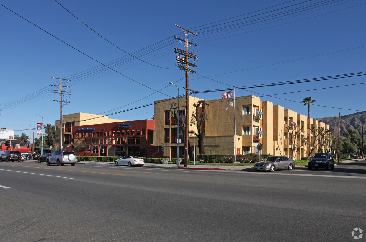
8155 Foothill Blvd
Sunland, CA 91040


