
Skyline On Stokes
2132 Stokes Blvd,
Cleveland, OH 44106
$1,310 - $3,406
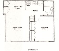
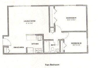
Studio - 2 Beds

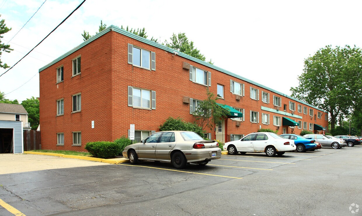
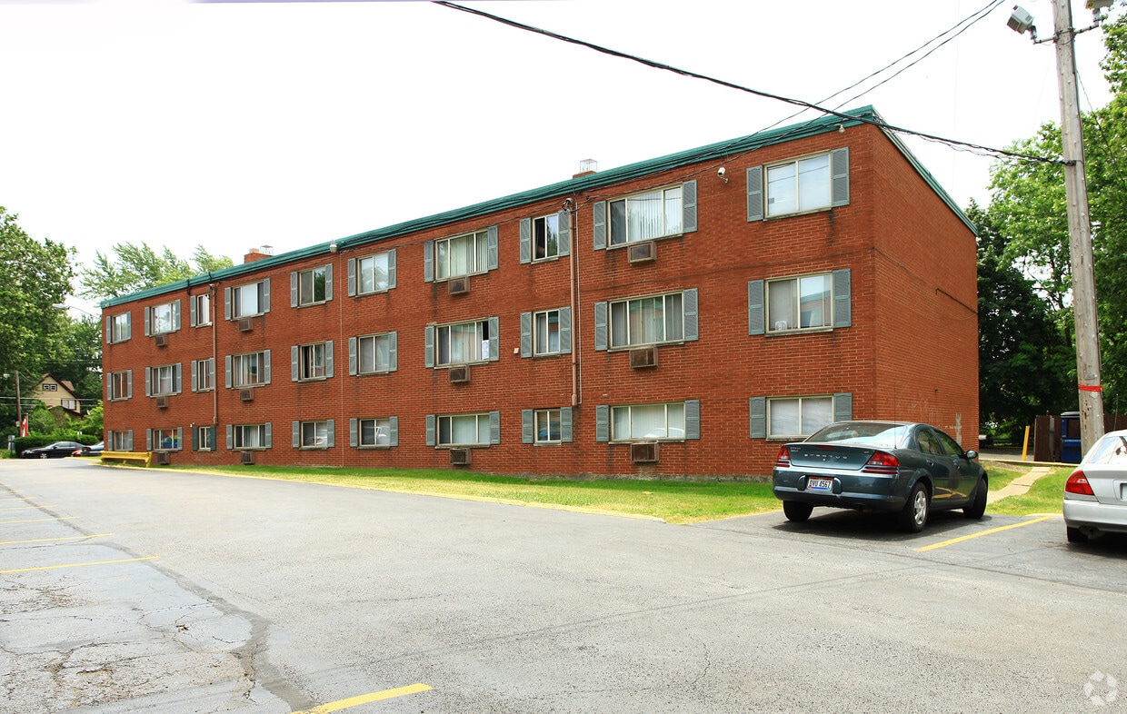
Come home to Bosworth Gardens. From amenities to floor plan options, the professional leasing team is ready to help you find your perfect new place. Living here, you'll have access to top amenities and features. These include: smoke-free options, security systems, and convenient on-site parking options. At Bosworth Gardens you're home.
Bosworth Gardens is an apartment community located in Cuyahoga County and the 44111 ZIP Code. This area is served by the Cleveland Metropolitan School District attendance zone.
Air Conditioning
High Speed Internet Access
Refrigerator
Tub/Shower
Named for the broad thoroughfare wending south from Lake Erie, West Boulevard offers residents a park-like feel with mature landscaping and spacious lawns. Described by locals as a "front porch" neighborhood, homes for rent include charming one- and two-story dwellings dating from the early 1900s. Hardly hidden, but a neighborhood gem all the same, Halloran Park features the city's first water playground and provides the area's only ice skating rink.
Residents of West Boulevard shop at the neighborhood Berea Road/West 117th shopping complex where suburban style meets local convenience. Neighborhood dining includes Mexican, Cambodian, and German eateries. At the Happy Dog, diners get to choose from among 50 different hot dog toppings.
Learn more about living in West BoulevardCompare neighborhood and city base rent averages by bedroom.
| West Boulevard | Cleveland, OH | |
|---|---|---|
| Studio | $787 | $1,208 |
| 1 Bedroom | $719 | $1,384 |
| 2 Bedrooms | $793 | $1,739 |
| 3 Bedrooms | $1,061 | $2,151 |
| Colleges & Universities | Distance | ||
|---|---|---|---|
| Colleges & Universities | Distance | ||
| Drive: | 17 min | 7.3 mi | |
| Drive: | 13 min | 7.9 mi | |
| Drive: | 13 min | 8.0 mi | |
| Drive: | 14 min | 8.3 mi |


Transportation options available in Cleveland include W 117Th St-Madison Av Station, located 1.8 miles from Bosworth Gardens. Bosworth Gardens is near Cleveland-Hopkins International, located 7.0 miles or 15 minutes away.
| Transit / Subway | Distance | ||
|---|---|---|---|
| Transit / Subway | Distance | ||
| Drive: | 5 min | 1.8 mi | |
| Drive: | 7 min | 2.2 mi | |
| Drive: | 8 min | 2.3 mi | |
| Drive: | 7 min | 2.7 mi | |
| Drive: | 6 min | 2.9 mi |
| Commuter Rail | Distance | ||
|---|---|---|---|
| Commuter Rail | Distance | ||
|
|
Drive: | 18 min | 8.0 mi |
| Drive: | 21 min | 11.2 mi | |
| Drive: | 23 min | 12.8 mi | |
| Drive: | 31 min | 18.1 mi | |
|
Boston Mill
|
Drive: | 39 min | 23.1 mi |
| Airports | Distance | ||
|---|---|---|---|
| Airports | Distance | ||
|
Cleveland-Hopkins International
|
Drive: | 15 min | 7.0 mi |
Scores provided by
Traffic
ActiveAirport
CalmBusinesses
ActiveScores provided by
HowLoud What is a Sound Score Rating? A Sound Score Rating aggregates noise caused by vehicle traffic, airplane traffic and local sources. How It WorksTime and distance from Bosworth Gardens.
| Shopping Centers | Distance | ||
|---|---|---|---|
| Shopping Centers | Distance | ||
| Drive: | 4 min | 1.5 mi | |
| Drive: | 5 min | 1.7 mi |
| Parks and Recreation | Distance | ||
|---|---|---|---|
| Parks and Recreation | Distance | ||
|
Big Creek Reservation
|
Drive: | 9 min | 3.7 mi |
|
Cleveland Metroparks Zoo
|
Drive: | 9 min | 3.9 mi |
|
Lakefront Reservation and Edgewater Park
|
Drive: | 12 min | 4.6 mi |
|
Great Lakes Science Center
|
Drive: | 15 min | 7.1 mi |
|
CanalWay Center
|
Drive: | 19 min | 10.5 mi |
| Hospitals | Distance | ||
|---|---|---|---|
| Hospitals | Distance | ||
| Drive: | 9 min | 3.4 mi | |
| Drive: | 11 min | 5.3 mi | |
| Drive: | 11 min | 5.7 mi |
| Military Bases | Distance | ||
|---|---|---|---|
| Military Bases | Distance | ||
| Drive: | 89 min | 75.8 mi | |
| Drive: | 95 min | 78.9 mi |
What Are Walk Score®, Transit Score®, and Bike Score® Ratings?
Walk Score® measures the walkability of any address. Transit Score® measures access to public transit. Bike Score® measures the bikeability of any address.
What is a Sound Score Rating?
A Sound Score Rating aggregates noise caused by vehicle traffic, airplane traffic and local sources.
3664 Bosworth Rd
Cleveland, OH 44111


