
The Tolman
39176 Fremont Blvd,
Fremont, CA 94538
$3,467 - $4,862 Total Monthly Price
Studio - 2 Beds
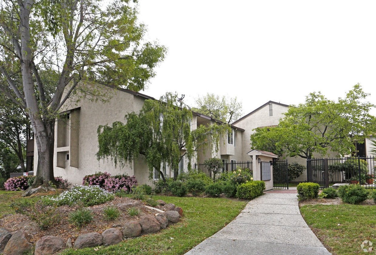

Explore Fremont living at Blacow Gardens. This apartment community is located in Fremont on Blacow Rd.. Schedule a time to view the available floorplans. The community staff is ready for you to visit. Experience a better way of living at Blacow Gardens. Stop by the leasing office to schedule a tour today.
Blacow Gardens is an apartment community located in Alameda County and the 94538 ZIP Code. This area is served by the Fremont Unified School District attendance zone.
Blacow is a suburban neighborhood about three miles south of Downtown Fremont. Blacow is family-friendly with several good schools, childcare centers, and parks. Along with large neighborhood parks, Blacow residents have access to amazing green spaces as well, including the Don Edwards San Francisco Bay National Wildlife Refuge and the Coyote Creek Lagoon Trail. This beautiful neighborhood is quiet and has mid-range to upscale single-family homes and apartments available for rent. Although residents certainly enjoy proximity to Downtown Fremont’s excellent shopping, dining, and cultural scenes, Blacow is convenient to several large commercial centers like NewPark Mall and Pacific Commons Shopping Center, which provides suburban staples including a movie theater, department stores, and chain restaurants. The south side of the neighborhood borders Interstate 880 allowing for easier commutes throughout the Bay Area and Silicon Valley.
Learn more about living in Blacow| Colleges & Universities | Distance | ||
|---|---|---|---|
| Colleges & Universities | Distance | ||
| Drive: | 6 min | 2.9 mi | |
| Drive: | 9 min | 4.6 mi | |
| Drive: | 16 min | 11.0 mi | |
| Drive: | 21 min | 14.6 mi |


Transportation options available in Fremont include Warm Springs / South Fremont, located 3.1 miles from Blacow Gardens. Blacow Gardens is near Norman Y Mineta San Jose International, located 15.1 miles or 20 minutes away, and Metro Oakland International, located 22.5 miles or 30 minutes away.
| Transit / Subway | Distance | ||
|---|---|---|---|
| Transit / Subway | Distance | ||
|
|
Drive: | 6 min | 3.1 mi |
|
|
Drive: | 8 min | 3.2 mi |
|
|
Drive: | 14 min | 8.1 mi |
|
|
Drive: | 14 min | 10.3 mi |
| Drive: | 16 min | 11.0 mi |
| Commuter Rail | Distance | ||
|---|---|---|---|
| Commuter Rail | Distance | ||
| Drive: | 8 min | 4.0 mi | |
| Drive: | 9 min | 4.1 mi | |
| Drive: | 17 min | 12.7 mi | |
| Drive: | 23 min | 16.5 mi | |
| Drive: | 24 min | 17.8 mi |
| Airports | Distance | ||
|---|---|---|---|
| Airports | Distance | ||
|
Norman Y Mineta San Jose International
|
Drive: | 20 min | 15.1 mi |
|
Metro Oakland International
|
Drive: | 30 min | 22.5 mi |
Scores provided by
Traffic
-Airport
-Businesses
-Scores provided by
HowLoud What is a Sound Score Rating? A Sound Score Rating aggregates noise caused by vehicle traffic, airplane traffic and local sources. How It WorksTime and distance from Blacow Gardens.
| Shopping Centers | Distance | ||
|---|---|---|---|
| Shopping Centers | Distance | ||
| Walk: | 3 min | 0.2 mi | |
| Walk: | 20 min | 1.1 mi | |
| Drive: | 2 min | 1.2 mi |
| Parks and Recreation | Distance | ||
|---|---|---|---|
| Parks and Recreation | Distance | ||
|
Central Park (Lake Elizabeth)
|
Drive: | 7 min | 3.2 mi |
|
Niles Canyon Railway
|
Drive: | 11 min | 5.6 mi |
|
Niles Community Park
|
Drive: | 13 min | 6.1 mi |
|
Quarry Lakes Regional Recreation Area
|
Drive: | 11 min | 6.4 mi |
|
Alameda Creek Regional Trail
|
Drive: | 11 min | 6.6 mi |
| Hospitals | Distance | ||
|---|---|---|---|
| Hospitals | Distance | ||
| Drive: | 5 min | 2.5 mi | |
| Drive: | 7 min | 3.4 mi |
| Military Bases | Distance | ||
|---|---|---|---|
| Military Bases | Distance | ||
| Drive: | 26 min | 17.8 mi | |
| Drive: | 41 min | 30.0 mi | |
| Drive: | 42 min | 30.2 mi |
Fitness Center Pool In Unit Washer & Dryer High-Speed Internet Stainless Steel Appliances Package Service
What Are Walk Score®, Transit Score®, and Bike Score® Ratings?
Walk Score® measures the walkability of any address. Transit Score® measures access to public transit. Bike Score® measures the bikeability of any address.
What is a Sound Score Rating?
A Sound Score Rating aggregates noise caused by vehicle traffic, airplane traffic and local sources.

41111 Blacow Rd
Fremont, CA 94538


