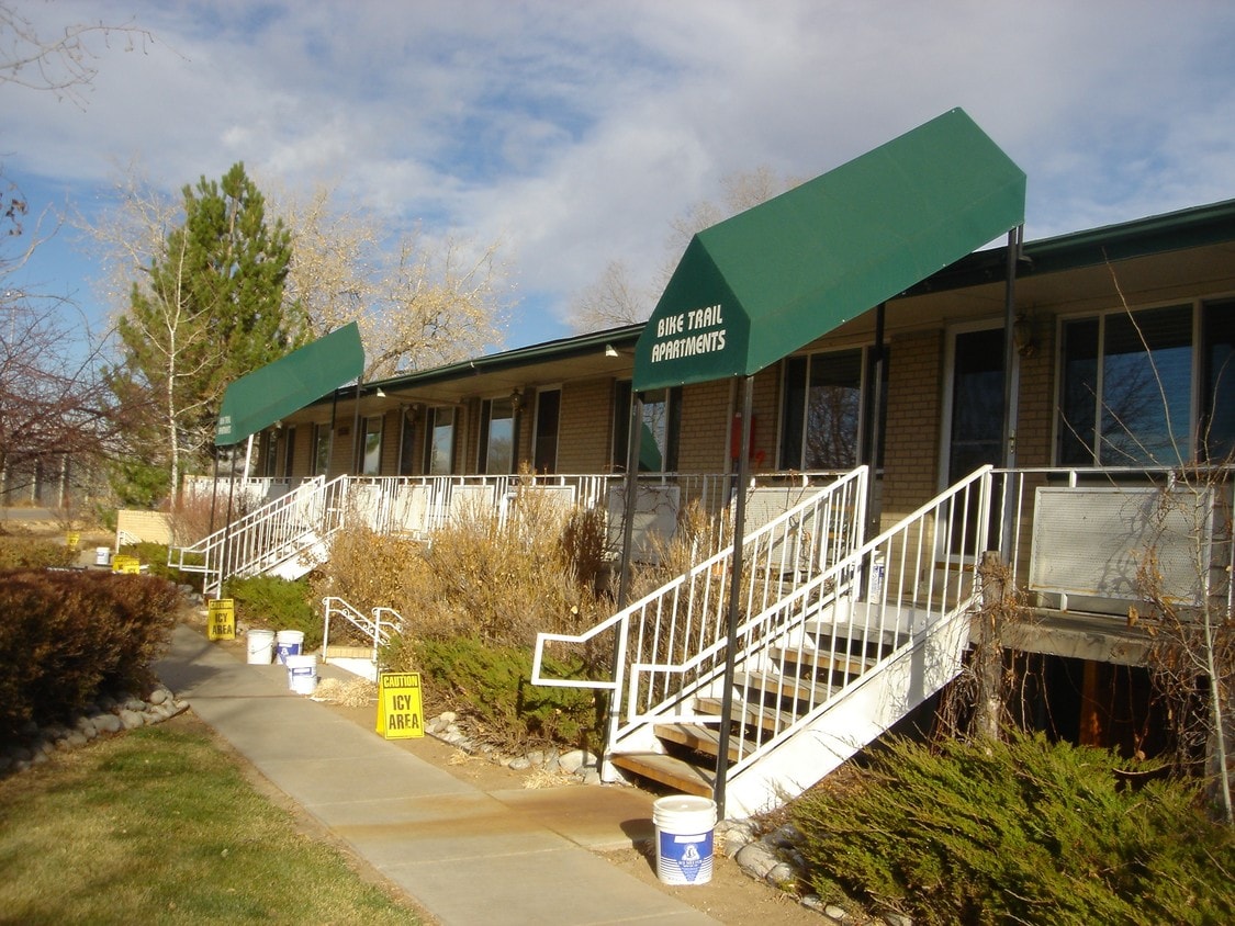
Bike Trail Apartments
2550 S Valley Hwy,
Denver,
CO
80222
-
Monthly Rent
Call for Rent
-
Bedrooms
1 - 2 bd
-
Bathrooms
1 ba
-
Square Feet
650 - 850 sq ft
Pricing & Floor Plans
Check Back Soon for Upcoming Availability
| Beds | Baths | Average SF | Availability |
|---|---|---|---|
| 1 Bedroom 1 Bedroom 1 Br | 1 Bath 1 Bath 1 Ba | 650 SF | Call for Availability |
| 2 Bedrooms 2 Bedrooms 2 Br | 1 Bath 1 Bath 1 Ba | 850 SF | Call for Availability |
Fees and Policies
Details
Property Information
-
Built in 1962
-
18 units/2 stories
About Bike Trail Apartments
Find your new home at Bike Trail Apartments. The 2550 S Valley Hwy location in the Southeast neighborhood of Denver has much to offer its residents. From pricing to features, the leasing team is ready to help you find your dream apartment. Select from 1 to 2 bedroom apartments then schedule a visit to see them in person. Stop by the leasing office to schedule your tour.
Bike Trail Apartments is an apartment community located in Arapahoe County and the 80222 ZIP Code. This area is served by the Cherry Creek 5 attendance zone.
Contact
Apartment Features
Lavavajillas
Acceso a Internet de alta velocidad
Microondas
Zona de eliminación de desechos
- Acceso a Internet de alta velocidad
- Libre de humo
- Almacén/trastero
- Lavavajillas
- Zona de eliminación de desechos
- Microondas
- Acceso a Internet de alta velocidad
- Libre de humo
- Almacén/trastero
- Lavavajillas
- Zona de eliminación de desechos
- Microondas
Located nine miles from Downtown Denver, Southeast Denver comprises the neighborhoods in the southeast of Denver along Interstate 25. Boasting a history almost as old as Denver itself, the area houses the University of Denver and its many beautiful historic buildings, but it has neighborhoods full of contemporary construction as well. Families enjoy the suburban feel of this area, students enjoy the proximity to the university, and professionals enjoy the easy commute into Denver. The beauty of the Rockies lies to the west, opening Southeast residents up to hiking opportunities and more.
Learn more about living in Southeast| Colleges & Universities | Distance | ||
|---|---|---|---|
| Colleges & Universities | Distance | ||
| Drive: | 6 min | 2.8 mi | |
| Drive: | 15 min | 6.6 mi | |
| Drive: | 13 min | 8.6 mi | |
| Drive: | 16 min | 9.4 mi |


View GreatSchools Rating Methodology
Data provided by GreatSchools.org © 2025. All rights reserved.
Transportation options available in Denver include Colorado, located 1.1 miles from Bike Trail Apartments. Bike Trail Apartments is near Denver International, located 28.4 miles or 35 minutes away.
| Transit / Subway | Distance | ||
|---|---|---|---|
| Transit / Subway | Distance | ||
|
|
Walk: | 21 min | 1.1 mi |
|
|
Drive: | 3 min | 1.6 mi |
|
|
Drive: | 3 min | 1.8 mi |
|
|
Drive: | 5 min | 3.4 mi |
|
|
Drive: | 7 min | 4.2 mi |
| Commuter Rail | Distance | ||
|---|---|---|---|
| Commuter Rail | Distance | ||
| Drive: | 18 min | 7.8 mi | |
|
|
Drive: | 14 min | 9.2 mi |
|
|
Drive: | 14 min | 9.4 mi |
| Drive: | 21 min | 9.5 mi | |
| Drive: | 21 min | 9.5 mi |
| Airports | Distance | ||
|---|---|---|---|
| Airports | Distance | ||
|
Denver International
|
Drive: | 35 min | 28.4 mi |
Time and distance from Bike Trail Apartments.
| Shopping Centers | Distance | ||
|---|---|---|---|
| Shopping Centers | Distance | ||
| Walk: | 10 min | 0.5 mi | |
| Walk: | 14 min | 0.7 mi | |
| Walk: | 15 min | 0.8 mi |
| Parks and Recreation | Distance | ||
|---|---|---|---|
| Parks and Recreation | Distance | ||
|
Chamberlin & Mt. Evans Observatories
|
Drive: | 5 min | 2.1 mi |
|
Washington Park
|
Drive: | 9 min | 4.8 mi |
|
Denver Botanic Gardens at York St.
|
Drive: | 14 min | 5.5 mi |
|
Denver Museum of Nature & Science
|
Drive: | 14 min | 6.0 mi |
|
DeKoevend Park
|
Drive: | 15 min | 7.6 mi |
| Hospitals | Distance | ||
|---|---|---|---|
| Hospitals | Distance | ||
| Drive: | 7 min | 3.5 mi | |
| Drive: | 9 min | 4.8 mi | |
| Drive: | 12 min | 4.9 mi |
| Military Bases | Distance | ||
|---|---|---|---|
| Military Bases | Distance | ||
| Drive: | 39 min | 16.7 mi | |
| Drive: | 69 min | 57.6 mi | |
| Drive: | 79 min | 67.3 mi |
Bike Trail Apartments Photos
Nearby Apartments
Within 50 Miles of Bike Trail Apartments
View More Communities-
Studio 135
135 Adams St
Denver, CO 80206
$1,945
1 Br 3.6 mi
-
Avenue 8 at Mayfair
5701 E 8th Ave
Denver, CO 80220
$1,245 - $1,875
1-2 Br 4.2 mi
-
Art Studios
1200 N Lincoln St
Denver, CO 80203
$1,799
1 Br 5.5 mi
-
The Avantus
8008 Montview Blvd
Denver, CO 80220
$1,191 - $1,659
1-2 Br 5.6 mi
-
The Mile
1598 Hooker St
Denver, CO 80204
$1,309 - $2,395
1-2 Br 7.4 mi
-
Iota Fox Station
500 W 41st Ave
Denver, CO 80216
$1,499 - $2,900
1-2 Br 8.0 mi
Bike Trail Apartments is in Southeast in the city of Denver. Here you’ll find three shopping centers within 0.8 mile of the property. Five parks are within 7.6 miles, including Chamberlin & Mt. Evans Observatories, Washington Park, and Denver Botanic Gardens at York St..
Applicant has the right to provide the property manager or owner with a Portable Tenant Screening Report (PTSR) that is not more than 30 days old, as defined in § 38-12-902(2.5), Colorado Revised Statutes; and 2) if Applicant provides the property manager or owner with a PTSR, the property manager or owner is prohibited from: a) charging Applicant a rental application fee; or b) charging Applicant a fee for the property manager or owner to access or use the PTSR.
What Are Walk Score®, Transit Score®, and Bike Score® Ratings?
Walk Score® measures the walkability of any address. Transit Score® measures access to public transit. Bike Score® measures the bikeability of any address.
What is a Sound Score Rating?
A Sound Score Rating aggregates noise caused by vehicle traffic, airplane traffic and local sources

2550 S Valley Hwy
Denver, CO 80222
Responded To This Review