
$3,495 / Month
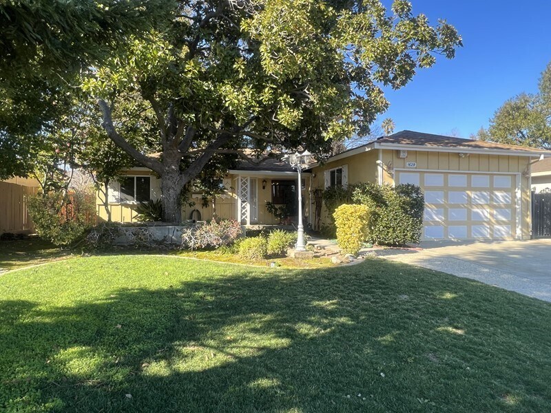
1629 Palo Santo Dr
Campbell, CA 95008
2 Weeks Ago
Favorites
1629 Palo Santo Dr

Favorites
Check Back Soon for Upcoming Availability
| Beds | Baths | Average SF |
|---|---|---|
| 3 Bedrooms 3 Bedrooms 3 Br | 1.5 Baths 1.5 Baths 1.5 Ba | 1,569 SF |
About This Property
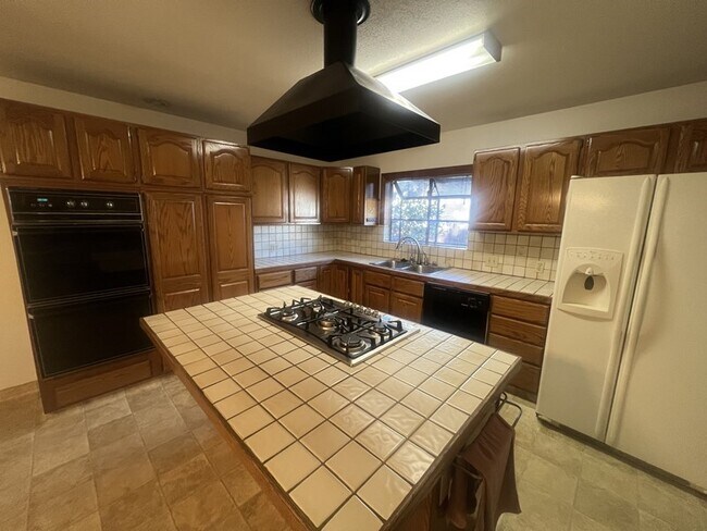
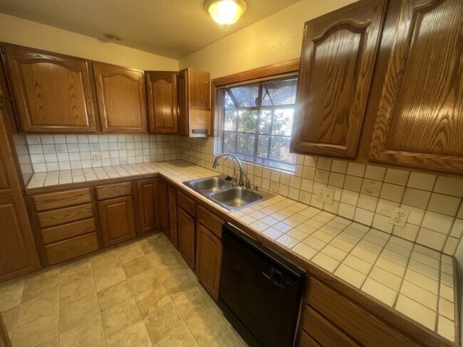
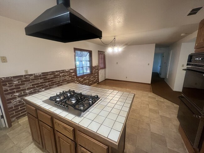
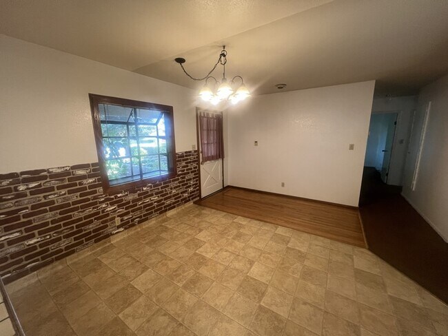
See more pictures and the virtual tour at Beautiful 3 bedroom 1.5 bath home in coveted Campbell neighborhood. Great floor plan includes fantastic kitchen with convenient island, lots of counter space, gas stove, double oven and more than enough cabinet space. Spacious sunroom is great for entertaining or just capturing a moment alone. Westgate shopping center is just a short walk away as well as several fabulous eateries. Great location with award winning schools and easy access to Silicon Valley companies via major freeways.
1629 Palo Santo Dr is a house located in Santa Clara County and the 95008 ZIP Code. This area is served by the Moreland attendance zone.
Location
Get Directions
Attractive homes and manicured lawns are the dominant features in this community, at the heart of one of San Jose’s most popular shopping districts. The majority of Castro’s landscape is occupied by suburban houses, with Moreland Middle School and Latimer Elementary School anchoring the east and west ends, respectively.
Right next door, residents have direct access to the huge Westgate Center shopping area, with its innumerable options for everything from groceries to casual dining to entertainment easily within walking distance from anywhere in the neighborhood.
Learn more about living in CastroBelow are rent ranges for similar nearby apartments
Education
| Colleges & Universities | Distance | ||
|---|---|---|---|
| Colleges & Universities | Distance | ||
| Drive: | 11 min | 3.6 mi | |
| Drive: | 11 min | 4.7 mi | |
| Drive: | 14 min | 6.2 mi | |
| Drive: | 13 min | 6.9 mi |
1629 Palo Santo Dr is within 11 minutes or 3.6 miles from West Valley College. It is also near San Jose City College and Santa Clara University.
Schools


Public Elementary & Middle School
Grades K-8
492 Students
Attendance Zone
Public Elementary School
Grades K-5
367 Students
Nearby
Public Middle School
Grades 6-8
783 Students
Attendance Zone
Public High School
Grades 9-12
1,459 Students
Attendance Zone
Private Elementary, Middle & High School
Grades K-10
22 Students
Nearby
Private Elementary & Middle School
Grades PK-8
Nearby
Private High School
Grades 9-12
Nearby
School data provided by
 The GreatSchools Rating helps parents compare schools within a state based on a variety of school quality indicators and provides a helpful picture of how effectively each school serves all of its students. Ratings are on a scale of 1 (below average) to 10 (above average) and can include test scores, college readiness, academic progress, advanced courses, equity, discipline and attendance data. We also advise parents to visit schools, consider other information on school performance and programs, and consider family needs as part of the school selection process.
View GreatSchools Rating Methodology
Data provided by GreatSchools.org © 2025. All rights reserved.
View GreatSchools Rating Methodology
Data provided by GreatSchools.org © 2025. All rights reserved.
Transportation options available in Campbell include Downtown Campbell Station, located 2.4 miles from 1629 Palo Santo Dr. 1629 Palo Santo Dr is near Norman Y Mineta San Jose International, located 6.7 miles or 15 minutes away, and San Francisco International, located 36.9 miles or 48 minutes away.
| Transit / Subway | Distance | ||
|---|---|---|---|
| Transit / Subway | Distance | ||
|
|
Drive: | 5 min | 2.4 mi |
|
|
Drive: | 6 min | 2.5 mi |
|
|
Drive: | 6 min | 2.8 mi |
|
|
Drive: | 8 min | 3.6 mi |
|
|
Drive: | 9 min | 4.5 mi |
| Commuter Rail | Distance | ||
|---|---|---|---|
| Commuter Rail | Distance | ||
| Drive: | 13 min | 5.9 mi | |
| Drive: | 13 min | 6.0 mi | |
| Drive: | 13 min | 7.2 mi | |
| Drive: | 13 min | 7.6 mi | |
| Drive: | 13 min | 7.6 mi |
| Airports | Distance | ||
|---|---|---|---|
| Airports | Distance | ||
|
Norman Y Mineta San Jose International
|
Drive: | 15 min | 6.7 mi |
|
San Francisco International
|
Drive: | 48 min | 36.9 mi |
Time and distance from 1629 Palo Santo Dr.
| Shopping Centers | Distance | ||
|---|---|---|---|
| Shopping Centers | Distance | ||
| Walk: | 8 min | 0.4 mi | |
| Walk: | 8 min | 0.5 mi | |
| Walk: | 11 min | 0.6 mi |
1629 Palo Santo Dr has 3 shopping centers within 0.6 mile, which is about a 11-minute walk. The miles and minutes will be for the farthest away property.
| Parks and Recreation | Distance | ||
|---|---|---|---|
| Parks and Recreation | Distance | ||
|
John D. Morgan Park
|
Drive: | 5 min | 2.0 mi |
|
Jack Fischer Park
|
Drive: | 6 min | 2.2 mi |
|
Orchard City Green
|
Drive: | 5 min | 2.5 mi |
|
Los Gatos Creek Trail
|
Drive: | 6 min | 2.9 mi |
|
Edith Morley Park
|
Drive: | 8 min | 3.6 mi |
1629 Palo Santo Dr has 5 parks within 3.6 miles, including John D. Morgan Park, Jack Fischer Park, and Orchard City Green.
| Hospitals | Distance | ||
|---|---|---|---|
| Hospitals | Distance | ||
| Drive: | 8 min | 4.6 mi | |
| Drive: | 9 min | 4.7 mi | |
| Drive: | 9 min | 4.9 mi |
1629 Palo Santo Dr has 3 hospitals within 4.9 miles, the nearest is Kaiser Foundation Hospital - Santa Clara which is 4.6 miles away and a 8 minute drive.
| Military Bases | Distance | ||
|---|---|---|---|
| Military Bases | Distance | ||
| Drive: | 23 min | 13.9 mi |
1629 Palo Santo Dr is 13.9 miles and a 23 minute drive from Ames Research Center.
You May Also Like
Similar Rentals Nearby


What Are Walk Score®, Transit Score®, and Bike Score® Ratings?
Walk Score® measures the walkability of any address. Transit Score® measures access to public transit. Bike Score® measures the bikeability of any address.
What is a Sound Score Rating?
A Sound Score Rating aggregates noise caused by vehicle traffic, airplane traffic and local sources

1629 Palo Santo Dr
Campbell, CA 95008