
Nova by Gomes
1213-1221 Broad St,
Newark, NJ 07114
$2,012 - $3,000
Studio - 2 Beds
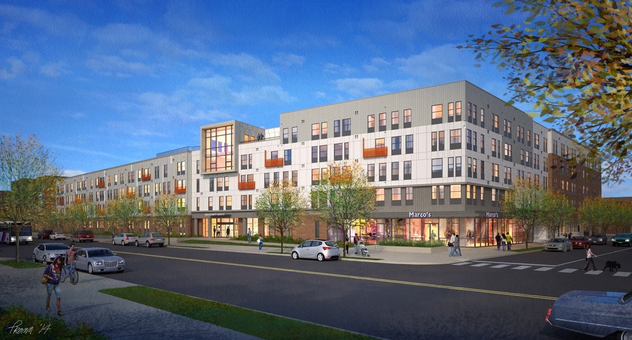
Discover your new apartment at Aston Heights. This property is situated in the Springfield Belmont area of Newark. Let the knowledgeable leasing staff show you everything this community has to offer. It's time to find your new home. Contact or stop by the Aston Heights leasing office to schedule a tour.
Aston Heights is an apartment community located in Essex County and the 07102 ZIP Code.
Air Conditioning
Dishwasher
Washer/Dryer Hookup
Tile Floors
Springfield-Belmont is an urban neighborhood in the heart of Newark. Filled with community parks like Jesse Allen Park and Nat Turner Park, the area is very family friendly. Springfield-Belmont sits just south of Rutgers University Newark Campus in University Heights. Residents of this convenient area have easy access to everything Downtown Newark has to offer, including the Prudential Center, the New Jersey Performing Arts Center, and University Hospital. Locals can easily travel to New York City as well, making this an ideal neighborhood for students and commuters.
Learn more about living in Springfield-BelmontCompare neighborhood and city base rent averages by bedroom.
| Springfield-Belmont | Newark, NJ | |
|---|---|---|
| Studio | $1,673 | $1,367 |
| 1 Bedroom | $1,676 | $1,609 |
| 2 Bedrooms | $2,136 | $2,027 |
| 3 Bedrooms | $2,056 | $2,115 |
| Colleges & Universities | Distance | ||
|---|---|---|---|
| Colleges & Universities | Distance | ||
| Walk: | 16 min | 0.9 mi | |
| Drive: | 3 min | 1.2 mi | |
| Drive: | 3 min | 1.5 mi | |
| Drive: | 10 min | 4.3 mi |
Transportation options available in Newark include Washington Street, located 1.0 miles from Aston Heights. Aston Heights is near Newark Liberty International, located 4.9 miles or 8 minutes away, and LaGuardia, located 24.2 miles or 43 minutes away.
| Transit / Subway | Distance | ||
|---|---|---|---|
| Transit / Subway | Distance | ||
|
|
Walk: | 19 min | 1.0 mi |
|
|
Drive: | 3 min | 1.2 mi |
|
|
Drive: | 3 min | 1.2 mi |
|
|
Drive: | 4 min | 1.6 mi |
|
|
Drive: | 4 min | 2.1 mi |
| Commuter Rail | Distance | ||
|---|---|---|---|
| Commuter Rail | Distance | ||
|
|
Drive: | 3 min | 1.5 mi |
|
|
Drive: | 5 min | 2.3 mi |
|
|
Drive: | 6 min | 2.5 mi |
|
|
Drive: | 8 min | 3.2 mi |
|
|
Drive: | 8 min | 3.2 mi |
| Airports | Distance | ||
|---|---|---|---|
| Airports | Distance | ||
|
Newark Liberty International
|
Drive: | 8 min | 4.9 mi |
|
LaGuardia
|
Drive: | 43 min | 24.2 mi |
Scores provided by
Traffic
-Airport
-Businesses
-Scores provided by
HowLoud What is a Sound Score Rating? A Sound Score Rating aggregates noise caused by vehicle traffic, airplane traffic and local sources. How It WorksTime and distance from Aston Heights.
| Shopping Centers | Distance | ||
|---|---|---|---|
| Shopping Centers | Distance | ||
| Walk: | 14 min | 0.8 mi | |
| Walk: | 18 min | 0.9 mi | |
| Drive: | 3 min | 1.2 mi |
| Parks and Recreation | Distance | ||
|---|---|---|---|
| Parks and Recreation | Distance | ||
|
Newark Museum and Dreyfuss Planetarium
|
Drive: | 3 min | 1.4 mi |
|
Branch Brook Park
|
Drive: | 8 min | 3.3 mi |
|
Kearny Marsh
|
Drive: | 10 min | 4.4 mi |
|
Edison National Historic Site
|
Drive: | 12 min | 5.9 mi |
|
Stephen Gregg Park
|
Drive: | 14 min | 8.3 mi |
| Hospitals | Distance | ||
|---|---|---|---|
| Hospitals | Distance | ||
| Drive: | 3 min | 1.4 mi | |
| Drive: | 3 min | 1.5 mi | |
| Drive: | 6 min | 2.7 mi |
| Military Bases | Distance | ||
|---|---|---|---|
| Military Bases | Distance | ||
| Drive: | 14 min | 8.7 mi | |
| Drive: | 26 min | 16.3 mi | |
| Drive: | 29 min | 16.8 mi |
What Are Walk Score®, Transit Score®, and Bike Score® Ratings?
Walk Score® measures the walkability of any address. Transit Score® measures access to public transit. Bike Score® measures the bikeability of any address.
What is a Sound Score Rating?
A Sound Score Rating aggregates noise caused by vehicle traffic, airplane traffic and local sources.

685 Dr Martin Luther King Jr Blvd
Newark, NJ 07102


