
Presidential Towers
555 W Madison St,
Chicago, IL 60661
$1,645 - $6,488
Studio - 2 Beds
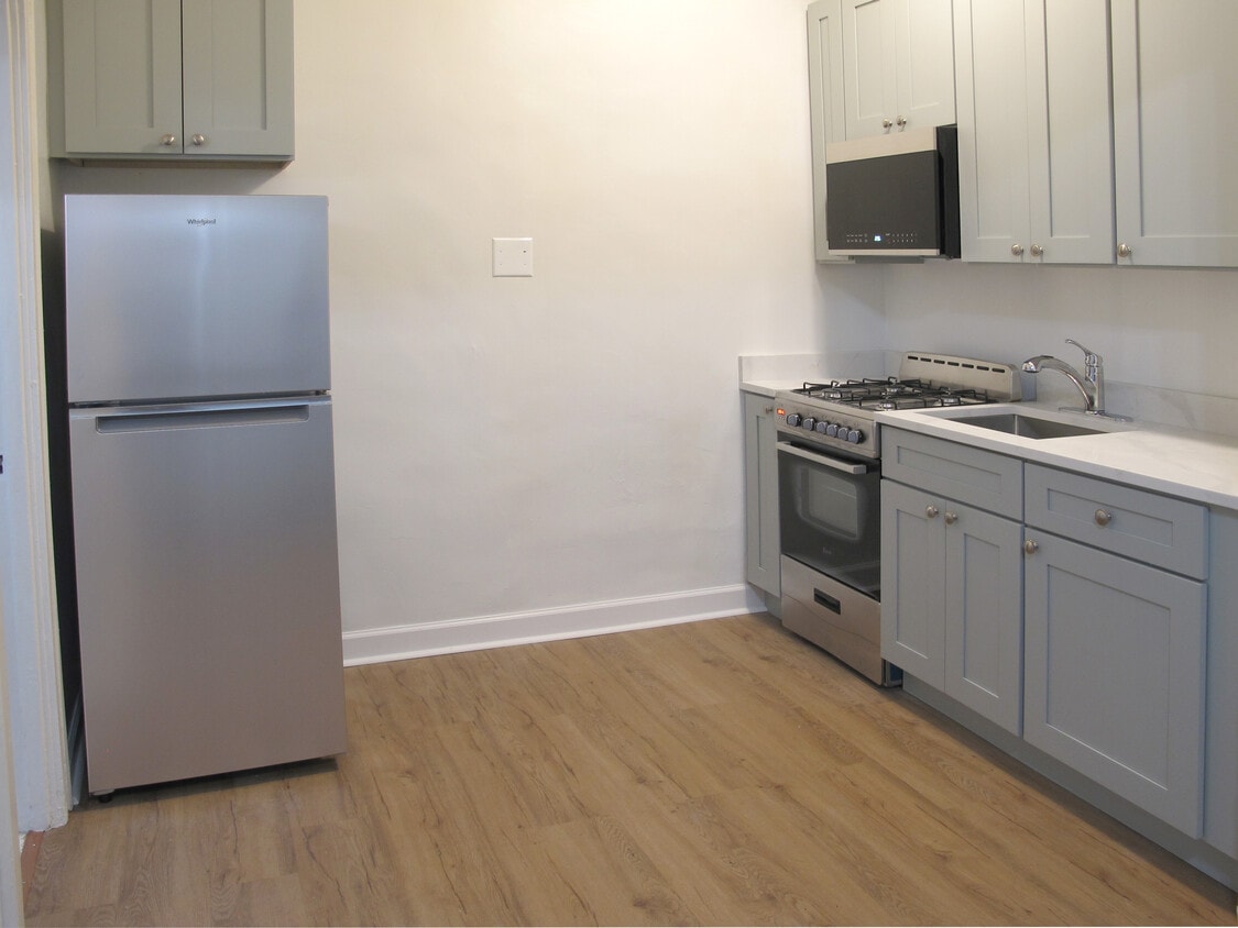
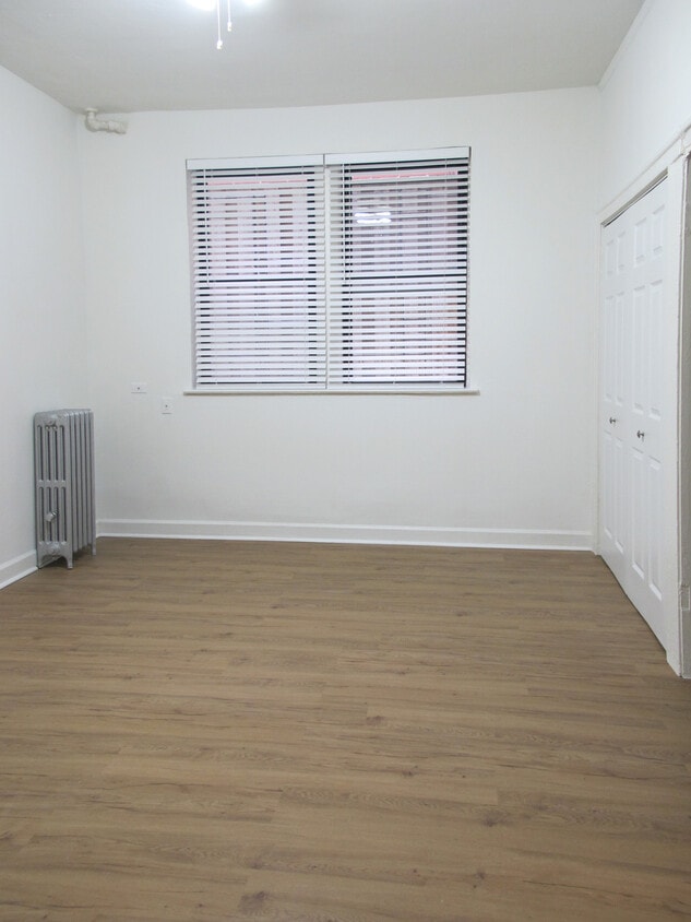
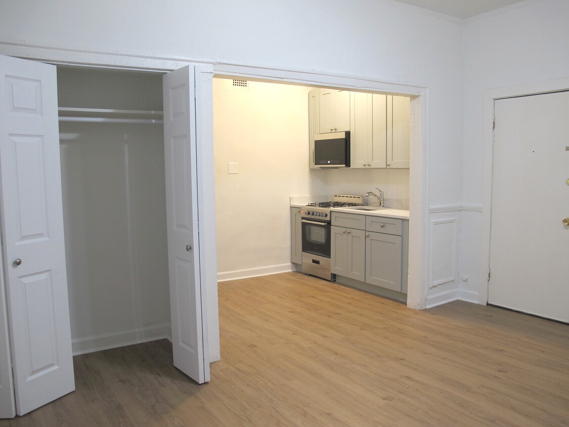
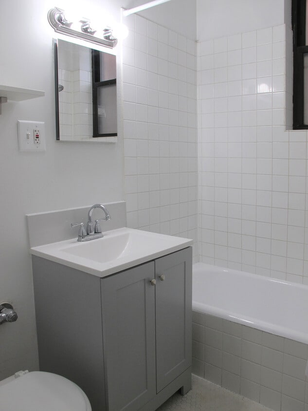

Estudio completamente renovado en el vecindario Ravenswood South. Fácil acceso a tiendas y transporte. Cocina nueva con encimeras de cuarzo, electrodomésticos de acero inoxidable y microondas empotrado. Pisos de madera. Ventilador de techo. Minipersianas. Conexión a cable e internet. Lavandería. Guardabicicletas. Edificio en buen estado. A pocos pasos de la línea marrón. No se admiten mascotas. Oficina de administración en el edificio. Alquiler: $975 - $995. Incluye servicios públicos: calefacción, gas para cocinar, agua caliente/fría y electricidad. El aire acondicionado tiene un costo adicional. Incluya su número de teléfono al responder a este anuncio.
Ashland Avenue Apartments is an apartment community located in Cook County and the 60613 ZIP Code. This area is served by the Chicago Public Schools attendance zone.
Instalaciones de lavandería
Control de accesos
Reciclaje
Recolección de basura: acera
Aire acondicionado
Acceso a Internet de alta velocidad
Suelos de madera maciza
Microondas
Chicago sprawls across roughly 228 square miles on the southwestern shore of Lake Michigan, with nearly 28 miles of lakefront where glass towers catch the morning light and commuter trains rumble through neighborhoods shaped by more than a century of reinvention. This is a city built on bold architecture and bolder ambition, where you can stand beneath the steel ribs of the “L” tracks one moment and find yourself strolling through Grant Park’s open lawns the next.
Renters here choose between classic greystone walk-ups in Lakeview, converted lofts in the West Loop’s Fulton Market district, and sleek high-rises with lake views in Streeterville. Logan Square draws crowds to its Milwaukee Avenue dining scene and the elevated 606 trail, while Lincoln Park offers tree-lined streets near the free zoo. River North packs art galleries alongside bustling restaurants, and Hyde Park anchors the South Side with the Museum of Science and Industry nearby.
Learn more about living in Chicago| Colleges & Universities | Distance | ||
|---|---|---|---|
| Colleges & Universities | Distance | ||
| Drive: | 3 min | 1.2 mi | |
| Drive: | 5 min | 2.5 mi | |
| Drive: | 6 min | 3.1 mi | |
| Drive: | 7 min | 3.2 mi |


Transportation options available in Chicago include Montrose Station (Brown Line), located 0.5 mile from Ashland Avenue Apartments. Ashland Avenue Apartments is near Chicago O'Hare International, located 13.5 miles or 22 minutes away, and Chicago Midway International, located 14.4 miles or 26 minutes away.
| Transit / Subway | Distance | ||
|---|---|---|---|
| Transit / Subway | Distance | ||
|
|
Walk: | 9 min | 0.5 mi |
|
|
Walk: | 11 min | 0.6 mi |
|
|
Walk: | 19 min | 1.0 mi |
|
|
Drive: | 2 min | 1.1 mi |
|
|
Drive: | 3 min | 1.3 mi |
| Commuter Rail | Distance | ||
|---|---|---|---|
| Commuter Rail | Distance | ||
|
|
Walk: | 17 min | 0.9 mi |
| Drive: | 5 min | 2.6 mi | |
|
|
Drive: | 5 min | 2.9 mi |
|
|
Drive: | 6 min | 3.6 mi |
|
|
Drive: | 9 min | 4.0 mi |
| Airports | Distance | ||
|---|---|---|---|
| Airports | Distance | ||
|
Chicago O'Hare International
|
Drive: | 22 min | 13.5 mi |
|
Chicago Midway International
|
Drive: | 26 min | 14.4 mi |
Scores provided by
Traffic
-Airport
-Businesses
-Scores provided by
HowLoud What is a Sound Score Rating? A Sound Score Rating aggregates noise caused by vehicle traffic, airplane traffic and local sources. How It WorksTime and distance from Ashland Avenue Apartments.
| Shopping Centers | Distance | ||
|---|---|---|---|
| Shopping Centers | Distance | ||
| Walk: | 14 min | 0.7 mi | |
| Walk: | 16 min | 0.8 mi | |
| Walk: | 17 min | 0.9 mi |
| Parks and Recreation | Distance | ||
|---|---|---|---|
| Parks and Recreation | Distance | ||
|
Chase Park
|
Walk: | 13 min | 0.7 mi |
|
Winnemac Park
|
Drive: | 4 min | 2.0 mi |
|
Wrightwood Park
|
Drive: | 5 min | 2.4 mi |
|
Oz Park
|
Drive: | 7 min | 3.5 mi |
|
Notebaert Nature Museum
|
Drive: | 6 min | 3.6 mi |
| Hospitals | Distance | ||
|---|---|---|---|
| Hospitals | Distance | ||
| Drive: | 2 min | 1.2 mi | |
| Drive: | 2 min | 1.2 mi | |
| Drive: | 4 min | 1.8 mi |
| Military Bases | Distance | ||
|---|---|---|---|
| Military Bases | Distance | ||
| Drive: | 30 min | 21.2 mi | |
| Drive: | 42 min | 32.1 mi | |
| Drive: | 50 min | 33.2 mi |
What Are Walk Score®, Transit Score®, and Bike Score® Ratings?
Walk Score® measures the walkability of any address. Transit Score® measures access to public transit. Bike Score® measures the bikeability of any address.
What is a Sound Score Rating?
A Sound Score Rating aggregates noise caused by vehicle traffic, airplane traffic and local sources.

4222 N Ashland Ave
Chicago, IL 60613


