
Aspire
5850 Central Ave,
Westminster, CO 80031
$1,545 - $3,139
Studio - 2 Beds
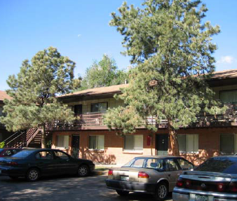

Quiet community located in Arvada. This complex is near shopping, restaurant parks, highway access and bus lines. Located near 52nd X Wadsworth.
Arvada Pines is an apartment community located in Jefferson County and the 80002 ZIP Code. This area is served by the Jeffco Public Schools attendance zone.
Air Conditioning
Dishwasher
High Speed Internet Access
Refrigerator
Tub/Shower
Disposal
Patio
Tile Floors
The I-70 Corridor runs through the suburb of Arvada and the city of Denver. Living along this corridor, residents experience a range of urban and suburban areas and amenities. Located just seven miles from the heart of Denver, the Corridor gives its residents easy access to Downtown, the suburbs, and the Rocky Mountains. On Interstate 70, locals can reach Vail ski resorts in less than two hours, making this neighborhood a popular locale for those interested in winter sports. Rent along the I-70 Corridor is affordable.
Learn more about living in I-70 Corridor| Colleges & Universities | Distance | ||
|---|---|---|---|
| Colleges & Universities | Distance | ||
| Drive: | 4 min | 1.6 mi | |
| Drive: | 10 min | 4.9 mi | |
| Drive: | 13 min | 7.0 mi | |
| Drive: | 17 min | 8.0 mi |


Transportation options available in Arvada include Lakewood/Wadsworth, located 4.9 miles from Arvada Pines. Arvada Pines is near Denver International, located 28.3 miles or 37 minutes away.
| Transit / Subway | Distance | ||
|---|---|---|---|
| Transit / Subway | Distance | ||
|
|
Drive: | 9 min | 4.9 mi |
|
|
Drive: | 11 min | 5.1 mi |
|
|
Drive: | 10 min | 5.1 mi |
|
|
Drive: | 10 min | 5.3 mi |
|
|
Drive: | 12 min | 6.0 mi |
| Commuter Rail | Distance | ||
|---|---|---|---|
| Commuter Rail | Distance | ||
| Drive: | 3 min | 1.2 mi | |
| Drive: | 3 min | 1.2 mi | |
| Drive: | 3 min | 1.3 mi | |
| Drive: | 3 min | 1.3 mi | |
| Drive: | 7 min | 2.6 mi |
| Airports | Distance | ||
|---|---|---|---|
| Airports | Distance | ||
|
Denver International
|
Drive: | 37 min | 28.3 mi |
Time and distance from Arvada Pines.
| Shopping Centers | Distance | ||
|---|---|---|---|
| Shopping Centers | Distance | ||
| Walk: | 14 min | 0.7 mi | |
| Walk: | 20 min | 1.1 mi | |
| Drive: | 3 min | 1.2 mi |
| Parks and Recreation | Distance | ||
|---|---|---|---|
| Parks and Recreation | Distance | ||
|
Wheat Ridge Active Adult Center
|
Drive: | 7 min | 3.1 mi |
|
Majestic View Nature Center
|
Drive: | 9 min | 3.1 mi |
|
Crown Hill Park
|
Drive: | 7 min | 3.3 mi |
|
Clements Community Center
|
Drive: | 8 min | 4.0 mi |
|
Van Bibber Park
|
Drive: | 10 min | 4.1 mi |
| Hospitals | Distance | ||
|---|---|---|---|
| Hospitals | Distance | ||
| Drive: | 5 min | 2.5 mi | |
| Drive: | 14 min | 8.4 mi | |
| Drive: | 15 min | 8.5 mi |
| Military Bases | Distance | ||
|---|---|---|---|
| Military Bases | Distance | ||
| Drive: | 51 min | 25.7 mi | |
| Drive: | 91 min | 72.6 mi | |
| Drive: | 100 min | 82.3 mi |
What Are Walk Score®, Transit Score®, and Bike Score® Ratings?
Walk Score® measures the walkability of any address. Transit Score® measures access to public transit. Bike Score® measures the bikeability of any address.
What is a Sound Score Rating?
A Sound Score Rating aggregates noise caused by vehicle traffic, airplane traffic and local sources

8440 W 52nd Ave
Arvada, CO 80002


