Adams Mill

93 Horseshoe Curve Rd, Tryon, NC 28782

2 Weeks Ago
Share Listing
Favorites
Adams Mill
Share Listing
Favorites

About Adams Mill

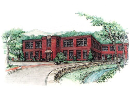
At Adams Mill, experience great living. Located at 93 Horseshoe Curve Rd. in Tryon, this community has so much to offer its residents. Schedule a time to see the current floorplan options. Here at this community, the leasing team will be ready to help you find the perfect fit. Stop by Adams Mill today.

Adams Mill is an apartment community located in Polk County and the 28782 ZIP Code. This area is served by the Polk County School District attendance zone.

Community Amenities

  • 24 Hour Access
  • Walk-Up

Apartment Features

Air Conditioning

Heating

Range

Kitchen

  • Air Conditioning
  • Heating
  • Wheelchair Accessible (Rooms)
  • Kitchen
  • Range
Location
93 Horseshoe Curve Rd, Tryon,
NC 28782
Get Directions
Education
Colleges & Universities Distance
Drive: 34 min 18.5 mi
Drive: 43 min 23.6 mi
Drive: 37 min 26.8 mi
Drive: 38 min 29.2 mi
Adams Mill is within 34 minutes or 18.5 miles from North Greenville University. It is also near Greenville Tech., Greer and Spartanburg Community College.
Schools
Public Elementary School
Grades PK-5
407 Students
Nearby
Public Middle School
Grades 6-8
218 Students
Nearby
Public High School
Grades 9-12
84 Students
Nearby
Private Elementary, Middle & High School
Grades PK-12
120 Students
Nearby
Private Elementary & Middle School
Grades K-8
30 Students
Nearby
Transportation

Adams Mill is near Greenville Spartanburg International, located 27.7 miles or 51 minutes away, and Asheville Regional, located 30.5 miles or 41 minutes away.

Commuter Rail Distance
Drive: 43 min 29.8 mi
Drive: 59 min 33.0 mi
Airports Distance
Airports Distance
Greenville Spartanburg International
Drive: 51 min 27.7 mi
Asheville Regional
Drive: 41 min 30.5 mi

Walkability Near Adams Mill

Getting Around
Somewhat Walkable
Walkability
20 / 100
Exceptionally Drivable
Drivability
90 / 100
Somewhat Bikeable
Bikeability
30 / 100

Scores provided by

What do Walkability, Transit, Drivability, and Bikeability mean? Walkability measures the walking distance to day-to-day needs. Transit measures access to public transportation. Drivability measures congestion, parking availability, and access to major roads. Bikeability measures the suitability for cycling. How It Works
-
Soundscore
- / 100

Traffic

-

Airport

-

Businesses

-

Scores provided by

HowLoud What is a Sound Score Rating? A Sound Score Rating aggregates noise caused by vehicle traffic, airplane traffic and local sources. How It Works
Points of Interest

Time and distance from Adams Mill.

Shopping Centers Distance
Drive: 4 min 1.4 mi
Drive: 5 min 2.0 mi
Drive: 5 min 2.0 mi
Adams Mill has 3 shopping centers within 2.0 miles, which is about a 5-minute drive. The miles and minutes will be for the farthest away property.
Parks and Recreation Distance
Foothills Equestrian Nature Center
Drive: 14 min 6.1 mi
Adams Mill has a nearby park, Foothills Equestrian Nature Center , located 6.1 miles or 14 minutes away.
Hospitals Distance
Hospitals Distance
Drive: 8 min 3.1 mi
Adams Mill is 3.1 miles and a 8 minute drive from St. Lukes Hospital.

Explore Similar Rentals Nearby