
$3,000
Total Monthly Price
12 Month Lease
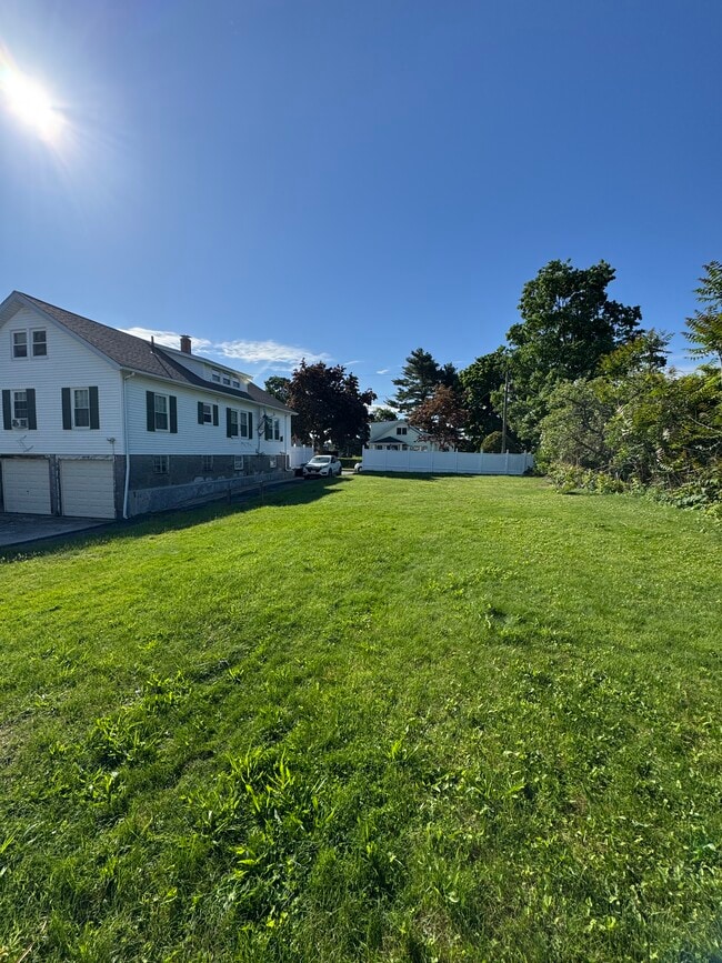
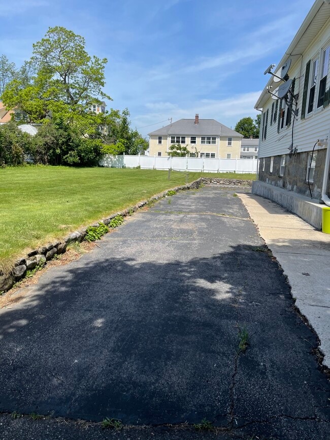
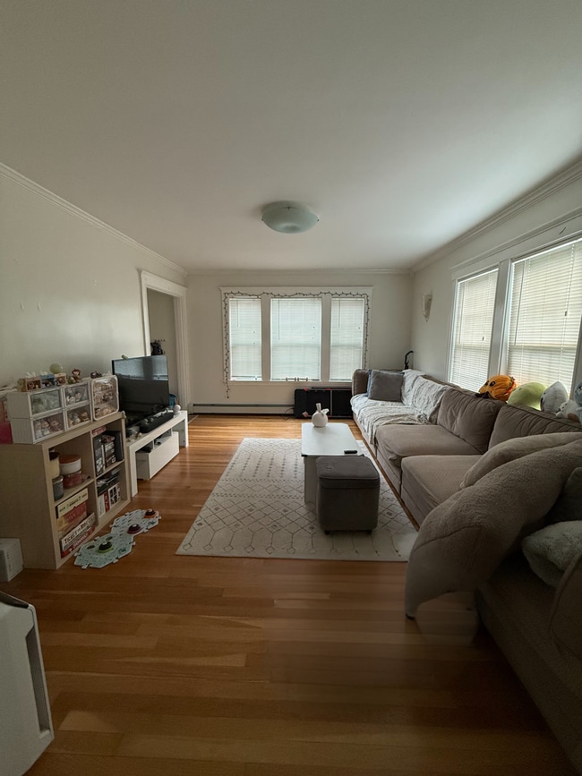
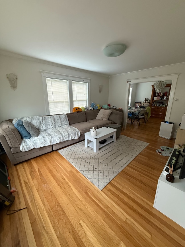
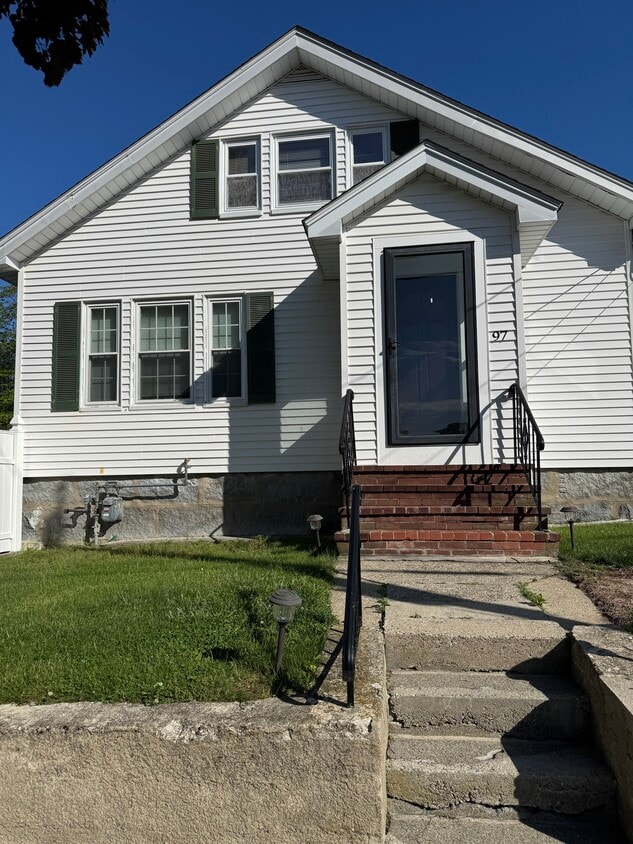
97 Elliot Ave
Quincy, MA 02171
Favorites
-
Bedrooms
3
-
Bathrooms
1
-
Square Feet
1,721 sq ft
-
Available
Available Aug 1
97 Elliot Ave

Favorites
About This Home
12 Month Lease,
$9,000 deposit,
Available Aug 1
Thank you for your interest in this property! To ensure an efficient screening process, please complete the rental application on apartments before requesting a tour. Once your application has been submitted, we will contact qualified applicants to arrange a viewing.
97 Elliot Ave is a house located in Norfolk County and the 02171 ZIP Code. This area is served by the Quincy School District attendance zone.
* Price shown is total price based on community-supplied monthly required fees. Excludes user-selected optional fees and variable or usage-based fees and required charges due at or prior to move-in or at move-out. Price, availability, fees, and any applicable rent special are subject to change without notice.
* Square footage definitions vary. Displayed square footage is approximate.
House Features
- Washer/Dryer
- Heating
- Tub/Shower
Fees and Policies
The fees listed below are community-provided and may exclude utilities or add-ons. All payments are made directly to the property and are non-refundable unless otherwise specified.
Details
Utilities Included
-
Water
-
Sewer
Contact
- Contact
Location
Get Directions
Across the Neponset River from Downtown Boston lies the Quincy neighborhood of Montclair. Commuters drive eight miles north on Interstate 93 to reach downtown, while residents without a car enjoy easy access using several bus lines or the Red Line's North Quincy subway station. This quiet residential community of apartments and bungalow-style houses provides a small-town atmosphere within a larger urban environment.
There’s a diverse mix of cuisine that belies Montclair’s relatively small size. Most of Montclair's businesses are found along Hancock Street near North Quincy station. Residents gather at Assembly Bar on Sundays for comfort food while watching the New England Patriots.
Learn more about living in Montclair
Education
| Colleges & Universities | Distance | ||
|---|---|---|---|
| Colleges & Universities | Distance | ||
| Drive: | 10 min | 4.4 mi | |
| Drive: | 14 min | 5.6 mi | |
| Drive: | 13 min | 6.9 mi | |
| Drive: | 13 min | 7.1 mi |
97 Elliot Ave is within 10 minutes or 4.4 miles from UMass Boston. It is also near Curry College and Northeastern University.
Schools


Public Elementary School
Grades K-5
365 Students
Attendance Zone
Public Elementary & Middle School
Grades PK-8
251 Students
Nearby
Public Middle School
Grades 6-8
574 Students
Attendance Zone
Public High School
Grades 9-12
1,505 Students
Attendance Zone
Private Elementary & Middle School
Grades PK-8
329 Students
Nearby
Private Elementary, Middle & High School
Grades K-12
Nearby
School data provided by
 The GreatSchools Rating helps parents compare schools within a state based on a variety of school quality indicators and provides a helpful picture of how effectively each school serves all of its students. Ratings are on a scale of 1 (below average) to 10 (above average) and can include test scores, college readiness, academic progress, advanced courses, equity, discipline and attendance data. We also advise parents to visit schools, consider other information on school performance and programs, and consider family needs as part of the school selection process.
View GreatSchools Rating Methodology
Data provided by GreatSchools.org © 2026. All rights reserved.
View GreatSchools Rating Methodology
Data provided by GreatSchools.org © 2026. All rights reserved.
Transportation options available in Quincy include North Quincy Station, located 0.7 mile from 97 Elliot Ave. 97 Elliot Ave is near General Edward Lawrence Logan International, located 9.8 miles or 18 minutes away.
| Transit / Subway | Distance | ||
|---|---|---|---|
| Transit / Subway | Distance | ||
|
|
Walk: | 13 min | 0.7 mi |
|
|
Walk: | 21 min | 1.1 mi |
|
|
Drive: | 5 min | 2.4 mi |
|
|
Drive: | 5 min | 2.6 mi |
|
|
Drive: | 6 min | 3.0 mi |
| Commuter Rail | Distance | ||
|---|---|---|---|
| Commuter Rail | Distance | ||
|
|
Drive: | 6 min | 2.3 mi |
|
|
Drive: | 7 min | 3.8 mi |
| Drive: | 9 min | 4.1 mi | |
| Drive: | 11 min | 4.3 mi | |
| Drive: | 9 min | 4.4 mi |
| Airports | Distance | ||
|---|---|---|---|
| Airports | Distance | ||
|
General Edward Lawrence Logan International
|
Drive: | 18 min | 9.8 mi |
Getting Around
 What do Walkability, Transit, Drivability, and Bikeability mean?
Walkability measures the walking distance to day-to-day needs.
Transit measures access to public transportation.
Drivability measures congestion, parking availability, and access to major roads.
Bikeability measures the suitability for cycling.
How It Works
What do Walkability, Transit, Drivability, and Bikeability mean?
Walkability measures the walking distance to day-to-day needs.
Transit measures access to public transportation.
Drivability measures congestion, parking availability, and access to major roads.
Bikeability measures the suitability for cycling.
How It Works
Moderately Walkable
Walkability
70
/ 100
Some Public Transit
Transit
40
/ 100
Moderately Drivable
Drivability
70
/ 100
Moderately Bikeable
Bikeability
60
/ 100
Scores provided by
Active
Soundscore™
75
/ 100
Traffic
ActiveAirport
CalmBusinesses
CalmScores provided by
HowLoud What is a Sound Score Rating? A Sound Score Rating aggregates noise caused by vehicle traffic, airplane traffic and local sources. How It WorksTime and distance from 97 Elliot Ave.
| Shopping Centers | Distance | ||
|---|---|---|---|
| Shopping Centers | Distance | ||
| Walk: | 2 min | 0.1 mi | |
| Drive: | 3 min | 1.2 mi | |
| Drive: | 4 min | 1.5 mi |
97 Elliot Ave has 3 shopping centers within 1.5 miles, which is about a 4-minute drive. The miles and minutes will be for the farthest away property.
| Parks and Recreation | Distance | ||
|---|---|---|---|
| Parks and Recreation | Distance | ||
|
Adams National Historical Park
|
Drive: | 5 min | 2.1 mi |
|
Squantum Point Park
|
Drive: | 8 min | 2.6 mi |
|
Dorchester Shores Reservation
|
Drive: | 9 min | 4.4 mi |
|
Mass Audubon's Boston Nature Center and Wildlife Sanctuary
|
Drive: | 10 min | 5.0 mi |
|
Franklin Park Zoo
|
Drive: | 10 min | 5.6 mi |
97 Elliot Ave has 5 parks within 5.6 miles, including Adams National Historical Park, Squantum Point Park, and Dorchester Shores Reservation.
| Hospitals | Distance | ||
|---|---|---|---|
| Hospitals | Distance | ||
| Drive: | 6 min | 3.0 mi | |
| Drive: | 6 min | 3.1 mi | |
| Drive: | 10 min | 5.9 mi |
97 Elliot Ave has 3 hospitals within 5.9 miles, the nearest is Beth Israel Deaconess Hospital - Milton which is 3.0 miles away and a 6 minute drive.
| Military Bases | Distance | ||
|---|---|---|---|
| Military Bases | Distance | ||
| Drive: | 38 min | 21.9 mi | |
| Drive: | 41 min | 22.1 mi | |
| Drive: | 43 min | 24.5 mi |
97 Elliot Ave has 3 military bases within 24.5 miles, the nearest is US Military Reservation which is 21.9 miles away and a 38 minute drive.
Amenities
- Washer/Dryer
- Heating
- Tub/Shower
97 Elliot Ave Photos
97 Elliot Ave
Quincy, MA 02171