

$850
/ Month
9353 Kendal Cir
Laurel, MD 20723
Today
|
Edit
Favorites
443-506-8488
-
Bedrooms
1
-
Bathrooms
1
-
Square Feet
--
-
Available
Available Now
Highlights
- Colonial Architecture
- 1 Fireplace
- No Interior Steps
- Central Heating
9353 Kendal Cir

Favorites
About This Home
Available Now
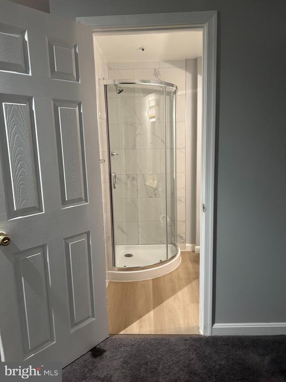
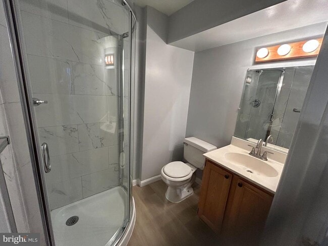
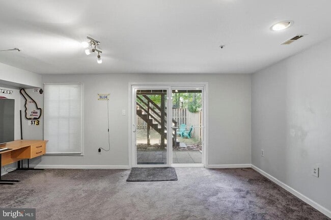
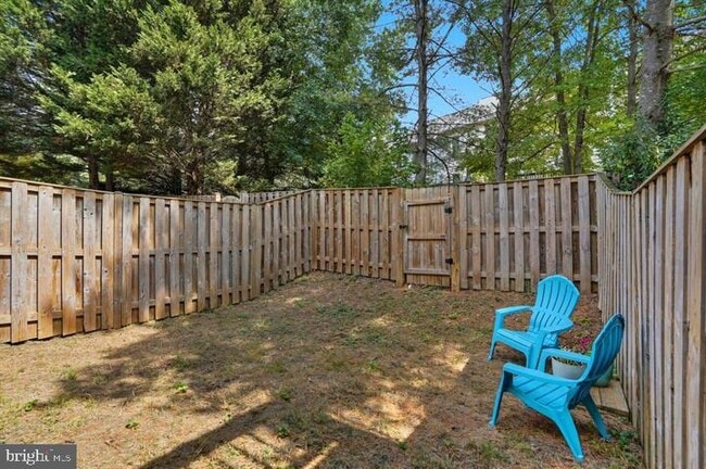
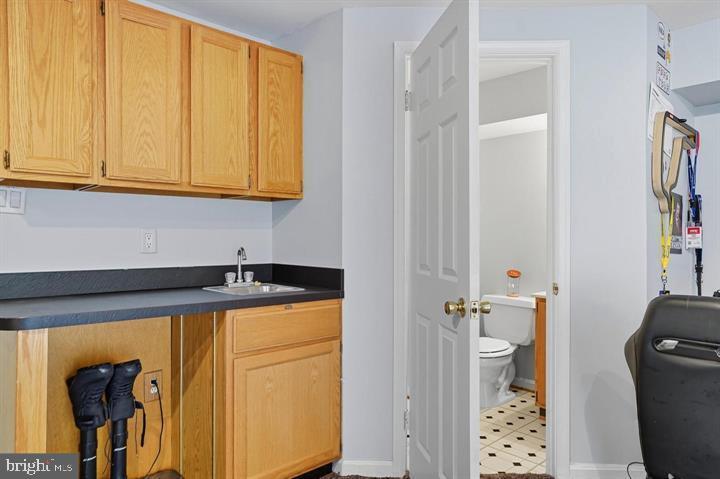
The rental space is ONLY the fully finished lower level. it is perfect for a room along with a full bath and extra storage. All utility costs are included in the $850 rent. Step outside to a fully fenced backyard, ideal for entertaining and outdoor fun. Parking is off site. Conveniently located near Route 1, Route 32, I-95, and just minutes from shops, restaurants, and entertainment, this home offers the best of both comfort and convenience.
9353 Kendal Cir is a house located in Howard County and the 20723 ZIP Code. This area is served by the Howard County Public Schools attendance zone.
* Price shown is base rent. Excludes user-selected optional fees and variable or usage-based fees and required charges due at or prior to move-in or at move-out. Price, availability, fees, and any applicable rent special are subject to change without notice.
* Square footage definitions vary. Displayed square footage is approximate.
Home Details
Home Type
Semi-Detached or Twin Home
Year Built
Built in 1989
Accessible Home Design
No Interior Steps
Bedrooms and Bathrooms
1 Full Bathroom
1 Bedroom
Home Design
Colonial Architecture
Permanent Foundation
Frame Construction
Interior Spaces
1 Fireplace
1,996 Sq Ft Home
Property has 3 Levels
Listing and Financial Details
Security Deposit $850
12-Month Min and 36-Month Max Lease Term
Available 11/23/25
Assessor Parcel Number 1406519962
Residential Lease
Lot Details
1,785 Sq Ft Lot
Parking
Off-Site Parking
Utilities
Central Heating
Heat Pump System
Electric Water Heater
Community Details
Overview
Bowling Brook Farms Subdivision
Pet Policy
No Pets Allowed
Contact
- Listed by Joanne M Lee | Realty 1 Maryland, LLC
- Phone Number
- Contact
-
Source
 Bright MLS, Inc.
Copyright © 2025 Bright MLS, Inc.
Location
Get Directions
Amenities
- Fireplace
Savage-Guilford is a peaceful neighborhood 18 miles south of Baltimore and 25 miles north of Washington, DC between Interstate 95 and Highway 1. Thanks to its ideal location and great amenities, the area attracts commuters and families. Renters will find an array of moderately priced apartments and townhomes that make up the rental scene. Within town, the Middle Patuxent River and Stone Lake provide renters with a variety of water sports as well as parks and trails to explore. Shops and restaurants are scattered throughout the area, but the Historic Savage Mill, a restored cotton mill turned into a trendy shopping mall, is a favorite spot for shopping and dining. Right outside of town, residents have access to more family-friendly fun at the Autobahn Indoor Speedway, Arundel Mills, and parks surrounding the Patuxent River.
Learn more about living in Savage-Guilford
Education
| Colleges & Universities | Distance | ||
|---|---|---|---|
| Colleges & Universities | Distance | ||
| Drive: | 17 min | 8.9 mi | |
| Drive: | 21 min | 12.6 mi | |
| Drive: | 22 min | 13.1 mi | |
| Drive: | 24 min | 13.1 mi |
9353 Kendal Cir is within 17 minutes or 8.9 miles from Howard Community College. It is also near UMBC and Bowie State University.
Schools


Public Elementary School
Grades PK-5
648 Students
Attendance Zone
Public Elementary School
Grades PK-5
742 Students
Nearby
Public Middle School
Grades 6-8
767 Students
Attendance Zone
Public High School
Grades 9-12
1,287 Students
Attendance Zone
Private Elementary & Middle School
Grades PK-8
248 Students
Nearby
Private Elementary, Middle & High School
Grades 4-11
71 Students
Nearby
Private Elementary, Middle & High School
Grades 3-12
75 Students
Nearby
School data provided by
 The GreatSchools Rating helps parents compare schools within a state based on a variety of school quality indicators and provides a helpful picture of how effectively each school serves all of its students. Ratings are on a scale of 1 (below average) to 10 (above average) and can include test scores, college readiness, academic progress, advanced courses, equity, discipline and attendance data. We also advise parents to visit schools, consider other information on school performance and programs, and consider family needs as part of the school selection process.
View GreatSchools Rating Methodology
Data provided by GreatSchools.org © 2025. All rights reserved.
View GreatSchools Rating Methodology
Data provided by GreatSchools.org © 2025. All rights reserved.
Transportation options available in Laurel include Dorsey, located 7.3 miles from 9353 Kendal Cir. 9353 Kendal Cir is near Baltimore/Washington International Thurgood Marshall, located 14.0 miles or 23 minutes away, and Ronald Reagan Washington Ntl, located 28.6 miles or 48 minutes away.
| Transit / Subway | Distance | ||
|---|---|---|---|
| Transit / Subway | Distance | ||
|
|
Drive: | 14 min | 7.3 mi |
|
|
Drive: | 23 min | 14.1 mi |
|
|
Drive: | 24 min | 14.2 mi |
| Drive: | 22 min | 14.9 mi |
| Commuter Rail | Distance | ||
|---|---|---|---|
| Commuter Rail | Distance | ||
|
|
Drive: | 8 min | 3.3 mi |
|
|
Drive: | 7 min | 3.5 mi |
|
|
Drive: | 8 min | 3.5 mi |
|
|
Drive: | 11 min | 4.9 mi |
|
|
Drive: | 14 min | 7.3 mi |
| Airports | Distance | ||
|---|---|---|---|
| Airports | Distance | ||
|
Baltimore/Washington International Thurgood Marshall
|
Drive: | 23 min | 14.0 mi |
|
Ronald Reagan Washington Ntl
|
Drive: | 48 min | 28.6 mi |
Time and distance from 9353 Kendal Cir.
| Shopping Centers | Distance | ||
|---|---|---|---|
| Shopping Centers | Distance | ||
| Walk: | 14 min | 0.8 mi | |
| Walk: | 19 min | 1.0 mi | |
| Drive: | 5 min | 2.3 mi |
9353 Kendal Cir has 3 shopping centers within 2.3 miles, which is about a 5-minute walk. The miles and minutes will be for the farthest away property.
| Parks and Recreation | Distance | ||
|---|---|---|---|
| Parks and Recreation | Distance | ||
|
Patuxent Research Refuge - North Tract
|
Drive: | 16 min | 8.0 mi |
|
Fairland Regional Park
|
Drive: | 15 min | 8.3 mi |
|
Browns Bridge Recreation Area
|
Drive: | 19 min | 9.3 mi |
|
Patuxent Research Refuge - South Tract
|
Drive: | 22 min | 11.0 mi |
|
Clark's Elioak Farm
|
Drive: | 21 min | 12.9 mi |
9353 Kendal Cir has 5 parks within 12.9 miles, including Patuxent Research Refuge - North Tract, Fairland Regional Park, and Browns Bridge Recreation Area.
| Hospitals | Distance | ||
|---|---|---|---|
| Hospitals | Distance | ||
| Drive: | 13 min | 6.2 mi | |
| Drive: | 18 min | 10.1 mi | |
| Drive: | 19 min | 12.4 mi |
9353 Kendal Cir has 3 hospitals within 12.4 miles, the nearest is Laurel Regional Medical Center which is 6.2 miles away and a 13 minute drive.
| Military Bases | Distance | ||
|---|---|---|---|
| Military Bases | Distance | ||
| Drive: | 14 min | 7.8 mi |
9353 Kendal Cir is 7.8 miles and a 14 minute drive from Fort George Meade.
You May Also Like
Similar Rentals Nearby


What Are Walk Score®, Transit Score®, and Bike Score® Ratings?
Walk Score® measures the walkability of any address. Transit Score® measures access to public transit. Bike Score® measures the bikeability of any address.
What is a Sound Score Rating?
A Sound Score Rating aggregates noise caused by vehicle traffic, airplane traffic and local sources
9353 Kendal Cir
Laurel, MD 20723