
Villa La Paz
10453 Artesia Blvd,
Bellflower, CA 90706
$1,940 - $2,530
Studio - 3 Beds


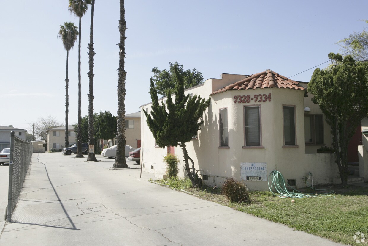
Discover your new place at 9328-9334 Palm St in Bellflower. This community can be found in Bellflower at 9328-9334 Palm St. in the 90706 area. Make sure you to see the current floorplan options. This community has a variety of amenities and features available to residents like high-speed internet access, convenient on-site parking options, and smoke free options. It's time to get moving on finding your next place. Contact or stop by 9328-9334 Palm St to schedule a tour!
9328-9334 Palm St is an apartment community located in Los Angeles County and the 90706 ZIP Code. This area is served by the Bellflower Unified School District attendance zone.
Bellflower is a dense, compact city in southeastern Los Angeles County, sitting about 20 miles from downtown LA with a character that feels distinctly its own. Incorporated in 1957, it grew from farmland into a tightly knit community that still carries traces of its agricultural past. Its name traces back to the Belle Fleur apple, a variety once harvested across local orchards before the area transitioned into the suburban city it is today. Bellflower Boulevard serves as the city's main artery, lined with small businesses, eateries, and a steady pulse of everyday activity.
The housing stock leans toward garden-style apartment communities, duplexes, and single-family rentals, with newer builds filling in alongside older midcentury construction. Renters looking for options between the sprawl of Long Beach and the denser urban core of LA find Bellflower sits in a practical middle ground.
Learn more about living in Bellflower| Colleges & Universities | Distance | ||
|---|---|---|---|
| Colleges & Universities | Distance | ||
| Drive: | 8 min | 3.1 mi | |
| Drive: | 9 min | 3.6 mi | |
| Drive: | 10 min | 5.6 mi | |
| Drive: | 17 min | 8.1 mi |


Transportation options available in Bellflower include Lakewood Station, located 3.3 miles from 9328-9334 Palm St. 9328-9334 Palm St is near Long Beach (Daugherty Field), located 6.6 miles or 13 minutes away, and Los Angeles International, located 20.4 miles or 29 minutes away.
| Transit / Subway | Distance | ||
|---|---|---|---|
| Transit / Subway | Distance | ||
|
|
Drive: | 7 min | 3.3 mi |
|
|
Drive: | 6 min | 4.7 mi |
|
|
Drive: | 12 min | 6.6 mi |
|
|
Drive: | 11 min | 6.6 mi |
|
|
Drive: | 14 min | 8.9 mi |
| Commuter Rail | Distance | ||
|---|---|---|---|
| Commuter Rail | Distance | ||
|
|
Drive: | 12 min | 7.1 mi |
|
|
Drive: | 15 min | 10.7 mi |
|
|
Drive: | 17 min | 11.4 mi |
|
|
Drive: | 18 min | 12.7 mi |
|
|
Drive: | 19 min | 14.1 mi |
| Airports | Distance | ||
|---|---|---|---|
| Airports | Distance | ||
|
Long Beach (Daugherty Field)
|
Drive: | 13 min | 6.6 mi |
|
Los Angeles International
|
Drive: | 29 min | 20.4 mi |
Scores provided by
Traffic
-Airport
-Businesses
-Scores provided by
HowLoud What is a Sound Score Rating? A Sound Score Rating aggregates noise caused by vehicle traffic, airplane traffic and local sources. How It WorksTime and distance from 9328-9334 Palm St.
| Shopping Centers | Distance | ||
|---|---|---|---|
| Shopping Centers | Distance | ||
| Walk: | 6 min | 0.4 mi | |
| Walk: | 11 min | 0.6 mi | |
| Walk: | 11 min | 0.6 mi |
| Parks and Recreation | Distance | ||
|---|---|---|---|
| Parks and Recreation | Distance | ||
|
Earl Burns Miller Japanese Garden
|
Drive: | 14 min | 7.2 mi |
|
El Dorado Nature Center
|
Drive: | 11 min | 7.6 mi |
|
El Dorado East Regional Park
|
Drive: | 13 min | 8.5 mi |
|
Compton Creek Natural Park at George Washington Elementary
|
Drive: | 14 min | 8.8 mi |
|
Colorado Lagoon
|
Drive: | 17 min | 11.9 mi |
| Hospitals | Distance | ||
|---|---|---|---|
| Hospitals | Distance | ||
| Drive: | 4 min | 2.1 mi | |
| Drive: | 6 min | 3.4 mi | |
| Drive: | 7 min | 3.7 mi |
| Military Bases | Distance | ||
|---|---|---|---|
| Military Bases | Distance | ||
| Drive: | 19 min | 12.0 mi | |
| Drive: | 28 min | 17.0 mi | |
| Drive: | 30 min | 20.9 mi |
Pets Allowed Fitness Center Pool In Unit Washer & Dryer Clubhouse Balcony
What Are Walk Score®, Transit Score®, and Bike Score® Ratings?
Walk Score® measures the walkability of any address. Transit Score® measures access to public transit. Bike Score® measures the bikeability of any address.
What is a Sound Score Rating?
A Sound Score Rating aggregates noise caused by vehicle traffic, airplane traffic and local sources.
9328-9334 Palm St
Bellflower, CA 90706


