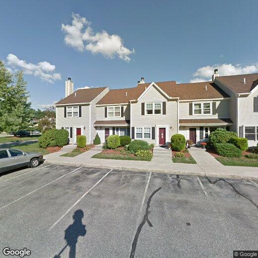
93 Cadogan Way

93 Cadogan Way

,

Nashua, NH 03062

2 Weeks Ago
| Edit

Under 30 minutes

Commute Time is calculated at rush hour.
Share Listing
Favorites
93 Cadogan Way
Share Listing
Favorites

Check Back Soon for Upcoming Availability

Beds Baths Average SF
2 Bedrooms 2 Bedrooms 2 Br 2.5 Baths 2.5 Baths 2.5 Ba 2,398 SF
Location
93 Cadogan Way, Nashua,
NH 03062
Get Directions
Neighborhood

Nestled on the New Hampshire-Massachusetts state line, Southwest Nashua combines the scenery of a New England village with the promise of a booming economy, all just an hour north of Boston. Southwest Nashua is home to excellent public schools, well-kept neighborhood parks, and an array of apartments available for rent, ranging from affordable to upscale. This family-friendly sector of the city sits just across U.S. Highway 3 from Pheasant Lane Mall and surrounding shopping centers, offering an abundance of retailers, restaurants, and services to choose from. Southwest Nashua is just minutes from downtown, so residents can easily travel into the city for work or leisure.

Learn more about living in Southwest Nashua 

Below are rent ranges for similar nearby apartments

Education
Colleges & Universities Distance
Drive: 9 min 3.4 mi
Drive: 22 min 12.0 mi
Drive: 24 min 13.1 mi
Drive: 34 min 19.6 mi
93 Cadogan Way is within 9 minutes or 3.4 miles from Rivier College. It is also near UMass Lowell and Middlesex C.C., Lowell Campus.
Transportation

93 Cadogan Way is near Manchester Boston Regional, located 19.0 miles or 31 minutes away, and General Edward Lawrence Logan International, located 46.1 miles or 64 minutes away.

Commuter Rail Distance
Drive: 23 min 13.0 mi
Drive: 32 min 14.6 mi
Drive: 27 min 16.9 mi
Drive: 37 min 17.2 mi
Drive: 34 min 18.4 mi
Airports Distance
Airports Distance
Manchester Boston Regional
Drive: 31 min 19.0 mi
General Edward Lawrence Logan International
Drive: 64 min 46.1 mi

Walkability Near 93 Cadogan Way Nashua, NH 03062

Getting Around
Somewhat Walkable
Walkability
30 / 100
Exceptionally Drivable
Drivability
90 / 100
Fairly Bikeable
Bikeability
50 / 100

Scores provided by

What do Walkability, Transit, Drivability, and Bikeability mean? Walkability measures the walking distance to day-to-day needs. Transit measures access to public transportation. Drivability measures congestion, parking availability, and access to major roads. Bikeability measures the suitability for cycling. How It Works
Calm
Soundscore
82 / 100

Traffic

Calm

Airport

Calm

Businesses

Calm

Scores provided by

HowLoud What is a Sound Score Rating? A Sound Score Rating aggregates noise caused by vehicle traffic, airplane traffic and local sources. How It Works
Points of Interest

Time and distance from 93 Cadogan Way.

Shopping Centers Distance
Drive: 5 min 1.8 mi
Drive: 7 min 2.4 mi
Drive: 7 min 2.5 mi
93 Cadogan Way has 3 shopping centers within 2.5 miles, which is about a 7-minute drive. The miles and minutes will be for the farthest away property.
Parks and Recreation Distance
Mine Falls Park
Drive: 11 min 4.6 mi
Nashua National Fish Hatchery
Drive: 11 min 5.5 mi
The Butterfly Place
Drive: 13 min 6.8 mi
Beaver Brook Association
Drive: 23 min 8.0 mi
Silver Lake State Park
Drive: 23 min 9.0 mi
93 Cadogan Way has 5 parks within 9.0 miles, including Mine Falls Park, Nashua National Fish Hatchery, and The Butterfly Place.
Hospitals Distance
Hospitals Distance
Drive: 11 min 4.2 mi
Drive: 10 min 4.4 mi
Drive: 20 min 10.6 mi
93 Cadogan Way has 3 hospitals within 10.6 miles, the nearest is Southern New Hampshire Health which is 4.2 miles away and a 11 minute drive.

You May Also Like

Similar Rentals Nearby