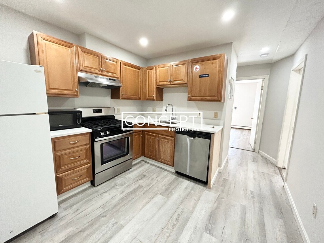
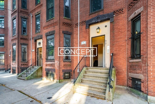
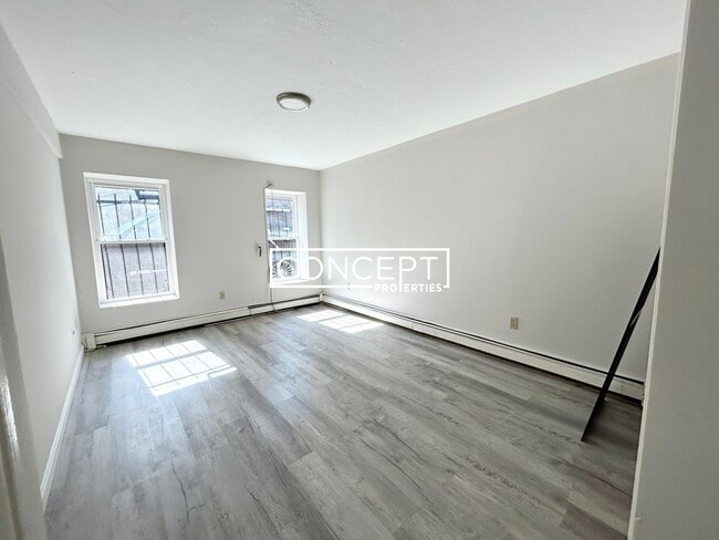
92 Hammond St Unit 1B
Boston, MA 02120
-
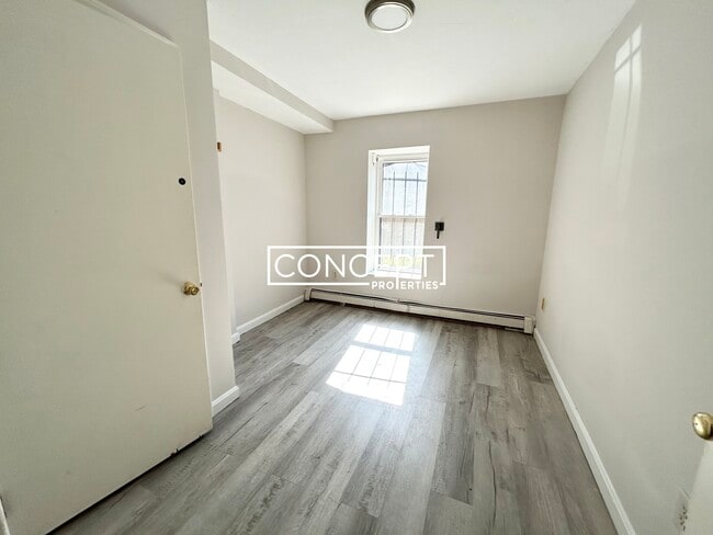
Bedrooms
3
-
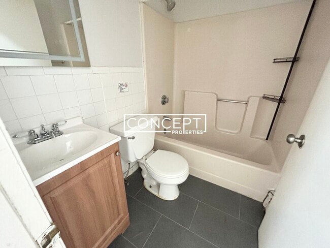
Bathrooms
1
-
Square Feet
--
-
Available
Available Now

About This Home
Transportation Bus: 28 Malcolm X Blvd @ O'Bryant HS (0.46 mi) Bus: 14 Centre St @ Highland Ave (0.67 mi) Bus: 45 205 Roxbury St (0.59 mi) Bus: SL4 Washington St @ Lenox St (0.26 mi) Bus: 47 Melnea Cass Blvd opp Kerr Way (0.12 mi) Bus: 1 Massachusetts Ave @ Tremont St (0.25 mi) Bus: CT3 Melnea Cass Blvd @ Washington St (0.27 mi) Bus: 22 Tremont St @ Prentiss St (0.52 mi) Bus: 43 Tremont St @ Hammond St (0.06 mi) Subway: Orange Line Ruggles (0.31 mi) Bus: 39 Ruggles (0.28 mi) Rail: Providence/Stoughton Line Ruggles (0.29 mi) Tram: E Northeastern University (0.39 mi) Bus: 10 Dartmouth St @ Tremont St (0.67 mi) Fee Disclosure: Application Fee: $35 First Month Rent: $2,700 Last Month Rent: $2,700 Security Deposit: $2,700 Disclaimer: Convenient to the Back Bay, South End, Bay Village, Beacon Hill, North End, Fenway, Kenmore, Audubon Circle, West End, Sowa, Mission Hill, Chinatown, Leather District, Downtown, Financial, Waterfront, Seaport, Charlestown, Prudential, Copley, Com
92A Hammond St. Unit 1B is a condo located in Suffolk County and the 02120 ZIP Code.
Condo Features
- Laundry Facilities
Fees and Policies
The fees below are based on community-supplied data and may exclude additional fees and utilities.
Pet policies are negotiable.
Details
Utilities Included
-
Water
Lease Options
-
12 Months
Contact
- Phone Number
- Website View Property Website
- Contact
-
Source

- Laundry Facilities
There's much to love about Boston's South End -- the elegant brownstones along Tremont Street, the fantastic shops and restaurants of Columbus Avenue, and the sophisticated yet collegiate feel of Harrison Avenue combine to create a tapestry of a neighborhood that offers something to everyone. This walkable, tree-filled neighborhood offers several parks, the Boston University School of Medicine, some of the best restaurants in the city, and easy access to Northeastern University.
By renting an apartment in South End Boston, you'll enjoy walking along brick-paved sidewalks past historic buildings housing everything from trendy boutiques to art galleries to the city's hottest cafes. You'll spend afternoons shopping at Copley Square and taking in sprawling greenery at Southwest Corridor Park, Blackstone Square, and beautiful Franklin Square. South End is popular with artists, and you'll discover a variety of terrific galleries to explore, especially along Harrison Avenue.
Learn more about living in South End Boston| Colleges & Universities | Distance | ||
|---|---|---|---|
| Colleges & Universities | Distance | ||
| Walk: | 8 min | 0.4 mi | |
| Walk: | 14 min | 0.7 mi | |
| Walk: | 19 min | 1.0 mi | |
| Drive: | 3 min | 1.2 mi |
Transportation options available in Boston include Massachusetts Ave Station (Orange Line), located 0.4 mile from 92A Hammond St. Unit 1B. 92A Hammond St. Unit 1B is near General Edward Lawrence Logan International, located 5.8 miles or 12 minutes away.
| Transit / Subway | Distance | ||
|---|---|---|---|
| Transit / Subway | Distance | ||
|
|
Walk: | 7 min | 0.4 mi |
|
|
Walk: | 10 min | 0.5 mi |
|
|
Walk: | 11 min | 0.6 mi |
|
|
Walk: | 15 min | 0.8 mi |
|
|
Walk: | 16 min | 0.9 mi |
| Commuter Rail | Distance | ||
|---|---|---|---|
| Commuter Rail | Distance | ||
|
|
Drive: | 2 min | 1.2 mi |
|
|
Drive: | 6 min | 1.4 mi |
| Drive: | 3 min | 1.5 mi | |
|
|
Drive: | 4 min | 1.6 mi |
|
|
Drive: | 8 min | 4.2 mi |
| Airports | Distance | ||
|---|---|---|---|
| Airports | Distance | ||
|
General Edward Lawrence Logan International
|
Drive: | 12 min | 5.8 mi |
Time and distance from 92A Hammond St. Unit 1B.
| Shopping Centers | Distance | ||
|---|---|---|---|
| Shopping Centers | Distance | ||
| Drive: | 4 min | 1.9 mi | |
| Drive: | 9 min | 5.2 mi | |
| Drive: | 10 min | 5.4 mi |
| Parks and Recreation | Distance | ||
|---|---|---|---|
| Parks and Recreation | Distance | ||
|
Roxbury Heritage State Park
|
Walk: | 15 min | 0.8 mi |
|
Boston Public Garden
|
Drive: | 5 min | 1.8 mi |
|
Charles River Reservation
|
Drive: | 5 min | 1.9 mi |
|
Boston African American National Historic Site
|
Drive: | 6 min | 2.2 mi |
|
Coit Observatory
|
Drive: | 5 min | 2.4 mi |
| Hospitals | Distance | ||
|---|---|---|---|
| Hospitals | Distance | ||
| Walk: | 13 min | 0.7 mi | |
| Drive: | 2 min | 1.1 mi | |
| Drive: | 3 min | 1.3 mi |
| Military Bases | Distance | ||
|---|---|---|---|
| Military Bases | Distance | ||
| Drive: | 29 min | 16.0 mi | |
| Drive: | 30 min | 16.1 mi |
You May Also Like
What Are Walk Score®, Transit Score®, and Bike Score® Ratings?
Walk Score® measures the walkability of any address. Transit Score® measures access to public transit. Bike Score® measures the bikeability of any address.
What is a Sound Score Rating?
A Sound Score Rating aggregates noise caused by vehicle traffic, airplane traffic and local sources

92 Hammond St
Boston, MA 02120