

$2,395 / Month
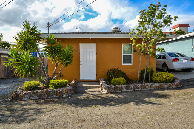
926 Appian Way
El Sobrante, CA 94803
2 Weeks Ago
Favorites
926 Appian Way

Favorites
Check Back Soon for Upcoming Availability
| Beds | Baths | Average SF |
|---|---|---|
| 2 Bedrooms 2 Bedrooms 2 Br | 1 Bath 1 Bath 1 Ba | 566 SF |
Fees and Policies
The fees below are based on community-supplied data and may exclude additional fees and utilities.
- Dogs Allowed
-
Fees not specified
- Cats Allowed
-
Fees not specified
- Parking
-
Other--
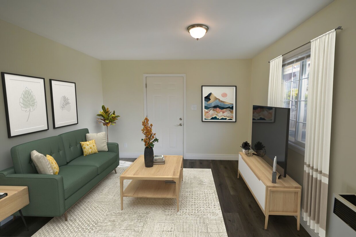
About This Property
This property is in the central thoroughfare between El Sobrante and Pinole. The area is central to the I-80 corridor and many conveniences such as the Pinole Vista Shopping Center. Within walking distance of the property, there are numerous restaurants to enjoy from around the world. Trader Joe's super market is a 5-minute drive down to Pinole Valley Road, where you will find Peet's Coffee and many other convenient places to stop in for your daily needs. If you are interested in the great outdoors, there is the San Pablo Reservoir Park and easy access to other hiking and recreation areas. If you are commuting, there's easy access to HWY-4, I-80, Orinda & Lafayette & Highway 24.
926 Appian Way is a house located in Contra Costa County and the 94803 ZIP Code.
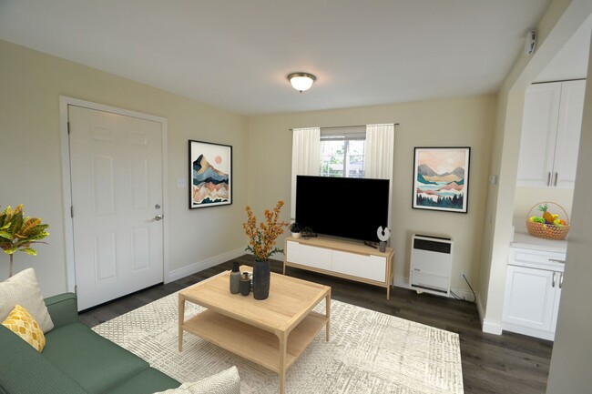
House Features
Washer/Dryer
Washer/Dryer Hookup
Hardwood Floors
Refrigerator
- Washer/Dryer
- Washer/Dryer Hookup
- Smoke Free
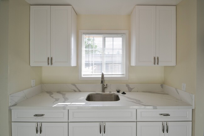
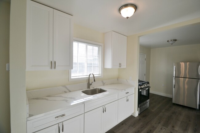
- Kitchen
- Oven
- Refrigerator
- Hardwood Floors
- Yard
Location
Get Directions
El Sobrante, which translates to “surplus” in Spanish, is a census designated place in Contra Costa County. Situated about 20 miles northwest of San Francisco, El Sobrante offers residents a quiet place to call home among tree-laden hills as well as convenience to one of the most dynamic cities in the United States.
While El Sobrante is a predominantly residential area, it is accessible to numerous retailers in the Pinole Vista Shopping Center and Hilltop Mall in addition to a variety of thrift stores and restaurants scattered along San Pablo Dam Road. El Sobrante residents enjoy the many outdoor recreational opportunities in their backyard, with Pinole Valley Park, Kennedy Grove Regional Recreation Area, Alvarado Park, Wildcat Canyon Regional Park, and San Pablo Reservoir Recreation Area all nearby. Easy access to the I-80 makes getting around from El Sobrante simple.
Learn more about living in El Sobrante
Amenities
- Washer/Dryer
- Washer/Dryer Hookup
- Smoke Free
- Kitchen
- Oven
- Refrigerator
- Hardwood Floors
- Yard
Education
| Colleges & Universities | Distance | ||
|---|---|---|---|
| Colleges & Universities | Distance | ||
| Drive: | 7 min | 3.7 mi | |
| Drive: | 20 min | 12.8 mi | |
| Drive: | 23 min | 13.9 mi | |
| Drive: | 24 min | 14.5 mi |
926 Appian Way is within 7 minutes or 3.7 miles from Contra Costa College. It is also near UC Berkeley and Berkeley City College.
Transportation options available in El Sobrante include El Cerrito Del Norte, located 6.9 miles from 926 Appian Way. 926 Appian Way is near Metro Oakland International, located 25.8 miles or 35 minutes away, and San Francisco International, located 33.4 miles or 47 minutes away.
| Transit / Subway | Distance | ||
|---|---|---|---|
| Transit / Subway | Distance | ||
|
|
Drive: | 10 min | 6.9 mi |
|
|
Drive: | 10 min | 6.9 mi |
|
|
Drive: | 11 min | 7.1 mi |
|
|
Drive: | 13 min | 8.7 mi |
|
|
Drive: | 18 min | 12.2 mi |
| Commuter Rail | Distance | ||
|---|---|---|---|
| Commuter Rail | Distance | ||
| Drive: | 12 min | 7.3 mi | |
|
|
Drive: | 15 min | 11.4 mi |
|
|
Drive: | 18 min | 13.2 mi |
|
|
Drive: | 20 min | 14.1 mi |
| Drive: | 26 min | 16.3 mi |
| Airports | Distance | ||
|---|---|---|---|
| Airports | Distance | ||
|
Metro Oakland International
|
Drive: | 35 min | 25.8 mi |
|
San Francisco International
|
Drive: | 47 min | 33.4 mi |
Time and distance from 926 Appian Way.
| Shopping Centers | Distance | ||
|---|---|---|---|
| Shopping Centers | Distance | ||
| Walk: | 9 min | 0.5 mi | |
| Walk: | 10 min | 0.6 mi | |
| Walk: | 12 min | 0.6 mi |
926 Appian Way has 3 shopping centers within 0.6 mile, which is about a 12-minute walk. The miles and minutes will be for the farthest away property.
| Parks and Recreation | Distance | ||
|---|---|---|---|
| Parks and Recreation | Distance | ||
|
Sobrante Ridge Regional Preserve
|
Drive: | 7 min | 2.8 mi |
|
Kennedy Grove Regional Recreation Area
|
Drive: | 9 min | 3.8 mi |
|
Ohlone Wilderness
|
Drive: | 7 min | 4.0 mi |
|
Point Pinole Regional Shoreline
|
Drive: | 8 min | 4.0 mi |
|
Wildcat Canyon Regional Park
|
Drive: | 16 min | 9.3 mi |
926 Appian Way has 5 parks within 9.3 miles, including Sobrante Ridge Regional Preserve, Ohlone Wilderness, and Kennedy Grove Regional Recreation Area.
| Hospitals | Distance | ||
|---|---|---|---|
| Hospitals | Distance | ||
| Drive: | 17 min | 12.5 mi | |
| Drive: | 17 min | 13.0 mi | |
| Drive: | 22 min | 14.4 mi |
926 Appian Way has 3 hospitals within 14.4 miles, the nearest is Adventist Health Vallejo which is 12.5 miles away and a 17 minute drive.
| Military Bases | Distance | ||
|---|---|---|---|
| Military Bases | Distance | ||
| Drive: | 8 min | 4.4 mi | |
| Drive: | 16 min | 9.4 mi | |
| Drive: | 23 min | 13.9 mi |
926 Appian Way has 3 military bases within 13.9 miles, the nearest is Armory West Contra Costa which is 4.4 miles away and a 8 minute drive.
You May Also Like
Similar Rentals Nearby


What Are Walk Score®, Transit Score®, and Bike Score® Ratings?
Walk Score® measures the walkability of any address. Transit Score® measures access to public transit. Bike Score® measures the bikeability of any address.
What is a Sound Score Rating?
A Sound Score Rating aggregates noise caused by vehicle traffic, airplane traffic and local sources
926 Appian Way
El Sobrante, CA 94803