$1,800 / Month
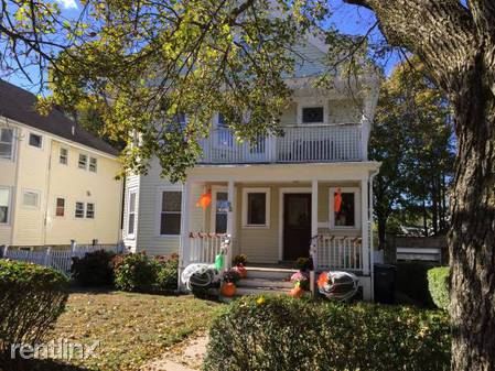
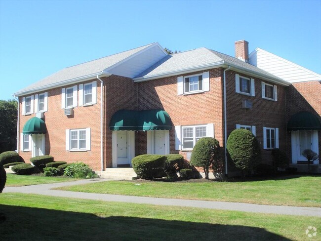
92 Manthorne Rd
West Roxbury, MA 02132
2 Weeks Ago
Favorites
92 Manthorne Rd

Favorites
Check Back Soon for Upcoming Availability
| Beds | Baths | Average SF |
|---|---|---|
| 2 Bedrooms 2 Bedrooms 2 Br | 1 Bath 1 Bath 1 Ba | — |
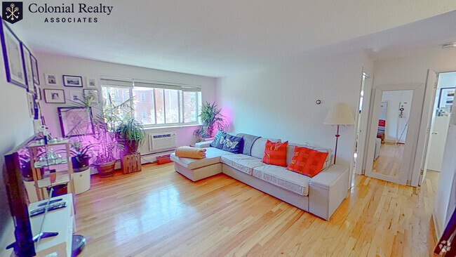
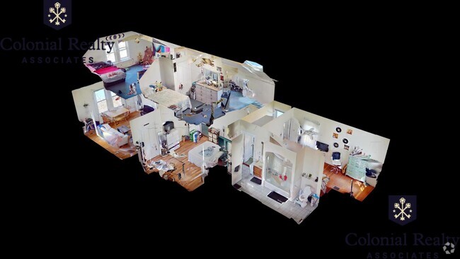
About This Property
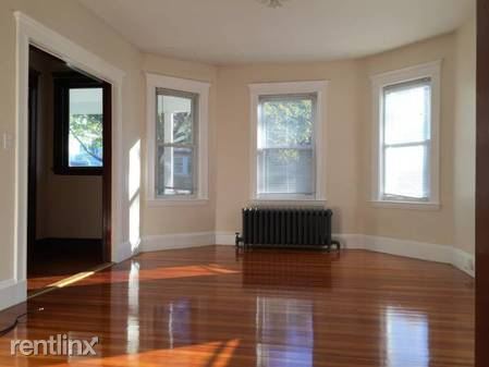
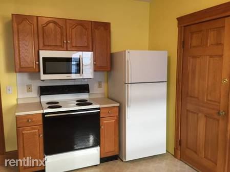
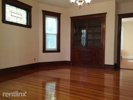
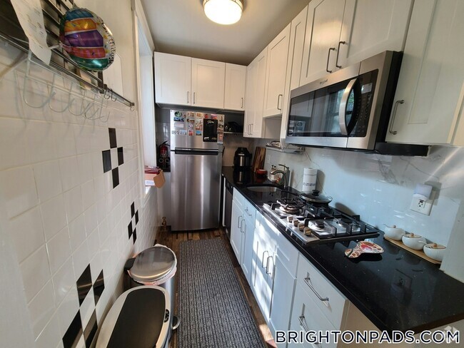
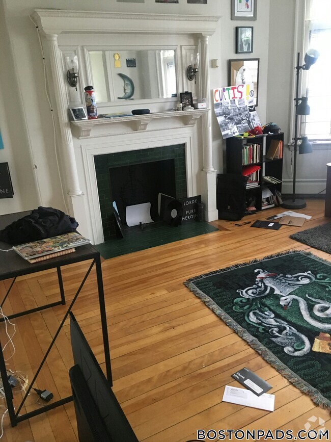
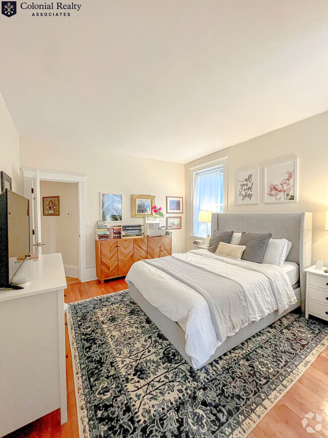
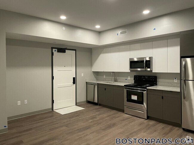
(617) 595-2600 - 2 BEDROOM - 1 BATH - First floor 2 bedroom apartment in West Roxbury available for rent now for $1800/month + utilities. The apartment has: • 2 Bedrooms, • Eat-in Kitchen • Dining room with built in china cabinet and stained glass window • Living room • Full bath • Hardwood floors throughout. • Storage available in the basement with washer and dryer Basement Free Laundry - NO PETS - Available parking On street Listing#-169421982 Tracy Johnson Centre Realty Group 617-595-2600 (RLNE1886642)
92 Manthorne Rd is a condo located in Suffolk County and the 02132 ZIP Code. This area is served by the Boston Public Schools attendance zone.
Location
Get Directions
Victorian homes perched along sidewalks that frame narrow streets flanked with trees, a historic downtown shopping district, and gorgeous parks help define the neighborhood of West Roxbury. This Boston neighborhood is on the southwest side of Downtown. This neighborhood was frequently visited by celebrities like author Nathaniel Hawthorne, who wrote a book about his stay in the community.
If you like the outdoors, then West Roxbury is perfect for you! Brook Farm's original 179 acres is now a National Historic Landmark and an ideal hiking and picnicking spot. The vast Millennium Park is attached to Brook Farm and includes six miles of hiking trails, a canoe launch, great views of the Boston skyline, and picnic areas. West Roxbury apartments are ideal for commuters, situated just eight miles southwest of Downtown Boston, with a ride on the MBTA Needham Line taking less than 20 minutes.
Learn more about living in West Roxbury
Education
| Colleges & Universities | Distance | ||
|---|---|---|---|
| Colleges & Universities | Distance | ||
| Drive: | 11 min | 5.1 mi | |
| Drive: | 14 min | 5.1 mi | |
| Drive: | 12 min | 5.2 mi | |
| Drive: | 12 min | 5.4 mi |
92 Manthorne Rd is within 12 minutes or 5.4 miles from Boston College. It is also near Boston College, Brighton and Curry College.
Schools

Public Elementary School
Grades PK-6
176 Students
Attendance Zone
Public Elementary & Middle School
Grades PK-8
586 Students
Attendance Zone
Public Middle School
Grades 6-8
348 Students
Attendance Zone
Public Middle School
Grades 6-8
133 Students
Attendance Zone
Public High School
Grades 12
39 Students
Attendance Zone
Private Elementary & Middle School
Grades PK-8
Nearby
Private Elementary School
Grades PK-6
314 Students
Nearby
Private Middle & High School
Grades 7-12
304 Students
Nearby
School data provided by
 The GreatSchools Rating helps parents compare schools within a state based on a variety of school quality indicators and provides a helpful picture of how effectively each school serves all of its students. Ratings are on a scale of 1 (below average) to 10 (above average) and can include test scores, college readiness, academic progress, advanced courses, equity, discipline and attendance data. We also advise parents to visit schools, consider other information on school performance and programs, and consider family needs as part of the school selection process.
View GreatSchools Rating Methodology
View GreatSchools Rating Methodology
Transportation options available in West Roxbury include Forest Hills Station, located 3.2 miles from 92 Manthorne Rd. 92 Manthorne Rd is near General Edward Lawrence Logan International, located 11.7 miles or 24 minutes away.
| Transit / Subway | Distance | ||
|---|---|---|---|
| Transit / Subway | Distance | ||
|
|
Drive: | 6 min | 3.2 mi |
|
|
Drive: | 8 min | 3.3 mi |
|
|
Drive: | 8 min | 3.3 mi |
|
|
Drive: | 10 min | 3.8 mi |
|
|
Drive: | 9 min | 4.1 mi |
| Commuter Rail | Distance | ||
|---|---|---|---|
| Commuter Rail | Distance | ||
|
|
Walk: | 10 min | 0.5 mi |
|
|
Walk: | 12 min | 0.6 mi |
|
|
Drive: | 4 min | 1.2 mi |
|
|
Drive: | 4 min | 1.4 mi |
|
|
Drive: | 6 min | 3.2 mi |
| Airports | Distance | ||
|---|---|---|---|
| Airports | Distance | ||
|
General Edward Lawrence Logan International
|
Drive: | 24 min | 11.7 mi |
Time and distance from 92 Manthorne Rd.
| Shopping Centers | Distance | ||
|---|---|---|---|
| Shopping Centers | Distance | ||
| Walk: | 10 min | 0.6 mi | |
| Drive: | 4 min | 1.4 mi | |
| Drive: | 6 min | 1.8 mi |
92 Manthorne Rd has 3 shopping centers within 1.8 miles, which is about a 6-minute walk. The miles and minutes will be for the farthest away property.
| Parks and Recreation | Distance | ||
|---|---|---|---|
| Parks and Recreation | Distance | ||
|
Arnold Arboretum of Harvard University
|
Drive: | 4 min | 1.6 mi |
|
Brook Farm Historic Site
|
Drive: | 4 min | 1.9 mi |
|
Stony Brook Reservation
|
Drive: | 5 min | 2.2 mi |
|
Mass Audubon's Boston Nature Center and Wildlife Sanctuary
|
Drive: | 10 min | 3.3 mi |
|
Frederick Law Olmsted National Historic Site
|
Drive: | 8 min | 3.5 mi |
92 Manthorne Rd has 5 parks within 3.5 miles, including Brook Farm Historic Site, Arnold Arboretum of Harvard University, and Stony Brook Reservation.
| Hospitals | Distance | ||
|---|---|---|---|
| Hospitals | Distance | ||
| Walk: | 12 min | 0.7 mi | |
| Drive: | 5 min | 1.9 mi | |
| Drive: | 8 min | 3.5 mi |
92 Manthorne Rd has 3 hospitals within 3.5 miles, the nearest is Bournewood Hospital which is 0.7 mile away and a 12 minute walk.
| Military Bases | Distance | ||
|---|---|---|---|
| Military Bases | Distance | ||
| Drive: | 25 min | 13.9 mi | |
| Drive: | 31 min | 17.8 mi |
92 Manthorne Rd is 13.9 miles from US Military Reservation, and is convenient to other military bases, including Hanscom Air Force Base.
You May Also Like
Similar Rentals Nearby

What Are Walk Score®, Transit Score®, and Bike Score® Ratings?
Walk Score® measures the walkability of any address. Transit Score® measures access to public transit. Bike Score® measures the bikeability of any address.
What is a Sound Score Rating?
A Sound Score Rating aggregates noise caused by vehicle traffic, airplane traffic and local sources

92 Manthorne Rd
West Roxbury, MA 02132