
$4,500
/ Month
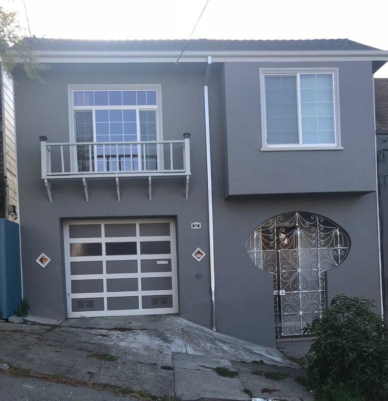
92 Manchester St
San Francisco, CA 94110
2 Weeks Ago
|
Edit
Favorites
92 Manchester St

Favorites
Check Back Soon for Upcoming Availability
| Beds | Baths | Average SF |
|---|---|---|
| 2 Bedrooms 2 Bedrooms 2 Br | 1 Bath 1 Bath 1 Ba | 963 SF |
Fees and Policies
The fees below are based on community-supplied data and may exclude additional fees and utilities.
- Dogs Allowed
-
Fees not specified
- Cats Allowed
-
Fees not specified
- Parking
-
Garage--
Details
Lease Options
-
12 Months
About This Property
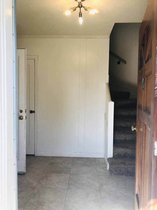
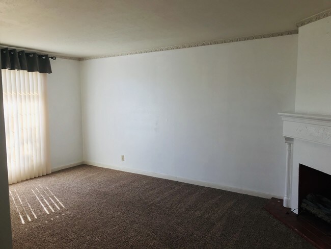
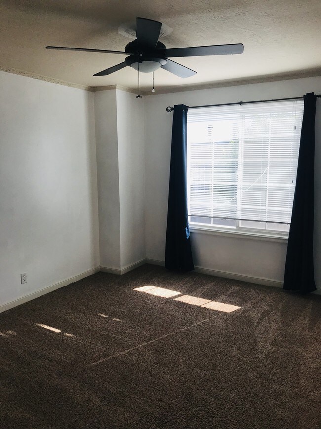
Nestled away on Manchester Street up on the hill, this property is in close proximity to Precita Park, cafes, shops and restaurants. The home has 2 bedrooms, 1 bathroom, and 1 car garage, Please contact me for more information. Kind Regards, James Wong
92 Manchester St is a house located in San Francisco County and the 94110 ZIP Code. This area is served by the San Francisco Unified attendance zone.
House Features
- Washer/Dryer
- Smoke Free
- Gated
Location
Get Directions
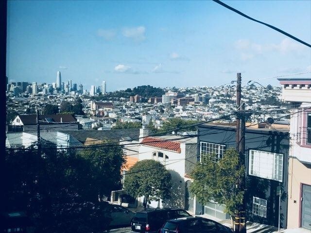
Life in the Bernal Heights neighborhood of San Francisco centers around the area's many parks, which provide space for community events, recreation, and more. This residential neighborhood keeps mostly to itself, with neighbors enjoying their spectacular views and access to a weekly farmer's market and flea market. Modern apartments give way to incredible homes in the classic San Francisco style.
The Fiesta on the Hill closes down streets every fall, and local filmmakers get to show off their latest work at the Bernal Heights Outdoor Cinema, which sets up for a couple of months a year. The more daring in the neighborhood participate in the yearly San Francisco Illegal Soap Box Derby, taking advantage of the steep hills to enjoy a true adventure as they race for the prize.
Learn more about living in Bernal HeightsBelow are rent ranges for similar nearby apartments
Amenities
- Washer/Dryer
- Smoke Free
- Gated
Education
| Colleges & Universities | Distance | ||
|---|---|---|---|
| Colleges & Universities | Distance | ||
| Drive: | 7 min | 2.4 mi | |
| Drive: | 7 min | 2.8 mi | |
| Drive: | 7 min | 3.1 mi | |
| Drive: | 12 min | 4.5 mi |
92 Manchester St is within 7 minutes or 2.4 miles from California College of the Arts. It is also near UC San Francisco, Mission Bay and City College of San Francisco.
Schools


Public Elementary School
Grades K-5
Nearby
Public Elementary & Middle School
Grades K-8
459 Students
Nearby
Public Elementary School
Grades K-5
416 Students
Nearby
Public Middle & High School
Grades 8-12
401 Students
Nearby
Private Elementary & Middle School
Grades PK-8
476 Students
Nearby
Private Elementary & Middle School
Grades 3-8
15 Students
Nearby
Private Middle & High School
Grades 8-12
Nearby
School data provided by
 The GreatSchools Rating helps parents compare schools within a state based on a variety of school quality indicators and provides a helpful picture of how effectively each school serves all of its students. Ratings are on a scale of 1 (below average) to 10 (above average) and can include test scores, college readiness, academic progress, advanced courses, equity, discipline and attendance data. We also advise parents to visit schools, consider other information on school performance and programs, and consider family needs as part of the school selection process.
View GreatSchools Rating Methodology
Data provided by GreatSchools.org © 2025. All rights reserved.
View GreatSchools Rating Methodology
Data provided by GreatSchools.org © 2025. All rights reserved.
Transportation options available in San Francisco include 24Th St Mission Station, located 0.7 mile from 92 Manchester St. 92 Manchester St is near San Francisco International, located 11.4 miles or 18 minutes away, and Metro Oakland International, located 22.1 miles or 34 minutes away.
| Transit / Subway | Distance | ||
|---|---|---|---|
| Transit / Subway | Distance | ||
|
|
Walk: | 13 min | 0.7 mi |
|
|
Walk: | 14 min | 0.7 mi |
|
|
Walk: | 14 min | 0.8 mi |
|
|
Walk: | 17 min | 0.9 mi |
| Walk: | 17 min | 0.9 mi |
| Commuter Rail | Distance | ||
|---|---|---|---|
| Commuter Rail | Distance | ||
| Drive: | 6 min | 2.8 mi | |
| Drive: | 6 min | 2.9 mi | |
| Drive: | 7 min | 3.5 mi | |
| Drive: | 7 min | 3.8 mi | |
| Drive: | 7 min | 3.8 mi |
| Airports | Distance | ||
|---|---|---|---|
| Airports | Distance | ||
|
San Francisco International
|
Drive: | 18 min | 11.4 mi |
|
Metro Oakland International
|
Drive: | 34 min | 22.1 mi |
Time and distance from 92 Manchester St.
| Shopping Centers | Distance | ||
|---|---|---|---|
| Shopping Centers | Distance | ||
| Walk: | 8 min | 0.4 mi | |
| Drive: | 7 min | 1.8 mi | |
| Drive: | 5 min | 1.8 mi |
92 Manchester St has 3 shopping centers within 1.8 miles, which is about a 5-minute walk. The miles and minutes will be for the farthest away property.
| Parks and Recreation | Distance | ||
|---|---|---|---|
| Parks and Recreation | Distance | ||
|
Heron's Head Park
|
Drive: | 7 min | 2.6 mi |
|
Buena Vista Park
|
Drive: | 9 min | 3.2 mi |
|
Children's Creativity Museum
|
Drive: | 8 min | 3.4 mi |
|
Randall Museum
|
Drive: | 10 min | 3.4 mi |
|
Candlestick Point State Recreation Area
|
Drive: | 10 min | 3.5 mi |
92 Manchester St has 5 parks within 3.5 miles, including Heron's Head Park, Randall Museum, and Buena Vista Park.
| Hospitals | Distance | ||
|---|---|---|---|
| Hospitals | Distance | ||
| Walk: | 11 min | 0.6 mi | |
| Drive: | 4 min | 1.2 mi | |
| Drive: | 5 min | 1.8 mi |
92 Manchester St has 3 hospitals within 1.8 miles, the nearest is California Pacific Medical Center - Mission Bernal which is 0.6 mile away and a 11 minute walk.
| Military Bases | Distance | ||
|---|---|---|---|
| Military Bases | Distance | ||
| Drive: | 20 min | 7.4 mi | |
| Drive: | 31 min | 16.7 mi |
92 Manchester St is 7.4 miles from East Fort Miley, and is convenient to other military bases, including Alameda/US Naval Air Station San Francisco.
You May Also Like
Similar Rentals Nearby


What Are Walk Score®, Transit Score®, and Bike Score® Ratings?
Walk Score® measures the walkability of any address. Transit Score® measures access to public transit. Bike Score® measures the bikeability of any address.
What is a Sound Score Rating?
A Sound Score Rating aggregates noise caused by vehicle traffic, airplane traffic and local sources

92 Manchester St
San Francisco, CA 94110