$1,800 / Month
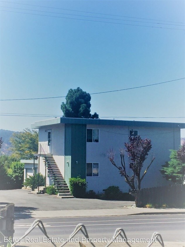
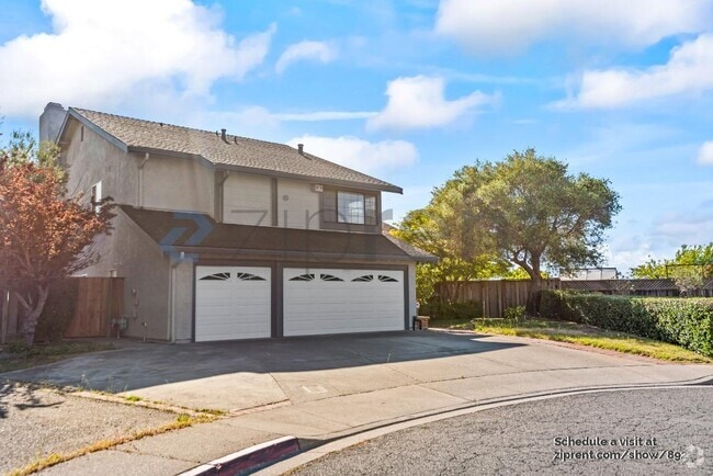
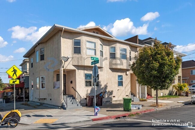
908 Military W
Benicia, CA 94510
2 Weeks Ago
Favorites
908 Military W

Favorites
Check Back Soon for Upcoming Availability
| Beds | Baths | Average SF |
|---|---|---|
| 2 Bedrooms 2 Bedrooms 2 Br | 1 Bath 1 Bath 1 Ba | 873 SF |
Fees and Policies
The fees below are based on community-supplied data and may exclude additional fees and utilities.
About This Property
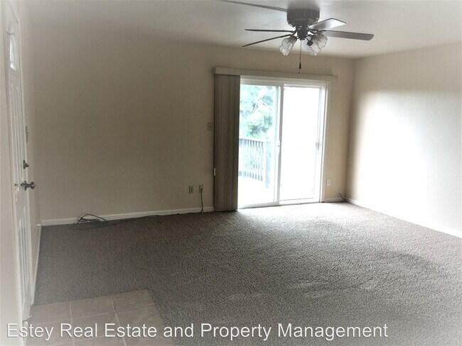
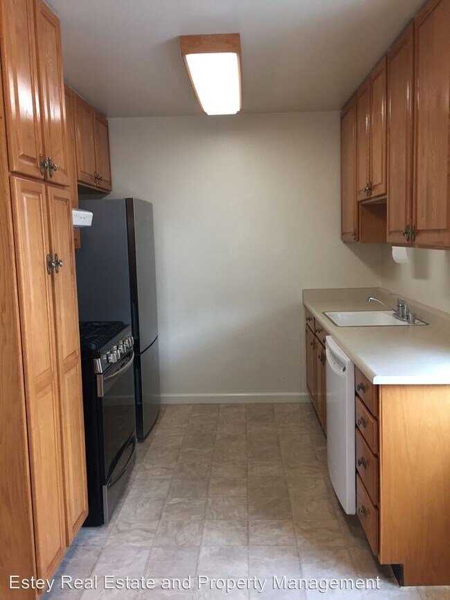
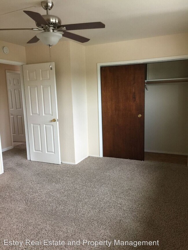
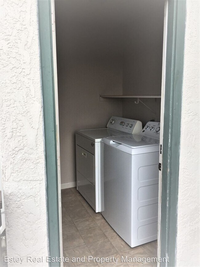
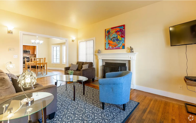
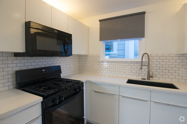
(707) 745-0924 - Benicia Upstairs Duplex With Bay Views - Estey Real Estate & Property Management presents this 2 bedrooms and 1 bathroom duplex. Gorgeous bay views from the deck. Has 1-car garage with lots of shelf space. Enclosed laundry room. Entry to spacious living room with ceiling fan. Dining room in kitchen. Kitchen has stainless appliances refrigerator, gas stove, and dishwasher. Close to Benicia High School and Mary Farmer Elementary and 9th Street beach. Renters insurance required. Due to third party listings please refer to our website at www.esteyrealestate.com for the accurate information. No Pets Allowed (RLNE4257079) Other Amenities: Other (washer, bay views), Garage. Appliances: Dishwasher, Refrigerator, Range, Garbage Disposal, Microwave. Pet policies: No Dogs Allowed, No Cats Allowed.
908 Military W is a house located in Solano County and the 94510 ZIP Code. This area is served by the Benicia Unified attendance zone.
Unique Features
- No Dogs Allowed, No Cats Allowed, Amenities - washer, bay views, Garage
House Features
- Dishwasher
Location
Get Directions
Situated along the Carquinez Strait in the San Francisco Bay Area, Benicia is a scenic waterfront city rich in history, cultural amenities, and sweeping vistas. Benicia boasts an irresistible historic charm, especially in its quaint downtown area, which is brimming with one-of-a-kind shops, delectable eateries, and vibrant artists’ studios.
Founded in 1847, Benicia once served as California’s state capital for 13 months, and now touts the only state capitol building outside of Sacramento. Residents and visitors alike can uncover much of Benicia’s past at the Benicia Historical Museum.
Nearly 500 acres of parkland provides ample green space and tranquil trails for all kinds of outdoor recreation. Benicia’s thriving arts community creates a broad range of art, from glass art and sculptures to theatrical plays and music. Benicia’s friendly community comes together for a variety of events, like the Downtown Farmers Market, Opening Day on the Strait, and artist studio open houses.
Learn more about living in Benicia
Amenities
- Dishwasher
- No Dogs Allowed, No Cats Allowed, Amenities - washer, bay views, Garage
Education
| Colleges & Universities | Distance | ||
|---|---|---|---|
| Colleges & Universities | Distance | ||
| Drive: | 18 min | 9.8 mi | |
| Drive: | 16 min | 10.6 mi | |
| Drive: | 22 min | 16.1 mi | |
| Drive: | 23 min | 16.9 mi |
908 Military W is within 18 minutes or 9.8 miles from Touro University California. It is also near Diablo Valley, Pleasant Hill and Contra Costa College.
Schools


Public Elementary School
Grades K-5
364 Students
Nearby
Public Elementary School
Grades K-5
420 Students
Attendance Zone
Public Middle School
Grades 6-8
986 Students
Attendance Zone
Public High School
Grades 9-12
1,432 Students
Attendance Zone
Private Elementary School
Grades PK-1
6 Students
Nearby
Private Elementary & Middle School
Grades PK-8
330 Students
Nearby
Private Elementary School
Grades K-5
Nearby
Private Middle & High School
Grades 7-12
Nearby
School data provided by
 The GreatSchools Rating helps parents compare schools within a state based on a variety of school quality indicators and provides a helpful picture of how effectively each school serves all of its students. Ratings are on a scale of 1 (below average) to 10 (above average) and can include test scores, college readiness, academic progress, advanced courses, equity, discipline and attendance data. We also advise parents to visit schools, consider other information on school performance and programs, and consider family needs as part of the school selection process.
View GreatSchools Rating Methodology
View GreatSchools Rating Methodology
Transportation options available in Benicia include North Concord Martinez Station, located 11.7 miles from 908 Military W. 908 Military W is near Metro Oakland International, located 38.3 miles or 50 minutes away, and San Francisco International, located 45.9 miles or 62 minutes away.
| Transit / Subway | Distance | ||
|---|---|---|---|
| Transit / Subway | Distance | ||
|
|
Drive: | 17 min | 11.7 mi |
|
|
Drive: | 17 min | 11.7 mi |
|
|
Drive: | 18 min | 12.2 mi |
| Commuter Rail | Distance | ||
|---|---|---|---|
| Commuter Rail | Distance | ||
|
|
Drive: | 10 min | 6.6 mi |
| Drive: | 27 min | 19.7 mi | |
|
|
Drive: | 27 min | 20.9 mi |
|
|
Drive: | 30 min | 23.9 mi |
|
|
Drive: | 33 min | 25.7 mi |
| Airports | Distance | ||
|---|---|---|---|
| Airports | Distance | ||
|
Metro Oakland International
|
Drive: | 50 min | 38.3 mi |
|
San Francisco International
|
Drive: | 62 min | 45.9 mi |
Time and distance from 908 Military W.
| Shopping Centers | Distance | ||
|---|---|---|---|
| Shopping Centers | Distance | ||
| Walk: | 20 min | 1.0 mi | |
| Walk: | 20 min | 1.0 mi | |
| Drive: | 2 min | 1.2 mi |
908 Military W has 3 shopping centers within 1.2 miles, which is about a 2-minute walk. The miles and minutes will be for the farthest away property.
| Parks and Recreation | Distance | ||
|---|---|---|---|
| Parks and Recreation | Distance | ||
|
Benicia Capitol State Historic Park
|
Drive: | 2 min | 1.3 mi |
|
Benicia State Recreation Area
|
Drive: | 7 min | 3.1 mi |
|
Alhambra Creek Watershed
|
Drive: | 10 min | 6.7 mi |
|
Crockett Hills Regional Park
|
Drive: | 11 min | 8.0 mi |
|
Carquinez Strait Regional Shoreline
|
Drive: | 17 min | 10.2 mi |
908 Military W has 5 parks within 10.2 miles, including Benicia Capitol State Historic Park, Benicia State Recreation Area, and Alhambra Creek Watershed.
| Hospitals | Distance | ||
|---|---|---|---|
| Hospitals | Distance | ||
| Drive: | 11 min | 6.8 mi | |
| Drive: | 12 min | 7.3 mi | |
| Drive: | 12 min | 7.9 mi |
908 Military W has 3 hospitals within 7.9 miles, the nearest is Adventist Health Vallejo which is 6.8 miles away and a 11 minute drive.
| Military Bases | Distance | ||
|---|---|---|---|
| Military Bases | Distance | ||
| Drive: | 5 min | 2.9 mi | |
| Drive: | 17 min | 9.2 mi |
908 Military W is 2.9 miles from Armory Vallejo, and is convenient to other military bases, including Mare Island Naval Reserve.
You May Also Like
Similar Rentals Nearby

What Are Walk Score®, Transit Score®, and Bike Score® Ratings?
Walk Score® measures the walkability of any address. Transit Score® measures access to public transit. Bike Score® measures the bikeability of any address.
What is a Sound Score Rating?
A Sound Score Rating aggregates noise caused by vehicle traffic, airplane traffic and local sources

908 Military W
Benicia, CA 94510