
$1,299
/ Month
905 Berwyck Ct
Gloucester Township, NJ 08081
Favorites
905 Berwyck Ct

Favorites
Check Back Soon for Upcoming Availability
| Beds | Baths | Average SF |
|---|---|---|
| 1 Bedroom 1 Bedroom 1 Br | 1 Bath 1 Bath 1 Ba | 530 SF |
About This Property
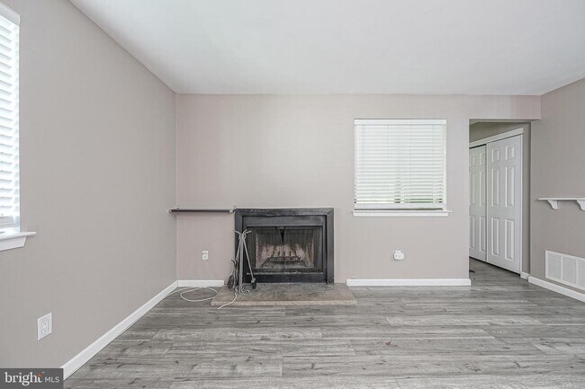
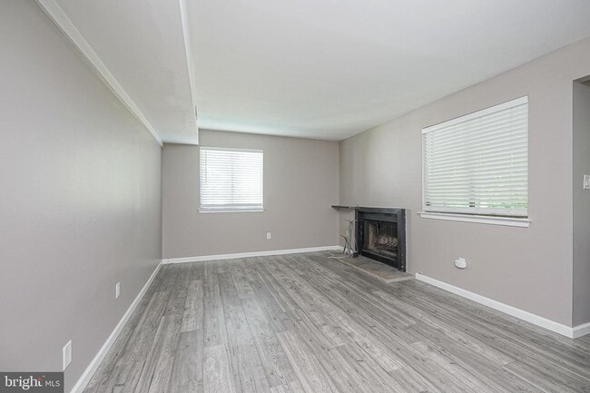
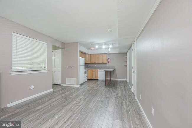
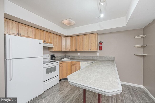
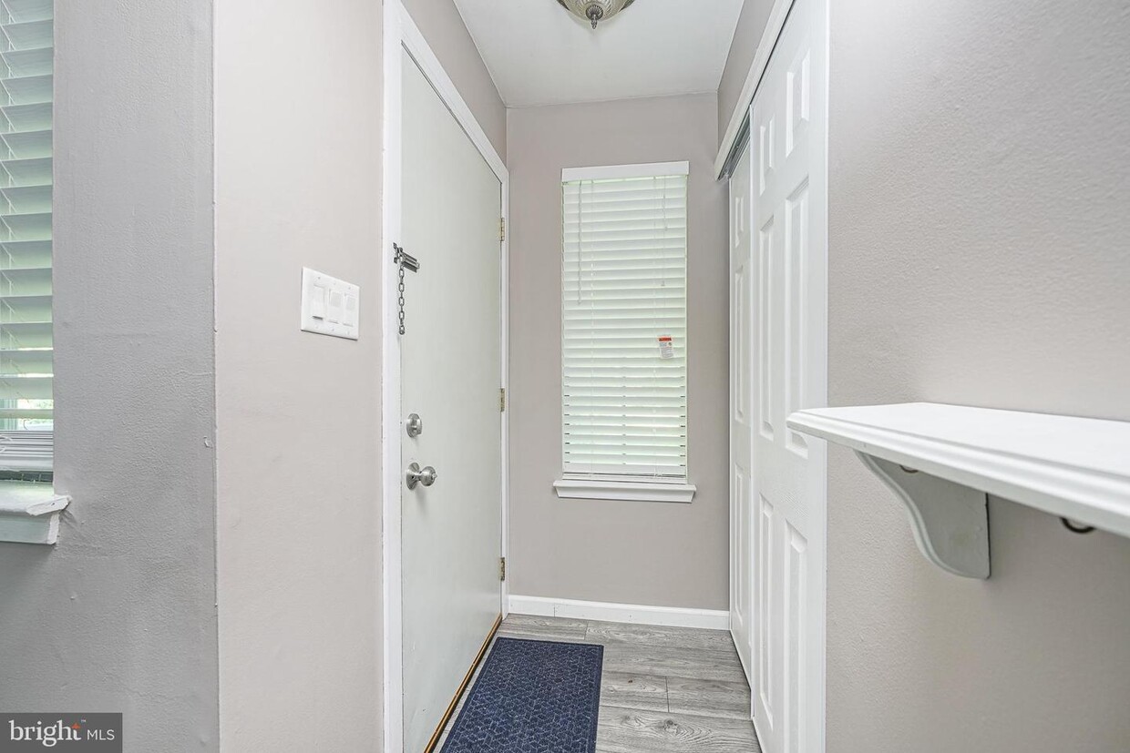
Welcome Home to this updated condo in La Bonne Vie! This first-floor condo offers a private entrance with a spacious patio facing the garden/trees. Plenty of room and privacy for outdoor entertaining. Enter into the large living room with a cozy fireplace and open flow into the eat-in kitchen. There is a spacious bedroom with ample closet space and a full bathroom with stackable laundry. The entire unit was renovated a few years ago to include updated and neutral paint, flooring, and fixtures throughout which really make the place feel like home. Don't delay as this one won't last!
905 Berwyck Ct is an apartment community located in Camden County and the 08081 ZIP Code.
Features
- Fireplace
905 Berwyck Ct,
Gloucester Township,
NJ
08081
Sicklerville is a large suburban community in southern New Jersey, about twenty miles southeast of Philadelphia. The area is largely defined by the residential neighborhoods that cover most of the landscape, with manicured lawns and large houses, condos, and townhomes lining many the streets. A handful of shopping centers can be found scattered throughout the community, with the dining scene made up of low-key cafes, unique international bistros, and popular chain eateries. Numerous large parks in the area provide great venues for spending quality time outdoors, and the sprawling Wharton State Forest is just a few minutes to the east.
Learn more about living in Sicklerville
Amenities
- Fireplace
Education
| Colleges & Universities | Distance | ||
|---|---|---|---|
| Colleges & Universities | Distance | ||
| Drive: | 6 min | 2.2 mi | |
| Drive: | 14 min | 7.0 mi | |
| Drive: | 16 min | 8.8 mi | |
| Drive: | 21 min | 14.8 mi |
905 Berwyck Ct is within 6 minutes or 2.2 miles from Camden Co. Coll., Blackwood. It is also near Gloucester County College and Rowan University.
Transportation options available in Gloucester Township include Lindenwold (Patco), located 7.2 miles from 905 Berwyck Ct. 905 Berwyck Ct is near Philadelphia International, located 21.1 miles or 35 minutes away, and Atlantic City International, located 37.8 miles or 66 minutes away.
| Transit / Subway | Distance | ||
|---|---|---|---|
| Transit / Subway | Distance | ||
|
|
Drive: | 13 min | 7.2 mi |
|
|
Drive: | 16 min | 10.1 mi |
|
|
Drive: | 17 min | 10.9 mi |
|
|
Drive: | 20 min | 11.7 mi |
| Commuter Rail | Distance | ||
|---|---|---|---|
| Commuter Rail | Distance | ||
|
|
Drive: | 13 min | 7.1 mi |
|
|
Drive: | 16 min | 10.6 mi |
|
|
Drive: | 23 min | 14.0 mi |
|
|
Drive: | 36 min | 20.8 mi |
|
|
Drive: | 35 min | 21.3 mi |
| Airports | Distance | ||
|---|---|---|---|
| Airports | Distance | ||
|
Philadelphia International
|
Drive: | 35 min | 21.1 mi |
|
Atlantic City International
|
Drive: | 66 min | 37.8 mi |
Walkability Near 905 Berwyck Ct Gloucester Township, NJ 08081
Getting Around
 What do Walkability, Transit, Drivability, and Bikeability mean?
Walkability measures the walking distance to day-to-day needs.
Transit measures access to public transportation.
Drivability measures congestion, parking availability, and access to major roads.
Bikeability measures the suitability for cycling.
How It Works
What do Walkability, Transit, Drivability, and Bikeability mean?
Walkability measures the walking distance to day-to-day needs.
Transit measures access to public transportation.
Drivability measures congestion, parking availability, and access to major roads.
Bikeability measures the suitability for cycling.
How It Works
Somewhat Walkable
Walkability
30
/ 100
Limited Public Transit
Transit
30
/ 100
Exceptionally Drivable
Drivability
100
/ 100
Fairly Bikeable
Bikeability
40
/ 100
Scores provided by
-
Soundscore™
-
/ 100
Traffic
-Airport
-Businesses
-Scores provided by
HowLoud What is a Sound Score Rating? A Sound Score Rating aggregates noise caused by vehicle traffic, airplane traffic and local sources. How It WorksTime and distance from 905 Berwyck Ct.
| Shopping Centers | Distance | ||
|---|---|---|---|
| Shopping Centers | Distance | ||
| Drive: | 5 min | 2.6 mi | |
| Drive: | 5 min | 2.7 mi | |
| Drive: | 6 min | 2.9 mi |
905 Berwyck Ct has 3 shopping centers within 2.9 miles, which is about a 6-minute drive. The miles and minutes will be for the farthest away property.
| Parks and Recreation | Distance | ||
|---|---|---|---|
| Parks and Recreation | Distance | ||
|
Downs Farms Trails
|
Drive: | 17 min | 10.8 mi |
|
Kresson Nature Trails
|
Drive: | 20 min | 11.0 mi |
|
Croft Farm Nature Trail
|
Drive: | 20 min | 12.3 mi |
905 Berwyck Ct has 3 parks within 12.3 miles, including Downs Farms Trails, Kresson Nature Trails, and Croft Farm Nature Trail.
| Hospitals | Distance | ||
|---|---|---|---|
| Hospitals | Distance | ||
| Drive: | 5 min | 3.0 mi | |
| Drive: | 11 min | 5.0 mi | |
| Drive: | 11 min | 6.3 mi |
905 Berwyck Ct has 3 hospitals within 6.3 miles, the nearest is Northbrook Behavioral Health Hospital which is 3.0 miles away and a 5 minute drive.
| Military Bases | Distance | ||
|---|---|---|---|
| Military Bases | Distance | ||
| Drive: | 25 min | 16.2 mi | |
| Drive: | 66 min | 39.4 mi | |
| Drive: | 59 min | 41.1 mi |
905 Berwyck Ct has 3 military bases within 41.1 miles, the nearest is Philadelphia Naval Busi Center which is 16.2 miles away and a 25 minute drive.
You May Also Like
How do I access Social Services in New Jersey?
Statewide service is free, confidential, multilingual and always open. Three easy ways to reach Social Services in NJ: Dial 2-1-1; text your zip code to 898-211; or chat at https://www.nj211.org
Similar Rentals Nearby


What Are Walk Score®, Transit Score®, and Bike Score® Ratings?
Walk Score® measures the walkability of any address. Transit Score® measures access to public transit. Bike Score® measures the bikeability of any address.
What is a Sound Score Rating?
A Sound Score Rating aggregates noise caused by vehicle traffic, airplane traffic and local sources.
905 Berwyck Ct
Gloucester Township, NJ 08081