
Hudson Park Community
1 Alexander St,
Yonkers, NY 10701
$2,250 - $3,500
1-2 Beds

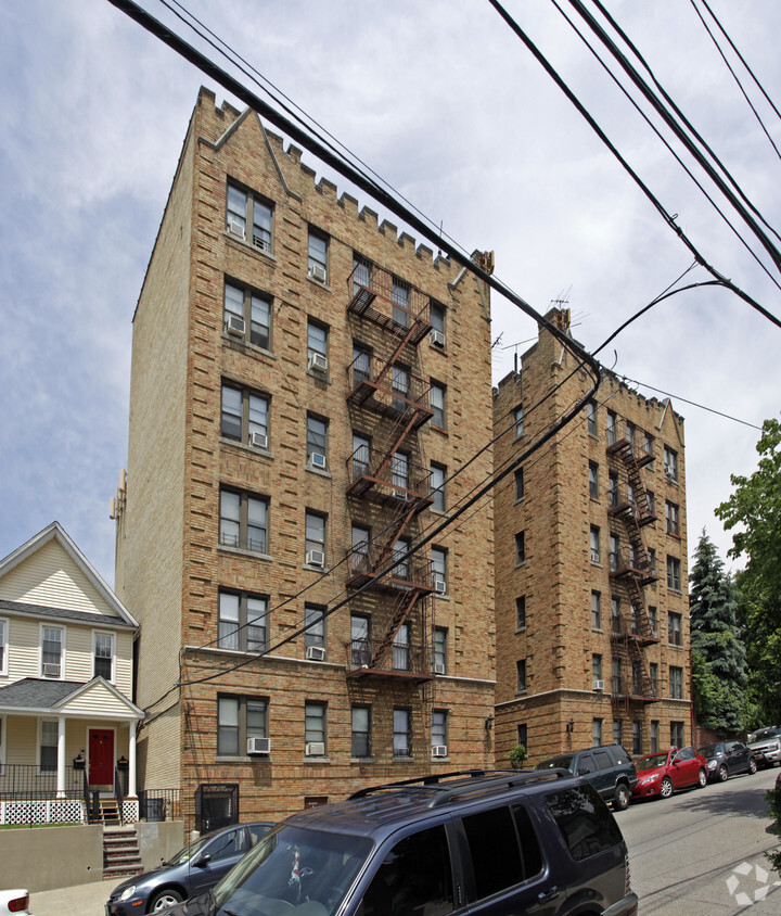
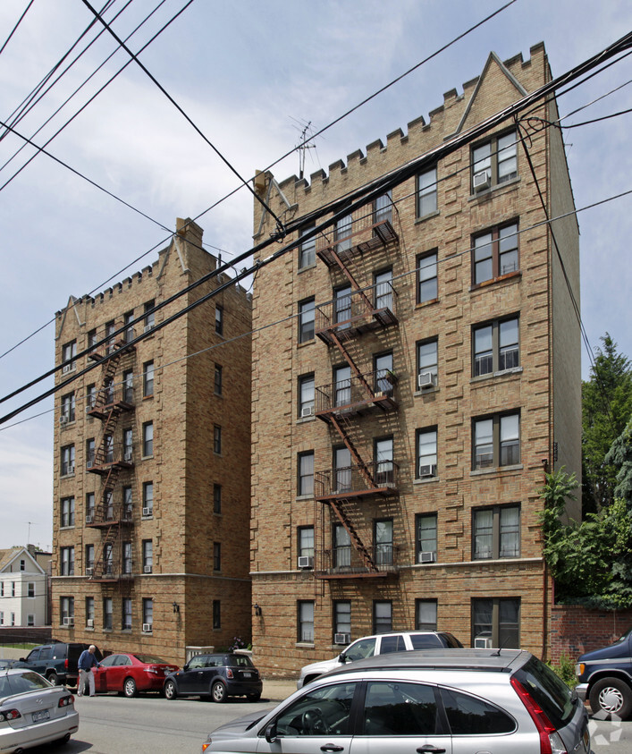
Consider living at 9-15 Glover Ave in Yonkers, NY. The location of this community is in Yonkers at 9-15 Glover Ave in the 10704 area. Come by to check out the apartment floorplan options. The community staff is ready to help you find the perfect place. Life is great at 9-15 Glover Ave. Contact or drop by to check the availability and schedule a tour today.
9-15 Glover Ave is an apartment community located in Westchester County and the 10704 ZIP Code. This area is served by the New York City Geographic District #11 attendance zone.
Refrigerator
Tub/Shower
Heating
Oven
Southeast Yonkers is situated between Bronx River Parkway and New York State Thruway. This neighborhood is part of the city of Yonkers and is located about 15 miles north of Manhattan off the Hudson River. Because of its ideal location, Southeast Yonkers is just a few train stops away from some of the best entertainment, bars, restaurants, and retailers in the country, but residents can enjoy great amenities closer to home as well. In the northern corner of the neighborhood there’s a large shopping complex that’s home to a variety of stores, chain eateries, grocers, gyms, and more.
The rest of the neighborhood is made up of mostly residential areas with local stores and grocers scattered throughout. Renters will find that there are many options for trendy apartments and condos located throughout the city with average prices for the New York area.
Learn more about living in Southeast YonkersCompare neighborhood and city base rent averages by bedroom.
| Southeast Yonkers | Yonkers, NY | |
|---|---|---|
| Studio | $1,686 | $2,015 |
| 1 Bedroom | $1,947 | $2,289 |
| 2 Bedrooms | $2,560 | $2,997 |
| 3 Bedrooms | $2,909 | $3,098 |
| Colleges & Universities | Distance | ||
|---|---|---|---|
| Colleges & Universities | Distance | ||
| Drive: | 7 min | 2.7 mi | |
| Drive: | 7 min | 3.3 mi | |
| Drive: | 7 min | 3.4 mi | |
| Drive: | 9 min | 4.0 mi |


Transportation options available in Yonkers include Nereid Avenue, located 0.8 mile from 9-15 Glover Ave. 9-15 Glover Ave is near LaGuardia, located 13.9 miles or 25 minutes away, and Westchester County, located 19.2 miles or 30 minutes away.
| Transit / Subway | Distance | ||
|---|---|---|---|
| Transit / Subway | Distance | ||
|
|
Walk: | 14 min | 0.8 mi |
|
|
Walk: | 20 min | 1.1 mi |
|
|
Drive: | 2 min | 1.2 mi |
|
|
Drive: | 3 min | 1.5 mi |
|
|
Drive: | 4 min | 1.8 mi |
| Commuter Rail | Distance | ||
|---|---|---|---|
| Commuter Rail | Distance | ||
|
|
Walk: | 20 min | 1.0 mi |
|
|
Drive: | 4 min | 2.0 mi |
|
|
Drive: | 4 min | 2.0 mi |
|
|
Drive: | 5 min | 2.5 mi |
|
|
Drive: | 5 min | 2.5 mi |
| Airports | Distance | ||
|---|---|---|---|
| Airports | Distance | ||
|
LaGuardia
|
Drive: | 25 min | 13.9 mi |
|
Westchester County
|
Drive: | 30 min | 19.2 mi |
Scores provided by
Traffic
-Airport
-Businesses
-Scores provided by
HowLoud What is a Sound Score Rating? A Sound Score Rating aggregates noise caused by vehicle traffic, airplane traffic and local sources. How It WorksTime and distance from 9-15 Glover Ave.
| Shopping Centers | Distance | ||
|---|---|---|---|
| Shopping Centers | Distance | ||
| Walk: | 14 min | 0.8 mi | |
| Drive: | 5 min | 2.2 mi | |
| Drive: | 5 min | 2.4 mi |
| Parks and Recreation | Distance | ||
|---|---|---|---|
| Parks and Recreation | Distance | ||
|
Seton Falls Park
|
Drive: | 4 min | 2.2 mi |
|
Williamsbridge Oval
|
Drive: | 6 min | 2.5 mi |
|
Van Cortlandt Park
|
Drive: | 6 min | 3.3 mi |
|
Wave Hill
|
Drive: | 8 min | 3.9 mi |
|
Riverdale Park
|
Drive: | 8 min | 4.2 mi |
| Hospitals | Distance | ||
|---|---|---|---|
| Hospitals | Distance | ||
| Drive: | 4 min | 2.2 mi | |
| Drive: | 5 min | 2.5 mi | |
| Drive: | 7 min | 3.3 mi |
| Military Bases | Distance | ||
|---|---|---|---|
| Military Bases | Distance | ||
| Drive: | 22 min | 12.3 mi |
What Are Walk Score®, Transit Score®, and Bike Score® Ratings?
Walk Score® measures the walkability of any address. Transit Score® measures access to public transit. Bike Score® measures the bikeability of any address.
What is a Sound Score Rating?
A Sound Score Rating aggregates noise caused by vehicle traffic, airplane traffic and local sources.
9-15 Glover Ave
Yonkers, NY 10704


