$2,100
/ Month
89 Walnut St Unit 2
Newark, NJ 07102
Favorites
89 Walnut St Unit 2

Favorites
Check Back Soon for Upcoming Availability
| Beds | Baths | Average SF |
|---|---|---|
| 2 Bedrooms 2 Bedrooms 2 Br | 2 Baths 2 Baths 2 Ba | — |
About This Property
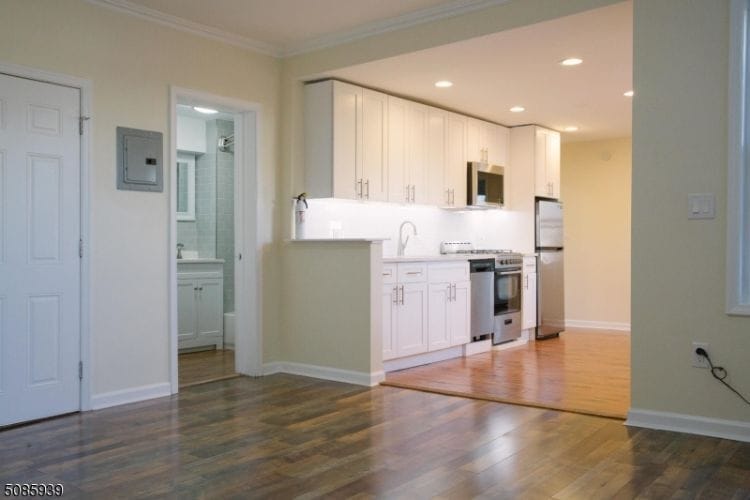
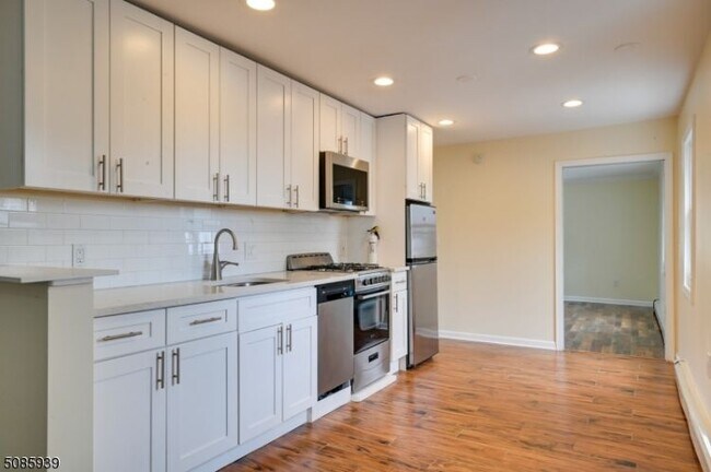
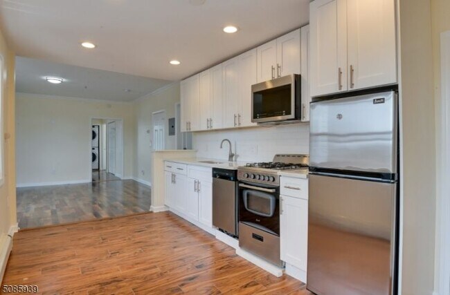
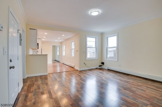
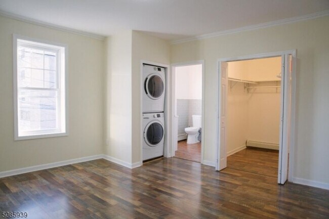
Great two-bedroom, two-full bathroom apartment conveniently located near major highways, Newark Penn Station, bus stops, easy NYC commute, and shopping stores The Ironbound Restaurants Ferry Street Shopping Stores Nightlife Newly renovated with stainless steel appliances, laundry, and hardwood floors.
89 Walnut St is an apartment community located in Essex County and the 07102 ZIP Code.
Features
Hardwood Floors
Tile Floors
Oven
Basement
- Oven
- Hardwood Floors
- Tile Floors
- Basement
89 Walnut St,
Newark,
NJ
07102
The largest city in New Jersey and the second biggest in the New York metro area, Newark has undergone an artistic and cultural renaissance in recent decades. A major international airport and shipping port, several institutions of higher learning, including two Rutgers campuses and the New Jersey Institute of Technology, and the headquarters of Prudential Financial, Panasonic, and PSEG all call Newark home, making it one of the busiest areas in the Garden State. With a melting pot of residents represented across the city's five distinct wards, Newark (which is Essex County's urban center) never fails to stimulate its residents with a diverse, urban landscape. Sitting just eight miles west of Manhattan, Newark allows its residents to easily commute to one of the world's most cosmopolitan destinations, which is just a short drive or train ride away.
Learn more about living in Downtown NewarkBelow are rent ranges for similar nearby apartments
Amenities
- Oven
- Hardwood Floors
- Tile Floors
- Basement
Education
| Colleges & Universities | Distance | ||
|---|---|---|---|
| Colleges & Universities | Distance | ||
| Walk: | 21 min | 1.1 mi | |
| Drive: | 2 min | 1.3 mi | |
| Drive: | 3 min | 1.5 mi | |
| Drive: | 11 min | 4.8 mi |
89 Walnut St Unit 2 is within 21 minutes or 1.1 miles from Essex County College. It is also near Rutgers, Newark Campus and N.J. Inst. of Technology.
Transportation options available in Newark include Military Park, located 0.7 mile from 89 Walnut St Unit 2. 89 Walnut St Unit 2 is near Newark Liberty International, located 4.8 miles or 7 minutes away, and LaGuardia, located 20.4 miles or 41 minutes away.
| Transit / Subway | Distance | ||
|---|---|---|---|
| Transit / Subway | Distance | ||
|
|
Walk: | 14 min | 0.7 mi |
|
|
Walk: | 18 min | 0.9 mi |
|
|
Drive: | 2 min | 1.2 mi |
|
|
Drive: | 2 min | 1.3 mi |
|
|
Drive: | 3 min | 1.4 mi |
| Commuter Rail | Distance | ||
|---|---|---|---|
| Commuter Rail | Distance | ||
|
|
Walk: | 16 min | 0.8 mi |
|
|
Drive: | 3 min | 1.6 mi |
|
|
Drive: | 4 min | 2.4 mi |
|
|
Drive: | 7 min | 3.1 mi |
|
|
Drive: | 7 min | 3.1 mi |
| Airports | Distance | ||
|---|---|---|---|
| Airports | Distance | ||
|
Newark Liberty International
|
Drive: | 7 min | 4.8 mi |
|
LaGuardia
|
Drive: | 41 min | 20.4 mi |
Walkability Near 89 Walnut St Newark, NJ 07102
Getting Around
 What do Walkability, Transit, Drivability, and Bikeability mean?
Walkability measures the walking distance to day-to-day needs.
Transit measures access to public transportation.
Drivability measures congestion, parking availability, and access to major roads.
Bikeability measures the suitability for cycling.
How It Works
What do Walkability, Transit, Drivability, and Bikeability mean?
Walkability measures the walking distance to day-to-day needs.
Transit measures access to public transportation.
Drivability measures congestion, parking availability, and access to major roads.
Bikeability measures the suitability for cycling.
How It Works
Very Walkable
Walkability
80
/ 100
Exceptional Public Transit
Transit
100
/ 100
Fairly Drivable
Drivability
50
/ 100
Fairly Bikeable
Bikeability
50
/ 100
Scores provided by
-
Soundscore™
-
/ 100
Traffic
-Airport
-Businesses
-Scores provided by
HowLoud What is a Sound Score Rating? A Sound Score Rating aggregates noise caused by vehicle traffic, airplane traffic and local sources. How It WorksTime and distance from 89 Walnut St Unit 2.
| Shopping Centers | Distance | ||
|---|---|---|---|
| Shopping Centers | Distance | ||
| Drive: | 2 min | 1.2 mi | |
| Drive: | 3 min | 1.5 mi |
89 Walnut St Unit 2 has 2 shopping centers within 1.5 miles, which is about a 3-minute drive. The miles and minutes will be for the farthest away property.
| Parks and Recreation | Distance | ||
|---|---|---|---|
| Parks and Recreation | Distance | ||
|
Newark Museum and Dreyfuss Planetarium
|
Drive: | 2 min | 1.2 mi |
|
Branch Brook Park
|
Drive: | 7 min | 3.3 mi |
|
Kearny Marsh
|
Drive: | 9 min | 3.9 mi |
|
Richard W. DeKorte Park
|
Drive: | 13 min | 6.7 mi |
|
Stephen Gregg Park
|
Drive: | 13 min | 8.1 mi |
89 Walnut St Unit 2 has 5 parks within 8.1 miles, including Newark Museum and Dreyfuss Planetarium, Branch Brook Park, and Kearny Marsh.
| Hospitals | Distance | ||
|---|---|---|---|
| Hospitals | Distance | ||
| Drive: | 2 min | 1.4 mi | |
| Drive: | 4 min | 1.9 mi | |
| Drive: | 6 min | 3.3 mi |
89 Walnut St Unit 2 has 3 hospitals within 3.3 miles, the nearest is Saint Michael's Medical Center which is 1.4 miles away and a 2 minute drive.
| Military Bases | Distance | ||
|---|---|---|---|
| Military Bases | Distance | ||
| Drive: | 13 min | 8.6 mi | |
| Drive: | 25 min | 12.6 mi | |
| Drive: | 28 min | 16.7 mi |
89 Walnut St Unit 2 has 3 military bases within 16.7 miles, the nearest is Military Ocean Terminal which is 8.6 miles away and a 13 minute drive.
You May Also Like
How do I access Social Services in New Jersey?
Statewide service is free, confidential, multilingual and always open. Three easy ways to reach Social Services in NJ: Dial 2-1-1; text your zip code to 898-211; or chat at https://www.nj211.org
Similar Rentals Nearby


What Are Walk Score®, Transit Score®, and Bike Score® Ratings?
Walk Score® measures the walkability of any address. Transit Score® measures access to public transit. Bike Score® measures the bikeability of any address.
What is a Sound Score Rating?
A Sound Score Rating aggregates noise caused by vehicle traffic, airplane traffic and local sources.

89 Walnut St
Newark, NJ 07102