
$1,150 / Month
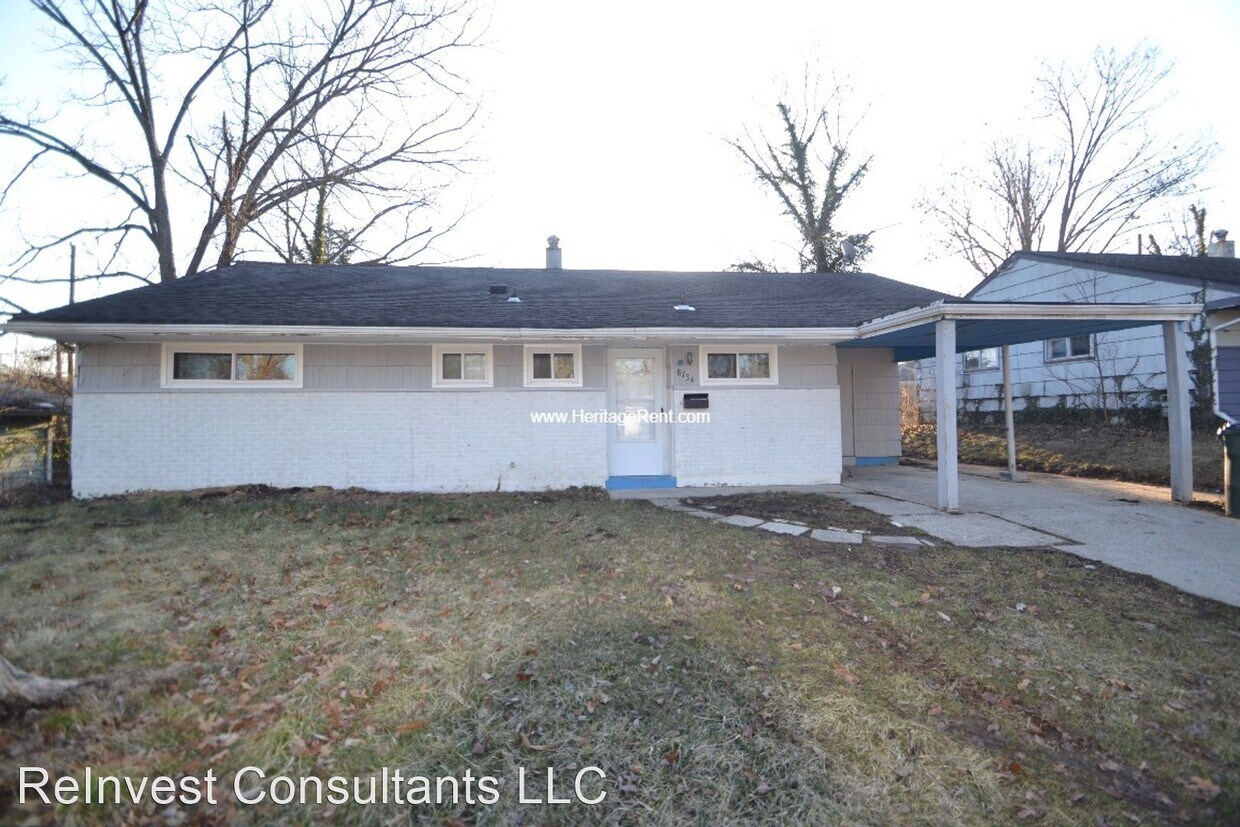
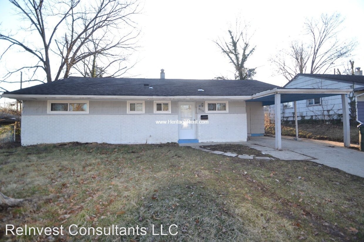
8734 Desoto Dr
Cincinnati, OH 45231
2 Weeks Ago
Favorites
8734 Desoto Dr

Favorites
Check Back Soon for Upcoming Availability
| Beds | Baths | Average SF |
|---|---|---|
| 3 Bedrooms 3 Bedrooms 3 Br | 1.5 Baths 1.5 Baths 1.5 Ba | 1,169 SF |
Fees and Policies
The fees below are based on community-supplied data and may exclude additional fees and utilities.
About This Property
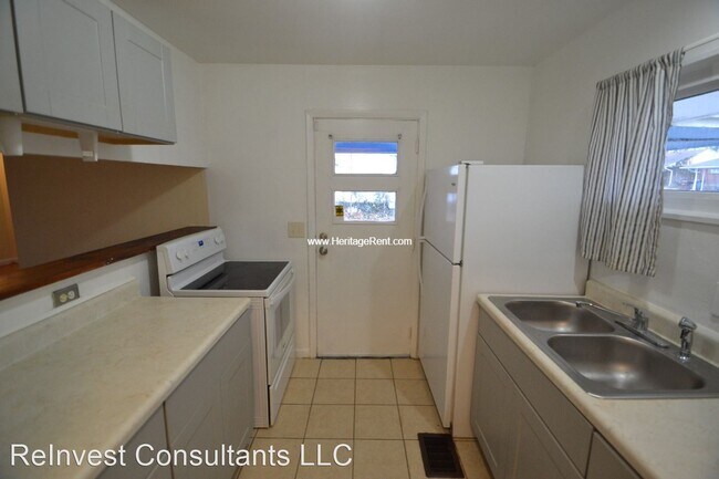
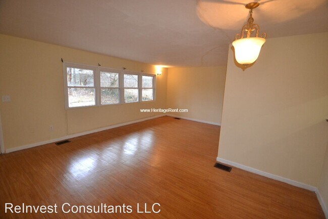
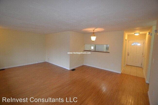
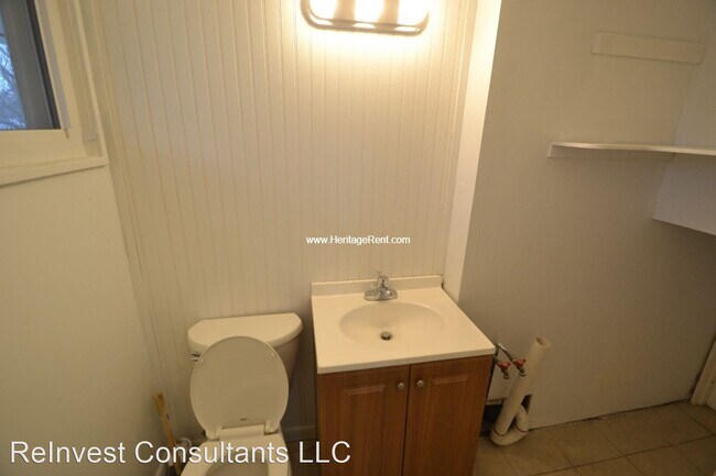
(513) 899-1112 - Cute 3 Bedroom in Mt. Healthy With Fenced Yard - Take a virtual tour here: https://bit.ly/3MhBkQ1 3 Bedroom house with some recent updates and a nice back yard. 2 year lease is required. (RLNE7263351) Other Amenities: Other (mulberry, pergo flooring, extra storage, car port).
8734 Desoto Dr is a house located in Hamilton County and the 45231 ZIP Code. This area is served by the Mt Healthy City attendance zone.
Unique Features
- Amenities - mulberry, pergo flooring, extra storage, car port
Location
Get Directions
Brentwood, a small community located in the northwestern portion of Springfield Township’s Finneytown neighborhood, sits in Hamilton County approximately 16 miles northeast of Downtown Cincinnati. Modest homes from the late 1940s line the tidy streets of the neighborhood, some with attached garages, fenced-in backyards, and private driveways.
Residents appreciate the neighborhood’s homey atmosphere, affordable housing options, and good school system. Also, State Route 126 runs through the southern portion of Brentwood, making it easy for residents to commute to and from Cincinnati.
Learn more about living in BrentwoodBelow are rent ranges for similar nearby apartments
Amenities
- Amenities - mulberry, pergo flooring, extra storage, car port
Education
| Colleges & Universities | Distance | ||
|---|---|---|---|
| Colleges & Universities | Distance | ||
| Drive: | 18 min | 7.5 mi | |
| Drive: | 19 min | 8.2 mi | |
| Drive: | 18 min | 8.7 mi | |
| Drive: | 19 min | 9.6 mi |
8734 Desoto Dr is within 18 minutes or 7.5 miles from Cincinnati State. It is also near Univ. of Cincinnati, Medical and Cincinnati State, WDC.
Schools


Public Elementary School
Grades 1-6
651 Students
Nearby
Charter Elementary & Middle School
Grades K-8
177 Students
Nearby
Public High School
Grades 9-12
828 Students
Attendance Zone
Private Elementary & Middle School
Grades PK-8
239 Students
Nearby
Private Elementary & Middle School
Grades K-8
141 Students
Nearby
Private High School
Grades 9-12
568 Students
Nearby
School data provided by
 The GreatSchools Rating helps parents compare schools within a state based on a variety of school quality indicators and provides a helpful picture of how effectively each school serves all of its students. Ratings are on a scale of 1 (below average) to 10 (above average) and can include test scores, college readiness, academic progress, advanced courses, equity, discipline and attendance data. We also advise parents to visit schools, consider other information on school performance and programs, and consider family needs as part of the school selection process.
View GreatSchools Rating Methodology
Data provided by GreatSchools.org © 2025. All rights reserved.
View GreatSchools Rating Methodology
Data provided by GreatSchools.org © 2025. All rights reserved.
Transportation options available in Cincinnati include Findlay Market-Race Station, Race & Elder, located 9.1 miles from 8734 Desoto Dr. 8734 Desoto Dr is near Cincinnati/Northern Kentucky International, located 25.2 miles or 46 minutes away.
| Transit / Subway | Distance | ||
|---|---|---|---|
| Transit / Subway | Distance | ||
| Drive: | 21 min | 9.1 mi | |
| Drive: | 21 min | 9.2 mi | |
| Drive: | 22 min | 9.2 mi | |
| Drive: | 22 min | 9.3 mi | |
| Drive: | 23 min | 9.6 mi |
| Commuter Rail | Distance | ||
|---|---|---|---|
| Commuter Rail | Distance | ||
|
|
Drive: | 22 min | 11.1 mi |
| Airports | Distance | ||
|---|---|---|---|
| Airports | Distance | ||
|
Cincinnati/Northern Kentucky International
|
Drive: | 46 min | 25.2 mi |
Time and distance from 8734 Desoto Dr.
| Shopping Centers | Distance | ||
|---|---|---|---|
| Shopping Centers | Distance | ||
| Drive: | 4 min | 1.2 mi | |
| Drive: | 5 min | 1.2 mi | |
| Drive: | 5 min | 1.8 mi |
8734 Desoto Dr has 3 shopping centers within 1.8 miles, which is about a 5-minute drive. The miles and minutes will be for the farthest away property.
| Parks and Recreation | Distance | ||
|---|---|---|---|
| Parks and Recreation | Distance | ||
|
Winton Woods Park
|
Drive: | 9 min | 3.6 mi |
|
LaBoiteaux Woods
|
Drive: | 10 min | 3.8 mi |
|
Caldwell Preserve
|
Drive: | 10 min | 4.5 mi |
|
Farbach-Werner Nature Preserve
|
Drive: | 9 min | 4.6 mi |
|
Buttercup Valley
|
Drive: | 12 min | 4.9 mi |
8734 Desoto Dr has 5 parks within 4.9 miles, including LaBoiteaux Woods, Winton Woods Park, and Farbach-Werner Nature Preserve.
| Hospitals | Distance | ||
|---|---|---|---|
| Hospitals | Distance | ||
| Drive: | 11 min | 5.6 mi | |
| Drive: | 16 min | 7.3 mi | |
| Drive: | 18 min | 7.4 mi |
8734 Desoto Dr has 3 hospitals within 7.4 miles, the nearest is Summit Behavioral Healthcare which is 5.6 miles away and a 11 minute drive.
| Military Bases | Distance | ||
|---|---|---|---|
| Military Bases | Distance | ||
| Drive: | 66 min | 49.9 mi | |
| Drive: | 72 min | 55.0 mi | |
| Drive: | 75 min | 58.3 mi |
8734 Desoto Dr has 3 military bases within 58.3 miles, the nearest is Gentile Air Force Station which is 49.9 miles away and a 66 minute drive.
You May Also Like
Similar Rentals Nearby


What Are Walk Score®, Transit Score®, and Bike Score® Ratings?
Walk Score® measures the walkability of any address. Transit Score® measures access to public transit. Bike Score® measures the bikeability of any address.
What is a Sound Score Rating?
A Sound Score Rating aggregates noise caused by vehicle traffic, airplane traffic and local sources
8734 Desoto Dr
Cincinnati, OH 45231