
$2,800
/ Month
867 8th St
Richmond, CA 94801
2 Weeks Ago
Favorites
867 8th St

Favorites
Check Back Soon for Upcoming Availability
| Beds | Baths | Average SF |
|---|---|---|
| 3 Bedrooms 3 Bedrooms 3 Br | 1 Bath 1 Bath 1 Ba | — |
About This Property
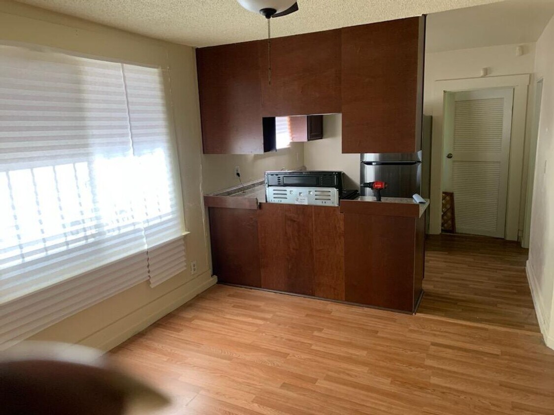
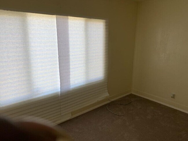
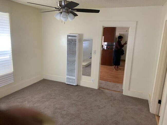
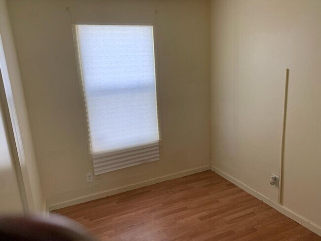
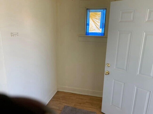
Welcome to your new home at 867 8th St, Richmond, CA 94801! This charming 3-bedroom, 1-bathroom house offers comfortable living spaces and a generous yard, perfect for families or anyone seeking ample outdoor space. Key Features: - Comfortable Living: With three bedrooms, this home provides ample space for relaxation and privacy. - Functional Layout: The layout is designed for convenience and practicality, ensuring easy flow between the living areas and bedrooms. - Well-Equipped Kitchen: The kitchen has essential appliances, making meal preparation a breeze. - Natural Light: Large windows throughout the house allow natural light to flood the interiors, creating a bright and inviting atmosphere. - Outdoor Oasis: Step outside into the expansive yard, where you'll find plenty of room for outdoor activities, gardening, or simply enjoying the fresh air. - Convenient Location: Situated in a desirable area of Richmond, this home offers easy access to local amenities, schools, parks, and transportation options. Rental Details: - Address: 867 8th St, Richmond, CA 94801 - Monthly Rent: $2800 - Security Deposit: $2750 Don't miss out on the opportunity to make this cozy property your new home. Schedule a viewing today and experience the comfort and convenience it has to offer!
867 8th St is a house located in Contra Costa County and the 94801 ZIP Code. This area is served by the West Contra Costa Unified attendance zone.
Location
Get Directions
The Iron Triangle neighborhood sits in the heart of Central Richmond, California. With the area being largely residential, most rentals reside in the upper part of the triangle and an easy three-mile commute north to Point Richmond, a major shipping and industrial area. To the south, Berkeley and Oakland lie roughly 10 miles away via Interstate 580.
Locals often head for the Miller/Knox Regional Shoreline for a bit of jogging or cycling, or to cast a line off the fishing pier. Wade into the waters of San Francisco Bay at Keller Beach on the northern end of the park, or enjoy a show at the Masquers Playhouse, also just outside the Iron Triangle's southern border. Most eateries sit along Interstate 580, including several fast food chains. The MacDonald 80 Shopping Center lies roughly three miles east of the neighborhood. Drive another three miles and find Wildcat Canyon Regional Park and the Tilden Nature Area.
Learn more about living in Iron TriangleBelow are rent ranges for similar nearby apartments
Education
| Colleges & Universities | Distance | ||
|---|---|---|---|
| Colleges & Universities | Distance | ||
| Drive: | 7 min | 3.1 mi | |
| Drive: | 17 min | 9.7 mi | |
| Drive: | 21 min | 10.8 mi | |
| Drive: | 20 min | 11.7 mi |
867 8th St is within 7 minutes or 3.1 miles from Contra Costa College. It is also near Berkeley City College and UC Berkeley.
Schools


Public Elementary School
Grades K-5
270 Students
Nearby
Public Elementary & Middle School
Grades K-8
537 Students
Attendance Zone
Public Middle School
Grades 7-8
591 Students
Attendance Zone
Public High School
Grades 9-12
1,431 Students
Attendance Zone
Private Elementary, Middle & High School
Grades PK-12
Nearby
Private Elementary School
Grades 3
2 Students
Nearby
Private Elementary, Middle & High School
Grades 1-12
Nearby
School data provided by
 The GreatSchools Rating helps parents compare schools within a state based on a variety of school quality indicators and provides a helpful picture of how effectively each school serves all of its students. Ratings are on a scale of 1 (below average) to 10 (above average) and can include test scores, college readiness, academic progress, advanced courses, equity, discipline and attendance data. We also advise parents to visit schools, consider other information on school performance and programs, and consider family needs as part of the school selection process.
View GreatSchools Rating Methodology
Data provided by GreatSchools.org © 2025. All rights reserved.
View GreatSchools Rating Methodology
Data provided by GreatSchools.org © 2025. All rights reserved.
Transportation options available in Richmond include Richmond Station, located 1.3 miles from 867 8th St. 867 8th St is near Metro Oakland International, located 22.7 miles or 32 minutes away, and San Francisco International, located 30.3 miles or 44 minutes away.
| Transit / Subway | Distance | ||
|---|---|---|---|
| Transit / Subway | Distance | ||
|
|
Drive: | 3 min | 1.3 mi |
|
|
Drive: | 8 min | 3.5 mi |
|
|
Drive: | 8 min | 3.5 mi |
|
|
Drive: | 11 min | 5.5 mi |
|
|
Drive: | 15 min | 9.1 mi |
| Commuter Rail | Distance | ||
|---|---|---|---|
| Commuter Rail | Distance | ||
| Drive: | 3 min | 1.2 mi | |
|
|
Drive: | 13 min | 8.3 mi |
| Drive: | 18 min | 10.0 mi | |
|
|
Drive: | 15 min | 10.1 mi |
| Drive: | 18 min | 10.9 mi |
| Airports | Distance | ||
|---|---|---|---|
| Airports | Distance | ||
|
Metro Oakland International
|
Drive: | 32 min | 22.7 mi |
|
San Francisco International
|
Drive: | 44 min | 30.3 mi |
Time and distance from 867 8th St.
| Shopping Centers | Distance | ||
|---|---|---|---|
| Shopping Centers | Distance | ||
| Walk: | 18 min | 1.0 mi | |
| Drive: | 4 min | 1.7 mi | |
| Drive: | 5 min | 2.3 mi |
867 8th St has 3 shopping centers within 2.3 miles, which is about a 5-minute walk. The miles and minutes will be for the farthest away property.
| Parks and Recreation | Distance | ||
|---|---|---|---|
| Parks and Recreation | Distance | ||
|
Rosie the Riveter WWII Home Front National Historical Park
|
Drive: | 6 min | 2.7 mi |
|
Marina Park & Green
|
Drive: | 7 min | 2.9 mi |
|
Miller/Knox Regional Shoreline
|
Drive: | 6 min | 3.1 mi |
|
Shimada Friendship Park
|
Drive: | 8 min | 3.6 mi |
|
Brooks Island Regional Preserve
|
Drive: | 11 min | 4.7 mi |
867 8th St has 5 parks within 4.7 miles, including Rosie the Riveter WWII Home Front National Historical Park, Marina Park & Green, and Miller/Knox Regional Shoreline.
| Hospitals | Distance | ||
|---|---|---|---|
| Hospitals | Distance | ||
| Drive: | 20 min | 11.3 mi | |
| Drive: | 21 min | 11.7 mi | |
| Drive: | 18 min | 12.2 mi |
867 8th St has 3 hospitals within 12.2 miles, the nearest is Alta Bates Summit Medical Center - Alta Bates Campus which is 11.3 miles away and a 20 minute drive.
| Military Bases | Distance | ||
|---|---|---|---|
| Military Bases | Distance | ||
| Drive: | 7 min | 3.1 mi | |
| Drive: | 13 min | 6.2 mi | |
| Drive: | 26 min | 16.4 mi |
867 8th St has 3 military bases within 16.4 miles, the nearest is Armory West Contra Costa which is 3.1 miles away and a 7 minute drive.
You May Also Like
Similar Rentals Nearby


What Are Walk Score®, Transit Score®, and Bike Score® Ratings?
Walk Score® measures the walkability of any address. Transit Score® measures access to public transit. Bike Score® measures the bikeability of any address.
What is a Sound Score Rating?
A Sound Score Rating aggregates noise caused by vehicle traffic, airplane traffic and local sources

867 8th St
Richmond, CA 94801