
$1,200
/ Month
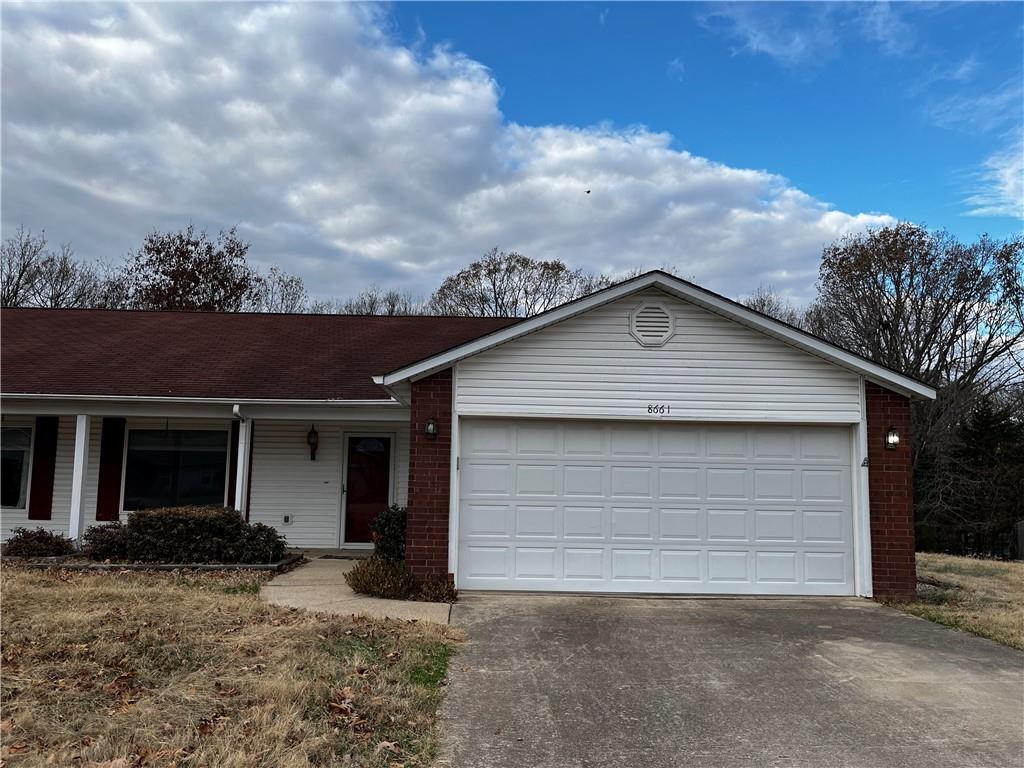
8661 Stoner Ln
Rogers, AR 72756
2 Weeks Ago
|
Edit
Favorites
8661 Stoner Ln

Favorites
Check Back Soon for Upcoming Availability
| Beds | Baths | Average SF |
|---|---|---|
| 2 Bedrooms 2 Bedrooms 2 Br | 2 Baths 2 Baths 2 Ba | 1,546 SF |
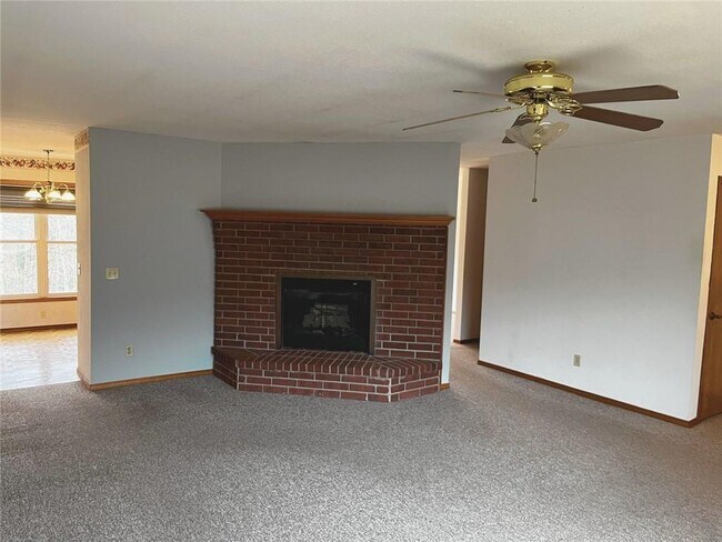
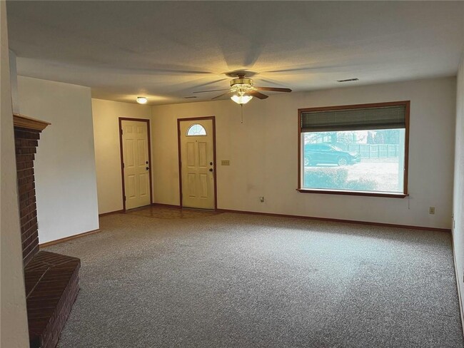
About This Property
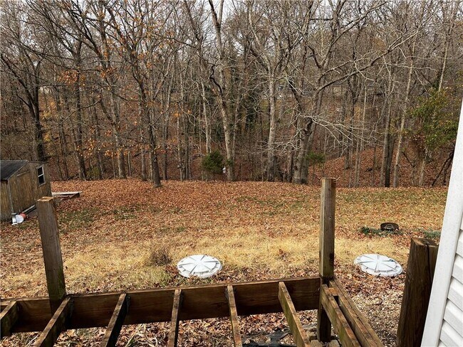
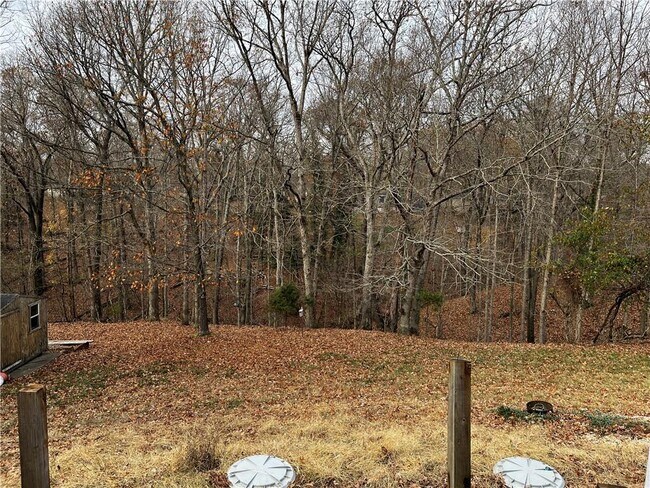
If you have been wanting to live out by the lake this property is for you. Located 2 miles from the Prairie Creek Marina this 2 bedroom 2 bath duplex is the perfect spot. Enjoy your morning coffee on the new deck overlooking wooded backyard.
8661 Stoner Ln is a townhome located in Benton County and the 72756 ZIP Code. This area is served by the Rogers School District attendance zone.
8661 Stoner Ln,
Rogers,
AR
72756
Rogers, Arkansas, combines historic charm with contemporary living in Northwest Arkansas's growing metropolitan area. Downtown Rogers preserves its heritage with brick streets and historic architecture, while Pinnacle Hills features the Pinnacle Hills Promenade shopping center. Outdoor enthusiasts can explore the city's 23-mile trail system, which connects to the Razorback Greenway, or spend time at Lake Atalanta and Beaver Lake.
Rogers holds a special place in retail history as the location of the original Walmart store, established in 1962. The city's entertainment scene includes the Walmart AMP (Arkansas Music Pavilion), an outdoor amphitheater hosting national touring acts, and the Daisy Airgun Museum, which chronicles the history of this longtime Rogers manufacturer. The prestigious LPGA Walmart NW Arkansas Championship at Pinnacle Country Club brings professional golf to the community annually.
Learn more about living in RogersBelow are rent ranges for similar nearby apartments
Education
| Colleges & Universities | Distance | ||
|---|---|---|---|
| Colleges & Universities | Distance | ||
| Drive: | 14 min | 7.8 mi | |
| Drive: | 40 min | 25.9 mi | |
| Drive: | 58 min | 38.8 mi |
8661 Stoner Ln is within 14 minutes or 7.8 miles from Northwest Ark. Comm. Coll.. It is also near University of Arkansas and John Brown University.
Schools


Public Elementary School
Grades PK-5
479 Students
Attendance Zone
Public Middle School
Grades 6-8
674 Students
Attendance Zone
Public High School
Grades 9-12
1,900 Students
Attendance Zone
Private Elementary, Middle & High School
Grades PK-12
Nearby
Private Elementary & Middle School
Grades PK-8
435 Students
Nearby
School data provided by
 The GreatSchools Rating helps parents compare schools within a state based on a variety of school quality indicators and provides a helpful picture of how effectively each school serves all of its students. Ratings are on a scale of 1 (below average) to 10 (above average) and can include test scores, college readiness, academic progress, advanced courses, equity, discipline and attendance data. We also advise parents to visit schools, consider other information on school performance and programs, and consider family needs as part of the school selection process.
View GreatSchools Rating Methodology
Data provided by GreatSchools.org © 2026. All rights reserved.
View GreatSchools Rating Methodology
Data provided by GreatSchools.org © 2026. All rights reserved.
Walkability Near 8661 Stoner Ln Rogers, AR 72756
Getting Around
 What do Walkability, Transit, Drivability, and Bikeability mean?
Walkability measures the walking distance to day-to-day needs.
Transit measures access to public transportation.
Drivability measures congestion, parking availability, and access to major roads.
Bikeability measures the suitability for cycling.
How It Works
What do Walkability, Transit, Drivability, and Bikeability mean?
Walkability measures the walking distance to day-to-day needs.
Transit measures access to public transportation.
Drivability measures congestion, parking availability, and access to major roads.
Bikeability measures the suitability for cycling.
How It Works
Somewhat Walkable
Walkability
20
/ 100
Exceptionally Drivable
Drivability
100
/ 100
Somewhat Bikeable
Bikeability
30
/ 100
Scores provided by
-
Soundscore™
-
/ 100
Traffic
-Airport
-Businesses
-Scores provided by
HowLoud What is a Sound Score Rating? A Sound Score Rating aggregates noise caused by vehicle traffic, airplane traffic and local sources. How It WorksYou May Also Like
Similar Rentals Nearby


What Are Walk Score®, Transit Score®, and Bike Score® Ratings?
Walk Score® measures the walkability of any address. Transit Score® measures access to public transit. Bike Score® measures the bikeability of any address.
What is a Sound Score Rating?
A Sound Score Rating aggregates noise caused by vehicle traffic, airplane traffic and local sources.
8661 Stoner Ln
Rogers, AR 72756