

$750
/ Month
8616 State Hwy 76
Branson West, MO 65737
2 Weeks Ago
|
Edit
Favorites
8616 State Hwy 76

Favorites
Check Back Soon for Upcoming Availability
| Beds | Baths | Average SF |
|---|---|---|
| 2 Bedrooms 2 Bedrooms 2 Br | 1 Bath 1 Bath 1 Ba | 1,200 SF |
Fees and Policies
The fees listed below are community-provided and may exclude utilities or add-ons. All payments are made directly to the property and are non-refundable unless otherwise specified.
- Parking
-
Garage--
About This Property
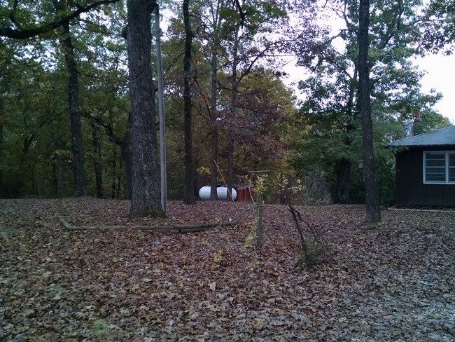
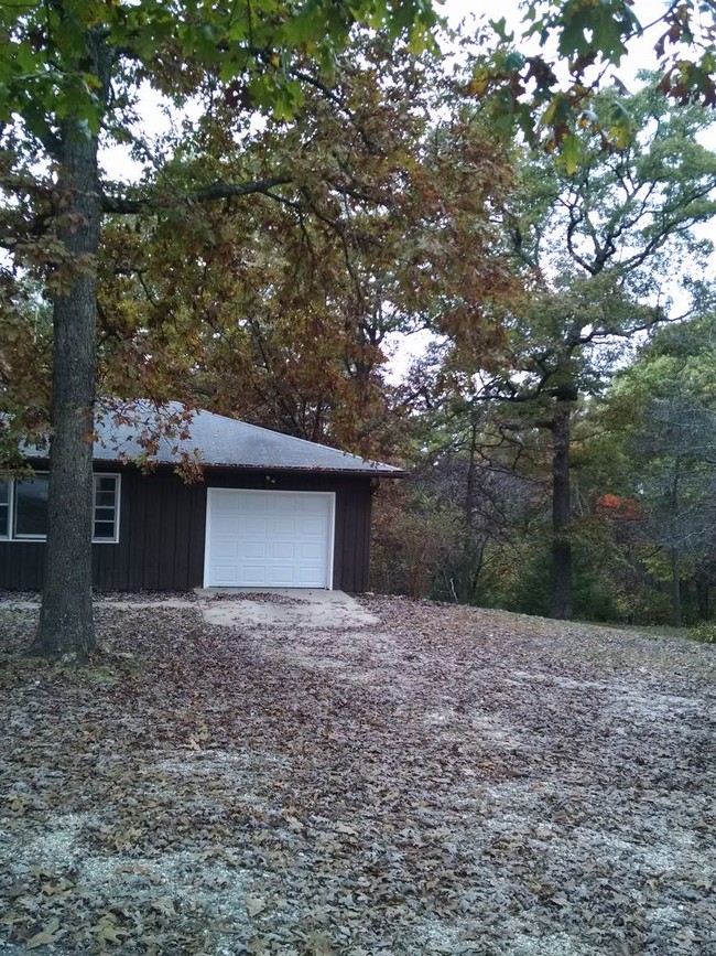
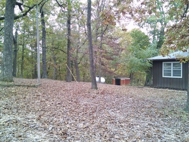
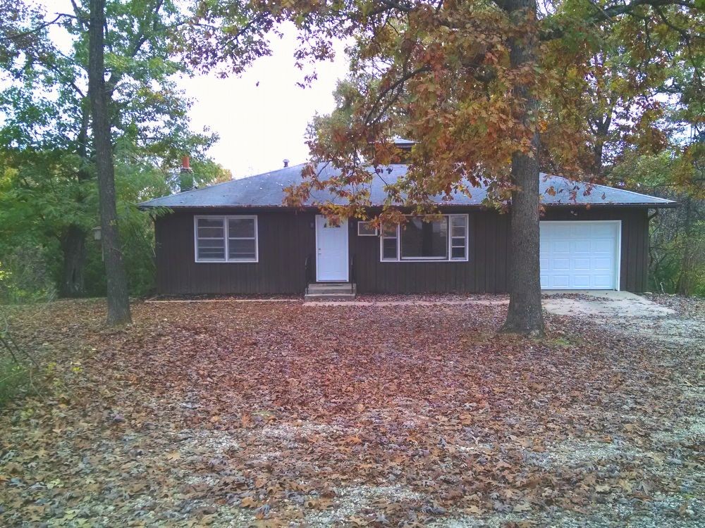
Location location location Feel like you are living in the woods in this 2 bedroom/1 bath home on 5 acres that sits right on Hwy 76. Single car garage nice back deck unfinished basement washer and dryer hookups. City water and sewer propane heat.
8616 State Hwy 76 is a house located in Stone County and the 65737 ZIP Code. This area is served by the Reeds Spring R-Iv School District attendance zone.
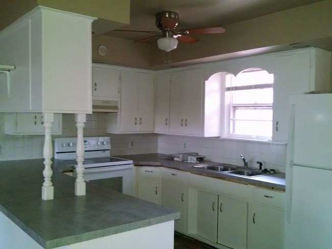
House Features
- Washer/Dryer Hookup
- Refrigerator
8616 State Hwy 76,
Branson West,
MO
65737
Amenities
- Washer/Dryer Hookup
- Refrigerator
Education
| Colleges & Universities | Distance | ||
|---|---|---|---|
| Colleges & Universities | Distance | ||
| Drive: | 14 min | 7.3 mi | |
| Drive: | 20 min | 11.6 mi |
8616 State Hwy 76 is within 14 minutes or 7.3 miles from Ozarks Tech. C.C., Branson. It is also near College of the Ozarks.
Schools


Public Elementary School
Grades PK-5
308 Students
Nearby
Public Elementary School
Grades K-5
358 Students
Attendance Zone
Public Elementary School
Grades K-5
253 Students
Attendance Zone
Public Middle School
Grades 6-8
286 Students
Attendance Zone
Public High School
Grades 9-12
602 Students
Attendance Zone
Private Elementary, Middle & High School
Grades PK-12
88 Students
Nearby
Private Elementary, Middle & High School
Grades PK-12
23 Students
Nearby
School data provided by
 The GreatSchools Rating helps parents compare schools within a state based on a variety of school quality indicators and provides a helpful picture of how effectively each school serves all of its students. Ratings are on a scale of 1 (below average) to 10 (above average) and can include test scores, college readiness, academic progress, advanced courses, equity, discipline and attendance data. We also advise parents to visit schools, consider other information on school performance and programs, and consider family needs as part of the school selection process.
View GreatSchools Rating Methodology
Data provided by GreatSchools.org © 2026. All rights reserved.
View GreatSchools Rating Methodology
Data provided by GreatSchools.org © 2026. All rights reserved.
Walkability Near 8616 State Hwy 76 Branson West, MO 65737
Getting Around
 What do Walkability, Transit, Drivability, and Bikeability mean?
Walkability measures the walking distance to day-to-day needs.
Transit measures access to public transportation.
Drivability measures congestion, parking availability, and access to major roads.
Bikeability measures the suitability for cycling.
How It Works
What do Walkability, Transit, Drivability, and Bikeability mean?
Walkability measures the walking distance to day-to-day needs.
Transit measures access to public transportation.
Drivability measures congestion, parking availability, and access to major roads.
Bikeability measures the suitability for cycling.
How It Works
Somewhat Walkable
Walkability
20
/ 100
Exceptionally Drivable
Drivability
100
/ 100
Somewhat Bikeable
Bikeability
20
/ 100
Scores provided by
-
Soundscore™
-
/ 100
Traffic
-Airport
-Businesses
-Scores provided by
HowLoud What is a Sound Score Rating? A Sound Score Rating aggregates noise caused by vehicle traffic, airplane traffic and local sources. How It WorksYou May Also Like
Similar Rentals Nearby
-
-

-

-
 2 Beds, 1 Bath, 750 sq ft$1,200Total Monthly PriceTotal Monthly Price NewPrices include all required monthly fees.1 Woodland Ave
 -
 2 Beds, 1 Bath, 750 sq ft$1,100Total Monthly PriceTotal Monthly Price NewPrices include all required monthly fees.1 Woodland Ave
 -

-

-

-

-

What Are Walk Score®, Transit Score®, and Bike Score® Ratings?
Walk Score® measures the walkability of any address. Transit Score® measures access to public transit. Bike Score® measures the bikeability of any address.
What is a Sound Score Rating?
A Sound Score Rating aggregates noise caused by vehicle traffic, airplane traffic and local sources.
8616 State Hwy 76
Branson West, MO 65737