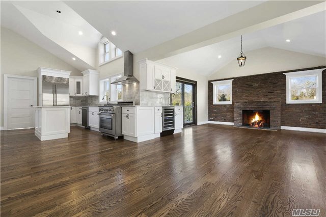
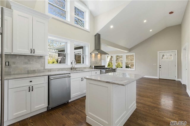
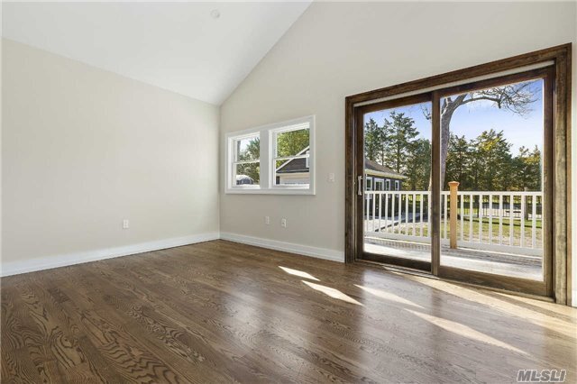
$70,000 / Month

86 Lower 7 Ponds Rd

,

Water Mill, NY 11976

Share Listing
Favorites
86 Lower 7 Ponds Rd
Share Listing
Favorites

Check Back Soon for Upcoming Availability

Beds Baths Average SF
4 Bedrooms 4 Bedrooms 4 Br 4 Baths 4 Baths 4 Ba
Location
86 Lower 7 Ponds Rd, Water Mill,
NY 11976
Get Directions
| Edit

Under 30 minutes

Commute Time is calculated at rush hour.
City - Water Mill

Water Mill, New York, is a hamlet nestled within the Town of Southampton on Long Island's South Fork, sitting comfortably between the Atlantic coastline and the rolling agricultural countryside that defines this corner of Suffolk County. The area carries real historical weight: in 1644, Edward Howell built a grist mill here that became such a landmark, nearby settlements were simply described as east or west of "the watermill," giving the community its enduring name. Today, Water Mill is recognized as one of the most sought-after addresses in the country, consistently ranking among the top ZIP codes nationally for real estate value. The landscape blends open farmland, working vineyards, and oceanside tranquility, with the broader Hamptons scene just minutes away. Cultural anchors like the Watermill Center and the Parrish Art Museum draw an engaged arts audience year-round.

Learn more about living in Water Mill 
Education
Colleges & Universities Distance
Drive: 37 min 21.9 mi
Drive: 180 min 70.7 mi
86 Lower 7 Ponds Rd is within 37 minutes or 21.9 miles from SUNY Suffolk Co., Eastern. It is also near University of Connecticut.
Transportation
Commuter Rail Distance
Drive: 5 min 2.0 mi
Drive: 9 min 4.2 mi
Drive: 18 min 9.6 mi
Drive: 24 min 10.8 mi
Drive: 44 min 25.5 mi

Walkability Near 86 Lower 7 Ponds Rd Water Mill, NY 11976

Getting Around
Somewhat Walkable
Walkability
30 / 100
Minimal Public Transit
Transit
0 / 100
Exceptionally Drivable
Drivability
100 / 100
Fairly Bikeable
Bikeability
40 / 100

Scores provided by

What do Walkability, Transit, Drivability, and Bikeability mean? Walkability measures the walking distance to day-to-day needs. Transit measures access to public transportation. Drivability measures congestion, parking availability, and access to major roads. Bikeability measures the suitability for cycling. How It Works
-
Soundscore
- / 100

Traffic

-

Airport

-

Businesses

-

Scores provided by

HowLoud What is a Sound Score Rating? A Sound Score Rating aggregates noise caused by vehicle traffic, airplane traffic and local sources. How It Works
Points of Interest

Time and distance from 86 Lower 7 Ponds Rd.

Shopping Centers Distance
Walk: 18 min 0.9 mi
Walk: 18 min 1.0 mi
Drive: 3 min 1.3 mi
86 Lower 7 Ponds Rd has 3 shopping centers within 1.3 miles, which is about a 3-minute drive. The miles and minutes will be for the farthest away property.
Parks and Recreation Distance
South Fork Natural History Museum & Nature Center
Drive: 11 min 5.4 mi
Elizabeth A. Morton National Wildlife Refuge
Drive: 13 min 5.7 mi
Shinnecock East County Park
Drive: 23 min 8.1 mi
Meschutt Beach County Park
Drive: 18 min 8.2 mi
LongHouse Reserve
Drive: 27 min 11.8 mi
86 Lower 7 Ponds Rd has 5 parks within 11.8 miles, including South Fork Natural History Museum & Nature Center, Elizabeth A. Morton National Wildlife Refuge, and Shinnecock East County Park.
Military Bases Distance
Drive: 104 min 66.4 mi
Drive: 172 min 66.5 mi
Drive: 180 min 70.5 mi
86 Lower 7 Ponds Rd has 3 military bases within 70.5 miles, the nearest is Eatons Neck CG Station North which is 66.4 miles away and a 104 minute drive.

You May Also Like

Similar Rentals Nearby