
$2,800 / Month
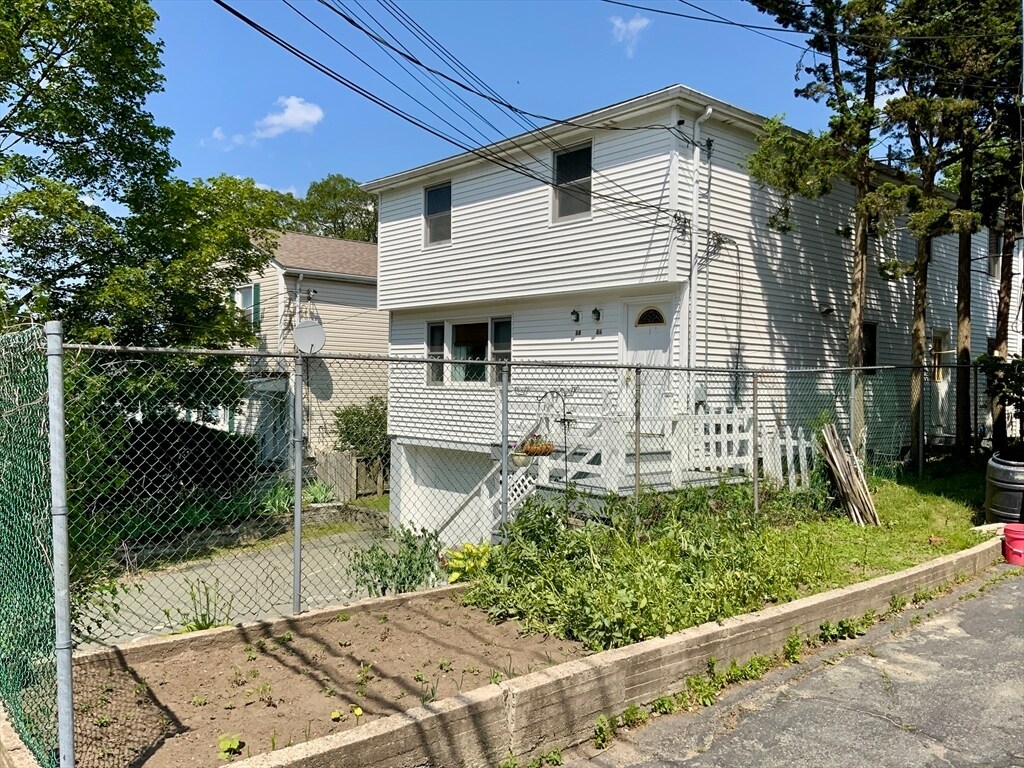
86-88-88 Sylvia St
Arlington, MA 02476
1 Day Ago
Favorites
617-416-4781
-
Bedrooms
2
-
Bathrooms
1
-
Square Feet
1,100 sq ft
-
Available
Available Now
Highlights
- Property is near public transit
- Jogging Path
- Fenced Yard
- No Cooling
- Patio
- Park
86-88-88 Sylvia St

Favorites
About This Home
$2,800 deposit,
Available Now
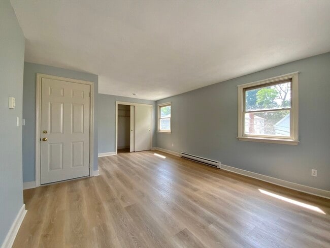
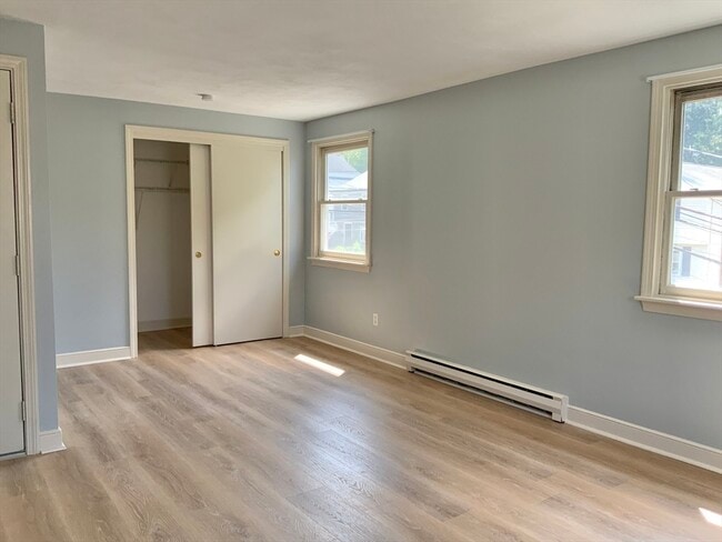
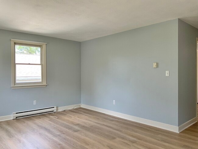
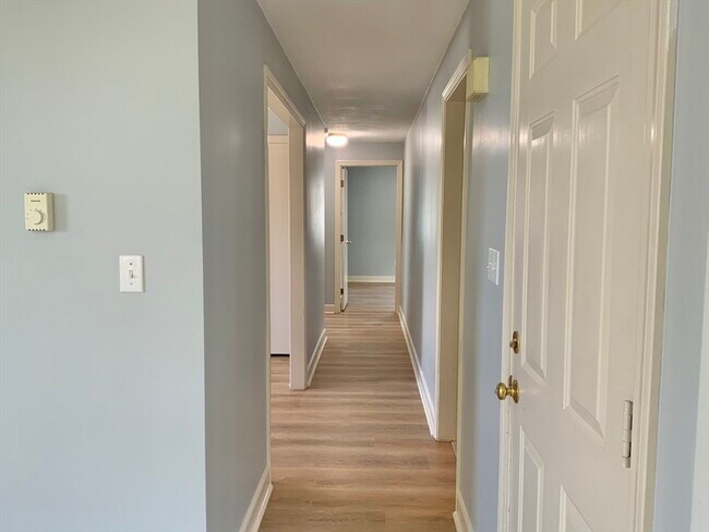
Newly renovated 2-bed,top-floor apt w/ spacious living room & flexible dining/family room/office. Prime location near East Lexington set between the Sutherland Woods and the Minuteman Bikeway. Includes garage parking + driveway space. Shared backyard w/ one other tenant. Freshly updated and move-in ready! Required with lease signing: 3x rent (first month,security deposit,broker fee). Group showing at 10am this Saturday! MLS# 73394560
86-88-88 Sylvia St is a townhome located in Middlesex County and the 02476 ZIP Code. This area is served by the Arlington Public Schools attendance zone.
* Price shown is base rent and may not include non-optional fees and utilities.
Price, availability, fees, and any applicable rent special are subject to change without notice.
* Square footage definitions vary. Displayed square footage is approximate.
Home Details
Accessible Home Design
Entry on the 2nd floor
Bedrooms and Bathrooms
1 Full Bathroom
2 Bedrooms
Home Design
Property Attached
Interior Spaces
1,100 Sq Ft Home
Kitchen
Range
Dishwasher
Disposal
Listing and Financial Details
Security Deposit $2,800
12 Month Lease Term
Assessor Parcel Number M:176.0 B:0006 L:0019,331667
Rent includes water, sewer, trash collection, extra storage, parking
Location
Property is near public transit
Lot Details
6,000 Sq Ft Lot
Fenced Yard
Garden
Fenced
Outdoor Features
Patio
Parking
1 Car Garage
Utilities
No Cooling
Heating Available
Community Details
Amenities
Laundry Facilities
Common Area
Overview
No Home Owners Association
Pet Policy
Call for details about the types of pets allowed
Recreation
Jogging Path
Park
Bike Trail
Fees and Policies
The fees below are based on community-supplied data and may exclude additional fees and utilities.
Pet policies are negotiable.
Contact
- Listed by Jonathan Hindmarsh | Gibson Sotheby's International Realty
- Phone Number
-
Source
 MLS Property Information Network
The property listing data and information set forth herein were provided to MLS Property Information Network, Inc. from third party sources, including sellers, lessors and public records, and were compiled by MLS Property Information Network, Inc. The property listing data and information are for the personal, non-commercial use of consumers having a good faith interest in purchasing or leasing listed properties of the type displayed to them and may not be used for any purpose other than to identify prospective properties which such consumers may have a good faith interest in purchasing or leasing. MLS Property Information Network, Inc. and its subscribers disclaim any and all representations and warranties as to the accuracy of the property listing data and information set forth herein. All properties are subject to prior sale, change or withdrawal. Copyright © 2025 MLS Property Information Network, Inc. All rights reserved.
Location
Get Directions
Amenities
- Dishwasher
- Disposal
- Range
- Refrigerator
- Fenced Lot
- Patio
Arlington Heights comprises one of three neighborhoods in Arlington and lies to the west of Arlington’s center. Located six miles northwest of Boston, this area is home to some historically significant sites and architecture and a more diverse housing market than the rest of Arlington.
A large number of famous residents, including actor Timothy Hutton, basketball player Tiny Archibald, and poet Robert Creeley have lived in Arlington Heights. Its dedication to preserving green space and natural areas has resulted in more than a dozen parks and historical sites in the town’s 5.5 square miles. Families love the area for its relative serenity and great schools, but all renters will find something they love thanks to single-family homes, mid and low-rise apartments, and a charming smattering of local restaurants and shops.
Learn more about living in Arlington Heights
Education
| Colleges & Universities | Distance | ||
|---|---|---|---|
| Colleges & Universities | Distance | ||
| Drive: | 10 min | 4.7 mi | |
| Drive: | 10 min | 5.4 mi | |
| Drive: | 11 min | 5.8 mi | |
| Drive: | 11 min | 6.2 mi |
86-88-88 Sylvia St is within 10 minutes or 4.7 miles from Bentley University. It is also near Tufts Univ., Medford and Lesley University, Porter.
Schools


Public Elementary School
Grades K-5
415 Students
Attendance Zone
Public Elementary School
Grades PK-5
507 Students
Nearby
Public Middle School
Grades 7-8
922 Students
Attendance Zone
Public High School
Grades 9-12
1,527 Students
Attendance Zone
Private Elementary School
Grades PK-5
96 Students
Nearby
Private Elementary & Middle School
Grades PK-8
175 Students
Nearby
Private Middle & High School
Grades 8-12
31 Students
Nearby
School data provided by
 The GreatSchools Rating helps parents compare schools within a state based on a variety of school quality indicators and provides a helpful picture of how effectively each school serves all of its students. Ratings are on a scale of 1 (below average) to 10 (above average) and can include test scores, college readiness, academic progress, advanced courses, equity, discipline and attendance data. We also advise parents to visit schools, consider other information on school performance and programs, and consider family needs as part of the school selection process.
View GreatSchools Rating Methodology
Data provided by GreatSchools.org © 2025. All rights reserved.
View GreatSchools Rating Methodology
Data provided by GreatSchools.org © 2025. All rights reserved.
Transportation options available in Arlington include Alewife Station, located 4.1 miles from 86-88-88 Sylvia St. 86-88-88 Sylvia St is near General Edward Lawrence Logan International, located 13.0 miles or 24 minutes away.
| Transit / Subway | Distance | ||
|---|---|---|---|
| Transit / Subway | Distance | ||
|
|
Drive: | 8 min | 4.1 mi |
| Drive: | 7 min | 4.1 mi | |
| Drive: | 10 min | 5.2 mi | |
|
|
Drive: | 10 min | 5.5 mi |
|
|
Drive: | 10 min | 5.6 mi |
| Commuter Rail | Distance | ||
|---|---|---|---|
| Commuter Rail | Distance | ||
|
|
Drive: | 6 min | 3.0 mi |
|
|
Drive: | 7 min | 3.4 mi |
|
|
Drive: | 8 min | 4.1 mi |
|
|
Drive: | 8 min | 4.1 mi |
|
|
Drive: | 8 min | 4.3 mi |
| Airports | Distance | ||
|---|---|---|---|
| Airports | Distance | ||
|
General Edward Lawrence Logan International
|
Drive: | 24 min | 13.0 mi |
Time and distance from 86-88-88 Sylvia St.
| Shopping Centers | Distance | ||
|---|---|---|---|
| Shopping Centers | Distance | ||
| Walk: | 12 min | 0.6 mi | |
| Drive: | 5 min | 2.8 mi | |
| Drive: | 7 min | 3.3 mi |
86-88-88 Sylvia St has 3 shopping centers within 3.3 miles, which is about a 7-minute walk. The miles and minutes will be for the farthest away property.
| Parks and Recreation | Distance | ||
|---|---|---|---|
| Parks and Recreation | Distance | ||
|
Mass Audubon's Habitat Education Center and Wildlife Sanctuary
|
Drive: | 7 min | 2.7 mi |
|
Beaver Brook Reservation
|
Drive: | 7 min | 3.4 mi |
|
Harvard-Smithsonian Center for Astrophysics
|
Drive: | 11 min | 5.8 mi |
|
Longfellow National Historic Site
|
Drive: | 11 min | 6.1 mi |
|
Harvard Museum of Natural History
|
Drive: | 12 min | 6.5 mi |
86-88-88 Sylvia St has 5 parks within 6.5 miles, including Mass Audubon's Habitat Education Center and Wildlife Sanctuary, Beaver Brook Reservation, and Harvard-Smithsonian Center for Astrophysics.
| Hospitals | Distance | ||
|---|---|---|---|
| Hospitals | Distance | ||
| Drive: | 6 min | 2.8 mi | |
| Drive: | 12 min | 6.1 mi | |
| Drive: | 11 min | 6.2 mi |
86-88-88 Sylvia St has 3 hospitals within 6.2 miles, the nearest is McLean Hospital Corporation which is 2.8 miles away and a 6 minute drive.
| Military Bases | Distance | ||
|---|---|---|---|
| Military Bases | Distance | ||
| Drive: | 13 min | 5.9 mi | |
| Drive: | 30 min | 17.9 mi |
86-88-88 Sylvia St is 5.9 miles from Hanscom Air Force Base, and is convenient to other military bases, including US Military Reservation.
You May Also Like
Similar Rentals Nearby


What Are Walk Score®, Transit Score®, and Bike Score® Ratings?
Walk Score® measures the walkability of any address. Transit Score® measures access to public transit. Bike Score® measures the bikeability of any address.
What is a Sound Score Rating?
A Sound Score Rating aggregates noise caused by vehicle traffic, airplane traffic and local sources

86-88-88 Sylvia St
Arlington, MA 02476