
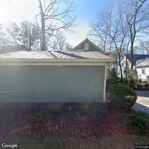
8553 Refuge Point Cir
8553 Refuge Point Cir
Charleston, SC 29420
Favorites
8553 Refuge Point Cir

Favorites
Check Back Soon for Upcoming Availability
| Beds | Baths | Average SF |
|---|---|---|
| 1 Bedroom 1 Bedroom 1 Br | 1 Bath 1 Bath 1 Ba | — |
8553 Refuge Point Cir,
Charleston,
SC
29420
South Carolina’s oldest and largest city, Charleston is nicknamed the “Holy City” because of an ordinance stating that no building can tower over the tallest church steeple. Because of this, there are no skyscrapers of any kind in the city, which has allowed Charleston to maintain its historic character. Home to a stunning landscape and award-winning restaurants, Charleston is truly the center for all things Southern charm.
History buffs revel in the many historical sites throughout Charleston, including the Fort Sumter National Monument, where the first shots at the Civil War were fired. Pristine beaches, the mighty Angel Oak tree, and the vast Lowcountry are popular with the city’s nature lovers. Residents adore the unique boutiques lining King Street, and the live performances at America’s first theater, the Dock Street Theater.
Learn more about living in Charleston
Education
| Colleges & Universities | Distance | ||
|---|---|---|---|
| Colleges & Universities | Distance | ||
| Drive: | 17 min | 8.1 mi | |
| Drive: | 17 min | 10.6 mi | |
| Drive: | 20 min | 10.9 mi | |
| Drive: | 28 min | 17.4 mi |
8553 Refuge Point Cir is within 17 minutes or 8.1 miles from Trident Tech, North Charleston. It is also near Charleston Southern University and Southern Wesleyan, Charleston.
Walkability Near 8553 Refuge Point Cir Charleston, SC 29420
Getting Around
 What do Walkability, Transit, Drivability, and Bikeability mean?
Walkability measures the walking distance to day-to-day needs.
Transit measures access to public transportation.
Drivability measures congestion, parking availability, and access to major roads.
Bikeability measures the suitability for cycling.
How It Works
What do Walkability, Transit, Drivability, and Bikeability mean?
Walkability measures the walking distance to day-to-day needs.
Transit measures access to public transportation.
Drivability measures congestion, parking availability, and access to major roads.
Bikeability measures the suitability for cycling.
How It Works
Somewhat Walkable
Walkability
20
/ 100
Minimal Public Transit
Transit
0
/ 100
Exceptionally Drivable
Drivability
90
/ 100
Somewhat Bikeable
Bikeability
30
/ 100
Scores provided by
-
Soundscore™
-
/ 100
Traffic
-Airport
-Businesses
-Scores provided by
HowLoud What is a Sound Score Rating? A Sound Score Rating aggregates noise caused by vehicle traffic, airplane traffic and local sources. How It WorksYou May Also Like
Similar Rentals Nearby
-
-
-
-
-
 3 Beds$2,130Total Monthly PriceTotal Monthly Price NewPrices include all required monthly fees.House for Rent
 -
 5 Beds$2,655Total Monthly PriceTotal Monthly Price NewPrices include all required monthly fees.House for Rent
 -
 3 Beds$2,125Total Monthly PriceTotal Monthly Price NewPrices include all required monthly fees.House for Rent
 -
 5 Beds$2,765Total Monthly PriceTotal Monthly Price NewPrices include all required monthly fees.House for Rent
 -
 5 Beds$2,610Total Monthly PriceTotal Monthly Price NewPrices include all required monthly fees.House for Rent
 -
 3 Beds$2,095Total Monthly PriceTotal Monthly Price NewPrices include all required monthly fees.House for Rent


What Are Walk Score®, Transit Score®, and Bike Score® Ratings?
Walk Score® measures the walkability of any address. Transit Score® measures access to public transit. Bike Score® measures the bikeability of any address.
What is a Sound Score Rating?
A Sound Score Rating aggregates noise caused by vehicle traffic, airplane traffic and local sources.
8553 Refuge Point Cir
Charleston, SC 29420