
$1,875 / Month
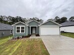
8415 Oxford Valley Dr
Little Rock, AR 72103
2 Weeks Ago
Favorites
-
Bedrooms
3
-
Bathrooms
2
-
Square Feet
1,566 sq ft
8415 Oxford Valley Dr

Favorites
About This Home
$1,000 deposit
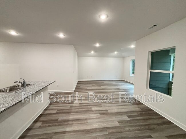
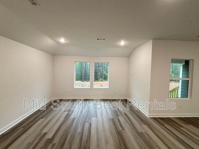
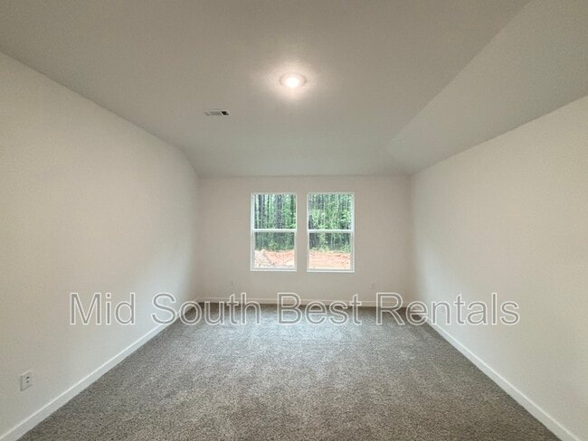
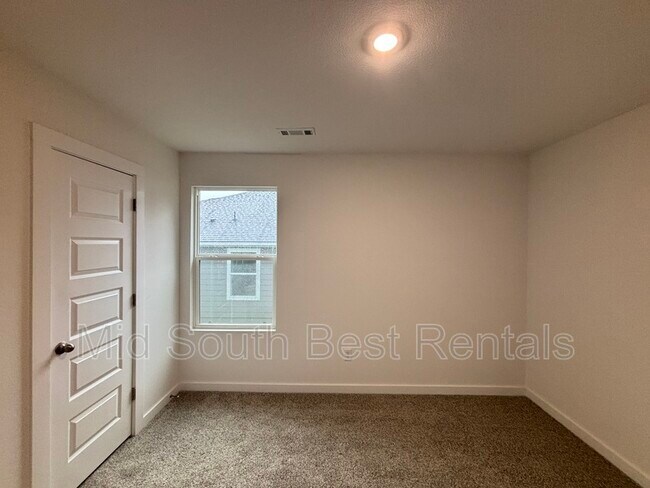
This brand-new 3-bedroom, 2-bath home in the desirable Shiloh Grove community offers thoughtfully designed living space, featuring an attached garage, separate laundry room with W/D connections, modern kitchen appliances, and a fully fenced backyard, this home blends comfort, style, and convenience—perfect for families in a welcoming neighborhood. This is the Denton floor plan. APPLY FOR FREE TODAY! or Join our wait list for this or other floor plans:
8415 Oxford Valley Dr is a house located in Pulaski County and the 72103 ZIP Code.
* Price shown is base rent and may not include non-optional fees and utilities.
Price, availability, fees, and any applicable rent special are subject to change without notice.
* Square footage definitions vary. Displayed square footage is approximate.
Location
Get Directions
The Chicot West section of Little Rock, located just south of Interstate 30, sits approximately 14 miles southwest of downtown's state government complex along the Arkansas River. Most of the residences and homes for rent lie in the northeast part of the neighborhood, near the intersection of I-30 and Chicot Road.
When the desire to eat out strikes, residents cross over I-30 for David's Burgers, which serves signature home-cut fries and fresh ground beef. For exercise, head to Morehart Park to tame the challenging nine-hole disc golf course. Navigate your disc among the tall trees to try to beat the par 65 score in the heart of this natural oasis.
Learn more about living in Chicot West I-30 South
Education
| Colleges & Universities | Distance | ||
|---|---|---|---|
| Colleges & Universities | Distance | ||
| Drive: | 14 min | 6.7 mi | |
| Drive: | 19 min | 9.4 mi | |
| Drive: | 19 min | 11.6 mi | |
| Drive: | 27 min | 15.9 mi |
8415 Oxford Valley Dr is within 14 minutes or 6.7 miles from UA Little Rock. It is also near Univ. of Ark. Medical Scis. and Philander Smith College.
Transportation options available in Little Rock include 2Nd St & Rock St, located 11.7 miles from 8415 Oxford Valley Dr. 8415 Oxford Valley Dr is near Bill and Hillary Clinton Ntl/Adams Field, located 12.5 miles or 19 minutes away.
| Transit / Subway | Distance | ||
|---|---|---|---|
| Transit / Subway | Distance | ||
| Drive: | 19 min | 11.7 mi | |
| Drive: | 18 min | 11.8 mi | |
| Drive: | 19 min | 11.8 mi | |
| Drive: | 19 min | 11.9 mi | |
| Drive: | 19 min | 12.1 mi |
| Commuter Rail | Distance | ||
|---|---|---|---|
| Commuter Rail | Distance | ||
|
|
Drive: | 20 min | 12.7 mi |
|
|
Drive: | 47 min | 37.1 mi |
| Airports | Distance | ||
|---|---|---|---|
| Airports | Distance | ||
|
Bill and Hillary Clinton Ntl/Adams Field
|
Drive: | 19 min | 12.5 mi |
Time and distance from 8415 Oxford Valley Dr.
| Shopping Centers | Distance | ||
|---|---|---|---|
| Shopping Centers | Distance | ||
| Drive: | 6 min | 2.1 mi | |
| Drive: | 6 min | 2.2 mi | |
| Drive: | 6 min | 2.2 mi |
8415 Oxford Valley Dr has 3 shopping centers within 2.2 miles, which is about a 6-minute drive. The miles and minutes will be for the farthest away property.
| Parks and Recreation | Distance | ||
|---|---|---|---|
| Parks and Recreation | Distance | ||
|
Little Rock Zoo
|
Drive: | 17 min | 8.4 mi |
|
Central High School National Historic Site
|
Drive: | 19 min | 8.8 mi |
|
Little Rock Audubon Center
|
Drive: | 16 min | 10.5 mi |
|
Museum of Discovery
|
Drive: | 19 min | 11.6 mi |
|
Lorance Creek Natural Area
|
Drive: | 26 min | 18.4 mi |
8415 Oxford Valley Dr has 5 parks within 18.4 miles, including Little Rock Zoo, Central High School National Historic Site, and Little Rock Audubon Center.
| Hospitals | Distance | ||
|---|---|---|---|
| Hospitals | Distance | ||
| Drive: | 18 min | 9.0 mi | |
| Drive: | 18 min | 9.2 mi | |
| Drive: | 19 min | 10.4 mi |
8415 Oxford Valley Dr has 3 hospitals within 10.4 miles, the nearest is Arkansas State Hospital which is 9.0 miles away and a 18 minute drive.
| Military Bases | Distance | ||
|---|---|---|---|
| Military Bases | Distance | ||
| Drive: | 46 min | 27.0 mi | |
| Drive: | 44 min | 28.9 mi | |
| Drive: | 51 min | 34.6 mi |
8415 Oxford Valley Dr has 3 military bases within 34.6 miles, the nearest is Camp Joseph T. Robinson Hill which is 27.0 miles away and a 46 minute drive.
You May Also Like
Similar Rentals Nearby


What Are Walk Score®, Transit Score®, and Bike Score® Ratings?
Walk Score® measures the walkability of any address. Transit Score® measures access to public transit. Bike Score® measures the bikeability of any address.
What is a Sound Score Rating?
A Sound Score Rating aggregates noise caused by vehicle traffic, airplane traffic and local sources

8415 Oxford Valley Dr
Little Rock, AR 72103