
$3,695
/ Month
836 Ashland Ave
Santa Monica, CA 90405
2 Weeks Ago
|
Edit
Favorites
836 Ashland Ave

Favorites
Check Back Soon for Upcoming Availability
| Beds | Baths | Average SF |
|---|---|---|
| 2 Bedrooms 2 Bedrooms 2 Br | 2 Baths 2 Baths 2 Ba | 1,200 SF |
Fees and Policies
The fees listed below are community-provided and may exclude utilities or add-ons. All payments are made directly to the property and are non-refundable unless otherwise specified.
Details
Utilities Included
-
Water
About This Property
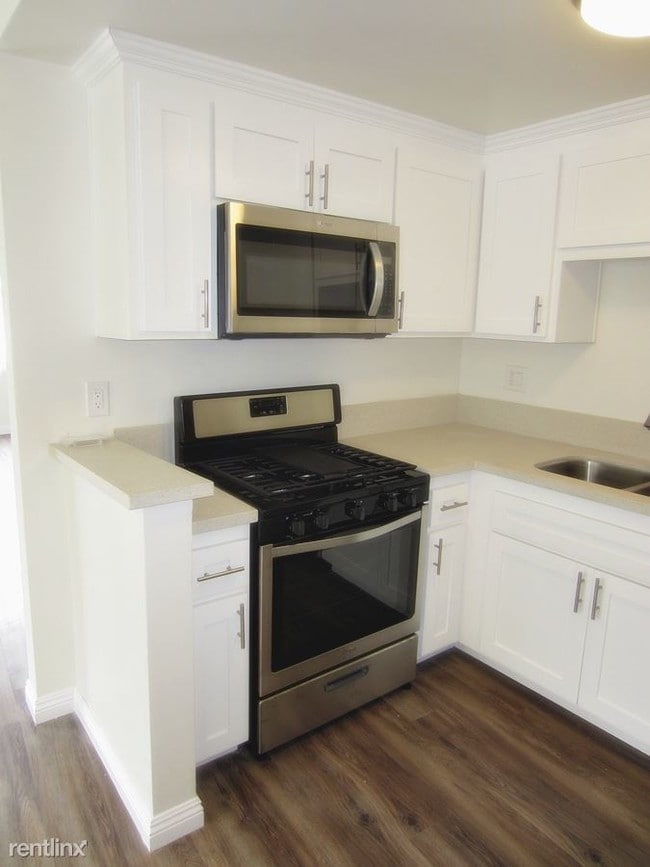
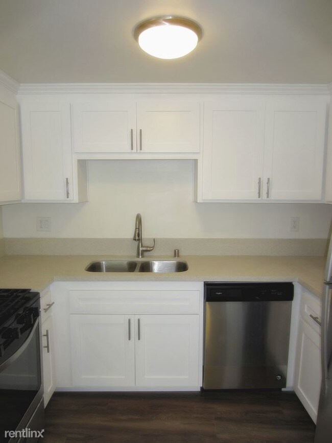
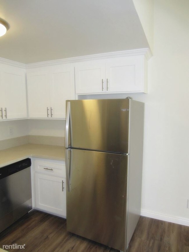
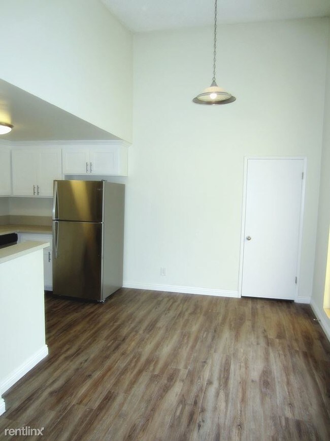
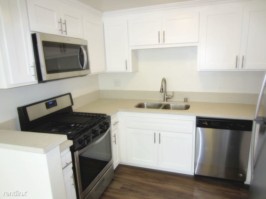
(310) 699-0643 - Available now! Large updated upper 2bed plus 2bath apartment. This unit is located near Ashland Ave and Lincoln Blvd. Unit comes with stainless steel stove/ fridge/ microwave and dishwasher. Unit also has a stack-able washer and dryer. Nearby schools include Olympic High (continuation) School, Santa Monica-Malibu Adult and John Muir Elementary School. The closest grocery stores are Gelson's Market, Whole Foods Market and Smart & Final extra!. Nearby coffee shops include McDonald's, Starbucks and Allegro Coffee Company. Nearby restaurants include RIZE, Pancho's Tacos and Burgers N Brews. 836 Ashland Ave is near Ozone Park, Joslyn Park and Hotchkiss Park. No Pets Allowed (RLNE4943376) Other Amenities: Unfurnished, Smoke Free, Balcony (2 Balconies). Appliances: Dishwasher, Refrigerator, Range, Garbage Disposal, Washer & Dryer, Microwave. Lease lengths: 12 Months. Utilities: Water Included, Trash Pick-up Included. Pet policies: No Pets Allowed.
836 Ashland Ave is an apartment community located in Los Angeles County and the 90405 ZIP Code.
Unique Features
- No Pets Allowed
Features
- Washer/Dryer
- Dishwasher
836 Ashland Ave,
Santa Monica,
CA
90405
Santa Monica, California combines coastal living with city convenience along Santa Monica Bay. This walkable 8.4-square-mile community features diverse housing options, from beachfront apartments to established residential neighborhoods. Current rental trends show average apartment rates ranging from $2,420 for studios to $6,413 for four-bedroom units, with modest year-over-year changes between -1.3% and 1.5% depending on unit size.
Santa Monica centers around notable landmarks like the Santa Monica Pier, with its Pacific Park amusement rides and historic carousel, and the open-air Third Street Promenade shopping district. The 26-acre Palisades Park offers ocean views and walking paths along the coastal bluffs. Cultural attractions include Bergamot Station, housing contemporary art galleries in a former trolley station, while the Santa Monica Farmers Market brings local produce to multiple locations throughout the week.
Learn more about living in Santa Monica
Amenities
- Washer/Dryer
- Dishwasher
- No Pets Allowed
Expenses
Utilities Included
Water
Included
Education
| Colleges & Universities | Distance | ||
|---|---|---|---|
| Colleges & Universities | Distance | ||
| Drive: | 6 min | 2.2 mi | |
| Drive: | 7 min | 2.6 mi | |
| Drive: | 11 min | 5.2 mi | |
| Drive: | 13 min | 6.3 mi |
836 Ashland Ave is within 6 minutes or 2.2 miles from Musicians Institute. It is also near Los Angeles Film School and City College.
Transportation options available in Santa Monica include Hollywood/Highland Station, located 2.1 miles from 836 Ashland Ave. 836 Ashland Ave is near Bob Hope, located 10.5 miles or 21 minutes away, and Los Angeles International, located 12.6 miles or 25 minutes away.
| Transit / Subway | Distance | ||
|---|---|---|---|
| Transit / Subway | Distance | ||
|
|
Drive: | 5 min | 2.1 mi |
|
|
Drive: | 7 min | 2.9 mi |
|
|
Drive: | 9 min | 3.8 mi |
|
|
Drive: | 12 min | 5.5 mi |
|
|
Drive: | 11 min | 5.9 mi |
| Commuter Rail | Distance | ||
|---|---|---|---|
| Commuter Rail | Distance | ||
|
|
Drive: | 16 min | 8.1 mi |
|
|
Drive: | 18 min | 8.5 mi |
|
|
Drive: | 17 min | 8.9 mi |
|
|
Drive: | 20 min | 9.4 mi |
| Drive: | 20 min | 10.0 mi |
| Airports | Distance | ||
|---|---|---|---|
| Airports | Distance | ||
|
Bob Hope
|
Drive: | 21 min | 10.5 mi |
|
Los Angeles International
|
Drive: | 25 min | 12.6 mi |
Walkability Near 836 Ashland Ave Santa Monica, CA 90405
Getting Around
 What do Walkability, Transit, Drivability, and Bikeability mean?
Walkability measures the walking distance to day-to-day needs.
Transit measures access to public transportation.
Drivability measures congestion, parking availability, and access to major roads.
Bikeability measures the suitability for cycling.
How It Works
What do Walkability, Transit, Drivability, and Bikeability mean?
Walkability measures the walking distance to day-to-day needs.
Transit measures access to public transportation.
Drivability measures congestion, parking availability, and access to major roads.
Bikeability measures the suitability for cycling.
How It Works
Very Walkable
Walkability
80
/ 100
Some Public Transit
Transit
50
/ 100
Moderately Drivable
Drivability
60
/ 100
Fairly Bikeable
Bikeability
40
/ 100
Scores provided by
Active
Soundscore™
68
/ 100
Traffic
BusyAirport
CalmBusinesses
ActiveScores provided by
HowLoud What is a Sound Score Rating? A Sound Score Rating aggregates noise caused by vehicle traffic, airplane traffic and local sources. How It WorksTime and distance from 836 Ashland Ave.
| Shopping Centers | Distance | ||
|---|---|---|---|
| Shopping Centers | Distance | ||
| Walk: | 6 min | 0.3 mi | |
| Walk: | 7 min | 0.4 mi | |
| Walk: | 8 min | 0.4 mi |
836 Ashland Ave has 3 shopping centers within 0.4 mile, which is about a 8-minute walk. The miles and minutes will be for the farthest away property.
| Parks and Recreation | Distance | ||
|---|---|---|---|
| Parks and Recreation | Distance | ||
|
Runyon Canyon
|
Drive: | 5 min | 1.8 mi |
|
Zimmer Children's Museum
|
Drive: | 6 min | 2.9 mi |
|
Virginia Robinson Gardens
|
Drive: | 9 min | 3.5 mi |
|
La Brea Tar Pits
|
Drive: | 7 min | 3.6 mi |
|
Franklin Canyon Park
|
Drive: | 16 min | 5.4 mi |
836 Ashland Ave has 5 parks within 5.4 miles, including Runyon Canyon, Zimmer Children's Museum, and La Brea Tar Pits.
| Hospitals | Distance | ||
|---|---|---|---|
| Hospitals | Distance | ||
| Drive: | 4 min | 2.0 mi | |
| Drive: | 6 min | 3.4 mi | |
| Drive: | 7 min | 3.4 mi |
836 Ashland Ave has 3 hospitals within 3.4 miles, the nearest is Cedars-Sinai Medical Center which is 2.0 miles away and a 4 minute drive.
| Military Bases | Distance | ||
|---|---|---|---|
| Military Bases | Distance | ||
| Drive: | 25 min | 14.3 mi |
836 Ashland Ave is 14.3 miles and a 25 minute drive from Los Angeles Air Force Base.
You May Also Like
Similar Rentals Nearby


What Are Walk Score®, Transit Score®, and Bike Score® Ratings?
Walk Score® measures the walkability of any address. Transit Score® measures access to public transit. Bike Score® measures the bikeability of any address.
What is a Sound Score Rating?
A Sound Score Rating aggregates noise caused by vehicle traffic, airplane traffic and local sources.
836 Ashland Ave
Santa Monica, CA 90405