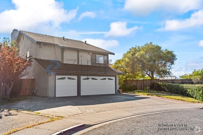
$4,500 / Month
833 Topper Ln
Lafayette, CA 94549
2 Weeks Ago
Favorites
833 Topper Ln

Favorites
Check Back Soon for Upcoming Availability
| Beds | Baths | Average SF |
|---|---|---|
| 2 Bedrooms 2 Bedrooms 2 Br | 1 Bath 1 Bath 1 Ba | 1,178 SF |
Fees and Policies
The fees below are based on community-supplied data and may exclude additional fees and utilities.
- Dogs Allowed
-
Fees not specified
- Cats Allowed
-
Fees not specified
- Parking
-
Garage--
Details
Utilities Included
-
Gas
-
Water
-
Electricity
-
Heat
-
Trash Removal
-
Sewer
-
Air Conditioning
About This Property
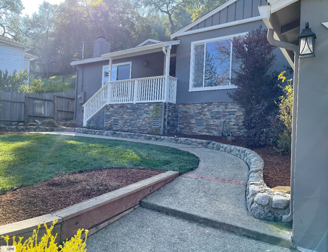
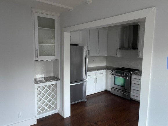
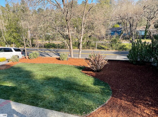
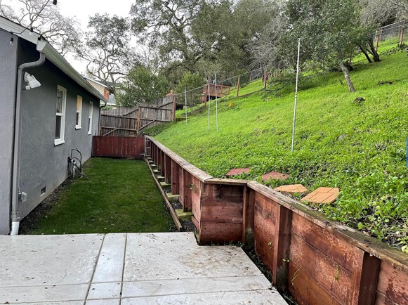
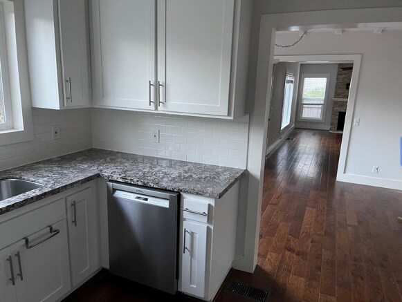
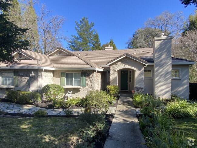
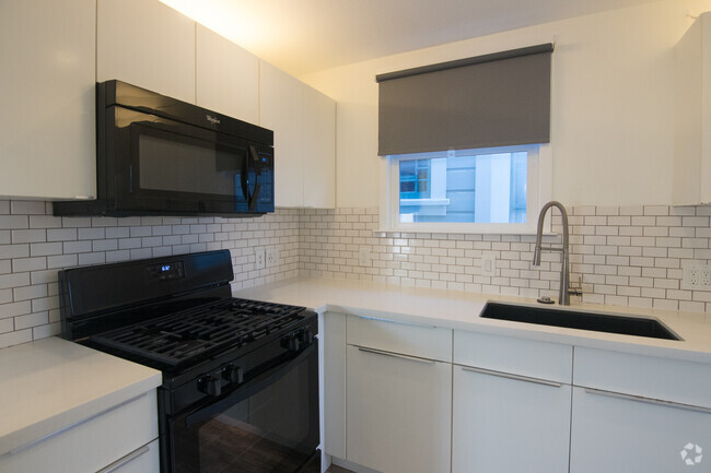
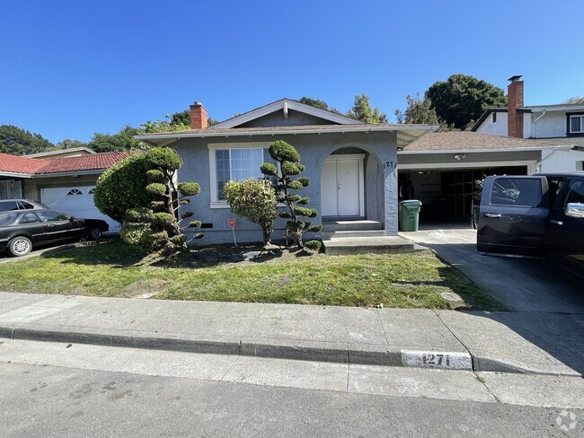
Located on .81 acres immediately facing the Lafayette Trail (the best part!) and a 20-minute walk along the trail to all of Downtown Lafayette. Beautiful details are showcased throughout this bright and inviting home including Craftsman style finishes, hardwood floors and large windows that deliver a lot of natural light. Approximately 1,178 sq. ft. with 2 bedrooms and an updated bath. The living room has a natural stone fireplace and multiple windows to allow you to take in the picturesque scenery. The updated kitchen features white subway tile, gorgeous stone counters, a Jenn-Air gas range and stainless appliances. The dining room is conveniently located right off the kitchen with a custom wine bar. Enjoy outdoor entertaining from sunny outdoor patio or front and back yards with old-growth oak trees to provide shade.
833 Topper Ln is a house located in Contra Costa County and the 94549 ZIP Code.
House Features
Washer/Dryer
Air Conditioning
Dishwasher
Hardwood Floors
- Washer/Dryer
- Air Conditioning
- Smoke Free
- Fireplace
- Dishwasher
- Kitchen
- Range
- Hardwood Floors
- Dining Room
- Patio
Location
Get Directions
Minutes from Oakland and San Francisco and practically right next door from the shopping, dining, and nightlife of Walnut Creek, Lafayette enjoys a perfect location for taking advantage of everything the North Bay Area has to offer. BART bus and rail service adds to the convenience, whether you’re a commuter or just checking out the neighboring communities for the day.
In town, the environment is mostly suburban, with top-notch schools, one of the lowest crime rates in the state, and an abundance of locally-owned shops and restaurants. The parks in town offer something for every taste, from small neighborhood greenspaces to enormous, trail-filled nature preserves like Lafayette Reservoir and Briones Hills.
Learn more about living in LafayetteBelow are rent ranges for similar nearby apartments
Amenities
- Washer/Dryer
- Air Conditioning
- Smoke Free
- Fireplace
- Dishwasher
- Kitchen
- Range
- Hardwood Floors
- Dining Room
- Patio
Expenses
Utilities Included
Gas, Water, Electricity, Heat, Trash Removal, Sewer, Air Conditioning
Included
Education
| Colleges & Universities | Distance | ||
|---|---|---|---|
| Colleges & Universities | Distance | ||
| Drive: | 10 min | 3.9 mi | |
| Drive: | 17 min | 9.4 mi | |
| Drive: | 22 min | 11.9 mi | |
| Drive: | 25 min | 15.7 mi |
833 Topper Ln is within 10 minutes or 3.9 miles from Saint Marys Coll. of Calif.. It is also near Diablo Valley, Pleasant Hill and UC Berkeley.
Transportation options available in Lafayette include Lafayette Station, located 1.8 miles from 833 Topper Ln. 833 Topper Ln is near Metro Oakland International, located 21.8 miles or 32 minutes away, and San Francisco International, located 33.7 miles or 50 minutes away.
| Transit / Subway | Distance | ||
|---|---|---|---|
| Transit / Subway | Distance | ||
|
|
Drive: | 4 min | 1.8 mi |
|
|
Drive: | 9 min | 4.5 mi |
|
|
Drive: | 9 min | 5.9 mi |
|
Pleasant Hill Station
|
Drive: | 10 min | 6.1 mi |
|
|
Drive: | 16 min | 10.3 mi |
| Commuter Rail | Distance | ||
|---|---|---|---|
| Commuter Rail | Distance | ||
|
|
Drive: | 22 min | 13.2 mi |
|
|
Drive: | 21 min | 14.9 mi |
|
|
Drive: | 21 min | 15.7 mi |
|
|
Drive: | 25 min | 16.8 mi |
|
|
Drive: | 36 min | 25.7 mi |
| Airports | Distance | ||
|---|---|---|---|
| Airports | Distance | ||
|
Metro Oakland International
|
Drive: | 32 min | 21.8 mi |
|
San Francisco International
|
Drive: | 50 min | 33.7 mi |
Time and distance from 833 Topper Ln.
| Shopping Centers | Distance | ||
|---|---|---|---|
| Shopping Centers | Distance | ||
| Walk: | 13 min | 0.7 mi | |
| Walk: | 14 min | 0.8 mi | |
| Walk: | 15 min | 0.8 mi |
833 Topper Ln has 3 shopping centers within 0.8 mile, which is about a 15-minute walk. The miles and minutes will be for the farthest away property.
| Parks and Recreation | Distance | ||
|---|---|---|---|
| Parks and Recreation | Distance | ||
|
Butterfly Habitat Gardens
|
Drive: | 8 min | 5.0 mi |
|
Civic Park
|
Drive: | 8 min | 5.0 mi |
|
Contra Costa Canal Regional Trail
|
Drive: | 10 min | 5.6 mi |
|
Larkey Park
|
Drive: | 11 min | 5.7 mi |
|
Lindsay Wildlife Museum
|
Drive: | 11 min | 5.8 mi |
833 Topper Ln has 5 parks within 5.8 miles, including Butterfly Habitat Gardens, Civic Park, and Larkey Park.
| Hospitals | Distance | ||
|---|---|---|---|
| Hospitals | Distance | ||
| Drive: | 9 min | 4.7 mi | |
| Drive: | 10 min | 5.9 mi | |
| Drive: | 15 min | 10.8 mi |
833 Topper Ln has 3 hospitals within 10.8 miles, the nearest is Kaiser Foundation Hospital - Walnut Creek which is 4.7 miles away and a 9 minute drive.
| Military Bases | Distance | ||
|---|---|---|---|
| Military Bases | Distance | ||
| Drive: | 31 min | 14.8 mi |
833 Topper Ln is 14.8 miles and a 31 minute drive from Military Reservation.
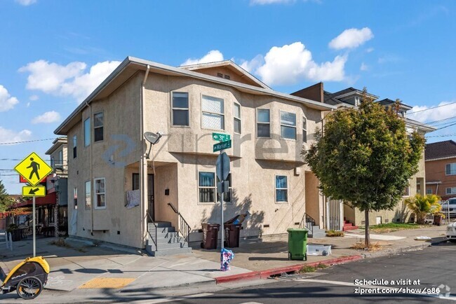
You May Also Like
Similar Rentals Nearby

What Are Walk Score®, Transit Score®, and Bike Score® Ratings?
Walk Score® measures the walkability of any address. Transit Score® measures access to public transit. Bike Score® measures the bikeability of any address.
What is a Sound Score Rating?
A Sound Score Rating aggregates noise caused by vehicle traffic, airplane traffic and local sources

833 Topper Ln
Lafayette, CA 94549