
$515
/ Month
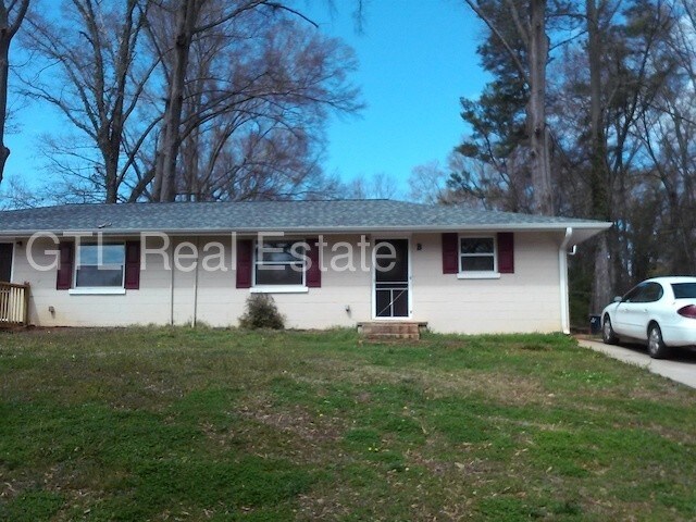
833 E Tinsley St
Griffin, GA 30223
Favorites
833 E Tinsley St

Favorites
Check Back Soon for Upcoming Availability
| Beds | Baths | Average SF |
|---|---|---|
| 2 Bedrooms 2 Bedrooms 2 Br | 1 Bath 1 Bath 1 Ba | 868 SF |
Fees and Policies
The fees listed below are community-provided and may exclude utilities or add-ons. All payments are made directly to the property and are non-refundable unless otherwise specified.
- Dogs Allowed
-
Fees not specified
- Cats Allowed
-
Fees not specified
About This Property
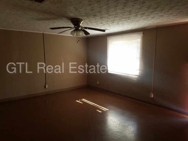
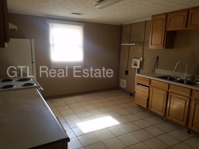
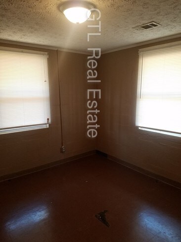
Large duplex unit with 2BR/1BA. Large private lot.Large open kitchen. Central heat and air. Newly painted throughout. No large dogs above 55 lbs. This property allows self guided viewing without an appointment. Contact for details.
833 E Tinsley St is a townhome located in Spalding County and the 30223 ZIP Code. This area is served by the Spalding County School District attendance zone.
833 E Tinsley St,
Griffin,
GA
30223
Education
| Colleges & Universities | Distance | ||
|---|---|---|---|
| Colleges & Universities | Distance | ||
| Drive: | 28 min | 18.5 mi | |
| Drive: | 44 min | 31.9 mi | |
| Drive: | 55 min | 35.8 mi | |
| Drive: | 55 min | 40.6 mi |
833 E Tinsley St is within 28 minutes or 18.5 miles from Gordon College, Barnesville. It is also near Clayton State University and Atlanta Metropolitan State.
Schools


Public Elementary School
Grades PK-5
331 Students
Attendance Zone
Public Middle School
Grades 6-8
439 Students
Attendance Zone
Public High School
Grades 9-12
1,171 Students
Attendance Zone
Private Elementary School
Grades PK-5
169 Students
Nearby
Private Middle & High School
Grades 6-12
36 Students
Nearby
School data provided by
 The GreatSchools Rating helps parents compare schools within a state based on a variety of school quality indicators and provides a helpful picture of how effectively each school serves all of its students. Ratings are on a scale of 1 (below average) to 10 (above average) and can include test scores, college readiness, academic progress, advanced courses, equity, discipline and attendance data. We also advise parents to visit schools, consider other information on school performance and programs, and consider family needs as part of the school selection process.
View GreatSchools Rating Methodology
Data provided by GreatSchools.org © 2026. All rights reserved.
View GreatSchools Rating Methodology
Data provided by GreatSchools.org © 2026. All rights reserved.
Walkability Near 833 E Tinsley St Griffin, GA 30223
Getting Around
 What do Walkability, Transit, Drivability, and Bikeability mean?
Walkability measures the walking distance to day-to-day needs.
Transit measures access to public transportation.
Drivability measures congestion, parking availability, and access to major roads.
Bikeability measures the suitability for cycling.
How It Works
What do Walkability, Transit, Drivability, and Bikeability mean?
Walkability measures the walking distance to day-to-day needs.
Transit measures access to public transportation.
Drivability measures congestion, parking availability, and access to major roads.
Bikeability measures the suitability for cycling.
How It Works
Fairly Walkable
Walkability
40
/ 100
Very Drivable
Drivability
80
/ 100
Somewhat Bikeable
Bikeability
30
/ 100
Scores provided by
-
Soundscore™
-
/ 100
Traffic
-Airport
-Businesses
-Scores provided by
HowLoud What is a Sound Score Rating? A Sound Score Rating aggregates noise caused by vehicle traffic, airplane traffic and local sources. How It WorksYou May Also Like
Similar Rentals Nearby
-
-
2 Beds$2,332+3 Beds$3,006+Total Monthly PriceTotal Monthly Price NewPrices include base rent and required monthly fees of $206. Variable costs based on usage may apply.Base Rent:2 Beds$2,125+3 Beds$2,799+3 Months Free
Pets Allowed Fitness Center Pool Dishwasher Refrigerator Kitchen
-
-
2 Beds$1,424+3 Beds$1,589+Total Monthly PriceTotal Monthly Price NewPrices include required monthly fees of $121.Base Rent:2 Beds$1,302+3 Beds$1,467+Specials
Pets Allowed Fitness Center Pool Dishwasher Walk-In Closets Clubhouse
-
-
-
-

-

-


What Are Walk Score®, Transit Score®, and Bike Score® Ratings?
Walk Score® measures the walkability of any address. Transit Score® measures access to public transit. Bike Score® measures the bikeability of any address.
What is a Sound Score Rating?
A Sound Score Rating aggregates noise caused by vehicle traffic, airplane traffic and local sources.
833 E Tinsley St
Griffin, GA 30223