$2,230
Total Monthly Price
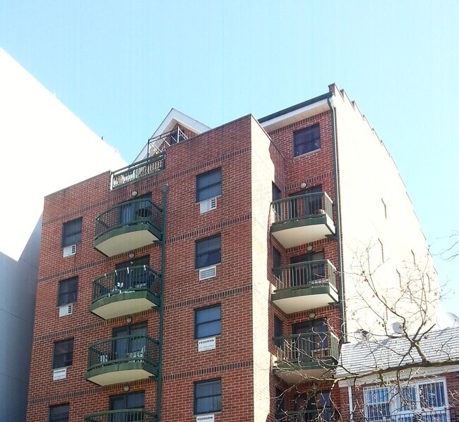
83-71 116 street Unit 7C
Kew Garden, NY 11415
Favorites
83-71 116 street Unit 7C

Favorites
Check Back Soon for Upcoming Availability
| Beds | Baths | Average SF |
|---|---|---|
| 1 Bedroom 1 Bedroom 1 Br | 1 Bath 1 Bath 1 Ba | 750 SF |
Fees and Policies
The fees listed below are community-provided and may exclude utilities or add-ons. All payments are made directly to the property and are non-refundable unless otherwise specified.
- Parking
-
Garage--
Details
Utilities Included
-
Water
-
Trash Removal
-
Sewer
-
Air Conditioning
About This Property
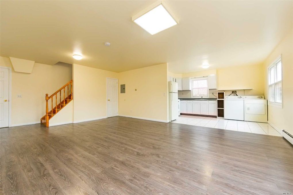
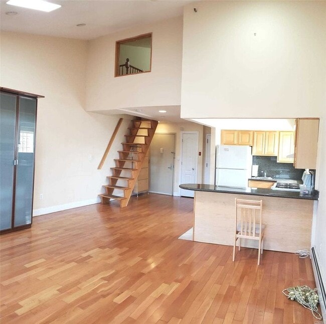
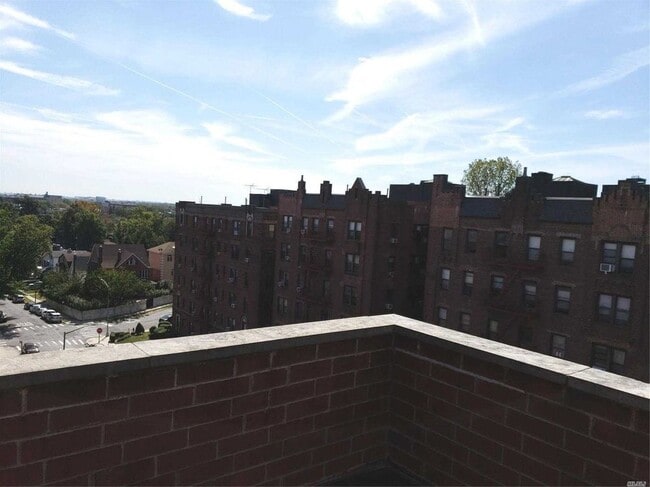
Sunny, spacious on the top floor with skylights large balcony, over looking beautiful park. Close to all major highway and public transportation with express trains E and F and buses nearby. Restaurant and stores a block away very convenience to all. Last but not least free garage parking.
83-71 116 Street is an apartment community located in Queens County and the 11415 ZIP Code.
Apartment Features
Air Conditioning
Dishwasher
Hardwood Floors
Smoke Free
- Air Conditioning
- Smoke Free
- Dishwasher
- Hardwood Floors
- Laundry Facilities
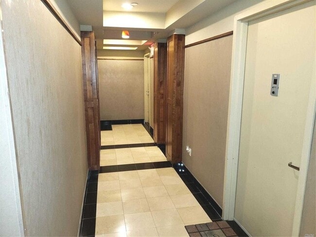
- Elevator
- Storage Space
- Balcony
83-71 116 street,
Kew Garden,
NY
11415
Kew Gardens sits at the geographic center of Queens, carrying the quiet confidence of a neighborhood that has never needed to prove itself. Developed in the early 20th century as one of seven planned garden communities in the borough, it retains its neo-Tudor architecture and tree-lined streets while remaining well-connected to the broader city. The Long Island Rail Road runs directly through the neighborhood, and nearby subway lines put Midtown Manhattan within a reasonable commute. Forest Park borders the area to the west, offering trails and open space without requiring a car. Lefferts Boulevard anchors the commercial corridor with a walkable stretch of shops and dining. The Queens County Criminal Court and Civil Court buildings also sit within the neighborhood, giving it an institutional presence that anchors steady local activity.
Learn more about living in Kew GardensBelow are rent ranges for similar nearby apartments
| Beds | Average Size | Lowest | Typical | Premium |
|---|---|---|---|---|
| Studio Studio Studio | 500 Sq Ft | $1,804 | $2,329 | $3,101 |
| 1 Bed 1 Bed 1 Bed | 670 Sq Ft | $2,095 | $2,797 | $4,246 |
| 2 Beds 2 Beds 2 Beds | 1266 Sq Ft | $1,595 | $4,146 | $11,892 |
| 3 Beds 3 Beds 3 Beds | 1511 Sq Ft | $2,025 | $3,904 | $6,475 |
| 4 Beds 4 Beds 4 Beds | 1060 Sq Ft | $1,040 | $10,747 | $35,066 |
Amenities
- Air Conditioning
- Smoke Free
- Dishwasher
- Hardwood Floors
- Laundry Facilities
- Elevator
- Storage Space
- Balcony
Expenses
Utilities Included
Water, Trash Removal, Sewer, Air Conditioning
Included
Education
| Colleges & Universities | Distance | ||
|---|---|---|---|
| Colleges & Universities | Distance | ||
| Drive: | 6 min | 3.0 mi | |
| Drive: | 8 min | 3.7 mi | |
| Drive: | 9 min | 4.8 mi | |
| Drive: | 14 min | 7.3 mi |
83-71 116 street Unit 7C is within 6 minutes or 3.0 miles from York College. It is also near St. John's University and Queens College.
Transportation options available in Kew Garden include 121 Street, located 0.6 mile from 83-71 116 street Unit 7C. 83-71 116 street Unit 7C is near John F Kennedy International, located 6.8 miles or 11 minutes away, and LaGuardia, located 6.9 miles or 13 minutes away.
| Transit / Subway | Distance | ||
|---|---|---|---|
| Transit / Subway | Distance | ||
|
|
Walk: | 11 min | 0.6 mi |
|
|
Walk: | 11 min | 0.6 mi |
|
|
Walk: | 17 min | 0.9 mi |
|
|
Drive: | 3 min | 1.2 mi |
|
|
Drive: | 3 min | 1.3 mi |
| Commuter Rail | Distance | ||
|---|---|---|---|
| Commuter Rail | Distance | ||
|
|
Walk: | 12 min | 0.6 mi |
|
|
Drive: | 5 min | 1.5 mi |
|
|
Drive: | 4 min | 1.8 mi |
|
|
Drive: | 8 min | 3.6 mi |
|
|
Drive: | 9 min | 5.0 mi |
| Airports | Distance | ||
|---|---|---|---|
| Airports | Distance | ||
|
John F Kennedy International
|
Drive: | 11 min | 6.8 mi |
|
LaGuardia
|
Drive: | 13 min | 6.9 mi |
Walkability Near 83-71 116 street Kew Garden, NY 11415
Getting Around
 What do Walkability, Transit, Drivability, and Bikeability mean?
Walkability measures the walking distance to day-to-day needs.
Transit measures access to public transportation.
Drivability measures congestion, parking availability, and access to major roads.
Bikeability measures the suitability for cycling.
How It Works
What do Walkability, Transit, Drivability, and Bikeability mean?
Walkability measures the walking distance to day-to-day needs.
Transit measures access to public transportation.
Drivability measures congestion, parking availability, and access to major roads.
Bikeability measures the suitability for cycling.
How It Works
Exceptionally Walkable
Walkability
100
/ 100
Exceptional Public Transit
Transit
100
/ 100
Fairly Drivable
Drivability
40
/ 100
Very Bikeable
Bikeability
80
/ 100
Scores provided by
-
Soundscore™
-
/ 100
Traffic
-Airport
-Businesses
-Scores provided by
HowLoud What is a Sound Score Rating? A Sound Score Rating aggregates noise caused by vehicle traffic, airplane traffic and local sources. How It WorksTime and distance from 83-71 116 street Unit 7C.
| Shopping Centers | Distance | ||
|---|---|---|---|
| Shopping Centers | Distance | ||
| Walk: | 13 min | 0.7 mi | |
| Drive: | 3 min | 1.5 mi | |
| Drive: | 4 min | 1.7 mi |
83-71 116 street Unit 7C has 3 shopping centers within 1.7 miles, which is about a 4-minute drive. The miles and minutes will be for the farthest away property.
| Parks and Recreation | Distance | ||
|---|---|---|---|
| Parks and Recreation | Distance | ||
|
Forest Park - Brooklyn-Queens
|
Walk: | 16 min | 0.9 mi |
|
Rufus King Park
|
Drive: | 6 min | 2.4 mi |
|
Juniper Valley Park
|
Drive: | 8 min | 3.0 mi |
|
Detective Keith L. Williams Park
|
Drive: | 8 min | 3.3 mi |
|
Flushing Meadows Corona Park
|
Drive: | 8 min | 4.8 mi |
83-71 116 street Unit 7C has 5 parks within 4.8 miles, including Forest Park - Brooklyn-Queens, Rufus King Park, and Detective Keith L. Williams Park.
| Hospitals | Distance | ||
|---|---|---|---|
| Hospitals | Distance | ||
| Drive: | 3 min | 1.3 mi | |
| Drive: | 6 min | 2.7 mi | |
| Drive: | 12 min | 4.4 mi |
83-71 116 street Unit 7C has 3 hospitals within 4.4 miles, the nearest is Jamaica Hospital Medical Center which is 1.3 miles away and a 3 minute drive.
| Military Bases | Distance | ||
|---|---|---|---|
| Military Bases | Distance | ||
| Drive: | 17 min | 9.7 mi | |
| Drive: | 21 min | 11.8 mi | |
| Drive: | 30 min | 13.3 mi |
83-71 116 street Unit 7C has 3 military bases within 13.3 miles, the nearest is Fort Totten US Govt Reservation which is 9.7 miles away and a 17 minute drive.
You May Also Like
Similar Rentals Nearby


What Are Walk Score®, Transit Score®, and Bike Score® Ratings?
Walk Score® measures the walkability of any address. Transit Score® measures access to public transit. Bike Score® measures the bikeability of any address.
What is a Sound Score Rating?
A Sound Score Rating aggregates noise caused by vehicle traffic, airplane traffic and local sources.

83-71 116 street
Kew Garden, NY 11415