

$3,495
/ Month
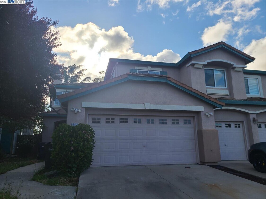
829 Berryessa Ct
Livermore, CA 94551
2 Weeks Ago
|
Edit
Favorites
829 Berryessa Ct

Favorites
Check Back Soon for Upcoming Availability
| Beds | Baths | Average SF |
|---|---|---|
| 3 Bedrooms 3 Bedrooms 3 Br | 2.5 Baths 2.5 Baths 2.5 Ba | 1,658 SF |
About This Property
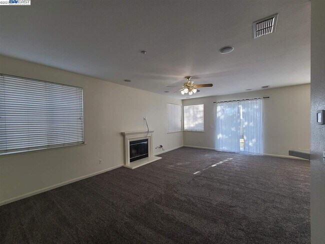
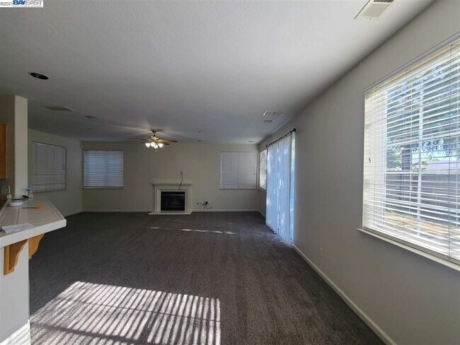
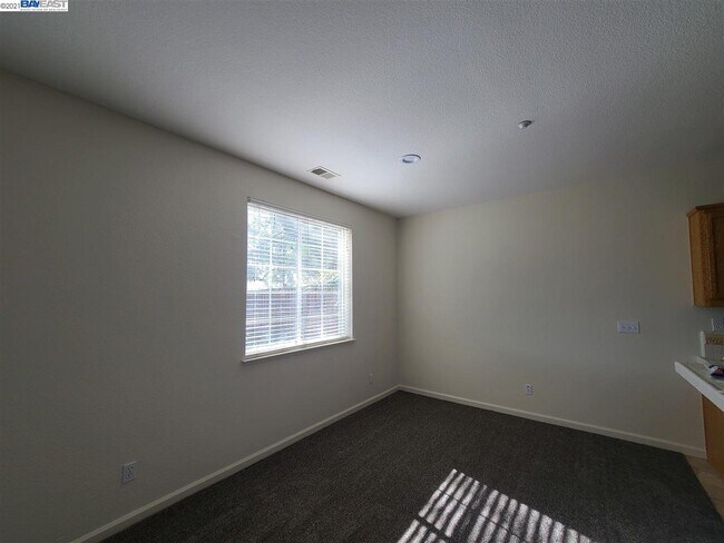
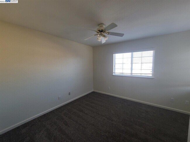
Fantastic two-story home available in the north Vasco area of Livermore. This 1,658 Sqft. attached home offers 3 bedrooms, 2.5 bathrooms and a two-car garage. A great floorplan features plenty of living space which creates a welcoming atmosphere for entertaining or daily life. Flooring consists of new carpet throughout. The kitchen comes equipped with new appliances including gas range/oven, microwave and dishwasher. The airy bedrooms are perfect for getting a good night's sleep. The master bedroom includes a walk in closet and a bathroom with a dual vanity. Additional amenities include: private backyard, washer & dryer hookups, updated paint, central A/C, forced air heat, and a fireplace. This ideal location is minutes to downtown Livermore, shopping, fine dining, movie theaters and Livermore's blossoming wine country. Easy freeway access to I-580. This is a perfect place to call home! *INFORMATION IS DEEMED RELIABLE, BUT IS NOT GUARANTEED.
829 Berryessa Ct is a house located in Alameda County and the 94551 ZIP Code. This area is served by the Livermore Valley Joint Unified School District attendance zone.
829 Berryessa Ct,
Livermore,
CA
94551
The cities of Livermore, Dublin and Pleasanton form a loosely shaped triangle within California's Tri-Valley region, a cluster of three small valleys about 33 miles east of San Francisco and 35 miles northeast of San Jose. Known for its Mediterranean climate, rolling hills and historic vineyards, this once bucolic region now boasts three separate downtown areas, a bustling business community and some of the best wineries in the state.
At the eastern end of the region lies the city of Livermore. Once known as Livermores, Livermore Ranch and Nottingham, the city sits at the center of Livermore Valley, a historic region dotted with more than 5,000 acres of mostly family-owned vineyards. A pastoral neighborhood known for its charming yet functional hilltop windmills, Livermore hosts the internationally recognized and sometimes controversial center of scientific research, Lawrence Livermore National Laboratories.
Learn more about living in Dublin/Pleasanton/LivermoreBelow are rent ranges for similar nearby apartments
| Beds | Average Size | Lowest | Typical | Premium |
|---|---|---|---|---|
| Studio Studio Studio | 565 Sq Ft | $1,295 | $2,292 | $3,300 |
| 1 Bed 1 Bed 1 Bed | 739 Sq Ft | $950 | $2,651 | $4,982 |
| 2 Beds 2 Beds 2 Beds | 1031-1032 Sq Ft | $1,990 | $3,231 | $7,141 |
| 3 Beds 3 Beds 3 Beds | 1355-1357 Sq Ft | $2,650 | $3,874 | $5,548 |
| 4 Beds 4 Beds 4 Beds | 2544 Sq Ft | $975 | $4,535 | $8,500 |
Education
| Colleges & Universities | Distance | ||
|---|---|---|---|
| Colleges & Universities | Distance | ||
| Drive: | 11 min | 6.2 mi | |
| Drive: | 16 min | 11.6 mi | |
| Drive: | 21 min | 14.8 mi | |
| Drive: | 32 min | 21.0 mi |
829 Berryessa Ct is within 11 minutes or 6.2 miles from Las Positas College. It is also near San Joaquin Delta, Mtn. House and Diablo Valley Coll, San Ramon.
Schools


Public Elementary School
Grades K-5
537 Students
Nearby
Public Elementary School
Grades K-5
620 Students
Attendance Zone
Public Middle School
Grades 6-8
592 Students
Attendance Zone
Public High School
Grades 9-12
1,827 Students
Attendance Zone
Private Elementary School
Grades PK-5
Nearby
Private Elementary, Middle & High School
Grades K-12
Nearby
Private Elementary, Middle & High School
Grades K-12
Nearby
School data provided by
 The GreatSchools Rating helps parents compare schools within a state based on a variety of school quality indicators and provides a helpful picture of how effectively each school serves all of its students. Ratings are on a scale of 1 (below average) to 10 (above average) and can include test scores, college readiness, academic progress, advanced courses, equity, discipline and attendance data. We also advise parents to visit schools, consider other information on school performance and programs, and consider family needs as part of the school selection process.
View GreatSchools Rating Methodology
Data provided by GreatSchools.org © 2026. All rights reserved.
View GreatSchools Rating Methodology
Data provided by GreatSchools.org © 2026. All rights reserved.
Transportation options available in Livermore include Dublin Pleasanton Station, located 11.6 miles from 829 Berryessa Ct. 829 Berryessa Ct is near Metro Oakland International, located 30.4 miles or 38 minutes away, and Norman Y Mineta San Jose International, located 36.3 miles or 48 minutes away.
| Transit / Subway | Distance | ||
|---|---|---|---|
| Transit / Subway | Distance | ||
|
|
Drive: | 14 min | 11.6 mi |
| Commuter Rail | Distance | ||
|---|---|---|---|
| Commuter Rail | Distance | ||
| Drive: | 5 min | 2.1 mi | |
| Drive: | 8 min | 4.0 mi | |
| Drive: | 20 min | 12.6 mi | |
| Drive: | 28 min | 20.8 mi | |
| Drive: | 38 min | 25.4 mi |
| Airports | Distance | ||
|---|---|---|---|
| Airports | Distance | ||
|
Metro Oakland International
|
Drive: | 38 min | 30.4 mi |
|
Norman Y Mineta San Jose International
|
Drive: | 48 min | 36.3 mi |
Walkability Near 829 Berryessa Ct Livermore, CA 94551
Getting Around
 What do Walkability, Transit, Drivability, and Bikeability mean?
Walkability measures the walking distance to day-to-day needs.
Transit measures access to public transportation.
Drivability measures congestion, parking availability, and access to major roads.
Bikeability measures the suitability for cycling.
How It Works
What do Walkability, Transit, Drivability, and Bikeability mean?
Walkability measures the walking distance to day-to-day needs.
Transit measures access to public transportation.
Drivability measures congestion, parking availability, and access to major roads.
Bikeability measures the suitability for cycling.
How It Works
Somewhat Walkable
Walkability
30
/ 100
Limited Public Transit
Transit
30
/ 100
Exceptionally Drivable
Drivability
100
/ 100
Fairly Bikeable
Bikeability
40
/ 100
Scores provided by
-
Soundscore™
-
/ 100
Traffic
-Airport
-Businesses
-Scores provided by
HowLoud What is a Sound Score Rating? A Sound Score Rating aggregates noise caused by vehicle traffic, airplane traffic and local sources. How It WorksTime and distance from 829 Berryessa Ct.
| Shopping Centers | Distance | ||
|---|---|---|---|
| Shopping Centers | Distance | ||
| Walk: | 9 min | 0.5 mi | |
| Walk: | 12 min | 0.6 mi | |
| Walk: | 16 min | 0.9 mi |
829 Berryessa Ct has 3 shopping centers within 0.9 mile, which is about a 16-minute walk. The miles and minutes will be for the farthest away property.
| Parks and Recreation | Distance | ||
|---|---|---|---|
| Parks and Recreation | Distance | ||
|
Brushy Peak Regional Preserve
|
Drive: | 6 min | 2.9 mi |
|
Los Vaqueros Watershed
|
Drive: | 9 min | 4.8 mi |
|
Shadow Cliffs Regional Recreation Area
|
Drive: | 17 min | 10.0 mi |
|
Carnegie State Vehicle Recreation Area
|
Drive: | 21 min | 12.3 mi |
|
Bethany Reservoir State Recreation Area
|
Drive: | 22 min | 12.6 mi |
829 Berryessa Ct has 5 parks within 12.6 miles, including Brushy Peak Regional Preserve, Los Vaqueros Watershed, and Shadow Cliffs Regional Recreation Area.
| Hospitals | Distance | ||
|---|---|---|---|
| Hospitals | Distance | ||
| Drive: | 13 min | 9.9 mi |
829 Berryessa Ct is 9.9 miles and a 13 minute drive from Stanford Health Care - ValleyCare.
You May Also Like
Similar Rentals Nearby


What Are Walk Score®, Transit Score®, and Bike Score® Ratings?
Walk Score® measures the walkability of any address. Transit Score® measures access to public transit. Bike Score® measures the bikeability of any address.
What is a Sound Score Rating?
A Sound Score Rating aggregates noise caused by vehicle traffic, airplane traffic and local sources.
829 Berryessa Ct
Livermore, CA 94551