829-833 Conestoga Road
829-833 Conestoga Rd,
Bryn Mawr,
PA
19010
-
Monthly Rent
$1,450 - $2,400
-
Bedrooms
1 - 3 bd
-
Bathrooms
1 - 1.5 ba
-
Square Feet
575 - 975 sq ft

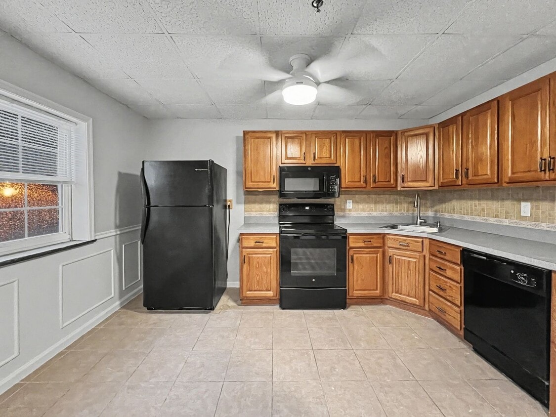
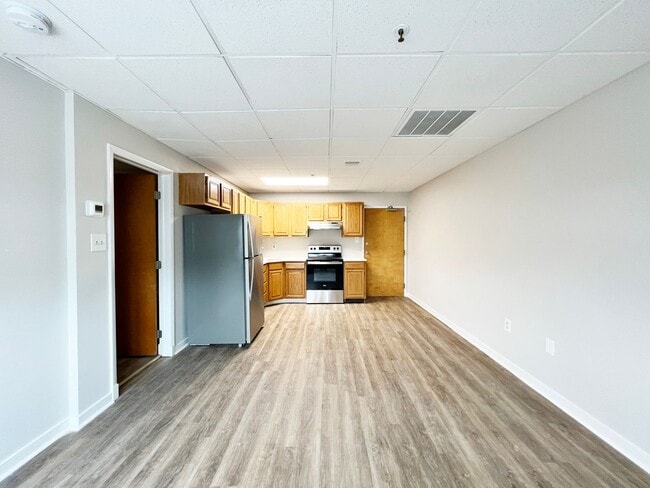
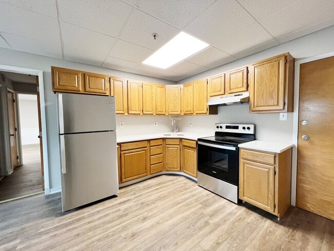
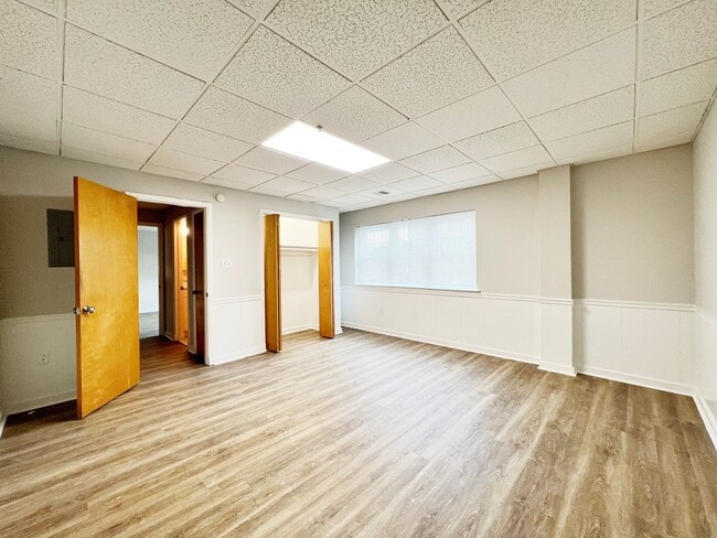
Conestoga Commons is a new to the student housing market property within walking distance to Villanova University. Residents will love the close proximity to campus, the large layouts, in unit laundry, and on-site parking. Close to Flip and Bailey's and Kelly's as well as all of the amenities of Lancaster Ave. Walk to the Paoli/Thorndale line to Center City, Philadelphia as well as the Norristown Highspeed Line.
Pricing & Floor Plans
-
Unit D2price $1,450square feetavailibility Now
-
Unit D5price $2,400square feet 975availibility Now
-
Unit D2price $1,450square feetavailibility Now
-
Unit D5price $2,400square feet 975availibility Now
Fees and Policies
The fees listed below are community-provided and may exclude utilities or add-ons. All payments are made directly to the property and are non-refundable unless otherwise specified. Use the Cost Calculator to determine costs based on your needs.
-
One-Time Basics
-
Due at Application
-
Application Fee Per ApplicantCharged per unit.$50
-
-
Due at Application
Pet policies are negotiable.
-
Parking
-
Security Deposit - Non-RefundableMax of 1. Charged per vehicle.$0
CommentsMax of 1Read More Read Less -
Property Fee Disclaimer: Based on community-supplied data and independent market research. Subject to change without notice. May exclude fees for mandatory or optional services and usage-based utilities.
Details
Lease Options
-
12 mo
Property Information
-
Built in 1990
-
10 units/3 stories
Specialty Housing Details
-
This property is intended and operated for occupancy by students, faculty and staff in higher education, but applications from individuals not involved in higher education may be accepted.
About 829-833 Conestoga Road
Conestoga Commons is a new to the student housing market property within walking distance to Villanova University. Residents will love the close proximity to campus, the large layouts, in unit laundry, and on-site parking. Close to Flip and Bailey's and Kelly's as well as all of the amenities of Lancaster Ave. Walk to the Paoli/Thorndale line to Center City, Philadelphia as well as the Norristown Highspeed Line.
829-833 Conestoga Road is an apartment community located in Delaware County and the 19010 ZIP Code. This area is served by the Radnor Township School District attendance zone.
Contact
Apartment Features
Air Conditioning
Refrigerator
Tub/Shower
Heating
- Air Conditioning
- Heating
- Tub/Shower
- Kitchen
- Oven
- Refrigerator
Spacious houses sitting on sprawling tracts of land with meticulously landscaped grounds characterize the Philadelphia Main Line, one of the most sought-after regions in the Philadelphia metropolitan area. The Main Line in Delaware County encompasses the northern part of the neighborhood around Newtown Square, about five miles west of Downtown Philadelphia. Renters have options of modern apartments and Colonial-style homes.
Commuters appreciate the easy transportation offered by this neighborhood. Interstate 476 runs along the western edge of town while SEPTA and Amtrak lines provide mass transit. For shopping and dining within the neighborhood, West Chester Pike is the place to be. Retail centers filled with hotels, restaurants, and shops round out the modern amenities within town.
Learn more about living in Main Line-DelawareCompare neighborhood and city base rent averages by bedroom.
| Main Line-Delaware | Bryn Mawr, PA | |
|---|---|---|
| Studio | $1,718 | $1,318 |
| 1 Bedroom | $2,034 | $1,788 |
| 2 Bedrooms | $2,639 | $2,384 |
| 3 Bedrooms | $3,063 | $2,908 |
- Air Conditioning
- Heating
- Tub/Shower
- Kitchen
- Oven
- Refrigerator
| Monday | 12am - 12am |
|---|---|
| Tuesday | 12am - 12am |
| Wednesday | 12am - 12am |
| Thursday | 12am - 12am |
| Friday | 12am - 12am |
| Saturday | 12am - 12am |
| Sunday | 12am - 12am |
| Colleges & Universities | Distance | ||
|---|---|---|---|
| Colleges & Universities | Distance | ||
| Drive: | 6 min | 1.6 mi | |
| Drive: | 5 min | 1.7 mi | |
| Drive: | 6 min | 1.7 mi | |
| Drive: | 5 min | 1.8 mi |


View GreatSchools Rating Methodology
Data provided by GreatSchools.org © 2026. All rights reserved.
Transportation options available in Bryn Mawr include Garrett Hill, located 0.2 mile from 829-833 Conestoga Road. 829-833 Conestoga Road is near Philadelphia International, located 21.0 miles or 35 minutes away, and Trenton Mercer, located 42.8 miles or 60 minutes away.
| Transit / Subway | Distance | ||
|---|---|---|---|
| Transit / Subway | Distance | ||
| Walk: | 3 min | 0.2 mi | |
| Walk: | 16 min | 0.9 mi | |
| Walk: | 19 min | 1.0 mi | |
| Drive: | 3 min | 1.2 mi | |
| Drive: | 7 min | 2.2 mi |
| Commuter Rail | Distance | ||
|---|---|---|---|
| Commuter Rail | Distance | ||
|
|
Walk: | 14 min | 0.7 mi |
|
|
Drive: | 4 min | 1.6 mi |
|
|
Drive: | 5 min | 1.8 mi |
|
|
Drive: | 7 min | 2.4 mi |
|
|
Drive: | 7 min | 2.9 mi |
| Airports | Distance | ||
|---|---|---|---|
| Airports | Distance | ||
|
Philadelphia International
|
Drive: | 35 min | 21.0 mi |
|
Trenton Mercer
|
Drive: | 60 min | 42.8 mi |
Scores provided by
Traffic
BusyAirport
CalmBusinesses
CalmScores provided by
HowLoud What is a Sound Score Rating? A Sound Score Rating aggregates noise caused by vehicle traffic, airplane traffic and local sources. How It WorksTime and distance from 829-833 Conestoga Road.
| Shopping Centers | Distance | ||
|---|---|---|---|
| Shopping Centers | Distance | ||
| Walk: | 16 min | 0.9 mi | |
| Walk: | 19 min | 1.0 mi | |
| Walk: | 20 min | 1.1 mi |
| Parks and Recreation | Distance | ||
|---|---|---|---|
| Parks and Recreation | Distance | ||
|
Haverford College Arboretum
|
Drive: | 6 min | 2.7 mi |
|
Chanticleer Garden
|
Drive: | 8 min | 3.1 mi |
|
Saunders Woods Preserve
|
Drive: | 9 min | 3.4 mi |
|
Henry Botanic Garden
|
Drive: | 11 min | 4.0 mi |
|
Rolling Hill Park
|
Drive: | 14 min | 4.8 mi |
| Hospitals | Distance | ||
|---|---|---|---|
| Hospitals | Distance | ||
| Drive: | 3 min | 1.3 mi | |
| Drive: | 22 min | 9.1 mi | |
| Drive: | 23 min | 9.6 mi |
| Military Bases | Distance | ||
|---|---|---|---|
| Military Bases | Distance | ||
| Drive: | 36 min | 15.4 mi | |
| Drive: | 34 min | 21.8 mi | |
| Drive: | 39 min | 23.7 mi |
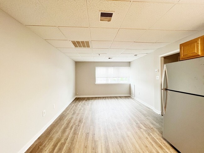
829-833 Conestoga Road Photos
-
829-833 Conestoga Road
-
-
-
-
-
-
-
-
Nearby Apartments
Within 50 Miles of 829-833 Conestoga Road
-
1 Pennsylvania Ave
1 Pennsylvania Ave
Wayne, PA 19087
$3,000
2 Br 3.0 mi
-
Edgehill Court
25 Old Lancaster Rd
Bala Cynwyd, PA 19004
$1,349 - $1,998
1-2 Br 5.7 mi
-
130 E Chestnut Street
130 E Chestnut St
West Chester, PA 19380
$2,700
3 Br 14.7 mi
-
428 N Church Street
428 N Church St
West Chester, PA 19380
$2,150
1 Br 15.0 mi
-
200 E. Maple Avenue
200 E Maple Ave
Merchantville, NJ 08109
$2,000
2 Br 16.4 mi
829-833 Conestoga Road does not offer in-unit laundry or shared facilities. Please contact the property to learn about nearby laundry options.
Utilities are not included in rent. Residents should plan to set up and pay for all services separately.
Parking is available at 829-833 Conestoga Road and is free of charge for residents.
829-833 Conestoga Road has one to three-bedrooms with rent ranges from $1,450/mo. to $2,400/mo.
829-833 Conestoga Road does not allow pets, though service animals are always welcome in accordance with applicable laws.
A good rule of thumb is to spend no more than 30% of your gross income on rent. Based on the lowest available rent of $1,450 for a one-bedroom, you would need to earn about $58,000 per year to qualify. Want to double-check your budget? Calculate how much rent you can afford with our Rent Affordability Calculator.
829-833 Conestoga Road is not currently offering any rent specials. Check back soon, as promotions change frequently.
While 829-833 Conestoga Road does not offer Matterport 3D tours, renters can request a tour directly through our online platform.

829-833 Conestoga Rd
Bryn Mawr, PA 19010