8240 Brownsway Ln
Cincinnati, OH 45239
-
Bedrooms
3
-
Bathrooms
2.5
-
Square Feet
1,674 sq ft
-
Available
Available Oct 24
Highlight
- Pets Allowed

About This Home
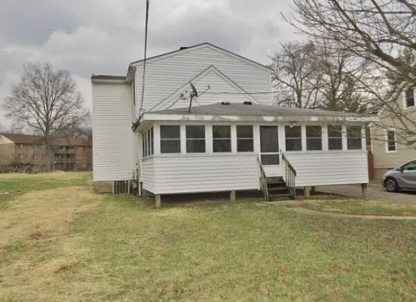
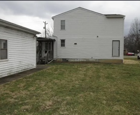
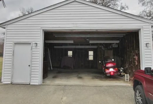
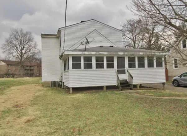
Property Id: 2195748 Welcome to your new home at 8240 Brownsway Ln in Cincinnati, OH! This charming single-family property features 3 bedrooms, 2.5 bathrooms, and central forced air. Enjoy the convenience of outside smoking and bring your small dogs or cats along. Don't miss out on this gem - schedule a viewing today!
8240 Brownsway Ln is a house located in Hamilton County and the 45239 ZIP Code. This area is served by the Northwest Local attendance zone.
Fees and Policies
The fees below are based on community-supplied data and may exclude additional fees and utilities.
- Dogs Allowed
-
Fees not specified
- Cats Allowed
-
Fees not specified
Contact
- Phone Number
- Contact
-
Source

Originally called West Union, Groesbeck is a charming Cincinnati community located just over 10 miles north of downtown. Technically a census-designated place, Groesbeck is home to nature preserves and shopping centers that will keep residents entertained and active well within the borders of their own community. The Groesbeck area is frequently rated as one of the top places in Cincinnati to raise a family, but you’ll find a wide variety of people enjoying the suburban atmosphere. A top school district and urban amenities off Ronald Reagan Cross County Highway, including popular fried chicken restaurants, make Groesbeck great. Low-rise apartments and long-standing homes remain affordable, and the buzz of Downtown Cincinnati is just a short drive south.
Learn more about living in Groesbeck| Colleges & Universities | Distance | ||
|---|---|---|---|
| Colleges & Universities | Distance | ||
| Drive: | 17 min | 6.8 mi | |
| Drive: | 18 min | 8.5 mi | |
| Drive: | 20 min | 9.0 mi | |
| Drive: | 21 min | 13.0 mi |


View GreatSchools Rating Methodology
Data provided by GreatSchools.org © 2025. All rights reserved.
Transportation options available in Cincinnati include Brewery District Station, Elm & Henry, located 9.3 miles from 8240 Brownsway Ln. 8240 Brownsway Ln is near Cincinnati/Northern Kentucky International, located 23.3 miles or 43 minutes away.
| Transit / Subway | Distance | ||
|---|---|---|---|
| Transit / Subway | Distance | ||
| Drive: | 19 min | 9.3 mi | |
| Drive: | 19 min | 9.3 mi | |
| Drive: | 20 min | 9.4 mi | |
| Drive: | 20 min | 9.5 mi | |
| Drive: | 20 min | 9.6 mi |
| Commuter Rail | Distance | ||
|---|---|---|---|
| Commuter Rail | Distance | ||
|
|
Drive: | 19 min | 9.2 mi |
| Airports | Distance | ||
|---|---|---|---|
| Airports | Distance | ||
|
Cincinnati/Northern Kentucky International
|
Drive: | 43 min | 23.3 mi |
Time and distance from 8240 Brownsway Ln.
| Shopping Centers | Distance | ||
|---|---|---|---|
| Shopping Centers | Distance | ||
| Walk: | 15 min | 0.8 mi | |
| Walk: | 17 min | 0.9 mi | |
| Walk: | 19 min | 1.0 mi |
| Parks and Recreation | Distance | ||
|---|---|---|---|
| Parks and Recreation | Distance | ||
|
Farbach-Werner Nature Preserve
|
Drive: | 5 min | 2.1 mi |
|
LaBoiteaux Woods
|
Drive: | 8 min | 3.2 mi |
|
Mt. Airy Forest
|
Drive: | 10 min | 4.2 mi |
|
Buttercup Valley
|
Drive: | 10 min | 4.2 mi |
|
Winton Woods Park
|
Drive: | 15 min | 5.8 mi |
| Hospitals | Distance | ||
|---|---|---|---|
| Hospitals | Distance | ||
| Drive: | 12 min | 5.0 mi | |
| Drive: | 17 min | 7.8 mi | |
| Drive: | 13 min | 9.1 mi |
| Military Bases | Distance | ||
|---|---|---|---|
| Military Bases | Distance | ||
| Drive: | 68 min | 53.3 mi | |
| Drive: | 74 min | 58.4 mi | |
| Drive: | 77 min | 61.7 mi |
8240 Brownsway Ln Photos
Nearby Apartments
Within 50 Miles of 8240 Brownsway Ln Cincinnati, OH 45239
-
2354 Victor St
Cincinnati, OH 45219
$3,000
3 Br 6.9 mi
-
2106 Pogue Ave
Cincinnati, OH 45208
$2,650
4 Br 8.3 mi
-
3742 Anioton Ct
Cincinnati, OH 45227
$1,885
3 Br 9.0 mi
-
Butterfield Crest
4488 Butterfield Pl
Cincinnati, OH 45227
$4,150 - $4,450
3 Br 10.2 mi
-
467 Auxier Dr
Cincinnati, OH 45244
$2,400
3 Br 16.8 mi
-
9021 Braxton Dr
Union, KY 41091
$2,290
3 Br 18.5 mi
What Are Walk Score®, Transit Score®, and Bike Score® Ratings?
Walk Score® measures the walkability of any address. Transit Score® measures access to public transit. Bike Score® measures the bikeability of any address.
What is a Sound Score Rating?
A Sound Score Rating aggregates noise caused by vehicle traffic, airplane traffic and local sources
8240 Brownsway Ln
Cincinnati, OH 45239