
$1,800 / Month
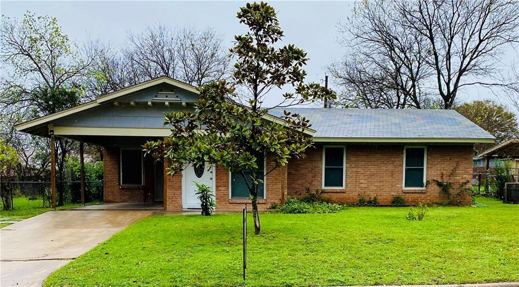
8207 Red Oak Cir S
Austin, TX 78753
2 Weeks Ago
Favorites
8207 Red Oak Cir S

Favorites
Check Back Soon for Upcoming Availability
| Beds | Baths | Average SF |
|---|---|---|
| 2 Bedrooms 2 Bedrooms 2 Br | 1 Bath 1 Bath 1 Ba | 1,012 SF |
About This Property
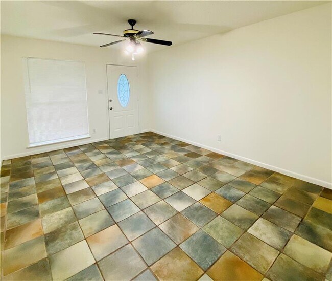
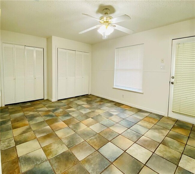
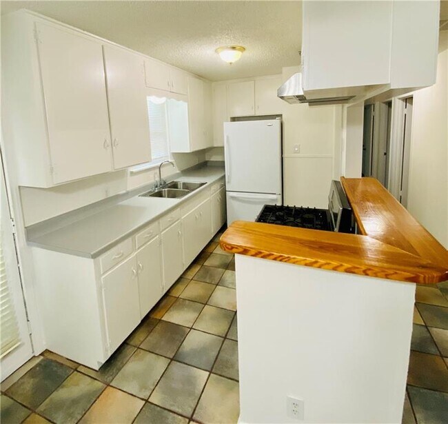
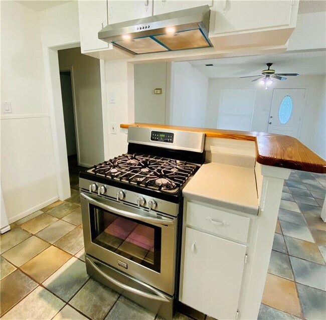
Very well kept home available immediately!
8207 Red Oak Cir S is a house located in Travis County and the 78753 ZIP Code. This area is served by the Austin Independent attendance zone.
Location
Get Directions
Situated just north of Austin, Georgian Acres is an energetic neighborhood with easy access to I-35. Founded in the 1800s largely as farming area, the neighborhood has become a hotspot for families because of its relatively affordable homes and apartments and its proximity to the downtown area.
The neighborhood is largely residential but does have a few local restaurants and shops on the perimeter. Georgian Acres is a very walkable area with a few pocket parks located nearby, such as Payton Gin Park.
Learn more about living in Georgian AcresBelow are rent ranges for similar nearby apartments
Education
| Colleges & Universities | Distance | ||
|---|---|---|---|
| Colleges & Universities | Distance | ||
| Drive: | 11 min | 5.2 mi | |
| Drive: | 10 min | 5.5 mi | |
| Drive: | 12 min | 6.9 mi | |
| Drive: | 13 min | 7.0 mi |
8207 Red Oak Cir S is within 11 minutes or 5.2 miles from Austin C.C., Northridge Campus. It is also near University of Texas at Austin and Austin C.C., Rio Grande Campus.
Schools


Public Elementary School
Grades PK-5
486 Students
Attendance Zone
Public Middle School
Grades 6-8
571 Students
Attendance Zone
Public High School
Grades 9-12
1,649 Students
Attendance Zone
Private Elementary, Middle & High School
Grades PK-12
145 Students
Nearby
Private Elementary, Middle & High School
Grades K-10
Nearby
School data provided by
 The GreatSchools Rating helps parents compare schools within a state based on a variety of school quality indicators and provides a helpful picture of how effectively each school serves all of its students. Ratings are on a scale of 1 (below average) to 10 (above average) and can include test scores, college readiness, academic progress, advanced courses, equity, discipline and attendance data. We also advise parents to visit schools, consider other information on school performance and programs, and consider family needs as part of the school selection process.
View GreatSchools Rating Methodology
Data provided by GreatSchools.org © 2025. All rights reserved.
View GreatSchools Rating Methodology
Data provided by GreatSchools.org © 2025. All rights reserved.
Transportation options available in Austin include Crestview Station, located 1.7 miles from 8207 Red Oak Cir S. 8207 Red Oak Cir S is near Austin-Bergstrom International, located 17.0 miles or 28 minutes away.
| Transit / Subway | Distance | ||
|---|---|---|---|
| Transit / Subway | Distance | ||
| Drive: | 4 min | 1.7 mi | |
| Drive: | 5 min | 2.1 mi | |
| Drive: | 8 min | 4.3 mi | |
| Drive: | 9 min | 4.7 mi | |
| Drive: | 11 min | 5.9 mi |
| Commuter Rail | Distance | ||
|---|---|---|---|
| Commuter Rail | Distance | ||
|
|
Drive: | 14 min | 8.1 mi |
|
|
Drive: | 41 min | 32.4 mi |
| Airports | Distance | ||
|---|---|---|---|
| Airports | Distance | ||
|
Austin-Bergstrom International
|
Drive: | 28 min | 17.0 mi |
Time and distance from 8207 Red Oak Cir S.
| Shopping Centers | Distance | ||
|---|---|---|---|
| Shopping Centers | Distance | ||
| Walk: | 14 min | 0.8 mi | |
| Drive: | 3 min | 1.3 mi | |
| Drive: | 4 min | 1.4 mi |
8207 Red Oak Cir S has 3 shopping centers within 1.4 miles, which is about a 4-minute walk. The miles and minutes will be for the farthest away property.
| Parks and Recreation | Distance | ||
|---|---|---|---|
| Parks and Recreation | Distance | ||
|
Beverly S. Sheffield Northwest District Park
|
Drive: | 9 min | 3.5 mi |
|
Walnut Creek Park
|
Drive: | 7 min | 4.0 mi |
|
Thinkery
|
Drive: | 9 min | 4.6 mi |
|
Elisabet Ney Museum
|
Drive: | 9 min | 4.6 mi |
|
Jourdan-Bachman Pioneer Farms
|
Drive: | 10 min | 4.9 mi |
8207 Red Oak Cir S has 5 parks within 4.9 miles, including Beverly S. Sheffield Northwest District Park, Elisabet Ney Museum, and Walnut Creek Park.
| Hospitals | Distance | ||
|---|---|---|---|
| Hospitals | Distance | ||
| Drive: | 6 min | 3.0 mi | |
| Drive: | 9 min | 4.0 mi | |
| Drive: | 8 min | 4.0 mi |
8207 Red Oak Cir S has 3 hospitals within 4.0 miles, the nearest is Cross Creek Hospital which is 3.0 miles away and a 6 minute drive.
| Military Bases | Distance | ||
|---|---|---|---|
| Military Bases | Distance | ||
| Drive: | 85 min | 68.2 mi | |
| Drive: | 88 min | 72.2 mi |
8207 Red Oak Cir S is 68.2 miles from Fort Cavazos, and is convenient to other military bases, including Randolph Air Force Base.
You May Also Like
Similar Rentals Nearby


What Are Walk Score®, Transit Score®, and Bike Score® Ratings?
Walk Score® measures the walkability of any address. Transit Score® measures access to public transit. Bike Score® measures the bikeability of any address.
What is a Sound Score Rating?
A Sound Score Rating aggregates noise caused by vehicle traffic, airplane traffic and local sources
8207 Red Oak Cir S
Austin, TX 78753