

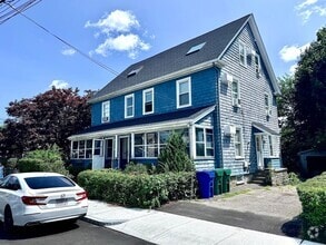
$2,900 / Month
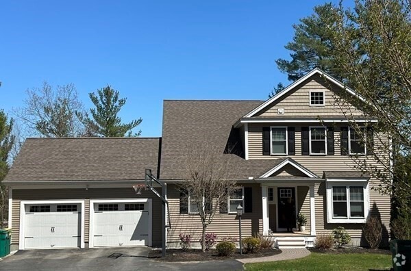
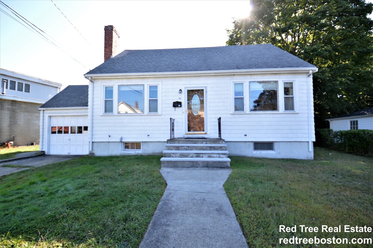
82 Lexington St
Auburndale, MA 02466
2 Weeks Ago
Favorites
82 Lexington St

Favorites
Check Back Soon for Upcoming Availability
| Beds | Baths | Average SF |
|---|---|---|
| 3 Bedrooms 3 Bedrooms 3 Br | 2 Baths 2 Baths 2 Ba | 1,500 SF |
Fees and Policies
The fees below are based on community-supplied data and may exclude additional fees and utilities.
- Dogs Allowed
-
Fees not specified
- Cats Allowed
-
Fees not specified
- Parking
-
Surface Lot--
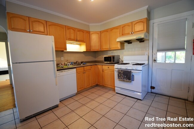
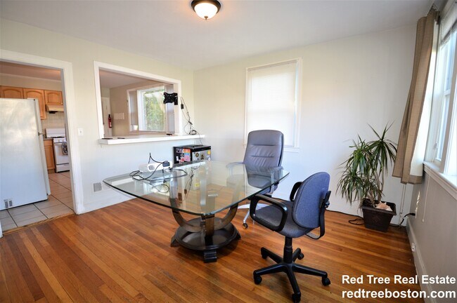
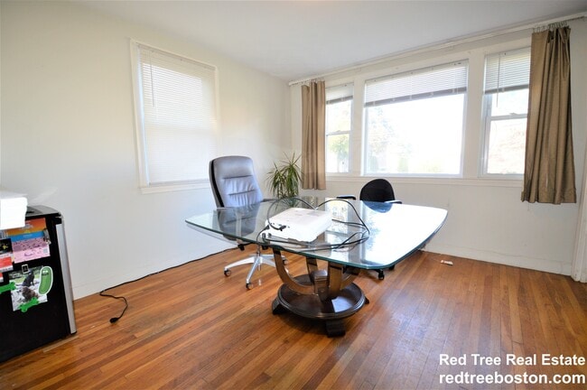
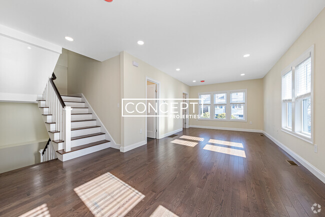
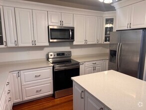
About This Property
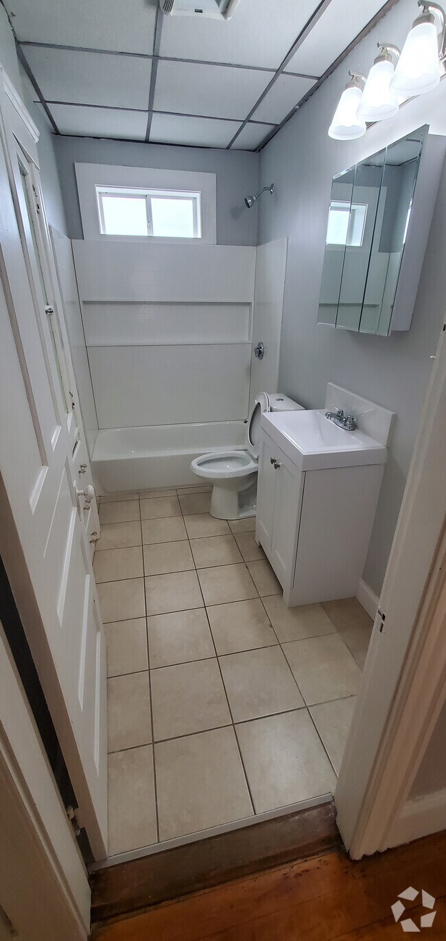
Single family home in West Newton/Auburndale. 3 bed 2 bath. Great yard space. Parking for 2-3 cars outdoor. No garage use. Pets negotiable (breed/weight restrictions). Prospective tenants must provide income and credit references/verification.
82 Lexington St is a house located in Middlesex County and the 02466 ZIP Code.
House Features
- Washer/Dryer Hookup
- Fireplace
- Dishwasher
- Yard
Location
Get Directions
Auburndale, affectionately referred to as “The Dale” by locals, is one of 13 villages in the City of Newton. Situated near the intersection of Interstates 90 and 95, the Dale is surrounded by the City of Waltham and the Charles River as well as three other Newton villages including West Newton, Waban, and Newton Lower Falls. Getting around from the Dale is simple with access to the MBTA commuter rail.
The western end of Auburndale is well known for containing two historic parks, Norumbega Park and the Auburndale Cove Park and Playground, which offer plenty of options for outdoor recreation. The Auburndale Historic District is comprised of about 275 properties, many of which are on the National Register of Historic Places. Treasured resources like the Auburndale Community Library and Lasell College provide learning opportunities for the community.
Learn more about living in Auburndale
Amenities
- Washer/Dryer Hookup
- Fireplace
- Dishwasher
- Yard
Education
| Colleges & Universities | Distance | ||
|---|---|---|---|
| Colleges & Universities | Distance | ||
| Drive: | 7 min | 2.3 mi | |
| Drive: | 7 min | 3.0 mi | |
| Drive: | 10 min | 5.0 mi | |
| Drive: | 12 min | 5.4 mi |
82 Lexington St is within 7 minutes or 2.3 miles from Brandeis University. It is also near Bentley University and Boston College.
Transportation options available in Auburndale include Riverside Station, located 1.6 miles from 82 Lexington St. 82 Lexington St is near General Edward Lawrence Logan International, located 14.1 miles or 23 minutes away, and Worcester Regional, located 39.4 miles or 56 minutes away.
| Transit / Subway | Distance | ||
|---|---|---|---|
| Transit / Subway | Distance | ||
|
|
Drive: | 4 min | 1.6 mi |
|
|
Drive: | 4 min | 2.2 mi |
|
|
Drive: | 6 min | 3.3 mi |
|
|
Drive: | 8 min | 3.5 mi |
|
|
Drive: | 9 min | 4.1 mi |
| Commuter Rail | Distance | ||
|---|---|---|---|
| Commuter Rail | Distance | ||
|
|
Drive: | 3 min | 1.3 mi |
| Drive: | 3 min | 1.3 mi | |
|
|
Drive: | 5 min | 2.3 mi |
|
|
Drive: | 10 min | 6.3 mi |
|
|
Drive: | 11 min | 7.1 mi |
| Airports | Distance | ||
|---|---|---|---|
| Airports | Distance | ||
|
General Edward Lawrence Logan International
|
Drive: | 23 min | 14.1 mi |
|
Worcester Regional
|
Drive: | 56 min | 39.4 mi |
Time and distance from 82 Lexington St.
| Shopping Centers | Distance | ||
|---|---|---|---|
| Shopping Centers | Distance | ||
| Walk: | 18 min | 0.9 mi | |
| Drive: | 4 min | 2.1 mi | |
| Drive: | 5 min | 2.1 mi |
82 Lexington St has 3 shopping centers within 2.1 miles, which is about a 5-minute walk. The miles and minutes will be for the farthest away property.
| Parks and Recreation | Distance | ||
|---|---|---|---|
| Parks and Recreation | Distance | ||
|
Beaver Brook Reservation
|
Drive: | 7 min | 3.6 mi |
|
Land's Sake Farm
|
Drive: | 8 min | 4.1 mi |
|
Hammond Pond Reservation
|
Drive: | 10 min | 4.4 mi |
|
Hemlock Gorge Reservation
|
Drive: | 10 min | 4.7 mi |
|
Mass Audubon's Habitat Education Center and Wildlife Sanctuary
|
Drive: | 12 min | 5.5 mi |
82 Lexington St has 5 parks within 5.5 miles, including Hemlock Gorge Reservation, Beaver Brook Reservation, and Land's Sake Farm.
| Hospitals | Distance | ||
|---|---|---|---|
| Hospitals | Distance | ||
| Drive: | 3 min | 1.4 mi | |
| Drive: | 4 min | 2.3 mi | |
| Drive: | 8 min | 4.0 mi |
82 Lexington St has 3 hospitals within 4.0 miles, the nearest is Walden Behavioral Care which is 1.4 miles away and a 3 minute drive.
| Military Bases | Distance | ||
|---|---|---|---|
| Military Bases | Distance | ||
| Drive: | 19 min | 8.8 mi | |
| Drive: | 18 min | 10.0 mi |
82 Lexington St is 8.8 miles from Hanscom Air Force Base, and is convenient to other military bases, including US Military Reservation.
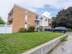
You May Also Like
Similar Rentals Nearby
What Are Walk Score®, Transit Score®, and Bike Score® Ratings?
Walk Score® measures the walkability of any address. Transit Score® measures access to public transit. Bike Score® measures the bikeability of any address.
What is a Sound Score Rating?
A Sound Score Rating aggregates noise caused by vehicle traffic, airplane traffic and local sources
82 Lexington St
Auburndale, MA 02466