
$4,500 / Month
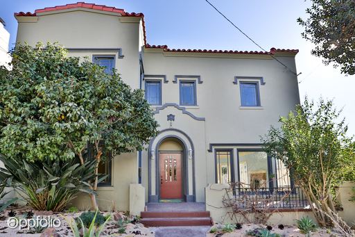
819 Santa Ray Ave
Oakland, CA 94610
2 Weeks Ago
Favorites
819 Santa Ray Ave

Favorites
Check Back Soon for Upcoming Availability
| Beds | Baths | Average SF |
|---|---|---|
| 4 Bedrooms 4 Bedrooms 4 Br | 3 Baths 3 Baths 3 Ba | 2,471 SF |
About This Property
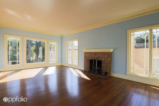
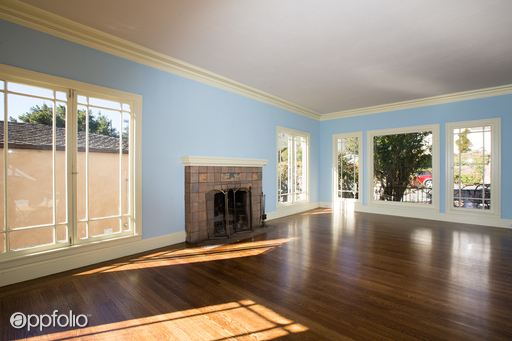
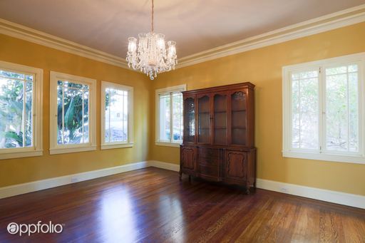
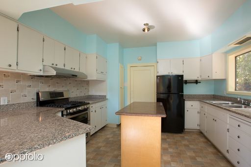
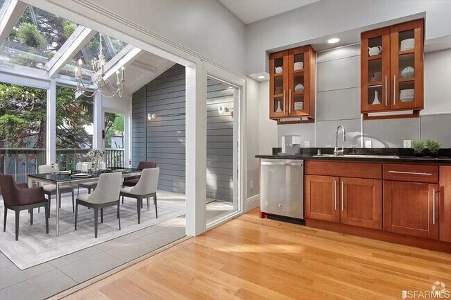
(510) 473-7767 - Crocker Highlands Traditional w/in-law - Step into this grand home located in the coveted Crocker Highlands neighborhood. This property is comprised of a three-bedroom, two-and-a-half bath main house and a 1-bedroom, 1-bath detached in-law apartment. The main house features formal living and dining rooms that abound with natural light through the large windows. An eat-in kitchen with island and half-bath rounds out the common areas. Up a stately staircase lie three bedrooms and two full baths, conveniently separated from the common living areas. The expansive property features an enclosed back yard with multiple areas for gardening, relaxation and play. Tons of storage and possibilities for extra spaces as well. OPEN HOUSE: 10-10:30am on Saturday September 24, 2016. (RLNE1881359) Other Amenities - Other- storage, guest/au pair cottage, walk in closet, Basement, Yard, Patio.
819 Santa Ray Ave is a house located in Alameda County and the 94610 ZIP Code. This area is served by the Oakland Unified attendance zone.
Location
Get Directions
The Lower Hills District of Oakland is made up of several small neighborhoods, including Piedmont, Crocker Heights, Oakmont, and Redwood Heights. Situated just seven miles to the east of Downtown Oakland on the north side of Interstate 580, the Lower Hills District maintains a small town feel despite its location among one of the Bay Area’s biggest communities. Windy, tree-lined streets house both new apartments and homes dating back to the '30s and '40s. Residents don’t have to travel far for everyday needs thanks to Oakland’s fast-growing economy. There is a plethora of shopping and dining options scattered around this sprawling community. You’ll find most of the amenities close to the MacArthur Freeway (Interstate 580) or near Park Boulevard. Access to the freeway and Bay Area Rapid Transit make getting around the rest of the Bay Area a breeze.
Learn more about living in Lower Hills DistrictBelow are rent ranges for similar nearby apartments
Education
| Colleges & Universities | Distance | ||
|---|---|---|---|
| Colleges & Universities | Distance | ||
| Drive: | 7 min | 2.7 mi | |
| Drive: | 8 min | 2.8 mi | |
| Drive: | 8 min | 2.9 mi | |
| Drive: | 13 min | 4.9 mi |
819 Santa Ray Ave is within 8 minutes or 2.8 miles from Laney College. It is also near Samuel Merritt University and Lincoln University, Oakland.
Schools


Charter Elementary School
Grades K-5
557 Students
Nearby
Public Elementary School
Grades K-5
407 Students
Nearby
Public Elementary School
Grades K-5
422 Students
Attendance Zone
Public Middle School
Grades 6-8
781 Students
Attendance Zone
Public High School
Grades 9-12
1,531 Students
Attendance Zone
Private Elementary & Middle School
Grades PK-7
177 Students
Nearby
Private Elementary & Middle School
Grades K-8
258 Students
Nearby
Private High School
Grades 9-12
Nearby
School data provided by
 The GreatSchools Rating helps parents compare schools within a state based on a variety of school quality indicators and provides a helpful picture of how effectively each school serves all of its students. Ratings are on a scale of 1 (below average) to 10 (above average) and can include test scores, college readiness, academic progress, advanced courses, equity, discipline and attendance data. We also advise parents to visit schools, consider other information on school performance and programs, and consider family needs as part of the school selection process.
View GreatSchools Rating Methodology
View GreatSchools Rating Methodology
Transportation options available in Oakland include 19Th St Oakland Station, located 2.5 miles from 819 Santa Ray Ave. 819 Santa Ray Ave is near Metro Oakland International, located 10.5 miles or 19 minutes away, and San Francisco International, located 24.3 miles or 37 minutes away.
| Transit / Subway | Distance | ||
|---|---|---|---|
| Transit / Subway | Distance | ||
|
|
Drive: | 7 min | 2.5 mi |
|
|
Drive: | 8 min | 2.8 mi |
|
|
Drive: | 7 min | 2.9 mi |
|
|
Drive: | 8 min | 3.7 mi |
|
|
Drive: | 11 min | 5.5 mi |
| Commuter Rail | Distance | ||
|---|---|---|---|
| Commuter Rail | Distance | ||
|
|
Drive: | 9 min | 3.1 mi |
|
|
Drive: | 10 min | 5.3 mi |
|
|
Drive: | 12 min | 7.3 mi |
| Drive: | 19 min | 11.8 mi | |
| Drive: | 21 min | 13.0 mi |
| Airports | Distance | ||
|---|---|---|---|
| Airports | Distance | ||
|
Metro Oakland International
|
Drive: | 19 min | 10.5 mi |
|
San Francisco International
|
Drive: | 37 min | 24.3 mi |
Time and distance from 819 Santa Ray Ave.
| Shopping Centers | Distance | ||
|---|---|---|---|
| Shopping Centers | Distance | ||
| Drive: | 6 min | 1.9 mi | |
| Drive: | 6 min | 2.2 mi | |
| Drive: | 7 min | 2.2 mi |
819 Santa Ray Ave has 3 shopping centers within 2.2 miles, which is about a 7-minute drive. The miles and minutes will be for the farthest away property.
| Parks and Recreation | Distance | ||
|---|---|---|---|
| Parks and Recreation | Distance | ||
|
Lakeside Park
|
Drive: | 4 min | 1.4 mi |
|
Morcom Rose Garden
|
Drive: | 5 min | 1.7 mi |
|
Rotary Nature Center
|
Drive: | 5 min | 1.7 mi |
|
Lakeside Park Garden Center
|
Drive: | 5 min | 1.7 mi |
|
Oakland Museum of California
|
Drive: | 8 min | 2.7 mi |
819 Santa Ray Ave has 5 parks within 2.7 miles, including Morcom Rose Garden, Lakeside Park, and Rotary Nature Center.
| Hospitals | Distance | ||
|---|---|---|---|
| Hospitals | Distance | ||
| Drive: | 5 min | 1.4 mi | |
| Drive: | 6 min | 2.3 mi | |
| Drive: | 8 min | 3.5 mi |
819 Santa Ray Ave has 3 hospitals within 3.5 miles, the nearest is Highland Hospital which is 1.4 miles away and a 5 minute drive.
| Military Bases | Distance | ||
|---|---|---|---|
| Military Bases | Distance | ||
| Drive: | 17 min | 6.5 mi | |
| Drive: | 16 min | 7.7 mi |
819 Santa Ray Ave is 6.5 miles from Alameda/US Naval Air Station Alameda, and is convenient to other military bases, including Oakland Army Base.
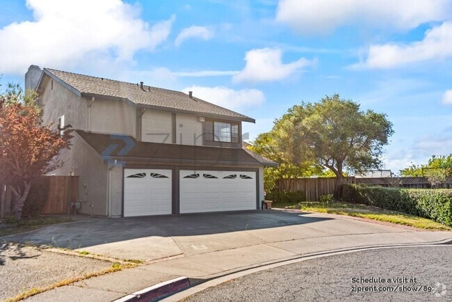
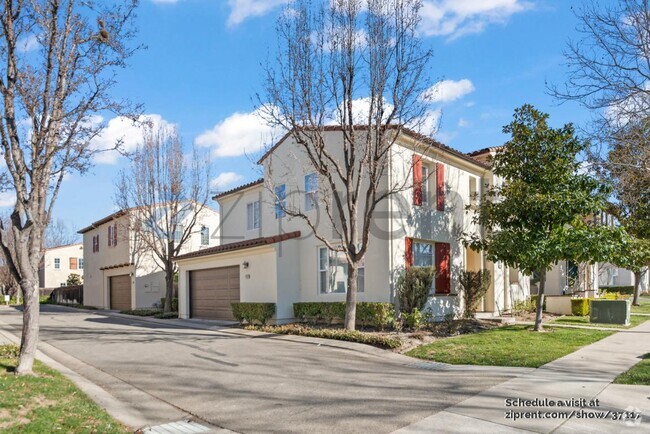
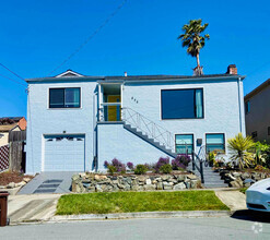
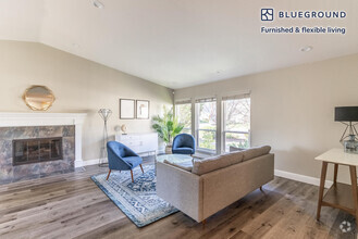
You May Also Like
Similar Rentals Nearby


What Are Walk Score®, Transit Score®, and Bike Score® Ratings?
Walk Score® measures the walkability of any address. Transit Score® measures access to public transit. Bike Score® measures the bikeability of any address.
What is a Sound Score Rating?
A Sound Score Rating aggregates noise caused by vehicle traffic, airplane traffic and local sources
819 Santa Ray Ave
Oakland, CA 94610