
$2,300 / Month
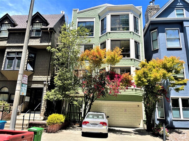
812 Antoinette Ln
South San Francisco, CA 94080
2 Weeks Ago
Favorites
812 Antoinette Ln

Favorites
Check Back Soon for Upcoming Availability
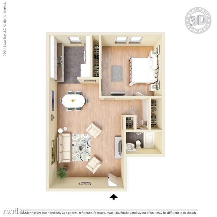
| Beds | Baths | Average SF |
|---|---|---|
| 1 Bedroom 1 Bedroom 1 Br | 1 Bath 1 Bath 1 Ba | 692 SF |
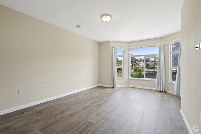
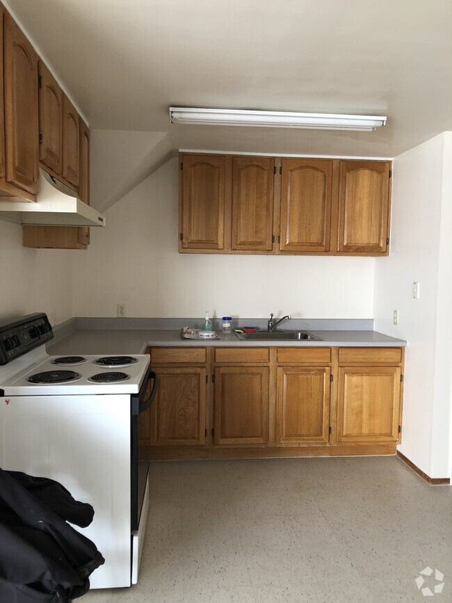
About This Property
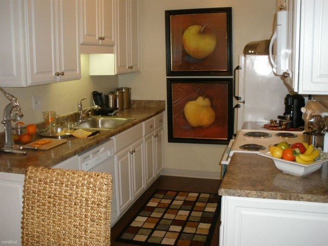
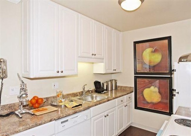
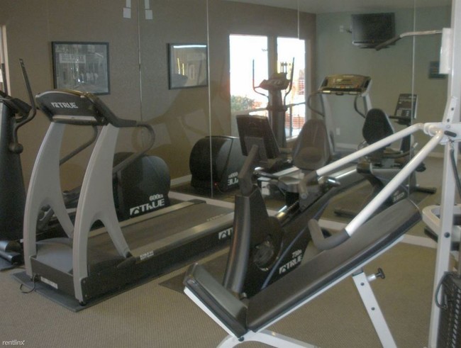
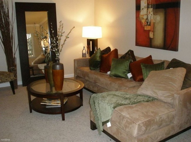
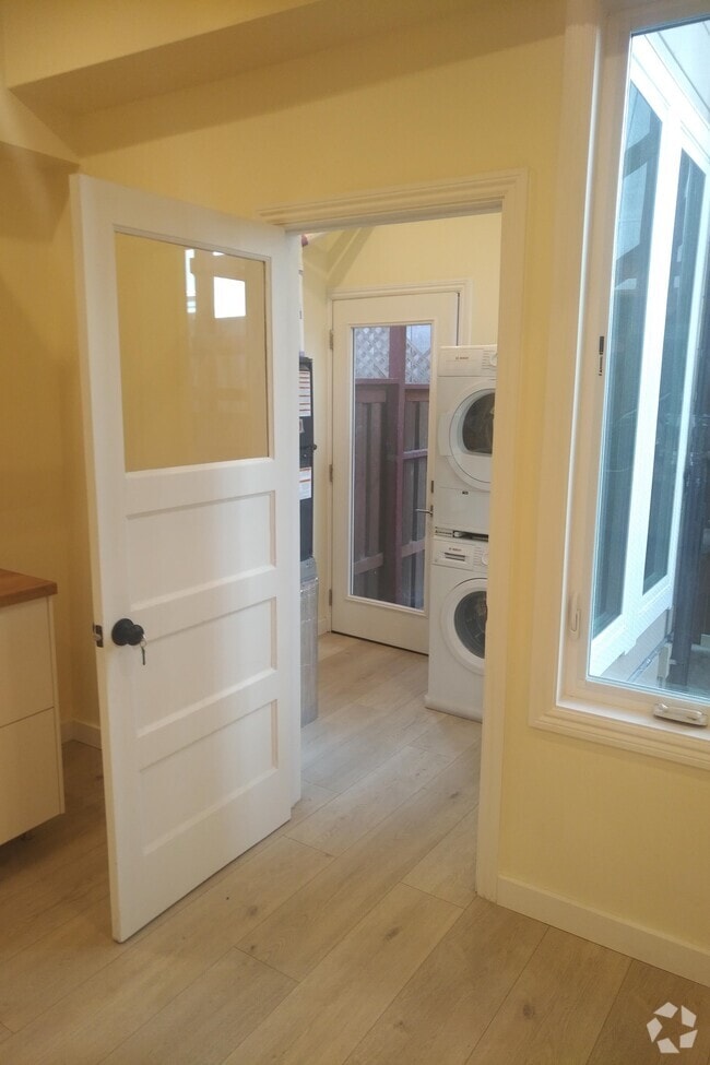
(617) 294-9398 - One bedroom unit in a luxury garden community available from Mar 15th. One bedroom unit is available for sublease or new lease (must qualify per the landlord) from March 15th in Peninsula pines, a luxury garden apartment community that has a fully equipped gym, heated swimming pool, Jacuzzi, and BBQ pits. The unit comes with reserved carport, and more on-street parking available. Located next to Safeway/Wells Fargo/USPS in an ideal location near El Camino real, and a beautiful bike trail, walking distance from South San Francisco Bart, and Tanforan Mall. Sublet is for 6 months with $2,000 security deposit. Instead of subleasing, tenant is also welcome to qualify on his/her own from the landlord for a new release. No Pets Allowed (RLNE2978697) Other Amenities - Parking, Pool, Exercise Facility, Garage, Patio. Appliances - Dishwasher, Refrigerator, Range, Oven, Garbage Disposal, Microwave, Washer & Dryer On-Site. Lease lengths - Month to Month, 6 Months, Other. Details regarding this property's Utilities - High-Speed Internet Available, Resident Pays Trash Pick-up. Pet policies - No Pets Allowed.
812 Antoinette Ln is a condo located in San Mateo County and the 94080 ZIP Code. This area is served by the South San Francisco Unified attendance zone.
Location
Get Directions
Folks in South San Francisco have easy access to The City via I-280, the 101, or BART rail service. This fact, coupled with the much lower crime rate and the area’s many excellent schools, makes South San Francisco apartments an appealing option for commuters, particularly those raising families.
Although primarily a residential community, South San Francisco does have a fairly active downtown scene, with much of the dining and entertainment centered around the intersection of Grande Avenue and Linden Avenue and shopping centers on the south side of town.
Many parks and nature preserves are scattered around the area, including the huge Sweeney Ridge and Fairway Park just to the west of the city limits. San Francisco International Airport sits directly south of town, making it highly convenient to travel anywhere.
Learn more about living in South San FranciscoBelow are rent ranges for similar nearby apartments
Education
| Colleges & Universities | Distance | ||
|---|---|---|---|
| Colleges & Universities | Distance | ||
| Drive: | 9 min | 4.0 mi | |
| Drive: | 13 min | 7.0 mi | |
| Drive: | 13 min | 7.4 mi | |
| Drive: | 19 min | 9.6 mi |
812 Antoinette Ln is within 9 minutes or 4.0 miles from Skyline College. It is also near City College of San Francisco and San Francisco State University.
Schools


Public Elementary School
Grades K-5
Nearby
Public Elementary School
Grades K-5
306 Students
Attendance Zone
Public Middle School
Grades 6-8
628 Students
Attendance Zone
Public High School
Grades 9-12
1,280 Students
Attendance Zone
Private Elementary & Middle School
Grades PK-8
129 Students
Nearby
Private Elementary, Middle & High School
Grades 1-12
17 Students
Nearby
Private Elementary & Middle School
Grades K-8
Nearby
School data provided by
 The GreatSchools Rating helps parents compare schools within a state based on a variety of school quality indicators and provides a helpful picture of how effectively each school serves all of its students. Ratings are on a scale of 1 (below average) to 10 (above average) and can include test scores, college readiness, academic progress, advanced courses, equity, discipline and attendance data. We also advise parents to visit schools, consider other information on school performance and programs, and consider family needs as part of the school selection process.
View GreatSchools Rating Methodology
View GreatSchools Rating Methodology
Transportation options available in South San Francisco include South San Francisco Station, located 1.2 miles from 812 Antoinette Ln. 812 Antoinette Ln is near San Francisco International, located 5.2 miles or 11 minutes away, and Metro Oakland International, located 30.1 miles or 44 minutes away.
| Transit / Subway | Distance | ||
|---|---|---|---|
| Transit / Subway | Distance | ||
|
|
Drive: | 3 min | 1.2 mi |
|
|
Drive: | 5 min | 2.3 mi |
| Drive: | 7 min | 3.7 mi | |
|
|
Drive: | 8 min | 4.0 mi |
|
|
Drive: | 10 min | 4.6 mi |
| Commuter Rail | Distance | ||
|---|---|---|---|
| Commuter Rail | Distance | ||
| Drive: | 5 min | 2.4 mi | |
| Drive: | 5 min | 2.7 mi | |
| Drive: | 11 min | 5.5 mi | |
| Drive: | 12 min | 6.9 mi | |
| Drive: | 12 min | 7.6 mi |
| Airports | Distance | ||
|---|---|---|---|
| Airports | Distance | ||
|
San Francisco International
|
Drive: | 11 min | 5.2 mi |
|
Metro Oakland International
|
Drive: | 44 min | 30.1 mi |
Time and distance from 812 Antoinette Ln.
| Shopping Centers | Distance | ||
|---|---|---|---|
| Shopping Centers | Distance | ||
| Walk: | 9 min | 0.5 mi | |
| Walk: | 9 min | 0.5 mi | |
| Walk: | 11 min | 0.6 mi |
812 Antoinette Ln has 3 shopping centers within 0.6 mile, which is about a 11-minute walk. The miles and minutes will be for the farthest away property.
| Parks and Recreation | Distance | ||
|---|---|---|---|
| Parks and Recreation | Distance | ||
|
Pacifica State Beach
|
Drive: | 13 min | 6.9 mi |
|
San Bruno Mountain State Park
|
Drive: | 17 min | 7.4 mi |
|
Charles F. Hagar Planetarium
|
Drive: | 15 min | 7.7 mi |
|
San Francisco State Univ. Observatory
|
Drive: | 15 min | 7.7 mi |
|
Candlestick Point State Recreation Area
|
Drive: | 16 min | 7.7 mi |
812 Antoinette Ln has 5 parks within 7.7 miles, including San Bruno Mountain State Park, Charles F. Hagar Planetarium, and San Francisco State Univ. Observatory.
| Hospitals | Distance | ||
|---|---|---|---|
| Hospitals | Distance | ||
| Walk: | 16 min | 0.8 mi | |
| Drive: | 7 min | 3.5 mi | |
| Drive: | 10 min | 5.4 mi |
812 Antoinette Ln has 3 hospitals within 5.4 miles, the nearest is Kaiser Foundation Hospital - South San Francisco which is 0.8 mile away and a 16 minute walk.
| Military Bases | Distance | ||
|---|---|---|---|
| Military Bases | Distance | ||
| Drive: | 26 min | 11.6 mi | |
| Drive: | 26 min | 12.2 mi |
812 Antoinette Ln is 11.6 miles from East Fort Miley, and is convenient to other military bases, including West Fort Miley.
You May Also Like
Similar Rentals Nearby

What Are Walk Score®, Transit Score®, and Bike Score® Ratings?
Walk Score® measures the walkability of any address. Transit Score® measures access to public transit. Bike Score® measures the bikeability of any address.
What is a Sound Score Rating?
A Sound Score Rating aggregates noise caused by vehicle traffic, airplane traffic and local sources
812 Antoinette Ln
South San Francisco, CA 94080