
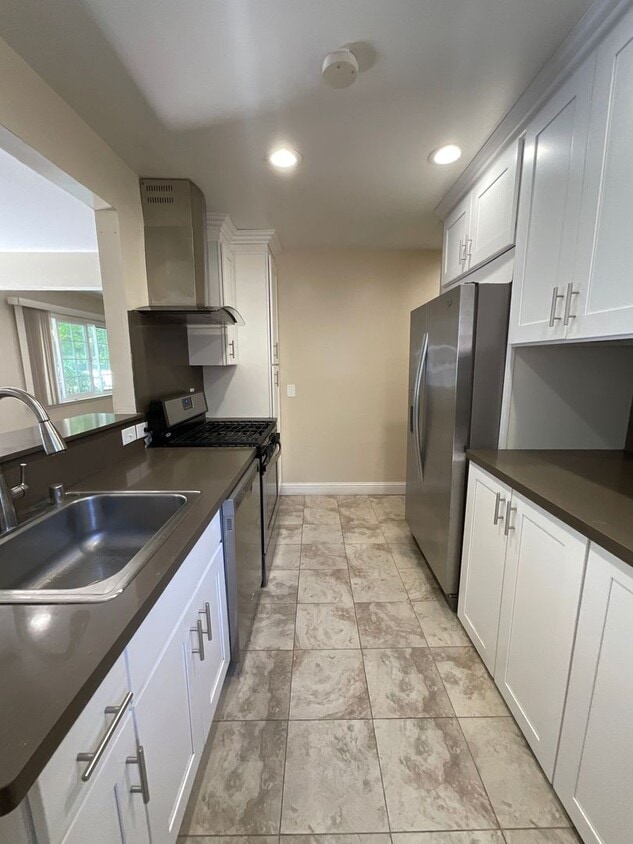
$3,300 / Month
80 Murlagan Ave Unit A
Mountain View, CA 94043
Today
Favorites
831-888-1798
-
Bedrooms
2
-
Bathrooms
1
-
Square Feet
925 sq ft
-
Available
Available Now
80 Murlagan Ave Unit A

Favorites
Contact
- Listed by C & C Property Management | C & C Property Management
- Phone Number
- Contact
Location
Get Directions
Known for its fantastic views of the Santa Cruz Mountains, the Wagon Wheel neighborhood of Mountain View, California lies 12 miles southeast of Palo Alto via US-101S. Residents of Wagon Wheel's apartments and home rentals enjoy convenient transportation via light rail, bus, and private shuttle. Featuring an online chat group, this community values resident participation in planning activities such as ice cream socials, community breakfasts, and pumpkin festivals at the local park.
Two parks serve this neighborhood where residents can picnic, relax in an arbor, or join a pick-up baseball game. Whisman Park provides access to the Stevens Creek Trail, with its paved paths for walking, biking, or jogging through scenic natural areas.
Learn more about living in Wagon Wheel
Education
| Colleges & Universities | Distance | ||
|---|---|---|---|
| Colleges & Universities | Distance | ||
| Drive: | 9 min | 3.6 mi | |
| Drive: | 14 min | 5.9 mi | |
| Drive: | 12 min | 7.0 mi | |
| Drive: | 18 min | 7.4 mi |
80 Murlagan Ave Unit A is within 9 minutes or 3.6 miles from Foothill College, Middlefield. It is also near Foothill Coll., Los Altos and De Anza College.
Transportation options available in Mountain View include Bayshore Nasa Station, located 1.0 mile from 80 Murlagan Ave Unit A. 80 Murlagan Ave Unit A is near Norman Y Mineta San Jose International, located 8.6 miles or 13 minutes away, and San Francisco International, located 25.5 miles or 33 minutes away.
| Transit / Subway | Distance | ||
|---|---|---|---|
| Transit / Subway | Distance | ||
| Walk: | 19 min | 1.0 mi | |
|
|
Walk: | 20 min | 1.0 mi |
|
|
Drive: | 3 min | 1.1 mi |
|
|
Drive: | 3 min | 1.1 mi |
|
|
Drive: | 3 min | 1.4 mi |
| Commuter Rail | Distance | ||
|---|---|---|---|
| Commuter Rail | Distance | ||
| Drive: | 6 min | 2.3 mi | |
| Drive: | 5 min | 2.3 mi | |
| Drive: | 7 min | 3.0 mi | |
| Drive: | 8 min | 3.9 mi | |
| Drive: | 9 min | 5.4 mi |
| Airports | Distance | ||
|---|---|---|---|
| Airports | Distance | ||
|
Norman Y Mineta San Jose International
|
Drive: | 13 min | 8.6 mi |
|
San Francisco International
|
Drive: | 33 min | 25.5 mi |
Time and distance from 80 Murlagan Ave Unit A.
| Shopping Centers | Distance | ||
|---|---|---|---|
| Shopping Centers | Distance | ||
| Drive: | 3 min | 1.2 mi | |
| Drive: | 4 min | 1.7 mi | |
| Drive: | 5 min | 2.3 mi |
80 Murlagan Ave Unit A has 3 shopping centers within 2.3 miles, which is about a 5-minute drive. The miles and minutes will be for the farthest away property.
| Parks and Recreation | Distance | ||
|---|---|---|---|
| Parks and Recreation | Distance | ||
|
Stevens Creek Shoreline Nature Study Area
|
Drive: | 9 min | 3.4 mi |
|
J. Pearce Mitchell Park
|
Drive: | 11 min | 4.4 mi |
|
Sunnyvale Baylands Park
|
Drive: | 10 min | 4.9 mi |
|
Terman Park
|
Drive: | 12 min | 5.1 mi |
|
Redwood Grove
|
Drive: | 13 min | 5.3 mi |
80 Murlagan Ave Unit A has 5 parks within 5.3 miles, including Stevens Creek Shoreline Nature Study Area, J. Pearce Mitchell Park, and Sunnyvale Baylands Park.
| Hospitals | Distance | ||
|---|---|---|---|
| Hospitals | Distance | ||
| Drive: | 6 min | 2.9 mi | |
| Drive: | 12 min | 7.8 mi | |
| Drive: | 13 min | 8.0 mi |
80 Murlagan Ave Unit A has 3 hospitals within 8.0 miles, the nearest is El Camino Hospital which is 2.9 miles away and a 6 minute drive.
| Military Bases | Distance | ||
|---|---|---|---|
| Military Bases | Distance | ||
| Drive: | 7 min | 2.1 mi |
80 Murlagan Ave Unit A is 2.1 miles and a 7 minute drive from Ames Research Center.
You May Also Like
Similar Rentals Nearby
-
-
-
1 / 29

-
-
-
-
-
-
-


What Are Walk Score®, Transit Score®, and Bike Score® Ratings?
Walk Score® measures the walkability of any address. Transit Score® measures access to public transit. Bike Score® measures the bikeability of any address.
What is a Sound Score Rating?
A Sound Score Rating aggregates noise caused by vehicle traffic, airplane traffic and local sources
80 Murlagan Ave
Mountain View, CA 94043