$1,400
/ Month
8-14 Westridge Cir SW Unit 8 Westridge Circle
Rome, GA 30165
Favorites
8-14 Westridge Cir SW Unit 8 Westridge Circle

Favorites
Check Back Soon for Upcoming Availability
| Beds | Baths | Average SF |
|---|---|---|
| 3 Bedrooms 3 Bedrooms 3 Br | 2 Baths 2 Baths 2 Ba | — |
8-14 Westridge Cir Sw is an apartment community located in Floyd County and the 30165 ZIP Code.
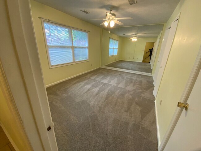
Features
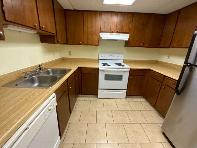
- Dishwasher
8-14 Westridge Cir SW,
Rome,
GA
30165
Nestled in the foothills of the Appalachian Mountains, Rome is Georgia’s premier city for history, natural beauty, and a lively community. This riverfront town is located about 70 miles northwest of Atlanta and less than 20 miles east of the Alabama state line. Rome offers residents a blend of rural seclusion, scenic views, and a vibrant urban oasis.
Rome cultivates a local culture rich with history, the arts, and stunning architecture throughout town. The city houses four colleges, collectively serving thousands of students and contributing major cultural and intellectual capital to Rome. This tight-knit community enjoys special events throughout the year, from the annual Rome International Film Festival to the Rome Shakespeare Festival. Downtown Rome features a top-notch selection of local restaurants, historic sites, specialty shops, and riverfront views.
Rentals in Rome are surprisingly affordable, ranging from upgraded apartments to cozy single-family homes.
Learn more about living in Rome
Amenities
- Dishwasher
Education
| Colleges & Universities | Distance | ||
|---|---|---|---|
| Colleges & Universities | Distance | ||
| Drive: | 8 min | 3.1 mi | |
| Drive: | 13 min | 6.0 mi | |
| Drive: | 21 min | 11.6 mi | |
| Drive: | 60 min | 40.2 mi |
8-14 Westridge Cir SW Unit 8 Westridge Circle is within 8 minutes or 3.1 miles from Shorter University. It is also near Berry College and Georgia Highlands College.
Walkability Near 8-14 Westridge Cir SW Rome, GA 30165
Getting Around
 What do Walkability, Transit, Drivability, and Bikeability mean?
Walkability measures the walking distance to day-to-day needs.
Transit measures access to public transportation.
Drivability measures congestion, parking availability, and access to major roads.
Bikeability measures the suitability for cycling.
How It Works
What do Walkability, Transit, Drivability, and Bikeability mean?
Walkability measures the walking distance to day-to-day needs.
Transit measures access to public transportation.
Drivability measures congestion, parking availability, and access to major roads.
Bikeability measures the suitability for cycling.
How It Works
Somewhat Walkable
Walkability
30
/ 100
Exceptionally Drivable
Drivability
90
/ 100
Somewhat Bikeable
Bikeability
20
/ 100
Scores provided by
-
Soundscore™
-
/ 100
Traffic
-Airport
-Businesses
-Scores provided by
HowLoud What is a Sound Score Rating? A Sound Score Rating aggregates noise caused by vehicle traffic, airplane traffic and local sources. How It WorksYou May Also Like
Similar Rentals Nearby


What Are Walk Score®, Transit Score®, and Bike Score® Ratings?
Walk Score® measures the walkability of any address. Transit Score® measures access to public transit. Bike Score® measures the bikeability of any address.
What is a Sound Score Rating?
A Sound Score Rating aggregates noise caused by vehicle traffic, airplane traffic and local sources.

8-14 Westridge Cir SW
Rome, GA 30165