
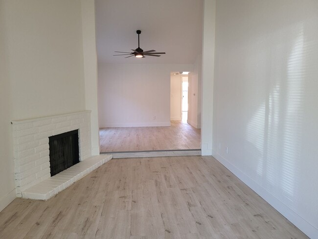
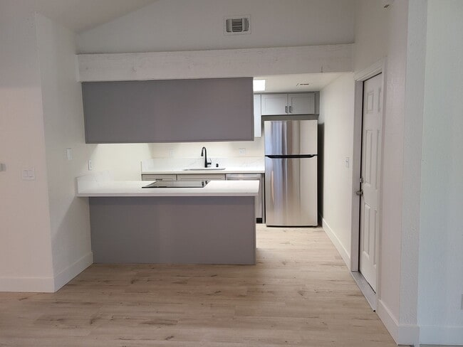
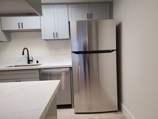
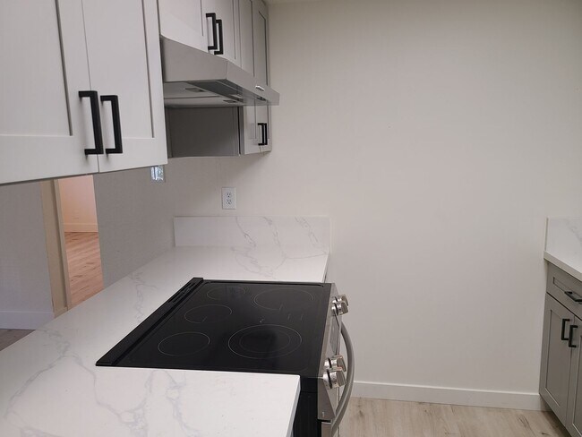
$2,195 / Month
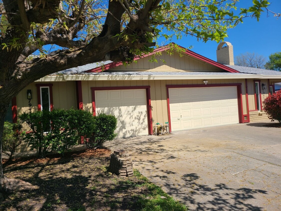
7945-7947 Tangors Way Unit 7945 Tangors Way
Citrus Heights, CA 95610
Today
Favorites
916-990-0770
-
Bedrooms
2
-
Bathrooms
2
-
Square Feet
1,116 sq ft
-
Available
Available Now
7945-7947 Tangors Way Unit 7945 Tangors Way

Favorites
Contact
- Listed by NextHome Haven Properties | NextHome Haven Properties
- Phone Number
- Contact
Location
Get Directions
Defined by sun-drenched neighborhoods, tree-lined streets, and lacy palm trees against bright blue sky, Citrus Heights is a beautiful suburban city just 14 miles northeast of Downtown Sacramento. Citrus Heights residents enjoy easy access to I-80, for quick trips to Sacramento or northeast to Roseville, home of the Westfield Galleria at Roseville. Folsom Lake, a popular resort area, is minutes east of Citrus Heights.
Apartments in Citrus Heights provide a quieter option to city living while still being well within reach of everything this busy area has to offer -- including California State University, Sacramento, the Sacramento Zoo, and Sacramento International Airport. But as a busy city with plenty of businesses, shops, restaurants, and entertainment of its own, you'll find plenty to do closer to home. Go shopping at the Sunrise Mall, visit Rusch Park, home of the Historic Rusch Home and Gardens, and spend the afternoon golfing at Foothill Golf Center.
Learn more about living in Citrus Heights
Education
| Colleges & Universities | Distance | ||
|---|---|---|---|
| Colleges & Universities | Distance | ||
| Drive: | 14 min | 6.7 mi | |
| Drive: | 16 min | 8.7 mi | |
| Drive: | 22 min | 10.2 mi | |
| Drive: | 24 min | 16.0 mi |
7945-7947 Tangors Way Unit 7945 Tangors Way is within 14 minutes or 6.7 miles from American River College. It is also near Sierra College, Rocklin Campus and Folsom Lake College, Folsom.
Transportation options available in Citrus Heights include Sunrise Station (Eb), located 6.8 miles from 7945-7947 Tangors Way Unit 7945 Tangors Way. 7945-7947 Tangors Way Unit 7945 Tangors Way is near Sacramento International, located 23.9 miles or 34 minutes away.
| Transit / Subway | Distance | ||
|---|---|---|---|
| Transit / Subway | Distance | ||
| Drive: | 13 min | 6.8 mi | |
|
Hazel Station (Wb)
|
Drive: | 12 min | 7.2 mi |
| Drive: | 13 min | 7.3 mi | |
| Drive: | 14 min | 8.1 mi | |
| Drive: | 16 min | 9.1 mi |
| Commuter Rail | Distance | ||
|---|---|---|---|
| Commuter Rail | Distance | ||
|
|
Drive: | 13 min | 6.1 mi |
|
|
Drive: | 14 min | 7.9 mi |
| Drive: | 24 min | 17.3 mi | |
| Drive: | 27 min | 20.1 mi | |
|
|
Drive: | 28 min | 20.1 mi |
| Airports | Distance | ||
|---|---|---|---|
| Airports | Distance | ||
|
Sacramento International
|
Drive: | 34 min | 23.9 mi |
Time and distance from 7945-7947 Tangors Way Unit 7945 Tangors Way.
| Shopping Centers | Distance | ||
|---|---|---|---|
| Shopping Centers | Distance | ||
| Walk: | 3 min | 0.2 mi | |
| Walk: | 5 min | 0.3 mi | |
| Drive: | 3 min | 1.3 mi |
7945-7947 Tangors Way Unit 7945 Tangors Way has 3 shopping centers within 1.3 miles, which is about a 3-minute walk. The miles and minutes will be for the farthest away property.
| Parks and Recreation | Distance | ||
|---|---|---|---|
| Parks and Recreation | Distance | ||
|
Lower Sunrise Recreational Area
|
Drive: | 11 min | 5.7 mi |
|
Jensen Botanical Gardens
|
Drive: | 9 min | 5.7 mi |
|
Sailor Bar County Park
|
Drive: | 12 min | 5.8 mi |
|
Folsom Powerhouse State Historic Park
|
Drive: | 13 min | 6.8 mi |
|
Rossmoor Bar County Park
|
Drive: | 13 min | 6.9 mi |
7945-7947 Tangors Way Unit 7945 Tangors Way has 5 parks within 6.9 miles, including Lower Sunrise Recreational Area, Jensen Botanical Gardens, and Sailor Bar County Park.
| Hospitals | Distance | ||
|---|---|---|---|
| Hospitals | Distance | ||
| Drive: | 8 min | 4.2 mi | |
| Drive: | 10 min | 5.4 mi | |
| Drive: | 12 min | 6.0 mi |
7945-7947 Tangors Way Unit 7945 Tangors Way has 3 hospitals within 6.0 miles, the nearest is Mercy San Juan Medical Center which is 4.2 miles away and a 8 minute drive.
| Military Bases | Distance | ||
|---|---|---|---|
| Military Bases | Distance | ||
| Drive: | 24 min | 10.7 mi |
7945-7947 Tangors Way Unit 7945 Tangors Way is 10.7 miles and a 24 minute drive from McClellan Air Force Base.
You May Also Like
Similar Rentals Nearby


What Are Walk Score®, Transit Score®, and Bike Score® Ratings?
Walk Score® measures the walkability of any address. Transit Score® measures access to public transit. Bike Score® measures the bikeability of any address.
What is a Sound Score Rating?
A Sound Score Rating aggregates noise caused by vehicle traffic, airplane traffic and local sources
7945-7947 Tangors Way
Citrus Heights, CA 95610