
$1,525
/ Month
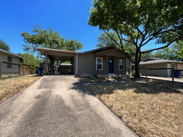
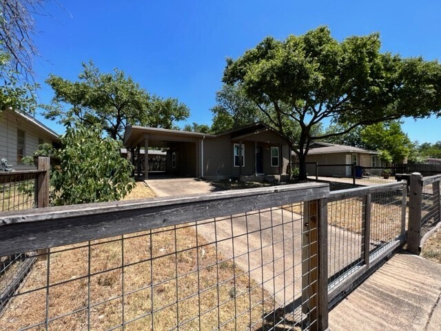
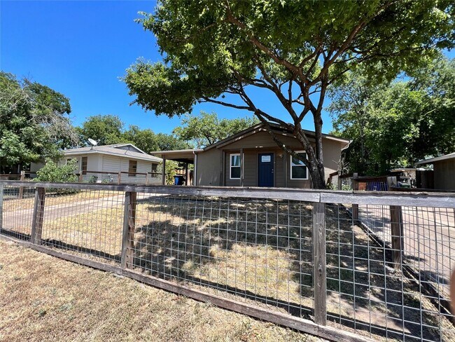
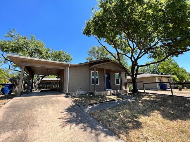
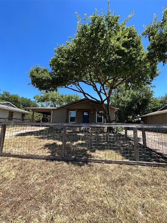
7909 Lazy Ln
Austin, TX 78757
2 Weeks Ago
|
Edit
Favorites
-
Bedrooms
3
-
Bathrooms
1
-
Square Feet
1,000 sq ft
7909 Lazy Ln

Favorites
About This Home
---- SCHEDULE A SHOWING ONLINE AT: ----
7909 Lazy Ln is a condo located in Travis County and the 78757 ZIP Code.
* Price shown is base rent. Excludes user-selected optional fees and variable or usage-based fees and required charges due at or prior to move-in or at move-out. Price, availability, fees, and any applicable rent special are subject to change without notice.
* Square footage definitions vary. Displayed square footage is approximate.
Contact
- Listed by Locayt
Location
Get Directions
The northern Austin neighborhood of Wooten is bordered on its east side by Highway 183. It is a compact, suburban neighborhood with plenty of shops and restaurants along the highway as well as along Burnet Road. Wooten has one small park, Wooten Neighborhood Park, next to Wooten Elementary School. Wooten is east of North Shoal Creek and north of Crestview, roughly seven miles north of Downtown Austin and six miles north of the University of Texas at Austin.
A cozy, family-friendly neighborhood with good schools and a strong sense of community, many choose Wooten apartments because they are relatively close to downtown but offer a much more residential, peaceful atmosphere. Wooten is fast-growing, diverse, and still relatively affordable. Favorite neighborhood restaurants include Mi Tradicion, P. Terry’s Burger Stand, and Shu Shu’s Asian Cuisine.
Learn more about living in Wooten
Education
| Colleges & Universities | Distance | ||
|---|---|---|---|
| Colleges & Universities | Distance | ||
| Drive: | 10 min | 4.6 mi | |
| Drive: | 10 min | 6.3 mi | |
| Drive: | 12 min | 7.8 mi | |
| Drive: | 14 min | 7.8 mi |
7909 Lazy Ln is within 10 minutes or 4.6 miles from Austin C.C., Northridge Campus. It is also near University of Texas at Austin and Austin C.C., Rio Grande Campus.
Transportation options available in Austin include Crestview Station, located 1.3 miles from 7909 Lazy Ln. 7909 Lazy Ln is near Austin-Bergstrom International, located 17.8 miles or 28 minutes away.
| Transit / Subway | Distance | ||
|---|---|---|---|
| Transit / Subway | Distance | ||
| Drive: | 3 min | 1.3 mi | |
| Drive: | 4 min | 2.0 mi | |
| Drive: | 7 min | 3.5 mi | |
| Drive: | 7 min | 3.9 mi | |
| Drive: | 12 min | 6.8 mi |
| Commuter Rail | Distance | ||
|---|---|---|---|
| Commuter Rail | Distance | ||
|
|
Drive: | 15 min | 9.1 mi |
|
|
Drive: | 41 min | 33.2 mi |
| Airports | Distance | ||
|---|---|---|---|
| Airports | Distance | ||
|
Austin-Bergstrom International
|
Drive: | 28 min | 17.8 mi |
Getting Around
 What do Walkability, Transit, Drivability, and Bikeability mean?
Walkability measures the walking distance to day-to-day needs.
Transit measures access to public transportation.
Drivability measures congestion, parking availability, and access to major roads.
Bikeability measures the suitability for cycling.
How It Works
What do Walkability, Transit, Drivability, and Bikeability mean?
Walkability measures the walking distance to day-to-day needs.
Transit measures access to public transportation.
Drivability measures congestion, parking availability, and access to major roads.
Bikeability measures the suitability for cycling.
How It Works
Moderately Walkable
Walkability
70
/ 100
Some Public Transit
Transit
40
/ 100
Exceptionally Drivable
Drivability
100
/ 100
Fairly Bikeable
Bikeability
50
/ 100
Scores provided by
Active
Soundscore™
71
/ 100
Traffic
BusyAirport
CalmBusinesses
ActiveScores provided by
HowLoud What is a Sound Score Rating? A Sound Score Rating aggregates noise caused by vehicle traffic, airplane traffic and local sources. How It WorksTime and distance from 7909 Lazy Ln.
| Shopping Centers | Distance | ||
|---|---|---|---|
| Shopping Centers | Distance | ||
| Walk: | 8 min | 0.5 mi | |
| Walk: | 9 min | 0.5 mi | |
| Walk: | 10 min | 0.5 mi |
7909 Lazy Ln has 3 shopping centers within 0.5 mile, which is about a 10-minute walk. The miles and minutes will be for the farthest away property.
| Parks and Recreation | Distance | ||
|---|---|---|---|
| Parks and Recreation | Distance | ||
|
Beverly S. Sheffield Northwest District Park
|
Drive: | 5 min | 2.0 mi |
|
Elisabet Ney Museum
|
Drive: | 9 min | 4.0 mi |
|
Bull Creek Greenbelt
|
Drive: | 8 min | 4.0 mi |
|
The Stephen F. Austin Planetarium
|
Drive: | 9 min | 4.4 mi |
|
Bright Leaf Preserve
|
Drive: | 9 min | 4.9 mi |
7909 Lazy Ln has 5 parks within 4.9 miles, including Beverly S. Sheffield Northwest District Park, Elisabet Ney Museum, and Bull Creek Greenbelt.
| Hospitals | Distance | ||
|---|---|---|---|
| Hospitals | Distance | ||
| Drive: | 6 min | 2.7 mi | |
| Drive: | 7 min | 3.5 mi | |
| Drive: | 8 min | 3.5 mi |
7909 Lazy Ln has 3 hospitals within 3.5 miles, the nearest is Northwest Hills Surgical Hospital which is 2.7 miles away and a 6 minute drive.
| Military Bases | Distance | ||
|---|---|---|---|
| Military Bases | Distance | ||
| Drive: | 86 min | 69.7 mi | |
| Drive: | 89 min | 73.1 mi |
7909 Lazy Ln is 69.7 miles from Fort Hood, and is convenient to other military bases, including Randolph Air Force Base.
You May Also Like
Similar Rentals Nearby
-
-

-

-

-

-
 3 Beds, 2 Baths, 2,303 sq ft$6,500Total Monthly PriceTotal Monthly Price NewPrices include all required monthly fees.901 W 9th St Unit 401
 -
 3 Beds, 3 Baths, 1,686 sq ft$2,250Total Monthly Price12 Month LeaseTotal Monthly Price NewPrices include all required monthly fees.2500 Forest Creek Dr Unit 2004
 -
 3 Beds, 3 Baths, 1,569 sq ft$1,850Total Monthly Price12 Month LeaseTotal Monthly Price NewPrices include all required monthly fees.2410 Great Oaks Dr Unit 202
 -
 3 Beds, 3 Baths, 1,722 sq ft$2,000Total Monthly Price12 Month LeaseTotal Monthly Price NewPrices include all required monthly fees.2105 Tiger Trail Unit 602
 -
 3 Beds, 3 Baths, 2,014 sq ft$2,100Total Monthly Price12 Month LeaseTotal Monthly Price NewPrices include all required monthly fees.2105 Tiger Trail Unit 502
What Are Walk Score®, Transit Score®, and Bike Score® Ratings?
Walk Score® measures the walkability of any address. Transit Score® measures access to public transit. Bike Score® measures the bikeability of any address.
What is a Sound Score Rating?
A Sound Score Rating aggregates noise caused by vehicle traffic, airplane traffic and local sources.

7909 Lazy Ln
Austin, TX 78757